


Jump to: Our Verdict / Features / Specifications
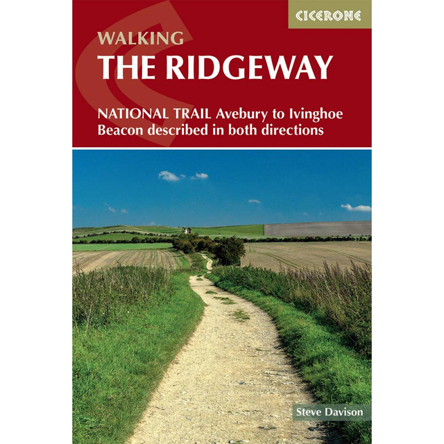
Guidebook to the Ridgeway National Trail, an 86 mile (139km) route through the south of England from Avebury in Wiltshire to Ivinghoe Beacon in Buckinghamshire. Accompanied by a pull-out 1:25K trail map, this guidebook details the trail in both directions and features information on historic sites and facilities along the way.
Cicerone says:
Follow Britain’s oldest road on the Ridgeway National Trail, a 139km (86 mile) journey from Avebury in Wiltshire to Ivinghoe Beacon in Buckinghamshire. This ancient trackway winds along chalk ridges and open downs, passing Neolithic burial mounds, Iron Age hill forts and sweeping viewpoints across the North Wessex Downs and the Chilterns.
With gentle gradients and well-waymarked paths that rarely rise above 300m, the Ridgeway National Trail offers relatively easy, low-level walking suitable for all abilities. The route is presented in 12 manageable stages of 8–16km (plus a separate pull-out map booklet) and is described in both directions, allowing flexibility for shorter itineraries or a relaxed week-long traverse across southern England.
- Step-by-step stage-by-stage route descriptions for the Ridgeway National Trail between Avebury and Ivinghoe Beacon, presented in both directions and including detours to nearby prehistoric and historic sites such as Uffington White Horse and Wayland’s Smithy.
- Each stage features 1:50,000 OS mapping alongside detailed navigation notes, distance, terrain summary and estimated walking times, plus a separate pull-out 1:25,000 OS mapping booklet covering the entire Ridgeway National Trail.
- Comprehensive accommodation and refreshment listings for inns, B&Bs, pubs and village cafés, with public transport information for each stage to help plan flexible start and finish points.
- Historical and archaeological background on the Ridgeway National Trail, exploring its prehistoric origins, hill forts, ancient monuments and centuries of use as a trading and droving route.
- GPX files for the Ridgeway National Trail available for download, enabling straightforward navigation using GPS devices or smartphone mapping apps.
- A handy route summary table and facilities planner offering quick reference for daily distances, services and logistical details along the Ridgeway National Trail.
Plan your Ridgeway National Trail adventure with confidence and explore ancient landscapes, chalk hill panoramas and thousands of years of history with this comprehensive guidebook.
Our Verdict
For nearly 50 years Cicerone have been producing guidebooks on recognised treks, regions, areas and general tips for hikers.
We have used them countless times and they've always provided excellent insight and knowledge that you only get through experience, giving you the edge to make your trip a success and more enjoyable too.
If you're a gram counter you can easily remove sections of the book to take with you making your own ultra-lightweight guidebook with only the essential sections that you require.
- Reviewed by Ultralight Outdoor Gear
Features
- Seasons: The Ridgeway can be undertaken at any time of the year, although between early spring and the end of autumn offers the chance of more settled weather and better walking conditions; parts can get muddy/slippery in winter. Spring and early summer are great for wild flowers, including carpets of bluebells, especially in the Chilterns; cooler autumn weather gives great autumn colour.
- Centres: Avebury, Wantage, Streatley and Goring, Wallingford, Princes Risborough, Wendover
- Difficulty: Fairly low level (not exceeding 300m) walking to suit most ages and abilities; no difficulties apart from some short steep uphill and downhill sections, can be muddy in winter, some road crossings and sections along quiet country roads and lanes that require extra care.
- Must See: Make to time to explore Avebury – a UNESCO World Heritage Site – including the Neolithic stone circle and henge, West Kennet stone avenue and the West Kennet long barrow. Visit the remains of Iron Age hillforts such as those at Barbury and Liddington for commanding views. Wonder at the famous Uffington White Horse galloping over the downs and visit nearby Wayland’s Smithy Neolithic long barrow. Wander through the Chiltern beechwoods and admire the great views from Coombe Hill and Ivinghoe Beacon.
Specifications
- Weight: 303g
- Edition: Third
- Number of pages: 200
- Size: 17.2 x 11.6 x 1.2cm
Contents
- Introduction
- Plants and wildlife
- Geology
- History
- Scenery
- When to walk
- Planning your walk
- Getting to and from the Ridgeway
- Where to stay
- Food and drink
- Communications and money matters
- What to pack
- Safety and emergencies
- Waymarking, access and rights of way
- Using this guide
- Maps & GPS
- Cycling and riding the Ridgeway
- The Ridgeway online
- The Great Chalk Way
- Protecting the countryside
- The Ridgeway:
- Stage 1 Overton Hill (Avebury) to Ogbourne St George
- Stage 2 Ogbourne St George to Ashbury Folly
- Stage 3 Ashbury Folly to the A338 (Wantage/Court Hill Centre)
- Stage 4 A338 (Wantage/Court Hill Centre) to Bury Down
- Stage 5 Bury Down to Streatley
- Stage 6 Streatley to Mongewell Park
- Stage 7 Mongewell Park to Watlington
- Stage 8 Watlington to Chinnor
- Stage 9 Chinnor to Princes Risborough
- Stage 10 Princes Risborough to Wendover
- Stage 11 Wendover to Wigginton
- Stage 12 Wigginton to Ivinghoe Beacon
- Appendix A Useful contact information
- Appendix B Accommodation table
- Appendix C Further reading