Andy's 2026 TGO Challenge
Posted by Andy Neil on Jun 11, 2026
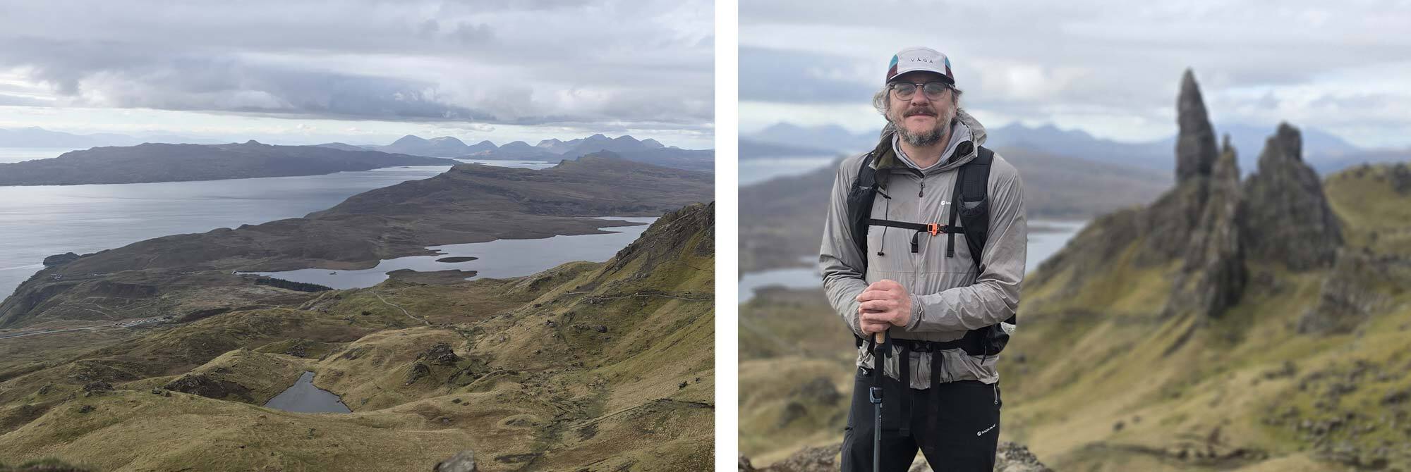
This year's Great Outdoors Challenge (TGO) started a little differently from my previous crossings. I’d been hiking and camping on the Isle of Skye for the week building up to this year's crossing, with my partner Sacha, my American annual-adventure companion Brian, and his wife, Jackie. We hiked part of the Skye Trail, spotted minke whales, and made the most of the island’s food and drink. So, as our adventure finished, we said goodbye to Brian and Jackie, and Sacha made her long 9-hour journey back down to Middlesbrough. My usual long journey north was a brief 20-minute bus ride from Kyle of Lochalsh, where the Skye Bridge meets the mainland, to Shiel Bridge, my chosen start point.
The TGO is a self-supported coast-to-coast crossing of Scotland; you must plan your own route. You can start at one of 14 designated starting locations and finish anywhere along the east coast between Fraserburgh in the north and Arbroath in the south.
I chose Shiel Bridge for its proximity to the Isle of Skye, but it fitted with my plans perfectly. It's very easy when planning your TGO route, especially if you have completed a few crossings, this would be my fourth, to revisit some of the better-known spots, such as Braemar and Tarfside, as you can be sure you will definitely meet lots of other challengers and become part of the social bubble that inevitably forms. This, in many ways, is the draw of the TGO Challenge: to see old friends you have met on previous crossings, and to meet new, like-minded people.
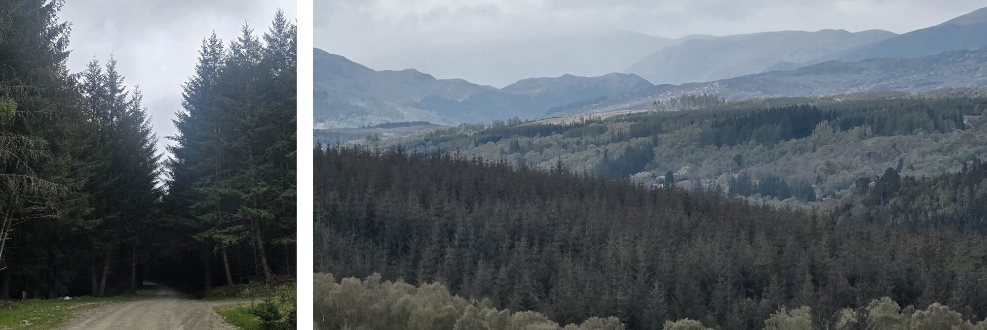
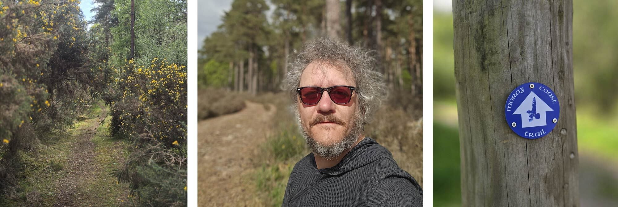
This year, that wasn't my plan. Given that you have almost limitless paths across Scotland, it seems a wasted opportunity not to try and cover completely new ground (I failed at that and retraced about 30 miles of walking I had done on a previous crossing). This year's big draw was the Moray Coast, which stretches from Inverness to Fraserburgh, offering challengers a chance to swap the Cairngorms for the rugged coast.
I love coastal walking, so the Moray Coast had been on my to-do list for a while, and the opportunity to combine the Moray Coast with this year's TGO seemed too good to miss. It's a coastal region famed for its dramatic rock formations, beautiful fishing villages, and abundance of wildlife, so I was very excited to hike along “the Scottish Riviera”.
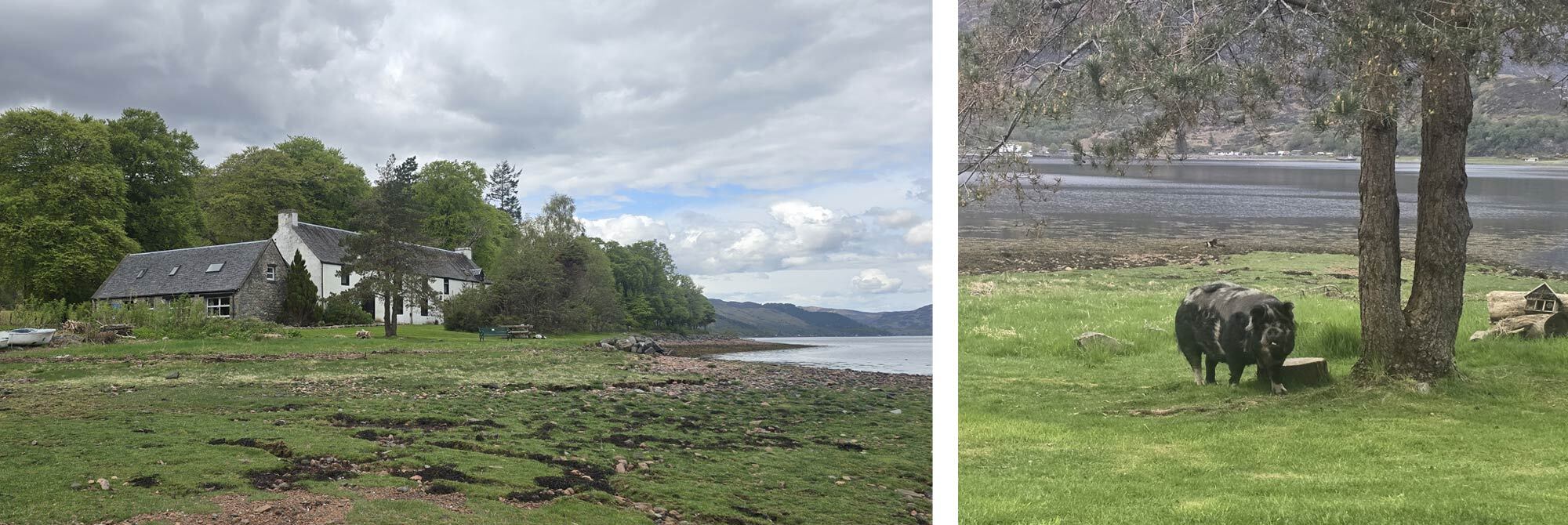
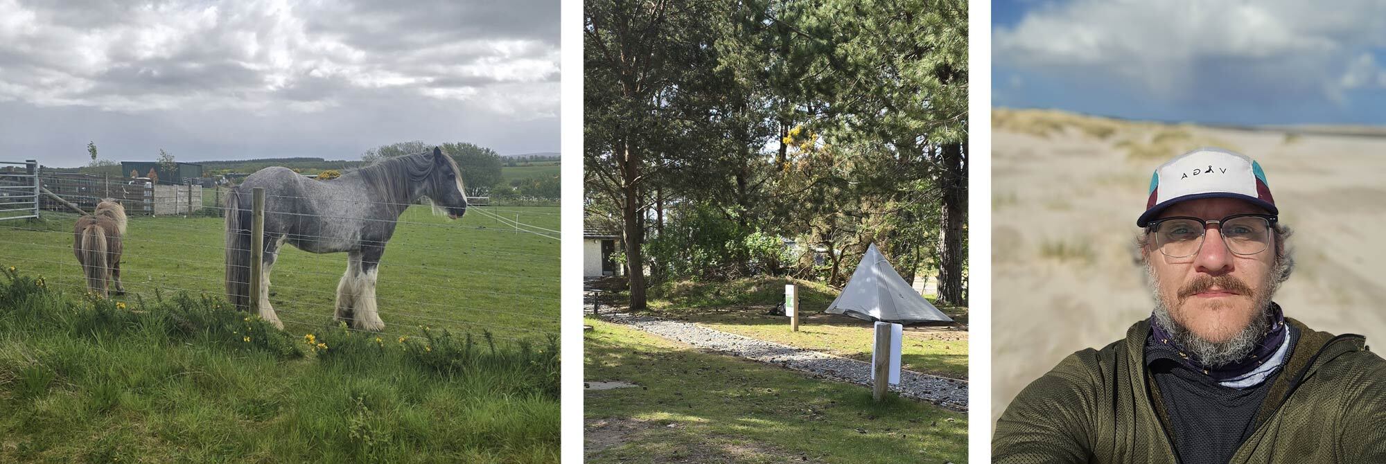
So after my incredibly brief and early bus ride, I found myself sitting outside Ratagan Youth Hostel, gazing across Loch Duich under the watchful presence of the famous Five Sisters range, keeping an eye out for the occasional porpoise breaking the water. It was an unforgettable place to sit and while away a few hours, until the hostel opened and the place slowly started to fill with fellow challengers, familiar faces and a few new ones to add to the ever-growing list of TGO’ers.
We spent the evening chatting and discussing our planned routes over a beer, then watched as the nice lady working at the Youth Hostel wrangled some rather large local pigs. She was adept at this; I suspect it wasn't the pigs' first escape attempt. After an entertaining evening, we all wanted to get a good night's sleep before our adventure began.
Day 1: Ratagan Youth Hostel to Affric Youth Hostel 23km / 14 Miles
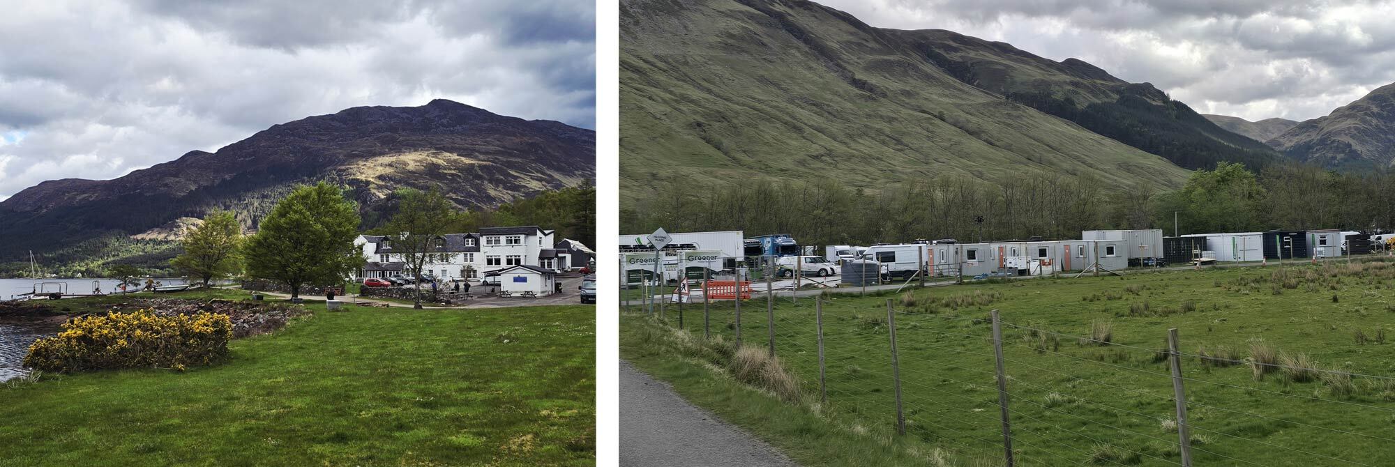
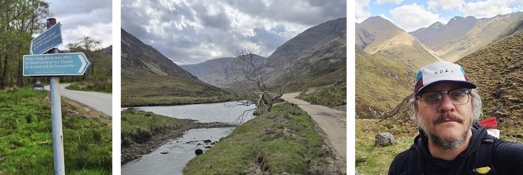
Eager to get going, it was an early start. After my continental breakfast and copious amounts of coffee, I shouldered my laden pack and was ready to be off. The dramatic views had lost none of their majesty. The lower slopes were still in shadow, but the early morning sun had already reached the summits of the Five Sisters, lighting them up above Loch Duich. My route hugged the loch shore, following the road towards the Shiel Bridge Hotel.
The TGO doesn't officially start until you have written your name and start time on the official sign-out sheet, which was located at the hotel, about two miles from Ratagan Youth Hostel. Already, a few TGO’ers were milling about, and the small on-site cafe was open for bacon buns, tea, and coffee. I said hello to a few familiar faces, but didn't stop for too long as I was keen to get some miles under foot.
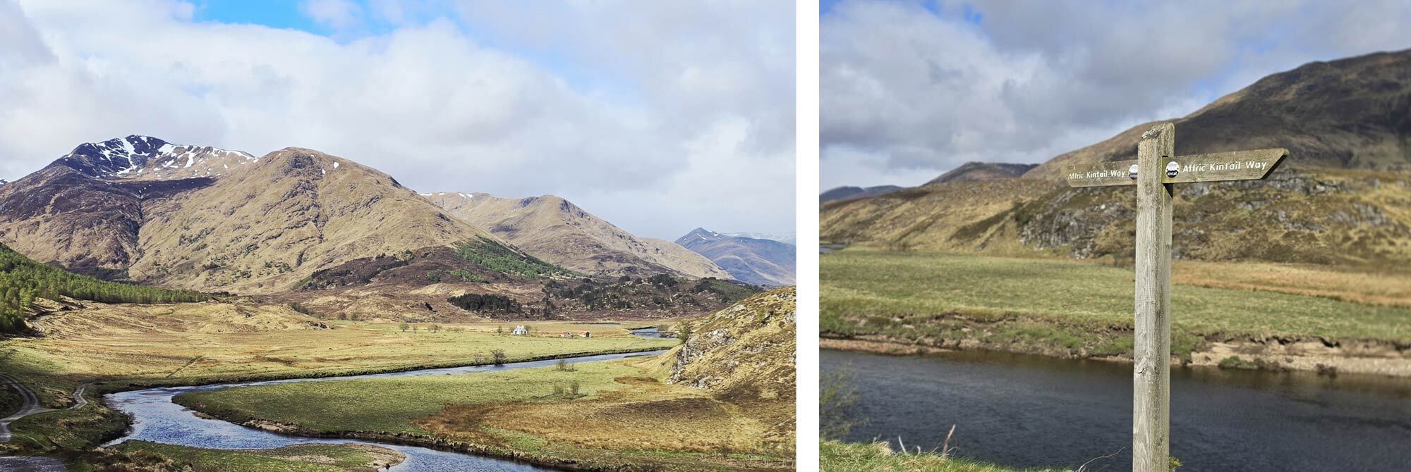
I followed the curves of Loch Duich toward Morvich, where there were still signs of rather interesting yet slightly jarring activity ahead. In the weeks before my arrival, Henry Cavill, Russell Crowe and some of their Hollywood chums had been filming a small independent film called Highlander. The evidence was hard to miss: around 50 portacabins sat behind a large construction fence, and just beyond them stood the remains of a forge that had been burnt down for the film. Sadly, there wasn't much going on by the time I arrived, other than people clearing the site. I pushed on toward the real start of the hike, the Affric Kintail Way.
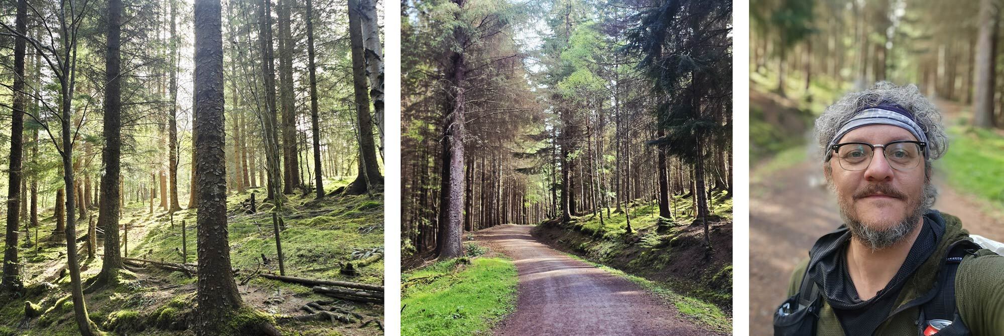
The Affric Kintail Way runs for 44 miles from Morvich all the way to Drumnadrochit on the banks of Loch Ness. I would be walking the whole route before venturing onto the Great Glen Way, on to Inverness, the ceremonial, if not actual, halfway point of my route.
The early morning clouds still clung to the mountain tops as I hiked onto the trail. For the most part, the Affric Kintail Way is a wide-open track. It's a fairly easy but dramatic trail that cuts through some of Scotland's most fantastic scenery. My pace was good as I continued up the glen, following the River Croe.
As the day progressed, the sun burnt away the clouds, revealing snow-capped peaks. A short but steep climb brought me into Glen Affric itself. I passed a few bothies and countless sheep as I made my way to the banks of the River Affric. Here you pass "the remotest youth hostel in Scotland”. I had been here previously on a TGO; the place had been packed, the youth hostel was fully booked, and tents spilt out around the small, isolated building.
Today, however, the place was firmly shut; it was only about 2 o’clock, and the hostel wasn't even open yet. However, it still made for a good spot to stop; there was a bench outside that was sheltered from the ever-strengthening wind, so I took the opportunity to take my pack off and have a snack when a gentleman ran up to me and asked if I was booked in for the night. I wasn't, but I inquired whether there were any rooms available, more out of curiosity to gauge the preparedness of fellow TGO’ers. He informed me that there was plenty of room available in the bunkhouse that night. It was only 35 pounds, so I decided to take the opportunity to stay in the remotest youth hostel in Scotland.
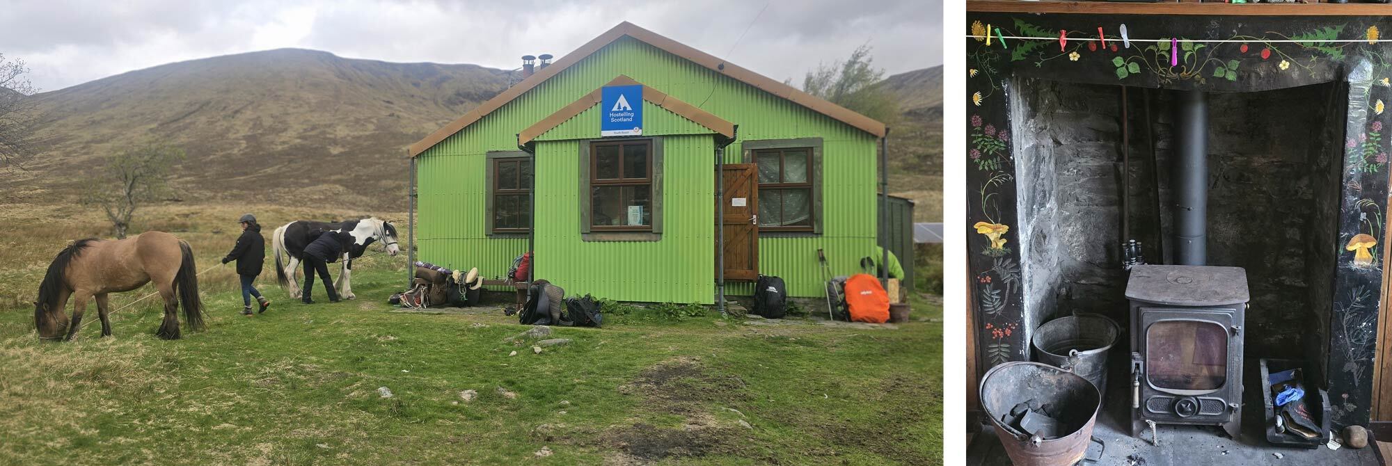
The interior of the hostel gives incredibly cosy cottage vibes, with an inviting kitchen, a small lounge, and a toilet and shower. The bunk house has two rooms, a male dormitory and a mixed dormitory, located about 15 metres behind the main building. I was shown into the kitchen, complete with a cast-iron fireplace, an array of pots and pans, several kettles (all soon to be on the go), and a pantry of “help yourself” food that other hostel users had left behind: pasta sauces, tea bags, rice, etc.
My landlord for the evening started stoking the fire with kindling. It wasn't too cold, but this heated the water I would later use for a shower. I got the kettle on as my new friend busied himself, first cutting some vegetables for soup, then attending to the now-constant stream of fellow hikers who either came to check in or just popped in for a cup of tea. I took over the veg cutting and was in my element, peeling potatoes next to the now-roaring fire.
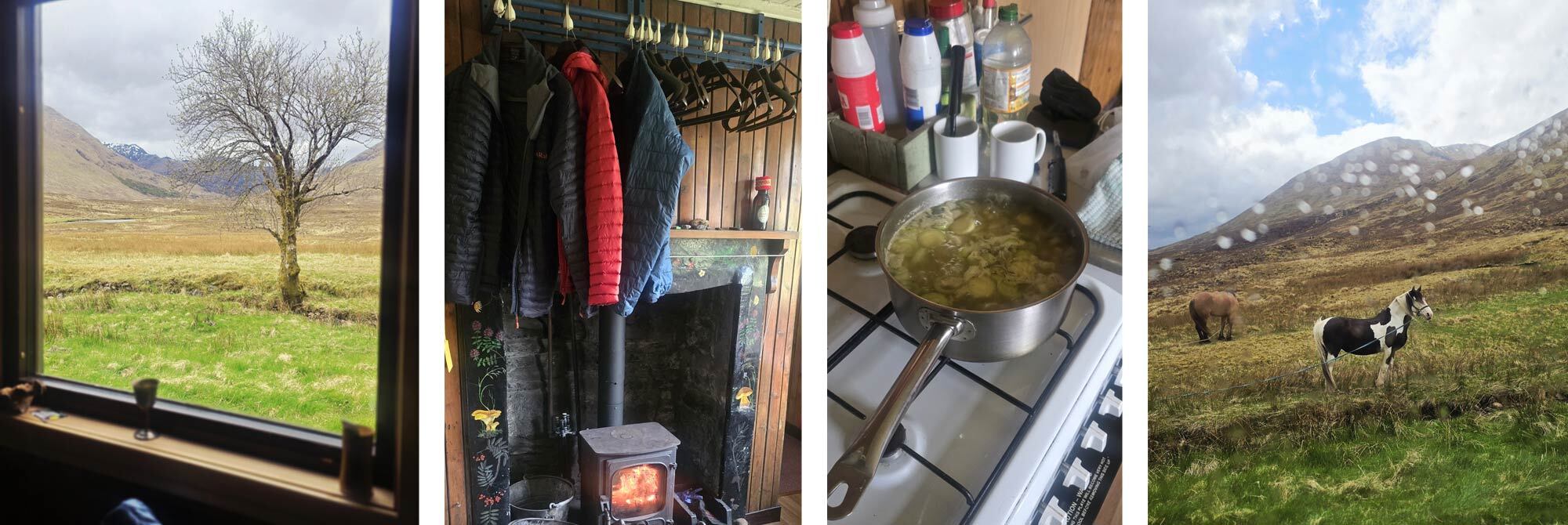
Two girls pony trekking arrived with their horses, who were both staying in the hostel that night, as well as some American and Scottish travellers, and some fellow TGO’ers. As the afternoon turned into evening, the throng of hikers thinned out till it was just us guests left. Full of vegetable soup and countless cups of tea, it was a lovely night, our entertainment for the evening being the two horses tied up outside and their imaginative escape attempts.
I already felt like I was in the heart of the Highlands, surrounded by the snow-capped peaks. The cosy evening and homemade soup were an unexpected treat, and as the howling winds swirled around the bothy, I was very glad of my decision to grab a bed for the evening. Day one, done.
Day 2: Affric Youth Hostel to Cannich, 32 km / 20 miles
I hadn't planned on stopping at the youth hostel. I had planned to hike a few more miles and wild camp as I headed up into the mountains; however, after discussing my plans in the hostel, I was informed that my route involved a fair bit of scrambling, which I wouldn't usually shy away from. But as the mountain tops were covered in snow, this was something I was not prepared for. I only had a thin pair of gloves, and my trail runners were not waterproof. Being on my own was also a factor in my decision to amend my plans and stick to the Affric Kintail Way.
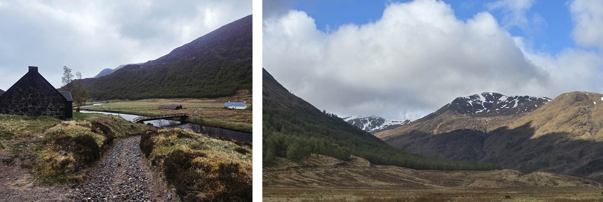
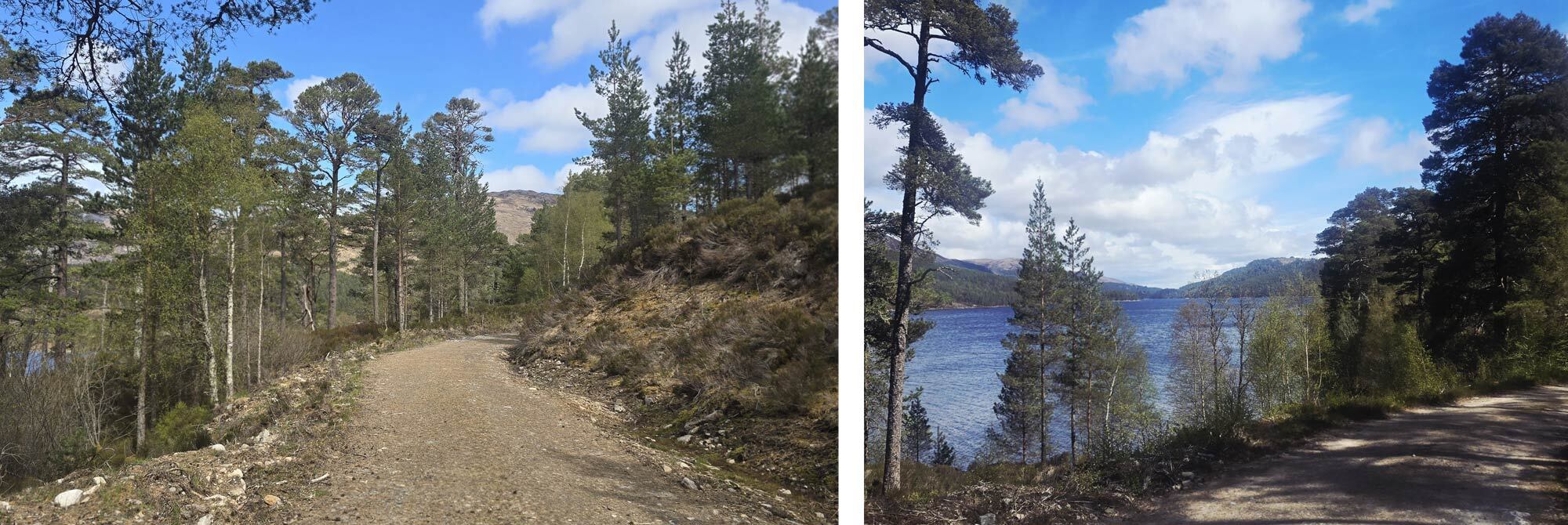
I said goodbye to the horses as I set out, once again, onto the wide, open track. I passed several campers, still quietly dozing or just starting to break camp as I set off along the river. The character of the walk changes as you encounter Loch Affric; the wide-open glens give way to a forest track that climbs above the loch below.
The weather held, my pace was good, and the miles slipped by as Loch Beinn a' Mheadhoin came into view; the path climbs higher here, and the forest becomes denser.
As I had planned to head into the mountains, I now had a conundrum. I was already ahead of myself; I had planned on camping on the other side of the loch, and I’m sure after a long day of Munro bagging, I would have welcomed the rest. But as I had spent the morning on a relatively flat, easy-going trail, I was past my camp spot before 11.
Should I slow my pace? Camp early? Or keep walking? I decided to push on to Cannich, the scheduled endpoint of day three.
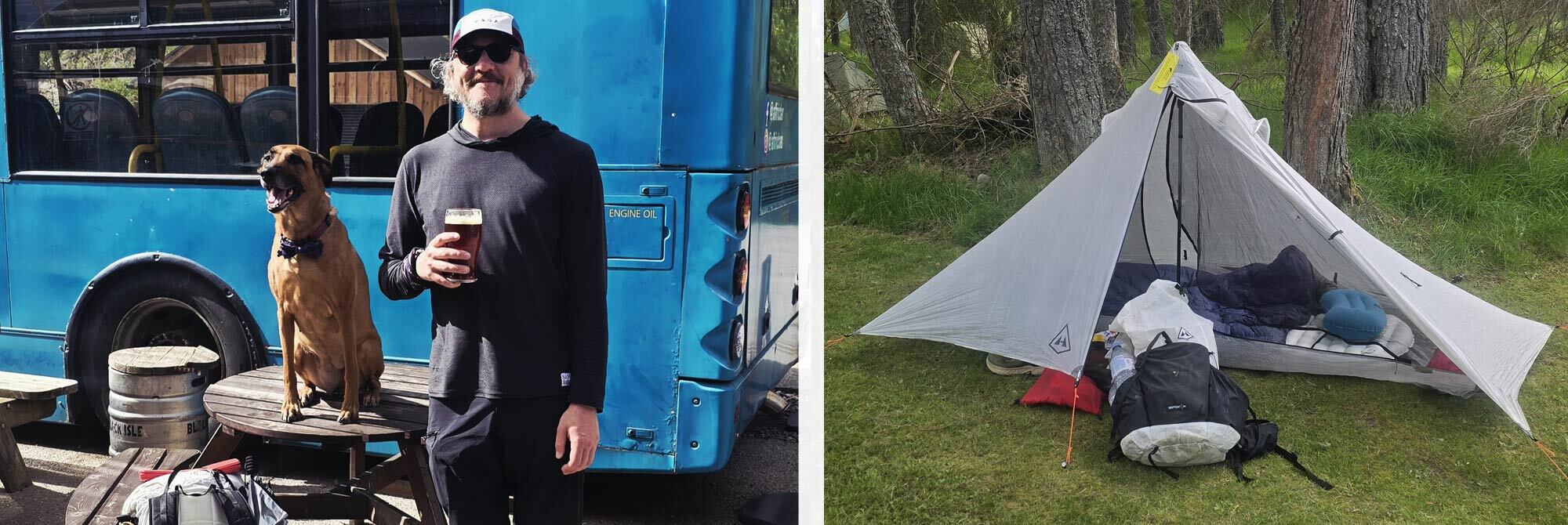
I was bolstered by the fact that I would be ending my day in civilisation: a shop, a pub (kind of), and a welcoming campsite. I took my time along Dog Falls, a series of dramatic waterfalls, appreciating the charms of the sheltered forest. I took the road, as opposed to the higher path the Affric Kintail Way opts for, and soon could see the top of the large blue bus that signals you have made it to Cannich.
On my last visit to Cannich, there was a friendly pub. Sadly, this has now closed down, so the community had no social hub until an entrepreneurial South African bought a large blue bus, fitted it with wooden tables, and parked it where the old pub once stood. This is now Cannich's local and is conveniently located next to the village shop, which now sells ale, snacks, and some unexpectedly good pub grub.
I picked up some refreshments and topped up my supplies at the shop before making my way to the Cannich Woodland Caravan & Camping Park. I explained that I was a day early, but rather than scuppering my plans, it gave me an unexpected opportunity. I booked a pitch for the night and decided to honour my original booking as well. Cannich seemed the perfect place to take an undeserved rest day. The campsite has a fantastic on-site cafe, and that night they were serving a special fish-and-chip supper for the TGO’ers, an unexpected treat I took advantage of. I pitched my tent and spent the evening chatting to fellow campers, knowing tomorrow I had little to do other than enjoy doing little.
Day 3: Cannich, Rest Day
A slow day with not much to do other than pass the time, I took advantage of the on-site cafe for a late breakfast, as well as the washing and drying facilities, and took the time to top up my powerbank. I chatted to fellow campers and challengers as they rolled in throughout the day, and was pleased to see that Ali, a former coordinator of the TGO, had set up camp nearby.
I had the honour of staying with Ali during my very first TGO challenge, an experience akin to staying at Michael Eavis' house during the Glastonbury Festival. It's always a treat to be in her company, but this was the first time we had actually met on the trail. We toasted with a glass of wine, then I headed for my tent.
It was nice to have spent a day resting, but it had also been a little frustrating. I was here to walk; I was feeling great and keen to get moving, to reach Drumnadrochit and the banks of Loch Ness.
Day 4: Cannich to Drumnadrochit, 22.6 km / 14 miles
I was pleased to see that my old mate Gavin had joined the cohort of campers that night. He had arrived late, well past 9 p.m., after a difficult day on the hills. It's always a pleasure to see him, a good friend I met on the trail a few years ago. Gav, Ali and I chatted over breakfast and discussed today's route. Ali pointed out that, rather than sticking entirely to the marked trail, a large, unremarkable section of the path can be bypassed by staying on the road instead of venturing off onto the trail. I had hiked this section before, so I was more than willing to change my plans if it saved me a few kilometres. I said goodbye to Gav and Ali. I would see them both again on this trip, but not for another 150 miles; in fact, these would be the last challengers I had any real social interaction with until I got to Montrose, the official endpoint of the TGO.
The path climbed steeply out of Cannich on a forest track before opening up into farmland, a juxtaposition with the relative wilderness I had been hiking in. The path joined the road, and as planned, I hiked the short section along it back into the shaded woods. This section felt much longer than the map would suggest, and I was contemplating a rest when I spotted someone frantically waving at me.
The concept of a trail angel was something I had never encountered before. I had passed plenty of honesty boxes on long-distance trails before, but nothing quite like this. The frantically waving lady was my first-ever trail angel.
She had a table laden with goodies: energy gels, sugary drinks, Smidge, sun cream, food, spare gas canisters, tea and coffee, even a portable power station to top up a battery pack. She was there supporting the Highland 550 bikepacking route, a long-distance self-supported mountain bike trail, but she was more than happy to cater to hikers, too. I stopped for a cup of tea, a biscuit and a chat. She was a keen bikepacker and was repaying services she had taken advantage of on other such trails. The world is a much better place because of people like her and her husband, who sacrificed a Saturday to support their friends and, more admirably, strangers.
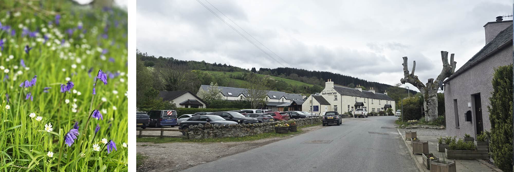
The path continued through the imposing woodlands, up and up, until I finally caught my first glimpse of Loch Ness. From there, the trail dropped suddenly through fields of bluebells and past some giant redwood trees. I found my accommodation for the night, the Loch Ness Bunkhouse, a fairly modern building attached to a restaurant and pub, more of a complex than the simple hostel I had imagined.
The room itself was equally impressive, with two sets of bunk beds, a shower and a toilet attached to each room. I took advantage of being the first to arrive and showered before setting off to find food. When I arrived back in the room, I met the only other occupant, “Big Daddy”.
Big Daddy was the trail name my 68-year-old bunkmate had picked up on the Appalachian Trail; he was here to hike the West Highland Way and Great Glen Way. He was given this title, to my relief, as he had ten children. We finished off my small water bottle of whisky and chatted much later into the evening than either of us intended to.
Day 5: Drumnadrochit to Inverness, 31.6 km / 19.5 miles
I had officially completed the (slightly abridged) Affric Kintail Way, and I now joined another of Scotland's great trails on my journey to Inverness: the Great Glen Way. The Great Glen Way starts in Fort William and is often used as a continuation of the West Highland Way. This was completely new territory to me, so I was keen to get going.
This is Nessie country, and Drumnadrochit is keen to make sure you know it. The famously inconspicuous monster's likeness adorns every shop window, lending its name to a myriad of hotels, cafes and shops that I passed as I made my way along the road around Urquhart Bay. This section of the trail follows the A82. It was still early, but the ceaseless traffic was drowning out my audiobook. I was very relieved when the path finally swung away from the road and up into the forest above the iconic loch.
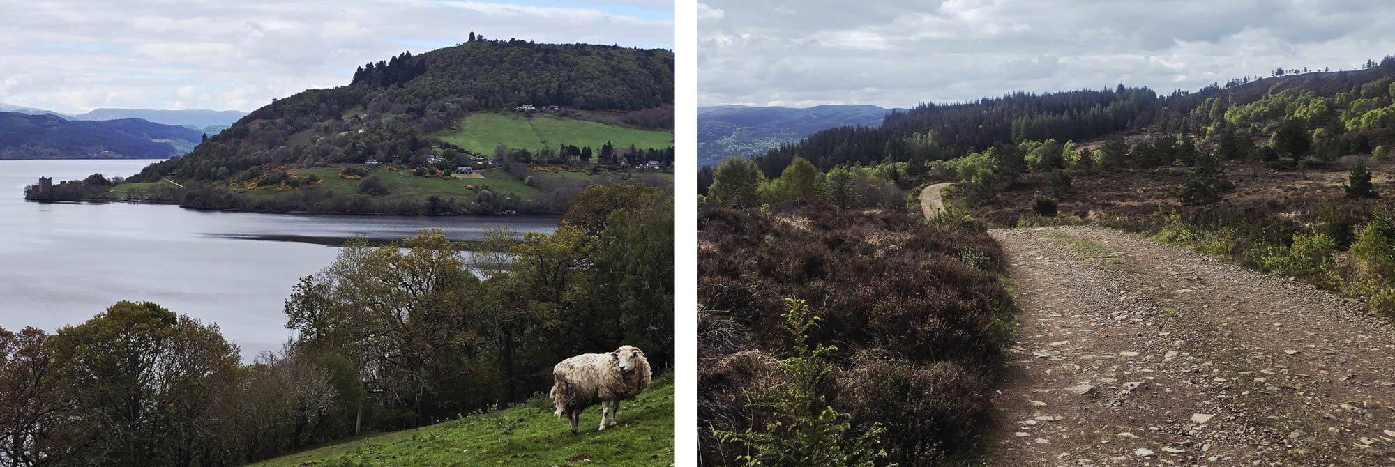
Looking back through the trees, I was treated to a magnificent view of Urquhart Castle standing in splendid isolation on the shores of Loch Ness. The path is a steady slog, not too bad on foot, but considerably less fun with a fully loaded bike. I passed two ladies on heavily laden bikes and somehow ended up helping push them up some of the steeper sections. Consider it payment to my trail angel.
Once you have gained height here, you don't really lose it till you descend into Inverness, so I was happy to get the climb done early. There was an incredibly well-timed viewpoint here, and I took a moment to get my breath back in the now-hot morning sun.
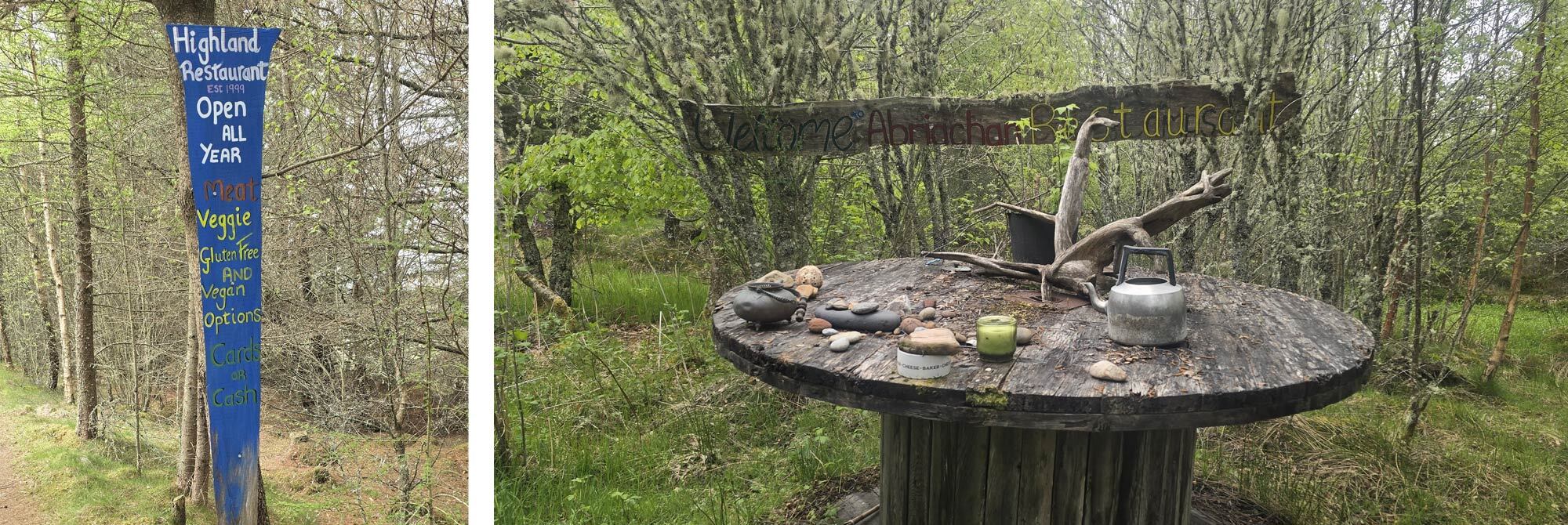
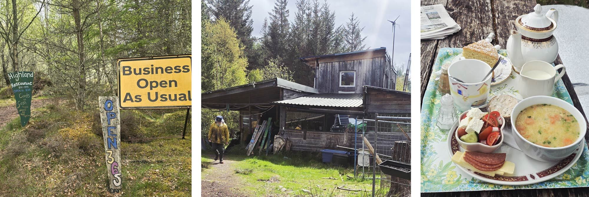
The trail could seemingly tell that my mind had turned to food. Every 200 metres or so, a hand-drawn sign would tell me, "Food this way", "Meat, veggie, gluten-free and vegan options", that "cash or card" was accepted, and that "they were open EVERY day". I must have passed around 30 of these signs. My hunger grew with each passing marker.
Eventually, I made it to the sign that said, “Highland restaurant, Est 1999, OPEN ALL YEAR”, and ducked off the trail towards the “restaurant”. My interest, as well as my hunger, had peaked.
The path cut through a mossy stretch of forest into an open glen with around 10 tables, some of them picnic benches, others improvised from old rope-coil housing, all adorned with antlers, old tea kettles, shells, candles, and brightly painted stones.
Next to a construction fence, which seemed to be protecting the world from the ramshackle house behind it, was a sign reading "Ring bell for service". I didn't need the bell.
The large chained-up dog quickly announced my arrival, drawing the attention of a large-framed man who was busy splitting logs with an equally large axe. He was wearing what I can only describe as a heavily stained lighthouse keeper's jacket.
Surely I'd just walked into the opening chapter of my very own Stephen King novel. I briefly pondered the last time I'd told my mother I loved her.
He beamed at me and gestured for me to wait while he called his wife over. As I waited, I asked how long they had lived there.
"Oh, since we got out of Broadmoor."
I'm fairly sure that was a joke. I think?
His wife, possibly the sweetest and warmest person I have ever met, told me in a beautiful sing-song Welsh accent that they offered "light bites" and refreshments. By this point, my anxiety levels had fallen enough that I was reasonably confident I wasn't going to be one of the light bites, so I ordered soup and a cup of tea.
The gentleman, and I mean that in every sense of the word, informed me that he had actually been a lighthouse keeper as he escorted me to my seat, provided me with a large foam sit pad, as well as that morning's paper, and disappeared to collect my food.
What was presented to me I can only describe as the best food I have ever eaten on trail; in fact, there is an argument for this being the highlight of my trip. My “light bite” consisted of soup (bacon and lentil), an entire pot of loose-leaf tea, and cake (lemon sponge), a Greek salad (because “you hikers don't eat enough fresh vegetables”, which is true), some cured meats with cheese and crackers, and some blueberries. I haven't been fed like that since my Nana was alive.
If you're in the area, you must visit the Abriachan Eco-Campsite & Cafe and follow them on Facebook too; it's well worth your time.
I thanked my incredibly generous hosts and was then back on the trail after one of the more spectacular trail experiences. A short but attractive section of road walking brought me to a gorse-laden forest that slowly descended to the outskirts of Inverness.
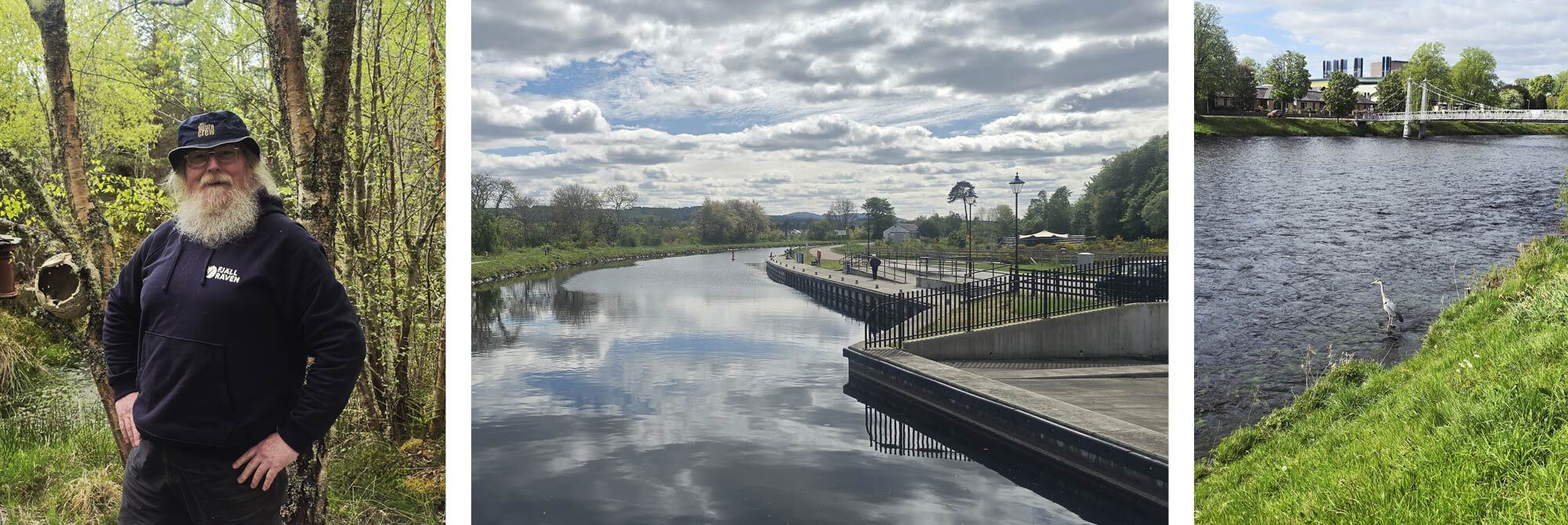
I hadn't particularly been looking forward to this section; a grand crossing of the Scottish wilderness doesn't mesh well with a hike through a city. I was still on the Great Glen Way, and I especially liked the section of the trail which passed over the Ness Islands, a public park split across a series of islands, connected by bridges in the heart of the city. The park is home to some beautiful, towering trees, and it was lovely to see so many people out enjoying the dappled light filtering through the canopy. It isn't until you are right in the centre that Inverness really feels like a city.
My bed for the night was the Black Isle Hostel, a much larger hostel than any I had stayed in before, not just on this trip, but in all my years of staying in hostels. Still, it was only four to a room. I set off in search of food, took advantage of some city living, and found myself a sushi bar.
Inverness felt like the transitional point of my hike; I had made it through the Highlands, and my thoughts and journey now headed towards the coast, but first, I had to get there.
Day 6: Inverness to Nairn, 34 km / 21 miles
If I hadn't been looking forward to walking into Inverness, even though it turned into an enjoyable experience, my trepidation of walking out of Inverness proved to be well-founded. It started well, the city centre giving way to a more industrial landscape. It was easy enough walking till I got to some roadworks revamping a roundabout in the city. After a schoolboy navigational error, I missed the national cycleway I had been meaning to take and ended up on the wrong side of the incredibly busy A96.
Full of morning commuters, the traffic was incessant. The large grass verge meant I was in no danger from the stream of cars, trucks and buses, but the walking was not enjoyable. Twenty-four hours ago, I had been bumbling along the banks of Loch Ness; now I was marching alongside traffic that seemed relentless.
Despite being on the wrong road, I was in fact heading in the right direction: east.
That's one thing about the TGO: if you're heading east, even if you're off trail, you're headed in the right direction. So, after a few minutes of swearing, I plotted a route off the busy road, back onto my intended route to Culloden, and away from the A96.
I covered about four miles by the time I got to Culloden, and I hadn't exactly been looking for a place to take a break, but I still hadn't had any breakfast or, more importantly, any caffeine. I found a small, well-stocked garage that had a coffee machine and loaded up on fruit and flapjacks. The rain started as I meandered up the road, so my brolly went up as I sipped my flat white, feeling rather dejected.
I passed throngs of schoolchildren chattering in their neat uniforms, as mercifully, I reached the sanctuary of Culloden Woods and breathed a sigh of relief to be back in nature, finally. I took shelter under a large pine tree as I sipped my coffee and took my time eating my banana and flapjack breakfast. The rain eased, and I shouldered my pack and headed off into the woods.
As a bit of a history buff, I’m a little disappointed in myself that I wasn't aware of the significance of the land I was walking through. It wasn't until I passed a sign for Prisoners' Stone that my interest was piqued, but I didn't do any relevant googling till later that night; if I had been aware, I might have lingered a moment longer. It was here in 1745 that 17 Jacobite soldiers were held and executed in the aftermath of the Battle of Culloden, the last pitched battle fought on British soil and the event that brought the Jacobite rebellion to an end. A stark, sobering reminder that these quiet woodland paths were once a field of slaughter.
Anyway, as I say, I didn't know any of that at the time. I would be in this stretch of woodland for over seven miles, which meant I was covering a good distance in the sheltered calm of this ever-changing woodland. Huge pines would suddenly give way to birch trees, as the once-dark woods opened up to gorse-lined paths. I passed the Scottish School of Forestry, which perhaps explained the woodland's constantly changing character.
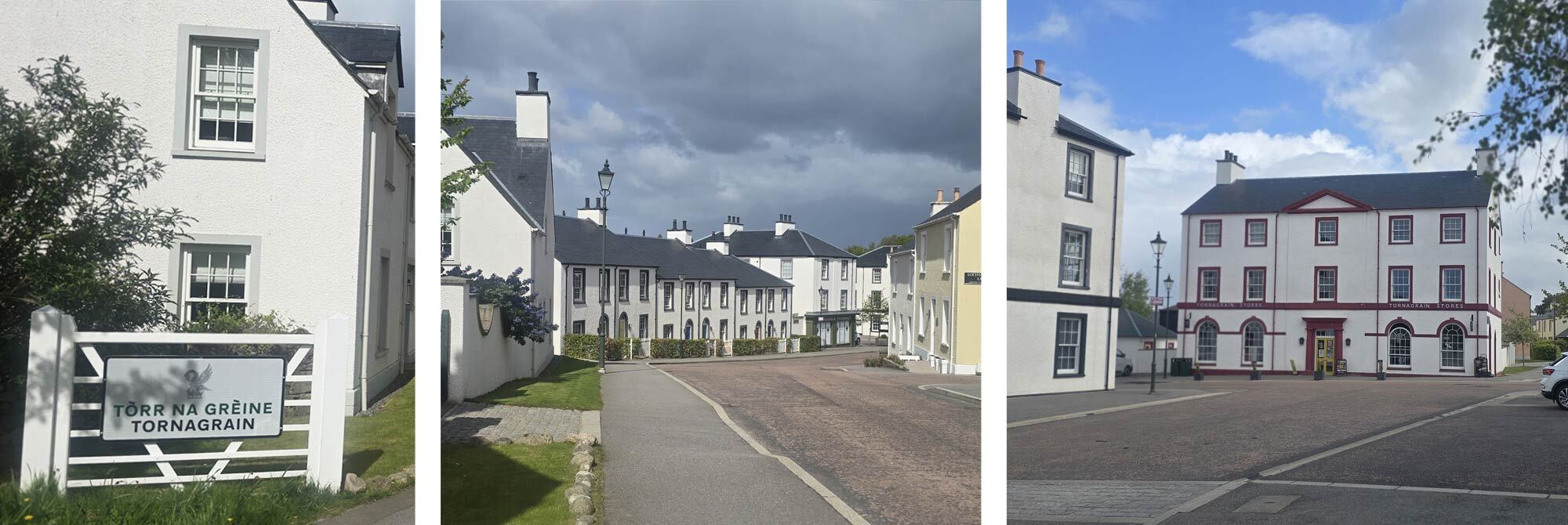
During a brief break from the woodland, I got chatting to a local dog walker who was eager to show me something rather peculiar. After a slight detour, I found myself in Tornagrain, a newly built town designed in a traditional Scottish-Georgian style. It was like stepping back in time, or at least into a new section of Beamish. Neat terrace houses, narrow streets, sash windows, and traditional lampposts complemented by attractive, elegant-style shop fronts. My dog-walking friend took me on a short tour of the town with glee. It was a nice distraction, but soon I once again found myself in the woodland, and then once again beside an old friend.
The A96 was, once again, unavoidable; there was no way around it (believe me, I checked), so there was nothing for it but to shoulder my pack, put BOTH earphones in, and crack on. I had three miles to cover, and they must have been the fastest three miles of the trip. Mercifully, the going wasn't too bad, and I soon found myself on the B roads on the outskirts of the town of Nairn.
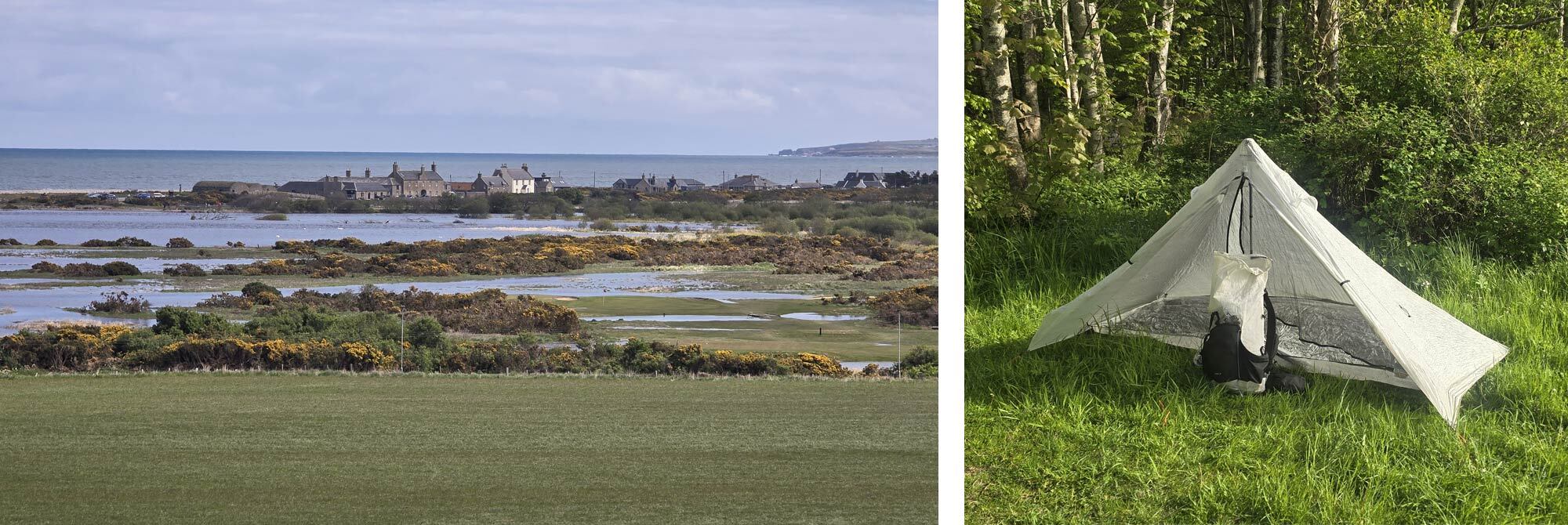
The walk through the town along the River Nairn was very pleasant. Seagulls flew overhead, and my nostrils were full of brackish sea air. I wandered down to the dunes and enquired at the Nairn Holiday Park for tent pitches: £15 a pitch. She handed me a coupon for that evening's on-site entertainment, which I would avoid at all costs, and for the swimming pool, which I would decline as well. The tent pitches were tucked right out of the way of the static caravans, right by....THE BEACH!!!
I left my pack before even erecting my tent, hopped over the dunes and was met with crisp white sand and a calm sea. I had made it to the Moray Coast.
Day 7: Nairn to Findhorn, 28 km / 17 miles.
I was elated to finally be on the coast; it's an odd feeling to be next to the sea on the TGO. As this is a coast-to-coast route, the sea is always your end goal; it's the sight that signals your journey is over. Yet here I was, a week into my journey, with the sea now becoming my constant walking companion.
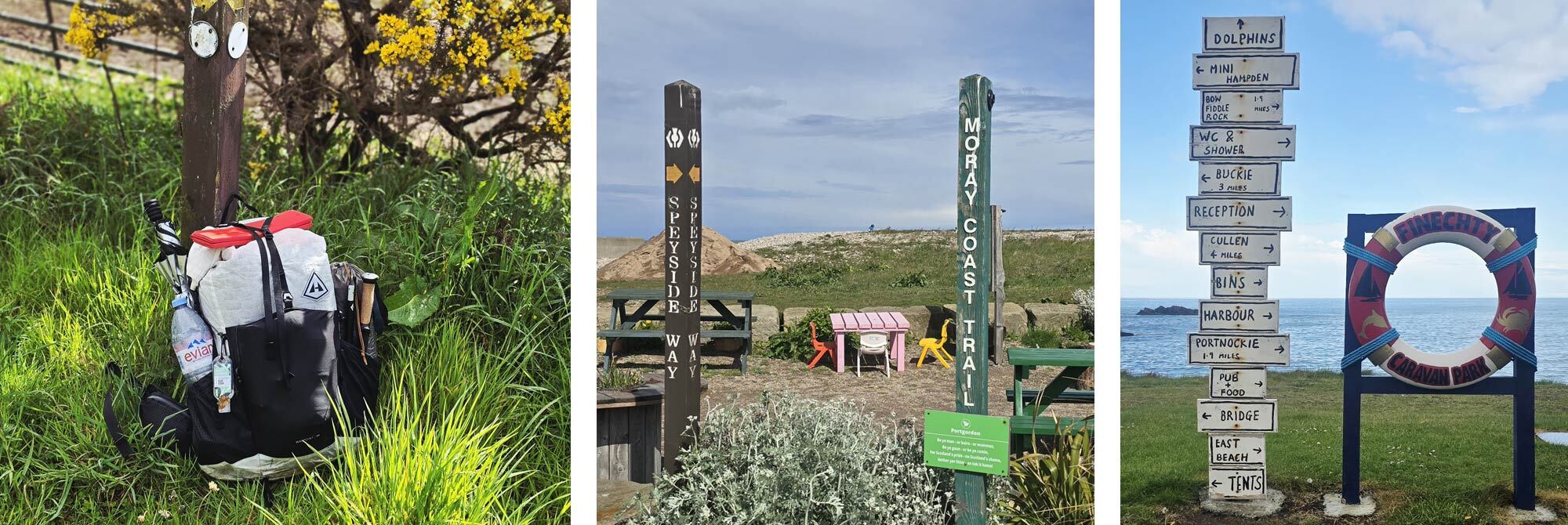
I nipped into Nairn the night before and grabbed a few supplies for that day's walk. I would pass at least one town every day now, so I was happy to lighten my load and carry only the food I needed (plus one emergency dehydrated meal), which massively reduced my pack weight.
I'd been pondering my map the night before and, in a very un-TGO way, I had decided to add a few more miles to my day, 6 in total. My original plan had been to walk through Culbin Forest, then take the water taxi over to Findhorn Bay, with Findhorn as my destination for the night.
My issue with that was Culbin Forest. The coastal forest is huge; it would have been 11 solid miles through relentless woodland, and as I'd spent the best part of yesterday doing something similar, I thought it was time to change things up (and it turned out to be a good thing I did).
The other reason for my change of plan was the Moray Coastal Path: the actual marked trail on the OS map starts in Forres, which my original route would have bypassed, so I decided to be a completionist and hike the full waymarked route.
I'd been warned way back in Ratagan Youth Hostel that Culbin Forest was notoriously difficult to navigate. Of course, I'm an experienced navigator and, armed with a paper map, my Suunto watch, and a map on my phone, I naturally got horribly lost.
It's not that I was off trail; it's that the trail occasionally stopped existing altogether. I started referring to the woods as Findhorn Forest, a suitably Tolkien-esque name, as I became increasingly convinced the trees were quietly rearranging themselves to make sure I got as lost as possible.
One moment, I was on an easy-to-navigate path, perfectly aligned with where I should be. Next, the trail would veer off in a completely different direction, coiling back on itself before opening out onto a wide vehicular track (God knows how the vehicle had got there; I was just glad it was heading out). That would then become so overgrown with gorse that I had to bushwhack around it, only to find myself back on the track I had originally started on.
Swearing and pulling gorse thorns out of myself, I decided to take a break and discovered I was actually quite close to my planned exit from the woods. If I hadn't extended my route that morning, there's a good chance I would still be wandering around in there, hoping old Tom Bombadil would come and rescue me.
I made my way to Forres, where I stopped for a bite to eat before picking up the official Moray Coastal Path. A waymarked sign confirmed I was finally on the right route, and I made a slight detour to Sueno's Stone, a 21-foot-high monument depicting scenes of battle and execution.
I had seen photos beforehand, but what struck me most was how out of place it felt. One minute I was walking through modern Forres, and the next I was standing in front of a giant carved stone that has been there for over a thousand years. It was exactly the sort of unexpected detour I enjoy on the TGO, and it was well worth the few extra minutes it took to visit.
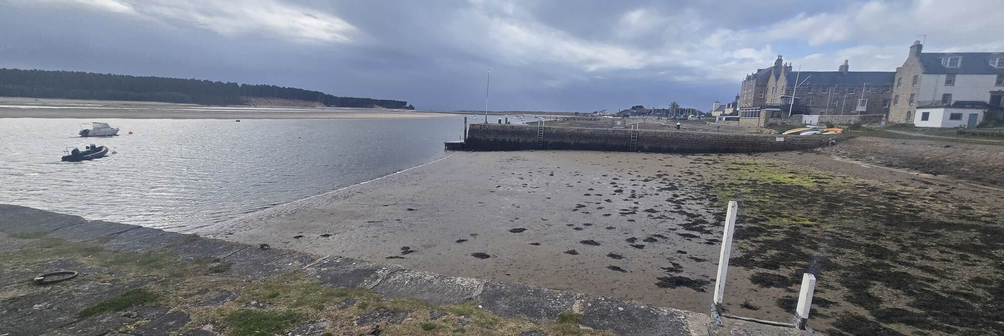
I walked the road along Findhorn Bay to Findhorn itself, a charming little fishing village with two decent pubs, one of which, the Crown & Anchor, provided me with a room for the night.
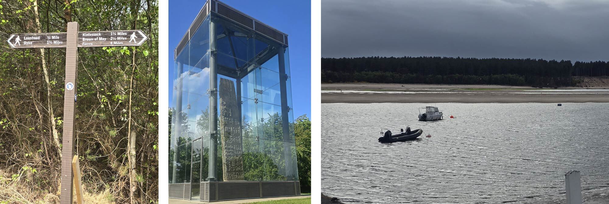
I wandered along the harbour front and took in the scale of Findhorn Bay, a large natural harbour dotted with little fishing boats. I could see the now-renamed Findhorn Forest across the bay, stretching as far as I could see to the west.
It was in the pub, scrolling through the TGO Facebook group, that I discovered the water taxi had broken down that day, so if I hadn't changed my plans, it would have meant spending the night in the accursed forest.
Day 8: Findhorn to Lossiemouth, 26 km / 16 miles
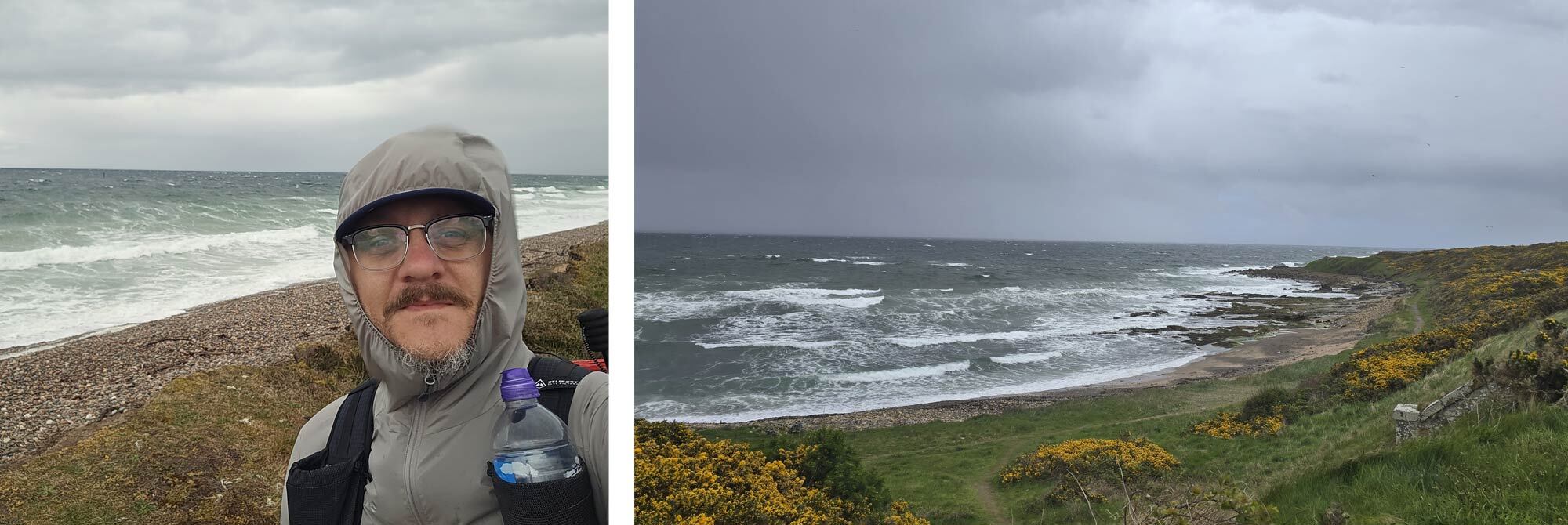
I awoke to the sound of rain against the pub window and the wind howling down the narrow streets. I had been pretty lucky with the weather so far, only having to put my brolly up a few times during the course of my trip. It wasn't the rain that really bothered me; it was the wind. Strong northerly winds were battering the whole of the UK, and little old me, on Scotland's north coast, was the first port of call for the Arctic blast.
For most other challengers further south, the higher passes and mountains were covered in snow. Strong winds and rain had been battering them for the best part of a week, and much of the discussion in the Facebook group had become fairly downhearted, so I figured it was my turn to share in the bad weather.
That said, I was actually excited about today's walk for a couple of reasons. Firstly, today's route would finally take me right along the coast. The diamond-and-dotted line that signifies a long-distance trail on the OS map, the Moray Coastal Path from Findhorn to Cullen, is rarely more than a few metres from the water's edge. This was what I had come here to walk. The gale blowing outside wasn't going to put me off.
The second reason I was excited for today's walk was the destination. My good friend Colin lives in Lossiemouth, so I was eager to see him and tell him about my journey so far over a beer.
After a fantastic breakfast of smoked kippers, scrambled eggs and rounds of toast, I was off. The wind was as bad as expected, but my wind shell was doing a good job of keeping me comfortable as I walked around the harbour onto the dunes.
The sea was angry that morning, swirling, foaming and roaring as it battered the exposed dunes. The wind snatched at my hood and drowned out my audiobook whenever I turned to face it. It was actually great fun.
I was offered some relief from the wind as I entered the woodland just south of Burghead; the wind was howling above the canopy, but below it was comparatively calm. It was early on a Friday morning, but a coffee stand was open, so I grabbed some refreshments before setting off towards the windswept coast.
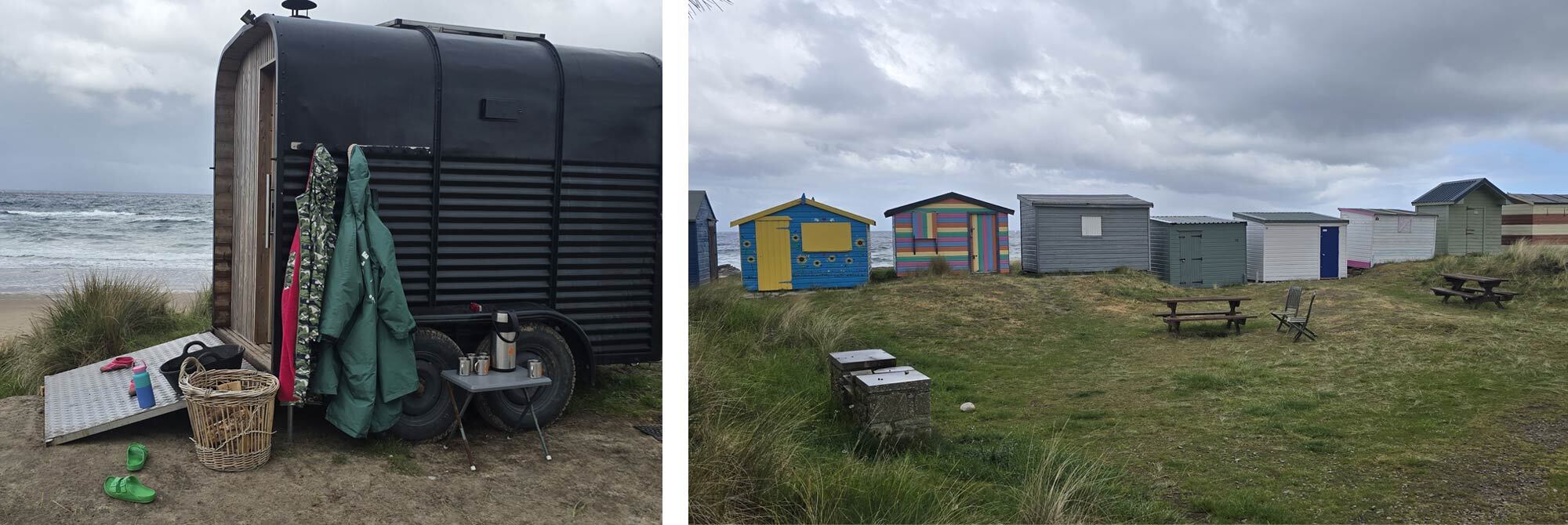
I paused at Hopeman, with its small harbour and brightly painted beach huts; two people were even enjoying a sauna on the beach. The long beaches and grey skies were perfectly punctuated by the bright yellow gorse bushes that grew in abundance along the coast.
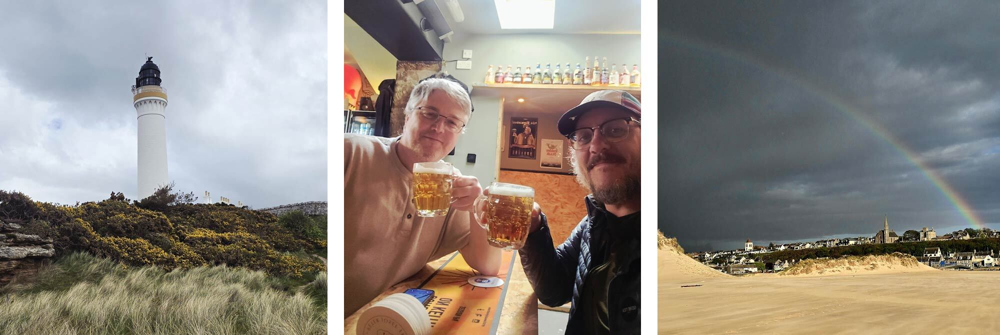
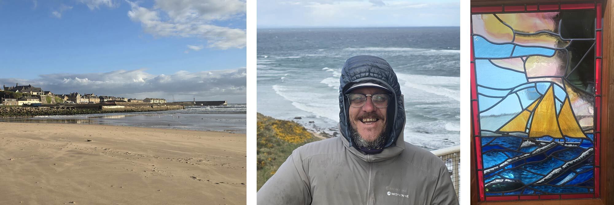
I walked above coves and cliffs as seagulls were blown off course overhead and the surf crashed below. This was the coastline I had in mind when I planned this walk, and it didn't disappoint. Despite the weather, I was in my element as Lossiemouth's majestic lighthouse came into view.
I met up with my mate Col, and we did indeed go for an ale. In fact, we got the bus to Elgin and spent the evening in a micropub with an excellent beer selection, catching up and swapping stories. It had been a week since I had started walking, and it was nice to spend an evening with a familiar face.
It had been back in Drumnadrochit, with Big Daddy, that I'd actually had a proper conversation with someone, so it was nice to feel social again. I was planning a rest day in Lossiemouth, and Col had promised me a treat the following morning.
With that to look forward to, I headed back to Lossiemouth and found a sheltered spot to bed down for the night.
Day 9 Lossiemouth Rest day.
Colin and his wife, Gisela, picked me up at 8.30 a.m. Despite knowing Colin for over a decade, this was the first time I had met his wife, who, after only a short time in her company, I decided I liked more than Colin, who is one of my dearest friends.
Gisela is a keen local history buff and incredibly passionate about Lossiemouth. She actually gives guided tours around the lighthouse, and this was my treat for the day. It was fascinating having a look around the lighthouse; the winds hadn't abated at all, so it was an exhilarating experience standing on the tallest building for miles around in the middle of a hooley. It was nice to be able to see where I had come from, away to the west, and, to the east, the landscape yet to come.
The rest of that morning, I explored around Lossy, had some breakfast, and visited the local museum. I had planned another night's wild camping, but as the wind showed no signs of dying down, I found myself at a quaint pub, checked in at 2 p.m. and didn't leave my room until the next day. It was wonderful just having a day to rest and recuperate. I was able to wash my clothes, charge my powerbank and zone out to a film. I was asleep by 8.30 p.m.
Day 10 Lossiemouth to Fochabers, 20km / 12 miles
The bridge directly opposite my hotel carried me across the River Lossie and onto the long dunes of the coastal trail. I’m not a huge fan of walking on sand, as you can never get a decent pace, and the shingle, which seemed to offer a more solid path, was just as slow going, as this was my unavoidable route for the next eight miles.
Despite my slow, frustrated pace, the walk along the ever-shifting shingle beach was fascinating. At the outbreak of World War II, this northern coastline was considered a prime target for a German landing. Over 600 kilometres of anti-invasion defences were set up along this section of coastline, and the stretch between Lossiemouth and Spey Bay has been left almost unaltered, despite showing signs of weathering and being covered in graffiti. All these decades later, they still look remarkably functional.
A long line of anti-tank concrete pillars is broken only by pillboxes, gun embankments and lookout towers. Set just behind the rise of the shingle ridge, an invading army wouldn't have been aware of the defences until they were almost on top of them.
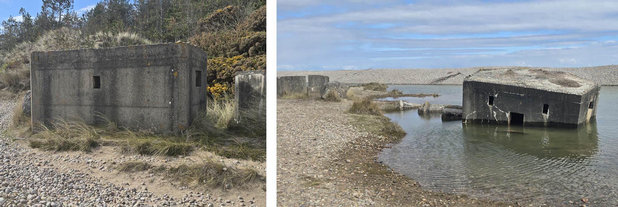
Walking past them one after another, it was hard not to imagine what this coastline must have looked like in 1940.
I reached Garmouth and gazed over the Spey estuary. Here, my route should have simply taken the viaduct over the fast-flowing River Spey; however, last year, a large section of the bridge collapsed. I was aware of the closure long before I submitted my TGO route, but it was frustrating to see a group of houses so close, knowing I wouldn't pass them till the next day.
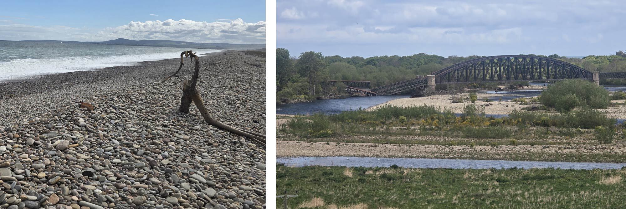
I would have to detour up to the next bridge crossing the River Spey at Fochabers, then join the Spey side, all the way back to Spey Bay, a detour of around seven miles.
The latter half of that section could wait until tomorrow, though. I made my way into Fochabers, grabbed some supplies and dinner, then headed to the River Spey. I had spent most of the day exposed to the wind on the open coast, so the sheltered banks of the river felt a world away from the crashing surf and shifting shingle of that morning. I had a pleasant evening watching the swifts and gulls along the water. As it got dark, I pitched my tent.
Day 11 Fochabers to Findochty 24km / 15 miles
The walk along the Speyside Way was actually the most interesting part of today's hike. It was a nice change of pace walking along the river in the quiet woods so early in the morning. I spotted my first herd of deer in the farmland that encroached on the town of Spey Bay.
I passed the hamlet of houses I had seen the afternoon before and turned eastward once again on the coastal path. I passed through the quiet town of Portgordon and then Buckie, another small fishing harbour town. Buckie felt like a working town rather than a tourist destination, with fishing boats tied up in the harbour and gulls constantly circling overhead.
I was mainly on the coast road for this section, and it wasn't uninteresting; it just wasn't as dramatic as the landscapes I had walked through, since I mainly passed through towns.
The never-ending gorse bushes were my companion again as I made my way to the town of Findochty, my endpoint for the day.
The campsite here is charming, right on the sea's edge, and the lady in charge told me it's a fantastic place for dolphin spotting, but unfortunately, they wouldn't appear for a month or two until the weather warms up. My pitch overlooked the sea, and I spent a while scanning the water in the hope the dolphins might ignore the calendar and make an early appearance.
I had a few drinks with some incredibly friendly locals in the nearby pub, who were all very keen to hear about my walk.
I met another TGOer, and we chatted about our walks and experiences so far, with the wind a few days ago being the main topic of conversation.
This had been a steady day underfoot, but, in all honesty, it became a little relentless later on with not much to keep the mind occupied. The scenery may have been less dramatic than previous days, but not every day on a long walk can be a highlight reel.
Day 12 Findochty to Banff, 29.5km / 18 miles
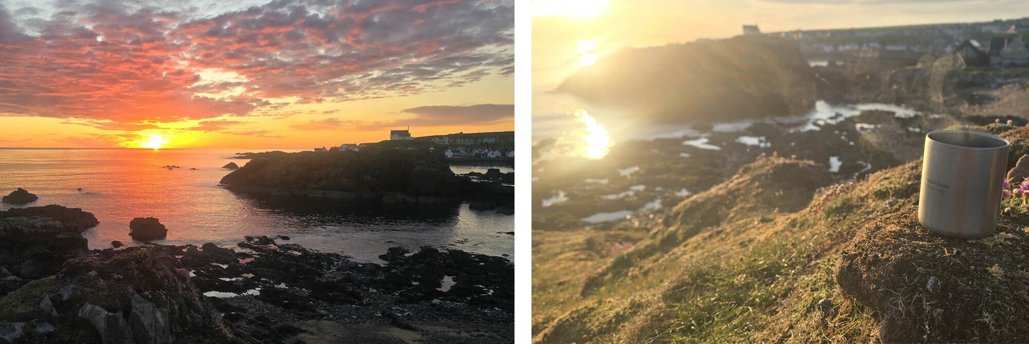
I did not sleep well that night. I was awake at 4.15 a.m. and went to the loo. I checked my watch and saw the sun would be rising in the next 10 minutes or so. Coming to the realisation that I wouldn't get back to sleep, I decided to take advantage of the early start and grabbed my cook kit. I headed up to a small mound overlooking the bay, awaiting the sunrise.
The sun broke over the sea as I sipped my instant black coffee and ate from my Real Turmat breakfast pouch. It's nice to be reminded that the small things, like watching the sun rise with a coffee, are often the moments you look back on and treasure most.
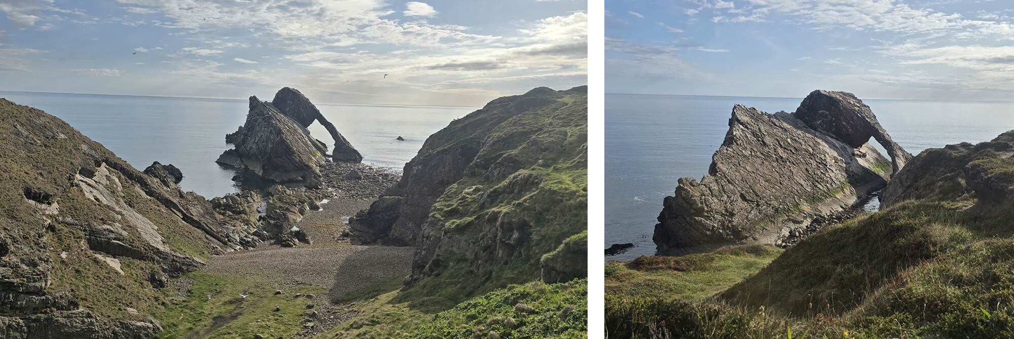
Packed up and on the trail before 6 a.m., I soon passed the quiet harbour of Portknockie; not a soul was around as boats gently bobbed on the calm sea. Just past the town, I started to see signs pointing the way to one of the Moray coastline's most impressive features: Bow Fiddle Rock, a distinctive natural sea arch. If you do any Googling of the Moray coastline, this inevitably will be the first image you see. So named, you guessed it, because it resembles a bow and a fiddle, but I think it looks more like a telephone, though I admit, Rotary Telephone Rock doesn't have the same…ring to it.
I spent a good while sitting, admiring not just the rock formation but the hundreds of seabirds that have made the rock their home. It looks like a quiet, peaceful place, but the air is filled with the calls of the colony. Guillemots, Oystercatchers and gulls of all varieties soared overhead.
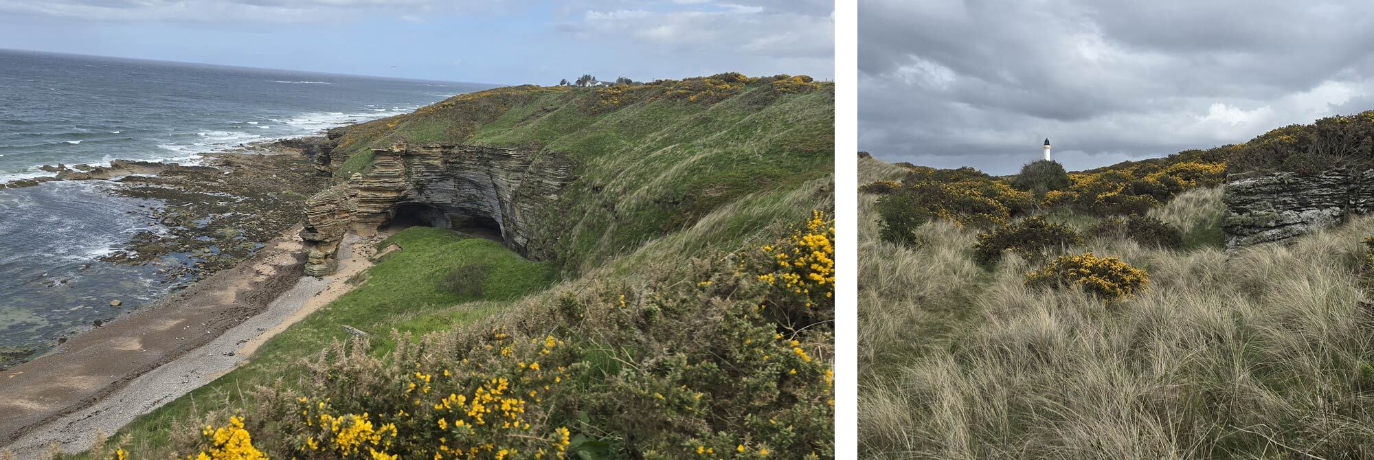
After some contemplation, I set off towards Cullen. The walk along the beach is full of more interesting rock formations, including another sea arch and some interesting caves. The tide was out, and the beach seemed to stretch on the horizon.
I'm a little disappointed that by the time I got to Cullen, it was barely 7 a.m. Cullen, of course, is famous for Cullen Skink, but I couldn't imagine many places serving piping hot fish soup for breakfast.
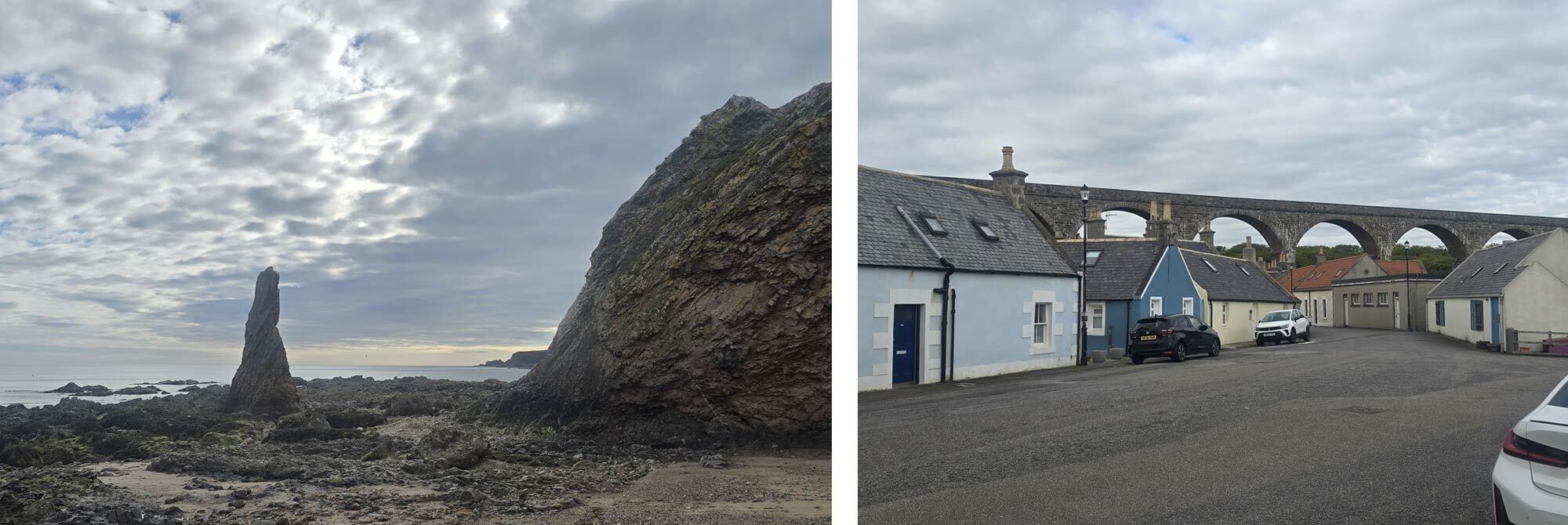
A large viaduct stretches across Cullen, giving it a distinct appearance for anyone approaching along the beach. The disused railway line is now used by walkers and cyclists, making it one of the town's most recognisable landmarks.
Cullen was only just waking up, but apart from a few early risers and dog walkers, the streets were quiet, giving me a chance to enjoy the town before the day properly began. Cullen is also the end of the “official” Moray Coastal Trail. If you are reading this and planning your own trip along this coastline, however, I implore you to continue at least as far as Portsoy. The next stretch of coastline is among the best on the route.
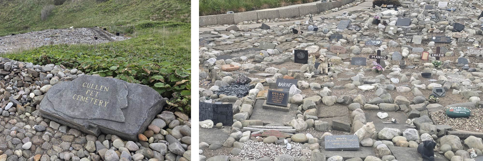
I’d already had one Stephen King encounter this trip, but passing Cullen Pet Cemetery, I did a double-take. The cemetery is a sorrowful yet charming little place right on the coastline, almost a tourist attraction in its own right. Stone-lined graves, granite headstones, wooden crosses and stone statues look out to the sea. I wish more places had pet cemeteries.
My path took me back up onto the cliffs, only to descend to the beach once more. When descending, I thought to myself, “these steps are really well made,” which, I admit, is an odd detail to include. Still, it turns out, and I know this because there was a plaque at the bottom, that one man, Tony Hetherington, built this entire section of steps with his bare hands. The plaque commemorates him rather than the staircase.
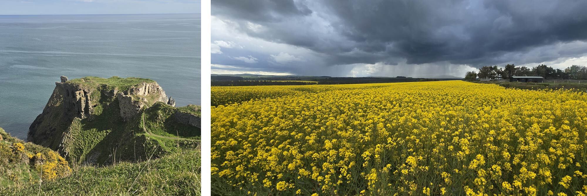
Around the corner, the remains of Findlater Castle appear almost from nowhere, as if they spring forth from the cliffs themselves. (I told you not to stop at Cullen.) These are the remains of a 15th-century castle that must have been an incredibly foreboding yet spectacular sight in its day. The ruins cling to the cliffs as if they are being drawn back into the earth, skeletal and hollow-eyed.
My coastal adventure now took a turn, and, unfortunately, the next couple of days would involve far more road walking than coastal paths. The sky darkened as I made my way past fields of oilseed rape, and the landscape changed into a more organised set of farmers' fields, so I was forced to finish the last 6 miles of today's walk along the road to the town of Banff.
It had been a fantastic day on the trail, arguably the last truly great day. Tomorrow was the penultimate day of the crossing, and my focus had narrowed to just two things: Fraserburgh and a phone box.
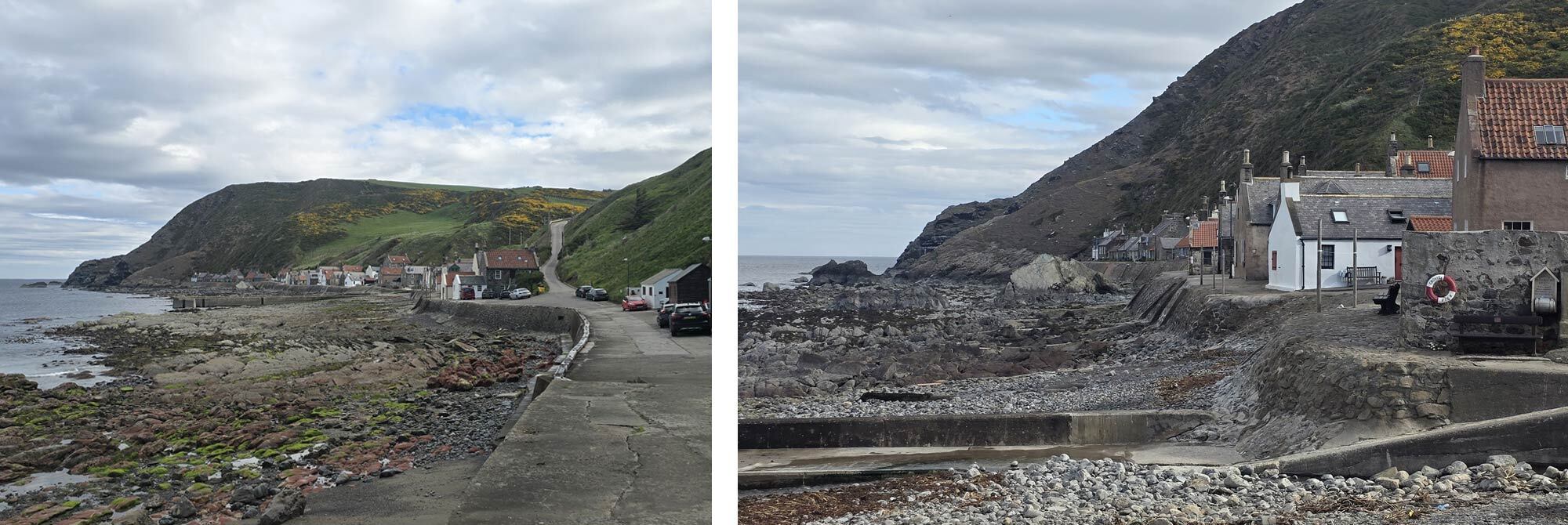
Day 13 Banff to Gardenstown, 17km / 10 miles
There is no point in sugarcoating it: today was a slog, thankfully a rather short one. I took full advantage of my 11 a.m. check-out time and lounged around, drinking all the complimentary tea and coffee in my room before I set off.
Ten miles. Three hours of walking, pretty much all along the same road. I took precisely three photos on this day before I got to Gardenstown: two of the same bridge and one of my breakfast, just to give you an idea of the day's spectacular majesty. Well, at least I was staying above a pub tonight. I could take solace in that, couldn't I?
I really liked Gardenstown. There is a single road, which snakes back and forth down to the seafront. The houses are built right down to the seawall. They struck me as the sort of places that would be fantastic to sit and watch a storm from.
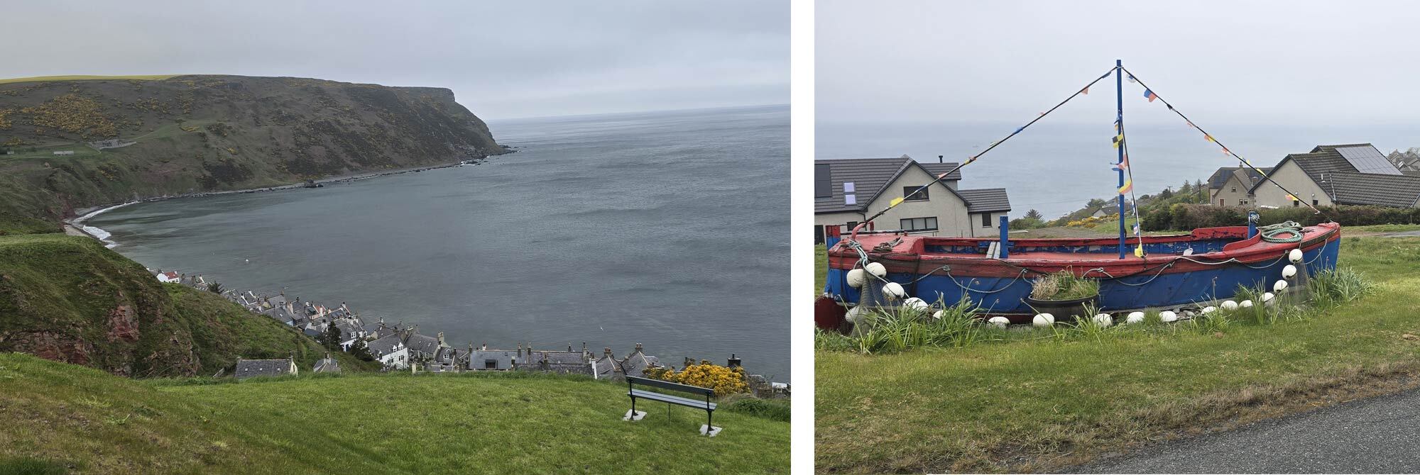
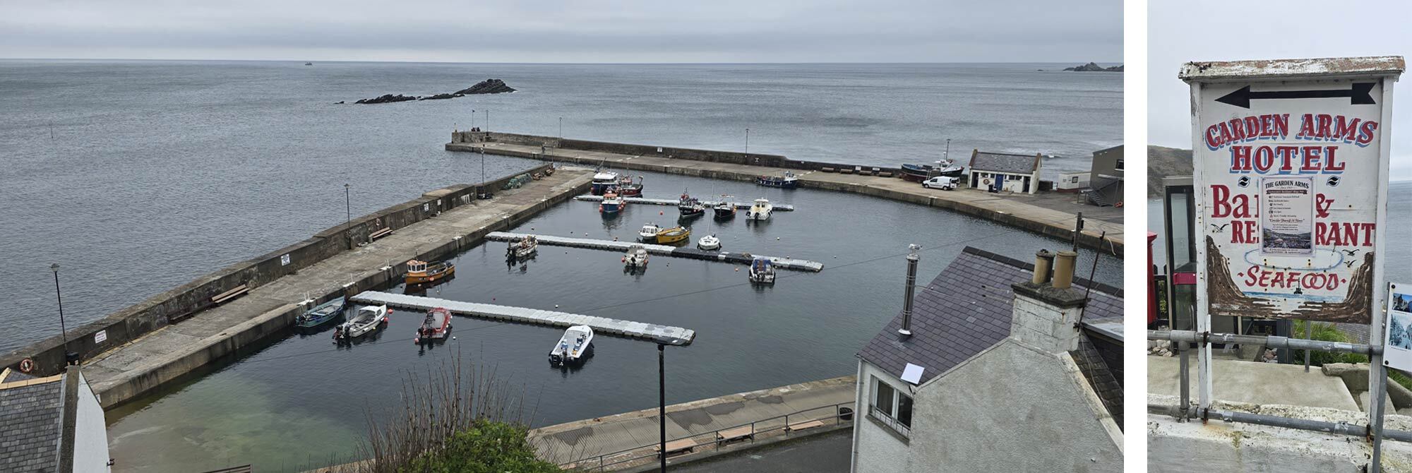
The place had a slight Wicker Man vibe (without the actual wicker man), a “folk style.” The door knockers and imaginatively decorated tables outside the pub had a brilliant aesthetic that gave me Summerisle vibes. Sadly, the pub (which I was staying above) doesn't open on a Tuesday. I still had my room; in fact, I had the whole floor of the building, but my pub lunch and a pint were now out the window.
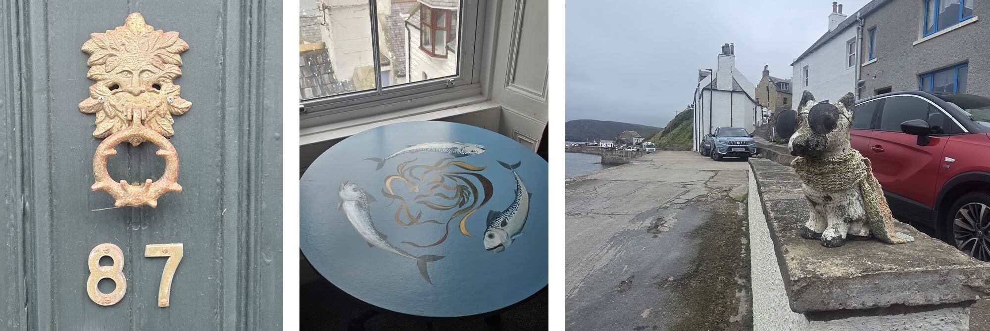
The “Wee Shop” on the “main road” (it had a pub, shop, and cafe) was well stocked, and the incredibly sarcastic shopkeeper was keen to hear about my walk across Scotland; we chatted for about 15 minutes. He was good company and a purveyor of fine malts.
I was in bed early, keen to get an early start on the last day of my TGO challenge. It felt strange knowing that tomorrow would be my final day on the trail. I was looking forward to being home, in my own bed, and seeing my love and the cats, yet I wasn't sure I was ready to just stop walking.
Day 14, Gardenstown to Fraserburgh, 27km / 17 miles.
I was pleased my route took me along the harbour front, rather than back along the main road out of town. My path hugged a small, gorse-lined stream that led me out into farmland, onto a track that turned into a quiet country road.
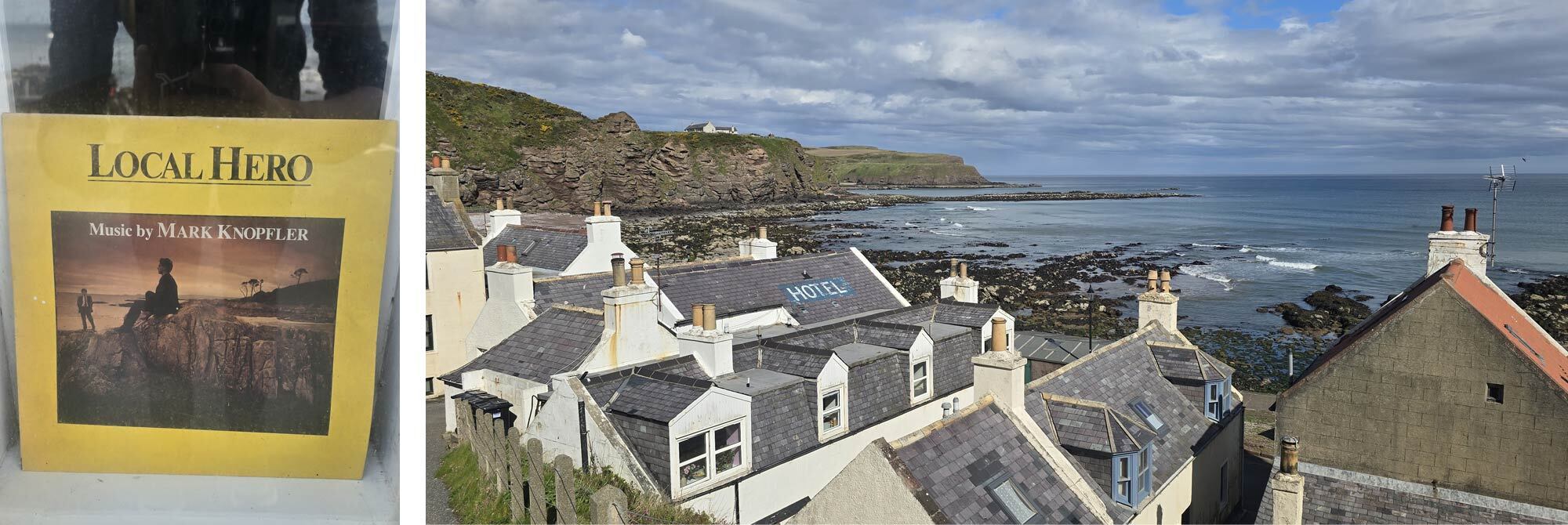
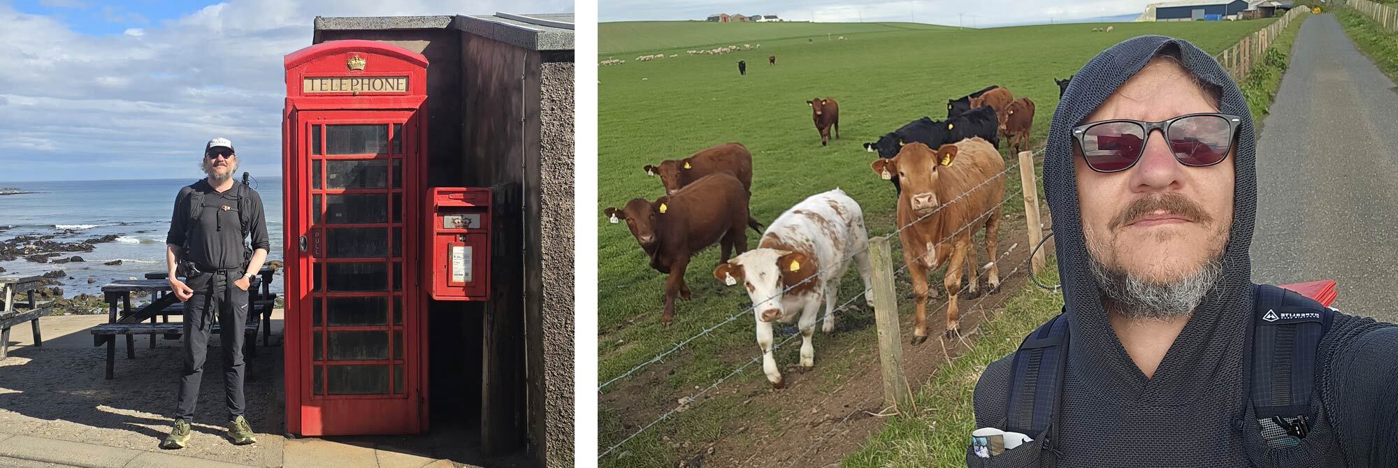
I was heading toward Pennan, a town famous to those in the know. Pennan has an unusual tourist destination: a red phone box that became famous for its role in the film Local Hero, starring Burt Lancaster, Peter Riegert and a young Peter Capaldi. Almost as famous as the film is the soundtrack recorded by Mark Knopfler; the main theme, "Going Home”, has become synonymous with this part of Scotland.
It's a film about a man falling ever more in love with the landscape he is attempting to buy for a Texan oil and gas company, with the isolated beauty of Pennan as a fitting setting for a film where stark beauty is the overwhelming theme. Local Hero is one of my favourite films (it's number two, behind The Wicker Man, just above Withnail and I), but it's also one of my Dad's, so this felt like a pilgrimage.
It was a strange feeling, finally standing beside something that had occupied such a large space in my route planning.
I got the obligatory photo of me next to the phone box, a friendly local was happy to oblige, and then I was off…going home.
The walk out of Pennan cuts through a farmer's field, which was home to a large number of curious cows. Evidently, I was the most interesting thing they had seen that morning, so I was eventually forced to hop over a barbed-wire fence.
The road through the farm would be the road I followed all the way to Rosehearty, where I stopped for a light bite. From there, the walk into Fraserburgh is largely on the pavement, following the coast road.
I was just walking along a road, but the views out to sea were still fantastic, a final flourish from the coastline before it sent me on my way. I passed a group of killer whale spotters and, remembering a conversation I'd had back on the Isle of Skye about two famous male orcas, asked if they were hoping to see them.
"No mate, they're on the other side of Scotland."
Didn't I just know it.
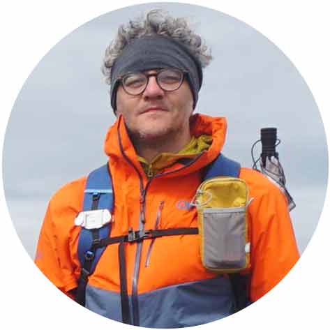
The Kinnaird Head Lighthouse, built into a converted castle, made a fitting endpoint to my walk and marks the most northerly official finish of the TGO. It came into view inconspicuously as I rounded the final corner. After two weeks on foot, it felt strangely surreal that there was nowhere left to walk to. The 2026 TGO was complete.
It had been an amazing journey, and I was proud to say I had completed it solo, on a path not often travelled by other challengers.
The Moray Coast had been everything I had hoped it would be and more. I'd set out looking for a different side of Scotland, and I'd certainly found it. It may not be the most popular TGO route, but I wouldn't hesitate to recommend it. Saying that, next year I’ll see you in Braemar, yeah?
 |
||
 |
||
| Andy Neil |
||
|
Andy has been a keen long-distance hiker and wild camping enthusiast since he completed the Cleveland Way in 2015. Since then, he has walked thousands of trail miles all over the UK and is an active member of the Wild Camping UK community, being an admin of the largest wild camping community on Facebook. He strongly advocates for responsible wild camping and believes it is important to leave no trace when camping in the wilderness. He joined the UOG team in 2021 and works as a website developer and content creator. |
||