One Year with the Suunto Vertical: A Long-Term Hiking & Camping Review
Posted by Andy Neil on Jul 09, 2025

The Suunto Vertical Titanium Solar (72g) is a rugged, GPS-enabled multi-sport watch built for outdoor adventure. It offers offline maps, dual-band GNSS tracking, an altimeter, barometer, compass, and solar-assisted battery life. While it’s capable of tracking just about every sport under the sun, I’ve used it exclusively for hiking and camping.
I first started using the Suunto Vertical last year during my TGO Challenge. I’d never used a “sports watch” before, but the idea of having a map on my wrist, saving me from constantly pulling out my phone or paper map, was what sold me on it. Since then, it’s been glued to my wrist any time I’m heading out, whether I’m lacing up my hiking boots or slipping on trail runners.
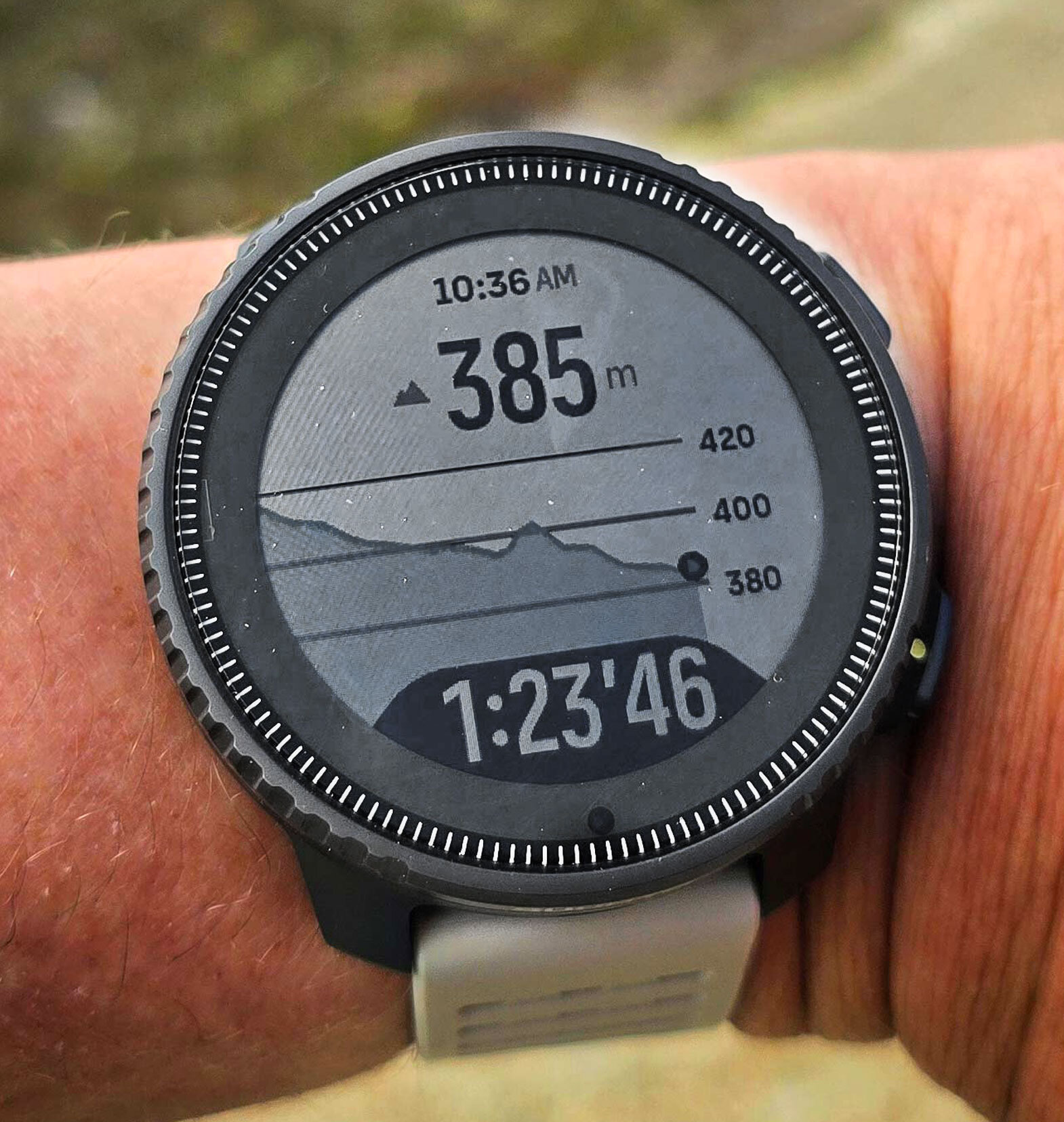
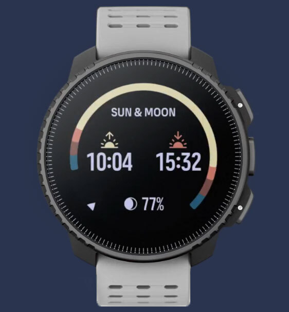
Over the past year, it has guided me along long-distance routes like the Pennine Way, supported wild camps in the Lake District and Yorkshire Dales, and accompanied me on nearly every day hike I’ve done since. It’s helped me find my way through low visibility on moorland ridges, check weather changes before committing to a pitch, and keep track of how much daylight I’ve got left before I need to call it a night.
Battery Life & Charging
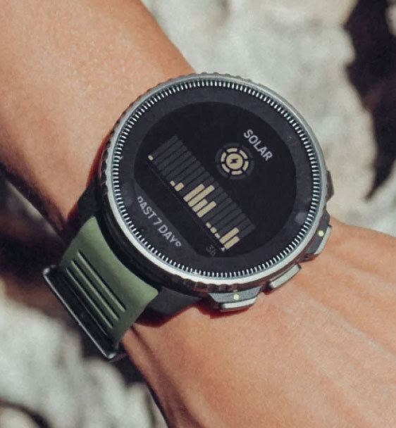
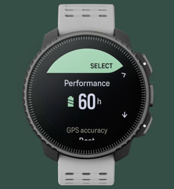
Battery life was one of the first things that sold me on the Suunto Vertical, and after a year, it continues to impress. With tracking and maps on, I regularly get 4–5 days before I need to think about charging.
Solar charging is a gentle top-up, not a full refill. But on bright days, I squeeze out an extra half-day, which can be a real bonus. On sunnier multi-day trips, I’ve noticed I can squeeze out an extra half-day or so. Is it game-changing? Not quite. But useful? Definitely.
Impressively, the magnetic charging cable hasn’t let me down either. The watch still latches onto it like it did on day one, even after the cable has spent countless days getting tossed around in my electronics bag.
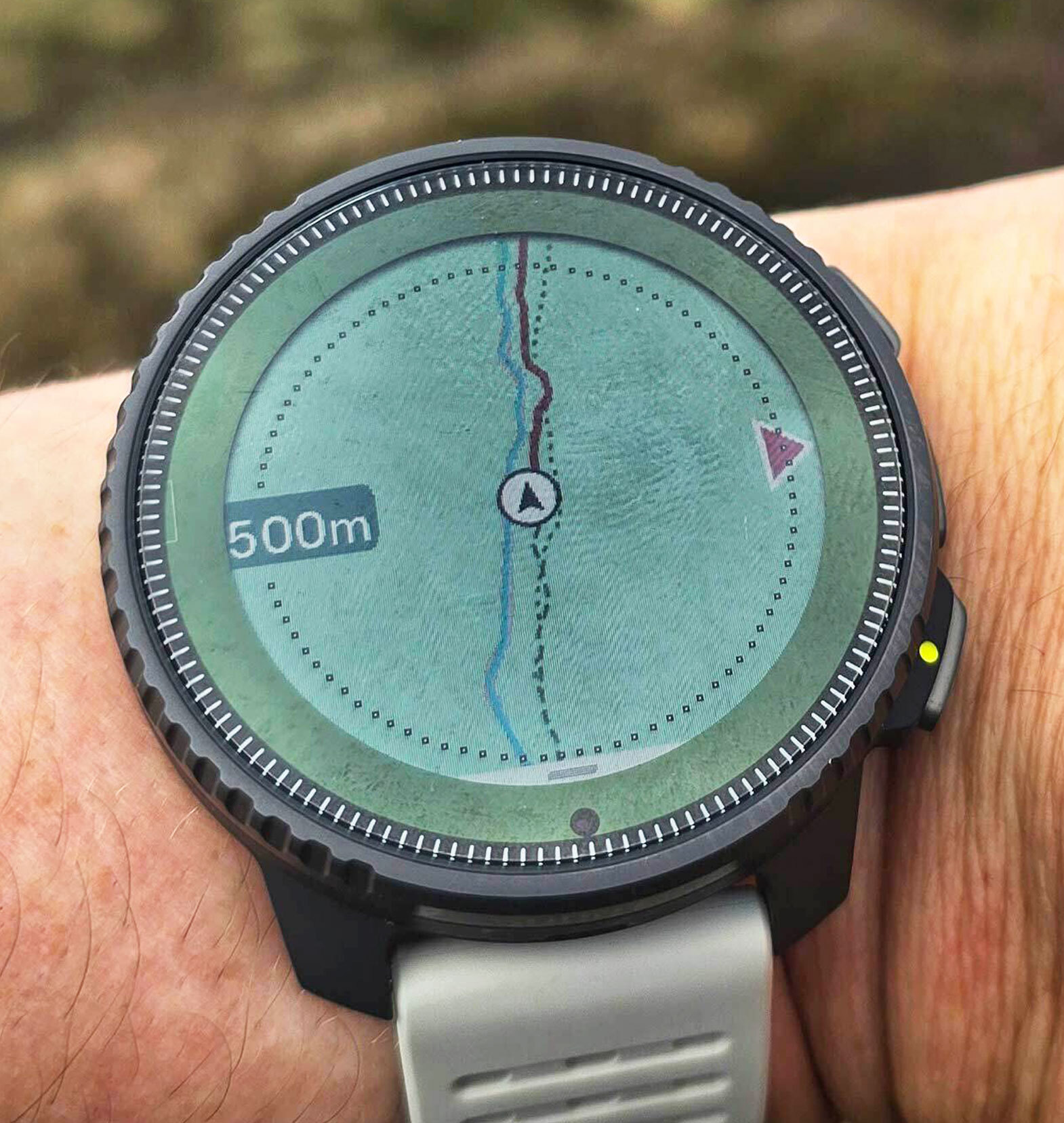
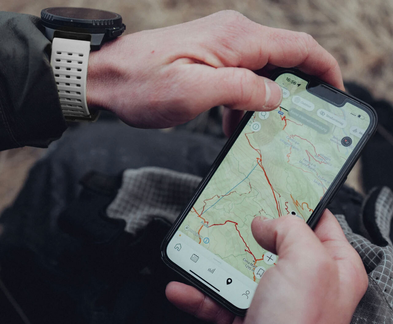
Mapping & Navigation
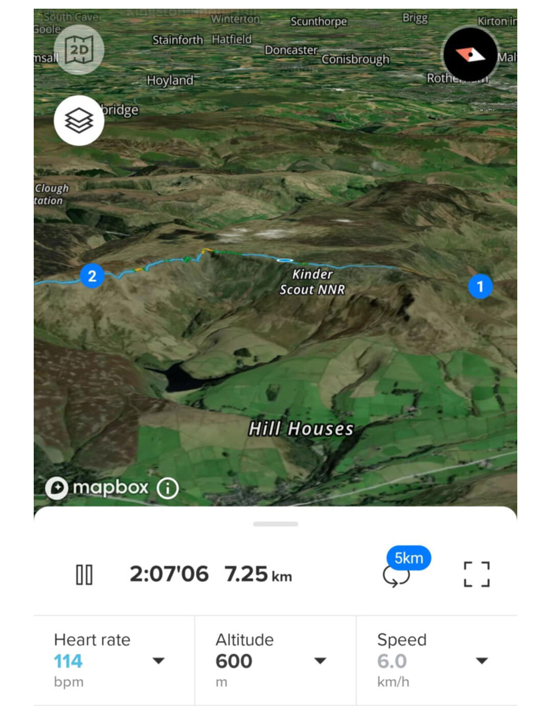
Having offline maps on my wrist has completely changed the way I hike. I am no longer reaching for my phone every time the trail splits. The Suunto displays contour lines, trails, waypoints, and landmarks without needing a mobile signal. You can download large sections of map data. Scotland, for example, is covered by a single file, so even if you leave the trail or need to cut a hike short, you still have full mapping available right on your wrist.
This has been especially useful in remote areas, such as Glen Feshie or the more isolated parts of the Howgills, where mobile signal is unreliable or completely absent. While my phone might struggle to load map tiles, the Suunto continues to show me exactly where I am and what's around me.

Since I no longer rely on my phone for navigation, I save a lot of battery life on multi-day hikes. That also means my phone and power bank last longer.
One lesson I learned the hard way is to always update your offline maps before a trip. I once started a section of the Pennine Way without refreshing my maps and was left with just a breadcrumb trail. Not ideal, but the tracking was still solid, and I managed to find my way just fine. It is genuinely impressive how well it holds accuracy, even in steep valleys or under tree cover.
Planning routes in the Suunto app is decent, although I would like to see a desktop version rolled out. Dragging waypoints around on a phone screen can get tiresome quickly. When importing GPX files from other platforms, such as Garmin or OS Maps, the elevation data can also be inconsistent. I have found it more reliable to plan routes directly in the Suunto app and export from there if needed. It is simpler and avoids surprises.
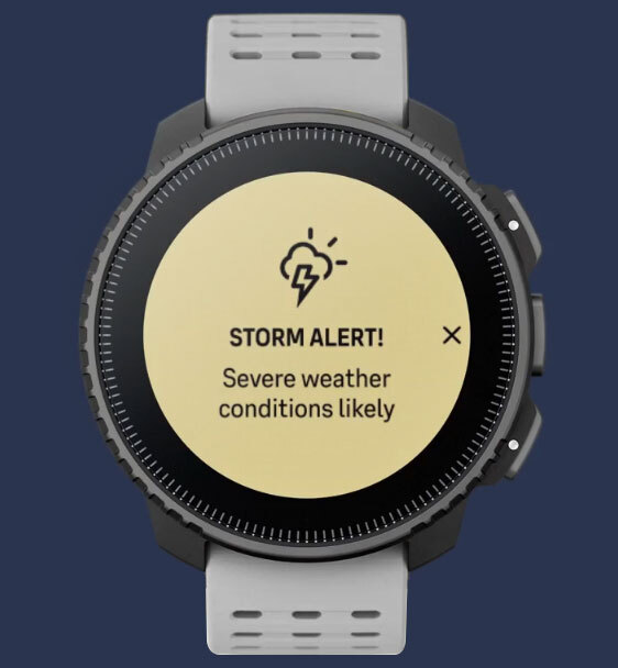
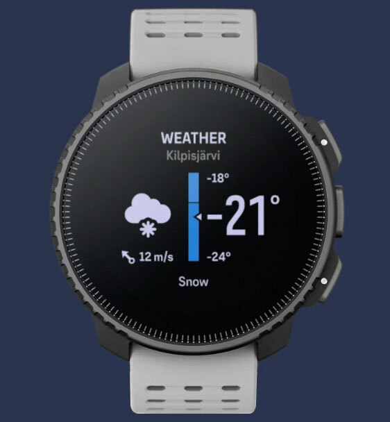
Weather & Safety Features
The storm alerts weren't something I was particularly aware of until my wrist started buzzing while climbing out of Ennerdale. This gave me just enough warning to drop off the ridge and get my tent pitched before the rain and thunder rolled in.
The weather forecasts aren't going to replace Met Office forecasts, but for real-time trail decisions, it does the job.
Interface & Updates
One thing to note: Suunto pushed a UI update shortly after I got the watch, which completely changed the layout. It was a bit jarring at first, so I recommend making sure the watch is fully updated before taking the time to learn the interface. Once I got used to it, the layout felt intuitive, and the menus became second nature. Since then, the regular firmware updates have made the watch more stable and user-friendly.
The interface is also highly customisable. You can choose different themes, adjust what is shown on the watch face during various activities, and even customise what the physical buttons do. Whether you prefer a minimal screen while hiking or more detailed data during navigation, the watch allows you to set it up the way that works best for you.
Durability & Wearability
In the year and a bit I have owned this watch, I have worn it in sideways rain, up scrambly ridgelines, through bogs, and while lugging a rucksack for miles. It still looks almost new. The screen is scratch-free, the case shows no signs of wear, and the magnetic charging system has held up without issue.
There are no fiddly ports or areas that trap grit or water, and I have never had to baby it. I usually take it off at night, just out of habit, but it is comfortable enough to wear all day. The perforated strap breathes well, even on sweaty summer days, and it never rubs awkwardly under a cuff or jacket sleeve.

Suunto App & Syncing
The app has been one of the more pleasant surprises. Syncing is fast, just open the app, and within seconds, routes, weather updates, and recent activities are all pulled in.
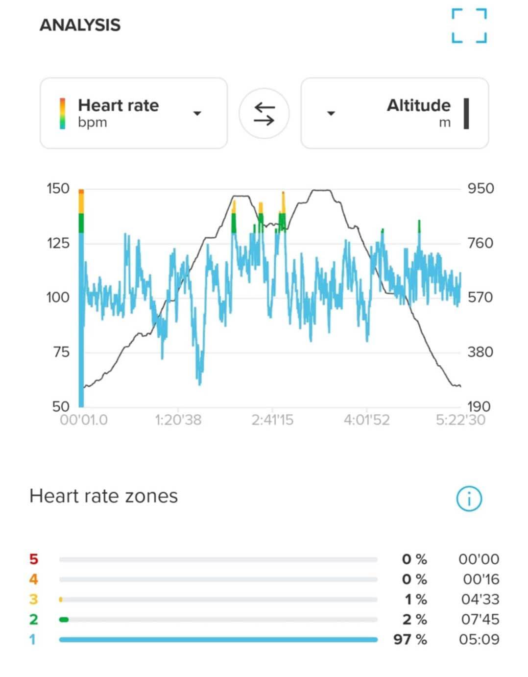
I really like being able to scroll through my old hikes, with pace, elevation, heart rate, and other details all laid out clearly. One of my favourite features is the ability to "dot-watch" my own trips. It's a nice reminder of previous adventures, a nice way to relive them in a few minutes, say on the settee.
That said, as mentioned, I’d love to see a desktop version of the app, especially for planning long routes with detailed information. Doing everything on a phone works in a pinch, but it's somewhat limiting when you’re planning multi-day trips.
Final Thoughts
After a full year, the Suunto Vertical is no longer just a piece of gear. It has become an integral part of how I hike and plan my trips. It is my map, my weather forecast, my tracker, and my safety net.
There are still things I would like to see improved. A proper desktop planner. Smoother GPX imports. I suggest a few more navigation tweaks. But the core experience is dependable, accurate, and rugged. It is rock solid.
If you are the kind of person who heads out into the hills not to escape tech, but to make it work for you quietly in the background, the Suunto Vertical is your new favourite trail companion. It certainly became mine.
.
 |
||
 |
||
| Andy Neil |
||
|
Andy has been a keen long-distance hiker and wild camping enthusiast since he completed the Cleveland Way in 2015. Since then, he has walked thousands of trail miles all over the UK and is an active member of the Wild Camping UK community, being an admin of the largest wild camping community on Facebook. He strongly advocates for responsible wild camping and believes it is important to leave no trace when camping in the wilderness. He joined the UOG team in 2021 and works as a website developer and content creator. |
||
The Suunto Vertical Titanium Solar (72g) is a rugged, GPS-enabled multi-sport watch built for outdoor adventure. It offers offline maps, dual-band GNSS tracking, an altimeter, barometer, compass, and solar-assisted battery life. While it’s capable of tracking just about every sport under the sun, I’ve used it exclusively for hiking and camping. I first started using the Suunto Vertical last year during my TGO Challenge. I’d never used a “sports watch” before, but the idea of having a map on my wrist, saving me from constantly pulling out my phone or paper map, was what sold me on it.