Nick's TGO Challenge 2025 – Part 2
Posted by Nick Brown on Aug 19, 2025

Day 7 - 14th May
Invernahavon Campsite – Glen Feshie
- Distance: 26.47km
- Altitude: 678m
- Steps: 27,783
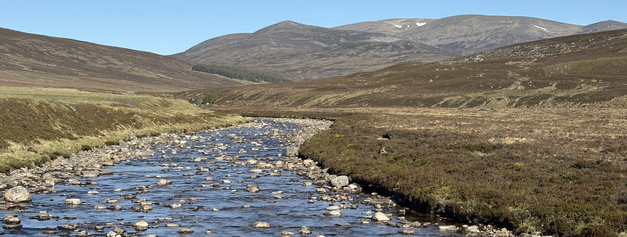
The downside of having a campsite so close to the A9 and railway line was when they decide to do any maintenance, they tend to do it at night so not to disturb the traffic. However, it does disturb campers! The sound of rattling machinery seemed to go on all night; I must have only managed to get a couple of hours sleep at best. I longed for the peaceful wild camp spots! I eventually woke to my first overcast day of the trip. Low cloud seemed to just touch the nearby peaks; this was more like Scotland. I packed my gear and headed off, crossing the A9 and headed into the Cairngorms. I was over halfway now and crossing the A9 felt like crossing a boundary. The landscape noticeably changed as well. Gone were the rugged mountains of the west coast, here were the high rolling heather clad hills of the Cairngorms. I followed a 4x4 track into the hills, checked the map and turned east to cross the moorland aiming for a valley. The low cloud was now beginning to break, and the sun was coming through. Bashing through heather isn’t too much fun but with the dry ground underneath made it easy going. It does mean you can’t see where your feet are landing which isn’t too much of an issue when dry however when I came across the skin of an Adder it did make me bash a little louder!
Once I had passed through the valley, and a lovely patch of woodland on the decent, I came to a proper footpath beside the banks of the River Tromie. When planning my route, I had been told that the bridges across the Tromie were all out and I would potentially have to walk 10km north to find a working bridge. I had put an alternative route in if the weather was poor but given the good weather I had already committed to my current route. I was just wishing the Tromie would be low enough to cross. Initially this didn’t seem the case as it looked at least waist deep in places and flowing quite fast. I looked at the map and decided to follow the edge of the river further up where it looked like it split and became wider, and I hoped shallower. Fortunately, my theory was correct and just by a stalker’s house I took my boots off, rolled up my trousers and attempted to cross. At this point I should say I had forgotten to bring any sandals or flip flops, despite planning to. I therefore edged my way across the river feeling for the least pointy or slippy rocks and steadying myself with my poles. Thankfully I made it across unscathed and rather enjoyed a cooling off.
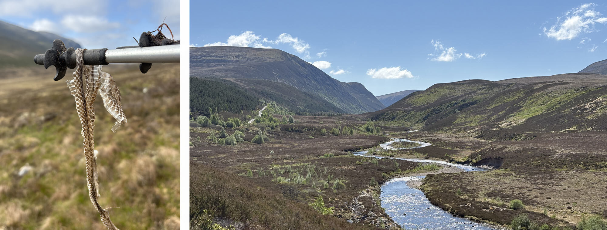
Shedded Adder Skin and View up the River Tromie having just crossed it.
After following the river and taking a break at a dam and enjoying the expansive views of the wide-open Glen, I checked the map and found a rough trail on the north side of the river. I quickly realised that the maps were not fully up to date and after bashing through more heather and a boggy riverbank, realised a gravel road had been put in on the other side as well as a brand-new bridge. My first clue came when I saw a large lorry thundering along in a cloud of dust! I was feeling a little annoyed I had been wasting time and energy trying to locate this path when I could have just stayed south of the river and crossed at the shiny new bridge. Oh well. This was also around my original camp spot but having gained some distance the day before and still only mid-afternoon I thought I’d carry on and get into Glen Feshie.
The dirt road led up the hill side to an area of wood that was being dug out, so I managed to skirt around the edge of these works and stay high on the hillside before regaining another dirt road and heading to the col between two peaks. The sun was quite unrelenting at this point and with little wind it was hard going, but as I dropped down the other side of the col, I found some shade. Having been to Glen Feshie before I knew it was a beautiful Glen with the landowner attempting to rewild it with native trees. I came down to a meeting point of trails at the bottom of the Glen and just next to a small stream and some trees I found the perfect camp spot. It was lovely and sheltered with little wind and no signs of midges. I got my tent up and sat and enjoyed the peaceful view. I was only about a kilometre south of the recently renovated Ruigh Aiteachain bothy which assumed would have been busy, so was quite glad of my idyllic spot.
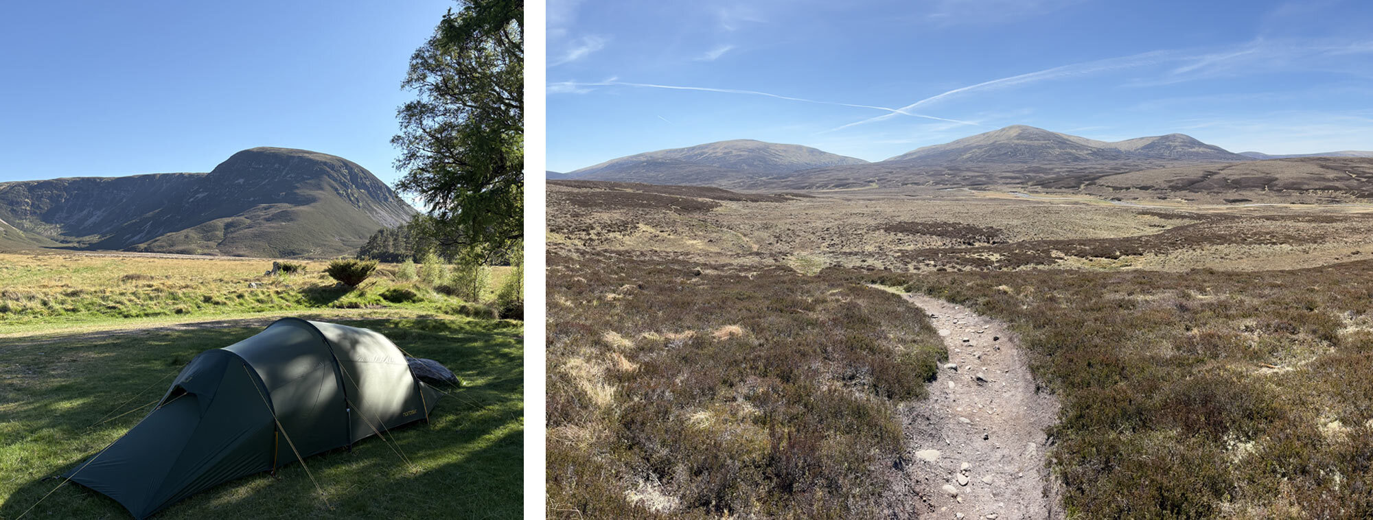
Lovely camp spot in Glen Feshie and the Wide expanse of the Southern Cairngorms.
Day 8 – 15th May
Glen Feshie – Red House Bothy
- Distance: 19.88km
- Altitude: 375m
- Steps: 19,874
Camping at just under 400m meant it was a colder night than most of my previous ones. I had to zip my down sleeping bag up for the first time. A little frost on the outside of the tent showed how cold it had been but as the sun began to break through into the valley it already felt warm. Once again it was a blue-sky morning. Surely this couldn’t last the whole two weeks I thought. Having previously lived in Scotland for a while this was unheard of! I had some breakfast, packed up my gear and headed up Glen Feshie. From this point I was crossing the middle of the southern Cairngorm range and wouldn’t see a road until I reached the Linn of Dee and Braemar. Glen Feshie continued to impress with a stunning rewilded wooded section full of native trees. I had to cross the river but because of the lack of rain it was not a problem and could hop across rocks barely getting my boots wet. I kept going and gradually got above the tree line, the Glen began to open out and the high rolling hills came into view. The trail was easy going gradually following the contours and undulating in places with the Feshie still flowing on my right-hand side. My steady speed was only interrupted when I came across a hissing Adder on the path that quickly headed into the heather. I managed to get a photo before it disappeared into a small hole in the ground continually hissing as it went. This area was the only place I had previously seen Adders in Scotland, so it was nice to see another.
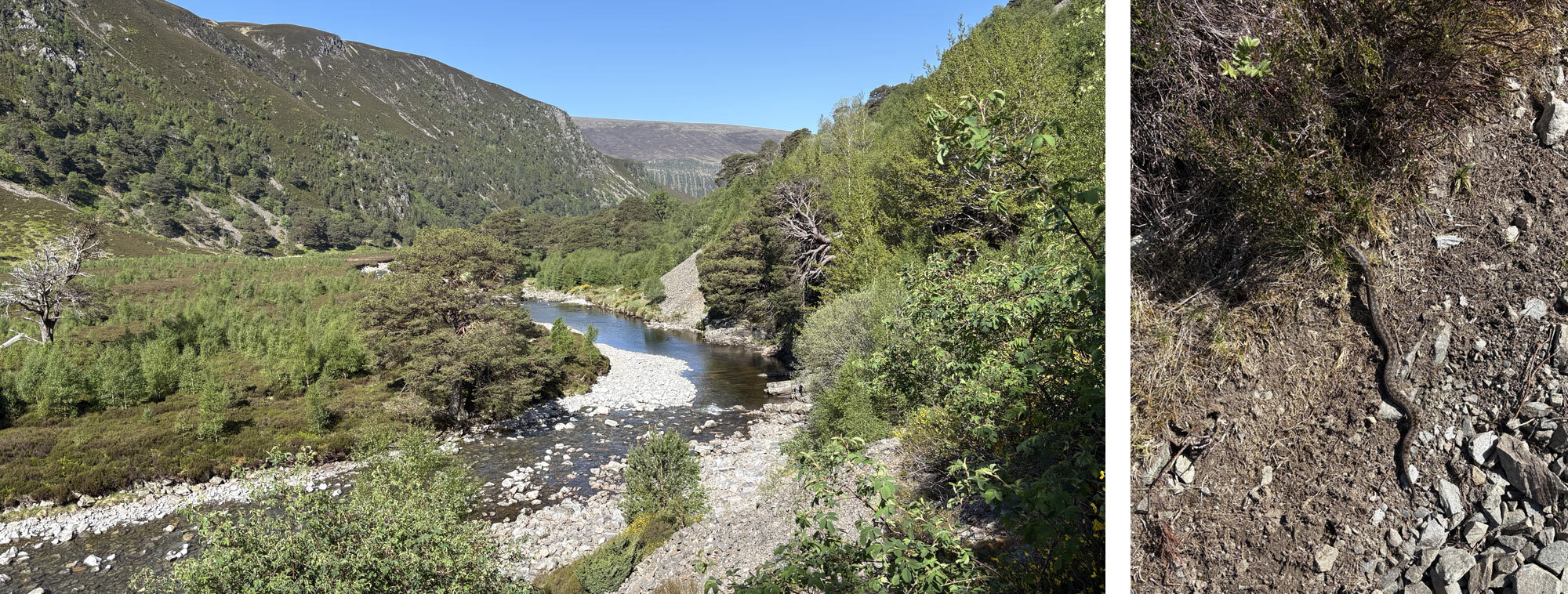
The river Feshie flowing into the Glen.
I continued on and got over the high point of the day. I had lost the Feshie at this point and picked up the River Geldie as it flowed down the opposite side. When I came to a small stream that was flowing off the hills and dropping into the main part of the river, I took the opportunity to refill my bottles and have some lunch. I sat on the rocks by the stream and enjoyed the tranquillity. Not long after sitting down a fellow Challenger appeared named Darren who happened to live not far from me. We had a quick chat, and he continued on. As I was getting comfy what can only be described as a “herd” of mountain bikers appeared on the trail. There must have been around 15 of them appearing to struggle on the narrow path but following the river down, I am assuming to Braemar as well. I packed up my stuff and started walking and despite only going at my normal pace, I seemed to be catching up with the bikers. At this point the path split and I headed away from the main river. It took me out, contouring around the hillside and crossed a small valley. The path crossed over the valley on a narrow bridge that went over a gorgeous waterfall with a large pool. It was a hidden gem that I didn’t expect to see. The trail was straightforward, and it wasn’t long before I got to the Red House Bothy. This was recently renovated, and they had done a fantastic job, it even had a composting toilet! However, as it was a popular spot I thought I’d pitch my tent outside as there was a nice flat area. As the evening went on numerous other Challengers appeared, some opted to stay in the Bothy and some camped outside as well. We exchanged our stories of the challenge so far and had a very pleasant evening.
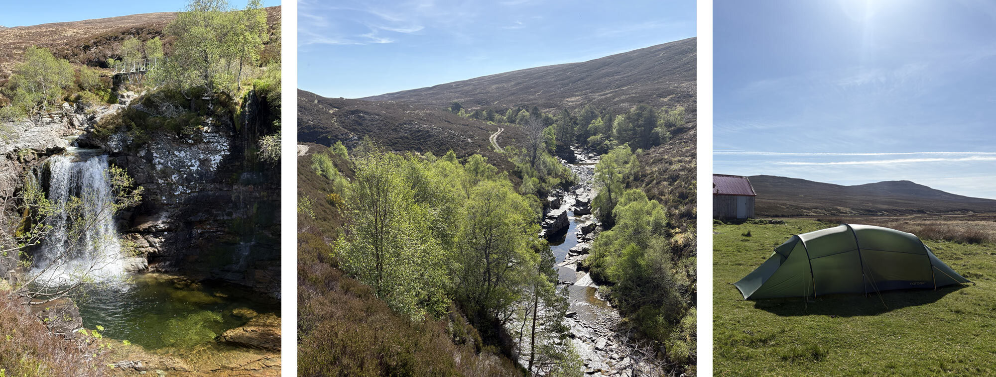
Stunning waterfall, upper stretches of Glen Feshie and camping next to the Red House Bothy.
Day 9 – 16th May
Red House Bothy - Braemar
- Distance: 19.07km
- Altitude: 168m
- Steps: 30,964 (extra steps taken walking around Braemar!)
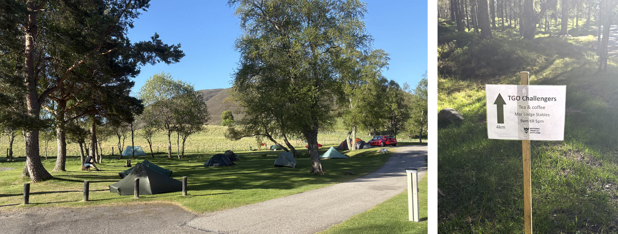
It was another frosty start to the day, so after shaking the ice from my tent I packed my gear and got ready to go. Today would be one of the shortest day walking days of the challenge. Originally, I had planned to walk through Braemar and camp somewhere nearer Balmoral. However, whilst reviewing my route I decided to change my plan and stay at Braemar campsite. This meant I could have a food parcel delivered and have a chance to wash some clothes. I also wasn’t sure how easy it would be to camp nearer Balmoral and didn’t want to risk it.
It was a very straightforward walk to the Linn of Dee and one I had done on numerous occasions, however usually on a bike. I passed a few people heading to bag some of the Munros in the area. It didn’t take too long to get to the Linn of Dee and start on the tarmac road. I had heard from other challengers that Mar Lodge put on tea, coffee and biscuits for anyone passing through, so I made sure I aimed for this. By mid-morning I was sipping a very welcome cup of tea at a large table with many other challengers. It was very pleasant and nice to chat about other people’s experiences so far. After a second cuppa I headed off over Victoria Bridge. I decided to take a scenic route via a wooded track to Tomintoul above Braemar. There were some lovely clear views over to the snow patches still on the peaks of Beinn a’Bhuird beyond the other side of the Glen. The path dropped down past the golf course and into Braemar.
Following the River Dee towards Braemar.
Being very used to TGO challengers Braemar campsite set aside an area of grass just for us. When I arrived, there were a few tents already pitched so I picked a spot and headed into the town for some lunch. I had a nice, chilled rest of the day and bumped into Paul and Charlie again which was good. I got some washing done (thanks to Darren who I met the day before for sharing a washing tablet) and enjoyed some fish and chips from ‘The Plaice To Be’. At the campsite there was a small communal area with a couple of sofas and where the TGO organisers had supplied a charging station. It was a nice spot to chat and socialise. I knew the next day was going to be a long one so had an early night.
Day 10 – 17th May
Braemar – Halfway Hut
- Distance: 40.25km
- Altitude: 813m
- Steps: 50,627
I woke early and packed up my tent and ate some porridge before setting off. This was going to be the longest distance day so wanted an early start. I headed out of Braemar and up into the woods through Corrie Ferragie. I wanted to avoid the road as much as possible so aimed to walk through the Balmoral estate, however it was a bit of a labyrinth of forest tracks, and I had to check the map on numerous occasions to make sure I was one the right route. The path took me just south of the estate and through a lovely Glen called Dudh-chlais and into Easter Balmoral. I was about 15km in, and it was now time to hit the tarmac.
Unfortunately, the route between Braemar and Ballater was all road walking. Having checked and double checked the map there really wasn’t an alternative that didn’t add significant distance to my route. It was 11km of very hard ground on already sore feet and the sun was unrelenting as well with not much shade. I broke it down into quarters and took a break every 2.5km with a longer break after 5km. When doing any monotonous walking or mountain climbing this was the way I would cope, and it always works. Sometimes its as simple as aiming for a point in front of you and only taking a break once you get there. One small bonus I did come across on this section was a couple of tubs of baked treats that had been left by the Ballater hotel with a small sign on top for TGO Challengers. Clearly someone at the hotel had done this route before and knew what sort of motivation would work and it absolutely did! I arrived at the outskirts of Ballater mid-afternoon. My route wasn’t taking me into the town but out and up into the hills behind the House of Glenmuick.
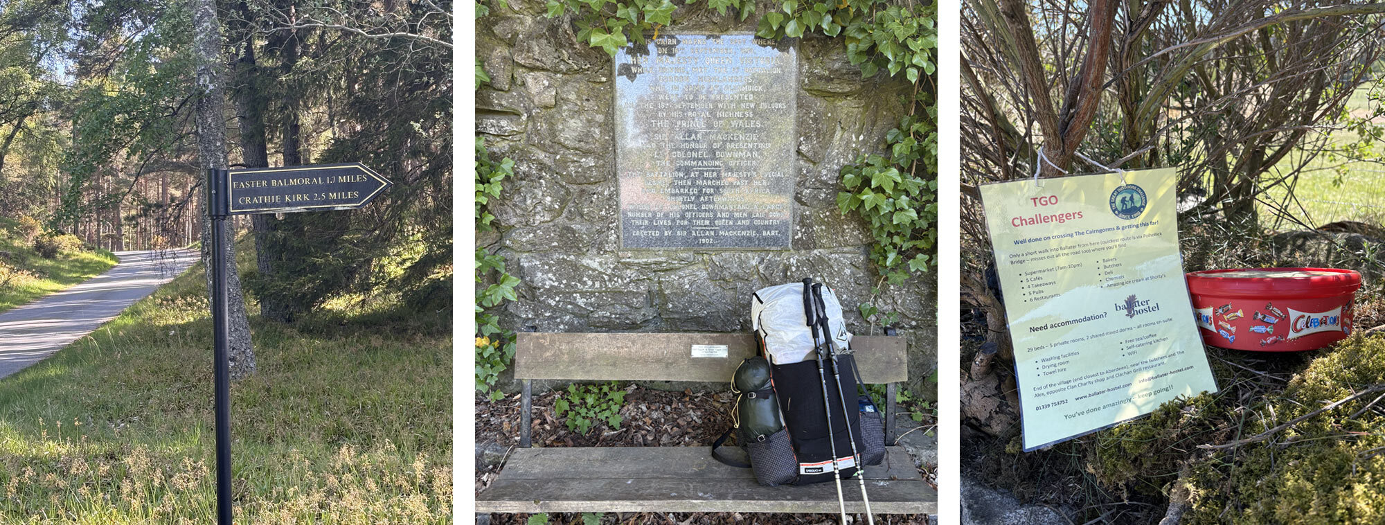
Heading through the Balmoral Estate, a bench just outside Ballater and Thank You Braemar Hotel!
The map shows a path going around and then behind the House of Glenmuick, however once I was there, big signs were clear in saying there wasn’t a through path, and it was private property. This meant a quick check of the map and I worked out a bypass route that would only add a couple of kilometres to my route. Once I had got behind the House of Glenmuick it was a brutal uphill climb straight to the top of Pannanich Hill. I was getting pretty tired by this point but knew this was the last big climb of the day. Once at the top the views were stunning. I could see right over to Lochnagar in the west and the lonely peak of Mount Keen to the south. Mount Keen is the most easterly Munro and stands isolated from any other similar size hills. Having been up it a few years back I wasn’t too tempted to head over again especially with my tired legs. It did make me wonder if a TGO route could be done that would encompass the most easterly, westerly and highest Munros on the mainland. Maybe for next year! I took a rest at the trig point of Pannanich Hill and tried to plot my route down the other side. The view in front of me was endless shin high heather bushes. I attempted to contour my way around the hillside to avoid too much climbing, but the going was tough and not very enjoyable. Heather bashing had worn thin and I just wanted to be off the hill now and down the other side. After much cursing and grumbling I eventually got myself back onto a 4x4 track near Black Moss. This should hopefully lead me down into Glen Tanar.
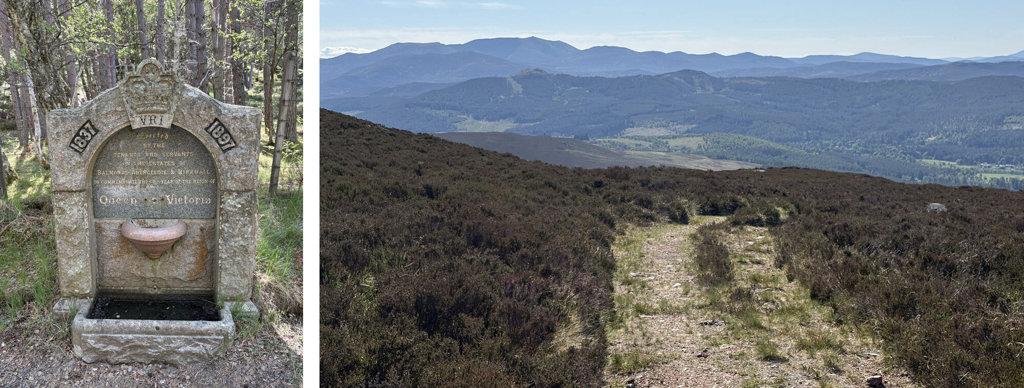
Unfortunately dry water point and the view out from Pannanich Hill over to Lochnagar.
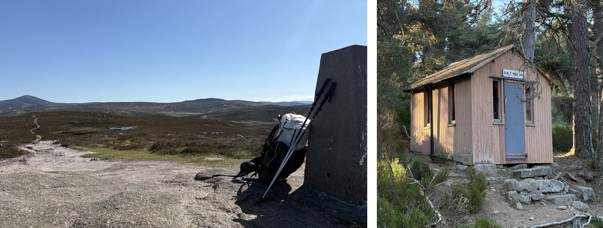
Despite being on a good track my tired feet were feeling very sore, and I was feeling every rock or bit of uneven ground. As I dropped into the Glen, I spied a few good potential camp areas however I was determined to get to the spot on the map I had planned to camp at. On the map there is a small building called Half Way Hut. This was the halfway point up Mount Keen if approaching from Glen Tanar and as it turned out was not much more than a garden shed perched just above the track. I eventually got there around 6:30pm having been on the move for around 11 hours and I was feeling tired. I had a look around and thought I could probably pitch my tent just off the track however I went and sat in the hut and got some food ready. I was exhausted at this point and having not seen another person since leaving Ballater decided I could bed down in the hut. No longer had a got my mat inflated and sleeping bag out than a ranger in a 4x4 pulled up. I thought he was going to ask me to move on however he was more concerned that I was okay and had enough water. He said I was fine to sleep in the hut and carried on his way. I was exhausted so settled into my sleeping bag. Looking up I could read all the eclectic graffiti scrawled around the wooden hut, the oldest I spotted was dated from 1970. This hut has stood the test of time.
Day 11 – 18th May
Half Way Hut – Feughside Campsite
- Steps: 32386
- Distance: 28.18km
- Altitude: 455m
It was a very peaceful night in the halfway hut. Being in the sheltered Glen Tanar and surrounded by trees there was no wind, and it was very quiet. I woke early and got myself some breakfast, packed up my gear and head off down the Glen. I followed the River Tanar through the beautifully forested Glen and despite it being a Sunday didn’t see a soul. I followed the path until the river split, and I started heading down another Glen following the Water of Allachy. This was a stunning area and wasn’t what I expected when plotting my route.
There were warning signs out saying Capercaillies were present here and the males can be aggressive, so I progressed cautiously. Capercaillies are the largest of the Grouse family and quite impressive looking. Unfortunately, or maybe fortunately I didn’t get to see one.
I took a trail that would take me up and out of the Glen onto the hillside. It was steep going but steady and soon I was up onto the Hill of Duchery and heading down into the Forest of Birse. The long descent took me past the very impressive and what looked to be recently renovated Birse Castle. It was now a private property, so I scurried past quickly hoping I wasn’t trespassing. I would now be following the Water of Feugh and be on a tarmac road for around 15km. This wasn’t much fun to be honest, so I just had to grind it out. I did meet a couple of cyclists who to my surprise looked at my pack and asked if I was on the TGO. I stopped and had a nice chat and regaled them about my journey so far. I carried on and managed to get through the kilometres with the help of some podcasts in my ears. The scenery had changed so much since leaving the cairngorms behind, I was now surrounded by fields full of livestock and some rolling green hills. I eventually got to my campsite that I had booked in advance at a village called Whitestone. The owners were clearly used to the challengers passing through and rewarded me with an ice lolly which I was very appreciative of! Despite this I was the only challenger there that night. I pitched my tent surrounded by static caravans and settled in for the night knowing I only had one full day of walking left.
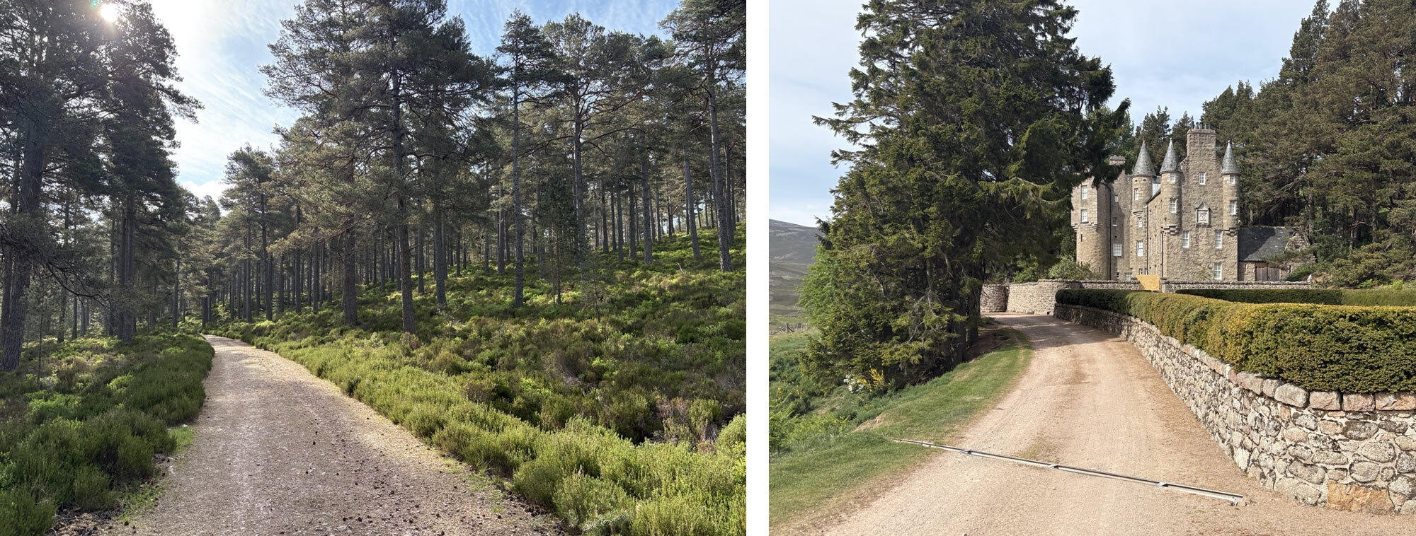
Glen Tanar looking lovely and Birse Castle.
Day 12 -19th May
Feughside Campsite – Jenny’s Bog
- Steps: 31354
- Distance: 24.90km
- Altitude: 448m
Once again having slept so well when wild camping I didn’t sleep particularly well at the campsite. There didn’t seem to be any reason for it apart from maybe the apprehension of finishing soon. It was another glorious day with a little high-level cloud to just keep the edge off the sun. I had been absolutely spoiled with the weather for the whole challenge so far and it was looking like it would last until the end. I never thought I would be pulling out my sun lotion more than my waterproofs when planning my route. I packed up my tent and headed off.
It was a hard first 6km on the road again until I turned off and headed onto forestry roads into Fetteresso forest. I was told by the friendly cyclists I had met the day before that the forest was pretty much entirely man made and consisted of tightly grown coniferous trees.
Early morning on the last day looking back to Fetteresso Forest.
It was a bit of a maze of forestry tracks that did have to be navigated carefully. On a few occasions I was on simple tracks that hadn’t been walked on much as they were overgrown. A few sections had also been hit badly by the storms of the last few years with lots of fallen trees crossing the path. The last section I passed a large forestry operation in progress with huge felling machines devouring trees and leaving a rather barren wasteland behind.
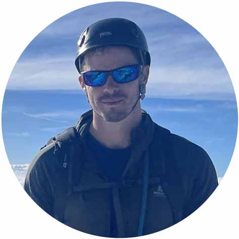
I had picked a spot on the map to try and camp at beneath the Hill of Swanley. It had a delightful name of Jenny’s Bog. With so little rainfall it surely couldn’t be too bad. This put me about 10km from Dunnottar Castle. I headed up towards the spot I picked and about 2km before I got there found a lovely flat area under some trees and next to a small stream. I thought this would do nicely and set myself up for my last camp.
Day 13 – 20th May
Jenny’s Bog – Dunnottar Castle
- Steps: 25922
- Distance: 17.83km
- Altitude: 355m
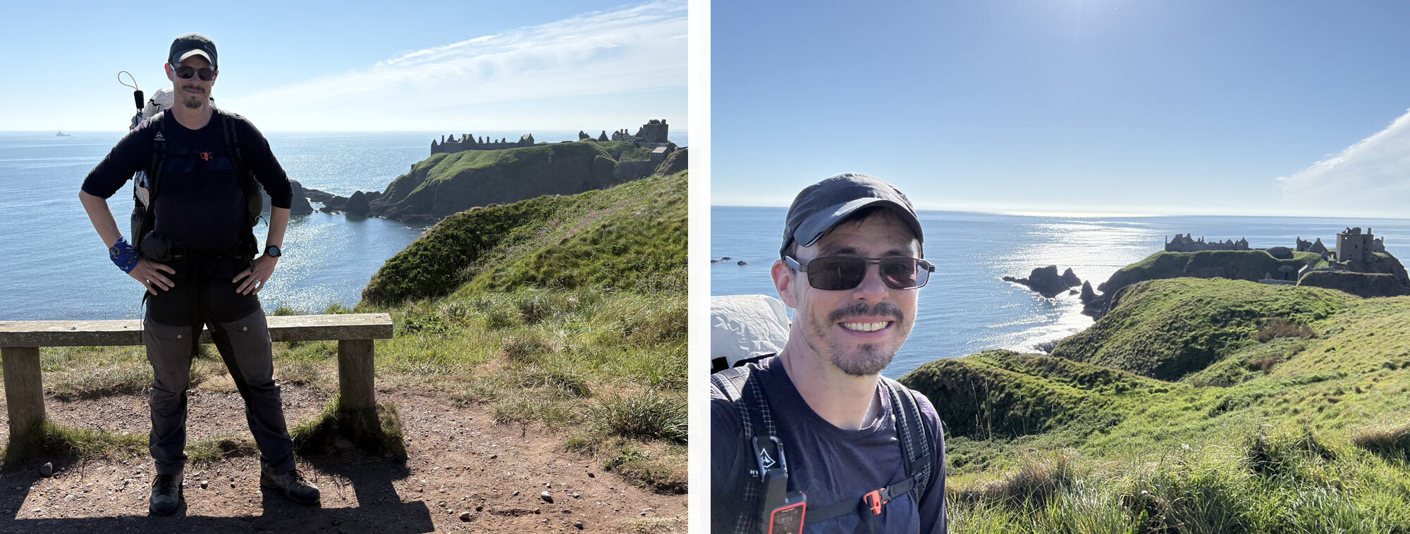
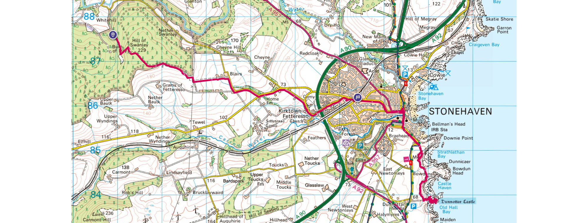
I woke early with the light so packed up and decided I would get to the Stonehaven as soon as possible and try and be on the lookout for a bacon sandwich and coffee before pushing on to Dunnottar Castle. It was an easy walk up onto the Hill of Swanley. I then dropped down before enjoying my first views of Dunnottar castle in the distance. The walk into the town was straightforward and arriving so early it was very quiet. I found a Greggs who supplied the bacon and coffee I had been dreaming of and headed out to the coastal path. It was only a couple of Kilometres along a lovely coastal path to the castle. I arrived 30mins before opening so sat on the beach beneath the castle and enjoyed the view. Dunnottar Castle is a stunning location situated on a dramatic piece of land that sticks out into a bay. It was an important building in Scotland’s history and once even held the Scottish Crown Jewels for a time to keep them hidden from Oliver Cromwell’s invading army in the 17th century. It was famously liberated from the English by William Wallace in the 13th century. A lot is in ruins, but they’ve done a nice job recreating some sections. I had a nice walk around the castle and even saw a pod of dolphins just off the coast. I then walked back to Stonehaven to catch the train to Montrose and officially sign out. It had been a fantastic challenge, and I had met a lot of lovely people. The weather had been stunning the whole time, and I had been lucky to see some of the best wild areas of Scotland at their best. My gear had all performed well without any major incidents. A few lessons learned but mainly due to packing for at least one wet day. Little did I know this wouldn’t happen!
- Total steps: 381,369
- Total distance: 313.31km
- Total altitude: 9345m
- Total ticks (attached): 2
- Total ticks (crawlers): Hundreds!
- Total rain drops felt: None!
 |
||
| Nick Brown | ||
|
Nick has had a love of the outdoors, especially the mountains, for over 20 years. His passion has led him all around the world on many multi-day treks and mountain climbs in the greater ranges. As well as experiences in harsh environments such as the jungles of Asia and South and Central America and the vastness of the Trans-Siberian railway. A qualified Mountain Leader, he spends most of his time exploring the Scottish highlands and wild areas bagging Munros. On top of this, he enjoys trail running and rock climbing and strongly believes any outdoor experiences are good experiences - no matter what the weather, especially for mental well-being and happiness. |
||