Nick's TGO Challenge 2025 – Part 1
Posted by Nick Brown on Aug 11, 2025
Day 1 - 8th May
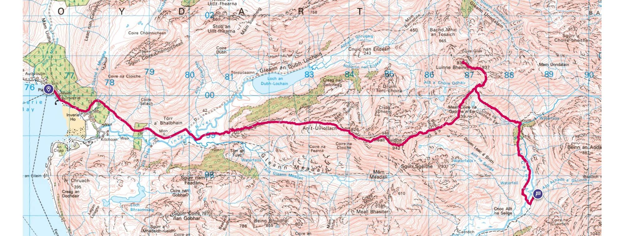
Mallaig to River Carnach
- Distance: 21.19km
- Altitude: 1636m
- Steps: 31,115
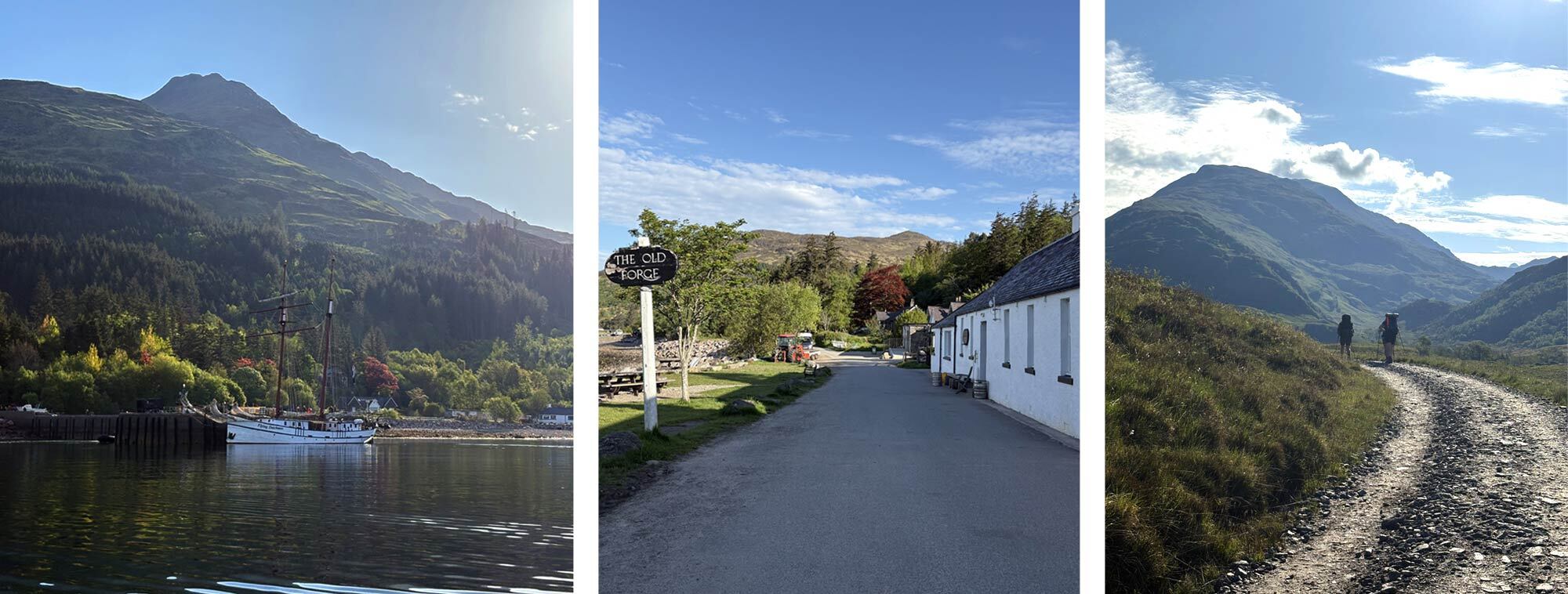
My route would start with a short 30-minute ferry ride from Mallaig to Inverie on the Knoydart peninsula. But first I would have to officially sign out from the West Highland Hotel. Situated just up the road from my slightly more rustic hostel. The hotel overlooked Mallaig and had a wonderful clear view out to the jagged peaks of the islands of Rum and Skye. The Skye Cullin impressively silhouetted in the distance. There were several fellow TGO challengers, one Dutch, one American and a Scot, waiting for the reception staff to arrive so we could sign out. The TGO attracts a mix of people from all around the world. With the ferry booked for 7:30am there was a sense of eagerness to get going. We’d probably not be this clean again for a couple of weeks!
The journey across the water was very pleasant but we were surprised to see a cruise ship moored just off the coast of Inverie. As we pulled in and hopped off the ferry, a line of tourists from the cruise ship were beginning to queue to head back to the ship after spending the night in Inverie. Knoydart is one of the most remote and least accessible peninsulas in the UK and the tiny village of Inverie is only accessible by boat or a very long walk out. However, the small community is thriving including The Old Forge pub which was recently bought by the community to keep it open. Inverie is effectively “off grid” and its power is supplied by small hydroelectric dams just outside the village. It makes for a unique place to visit. As the ferry arrived just past 8am and I had a full day of walking ahead there wasn’t time to hang around. I headed off along the one road that passes through the village, and despite it not connecting to the road network I still had to dodge an early morning commuter in his car!
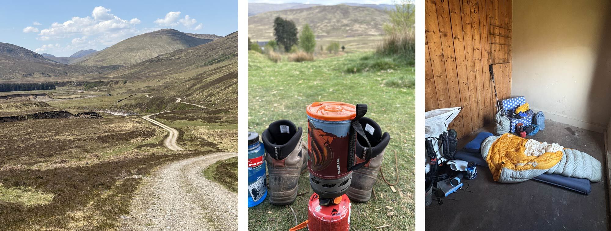
I quickly left Inverie and followed the track out towards the hills. My first aim was to bag the Munro Meall Dearg which soon loomed in front of me. I left my fellow challengers and took a rough trail directly towards the hill. A quick cross of a slightly lopsided bridge and it was straight into the first Scottish bog of the trip. Despite it being very dry weather the bogs are amazing at retaining the water. But some well-placed “tuft hopping” meant I got to the other side without getting too wet. And then the uphill walking began.
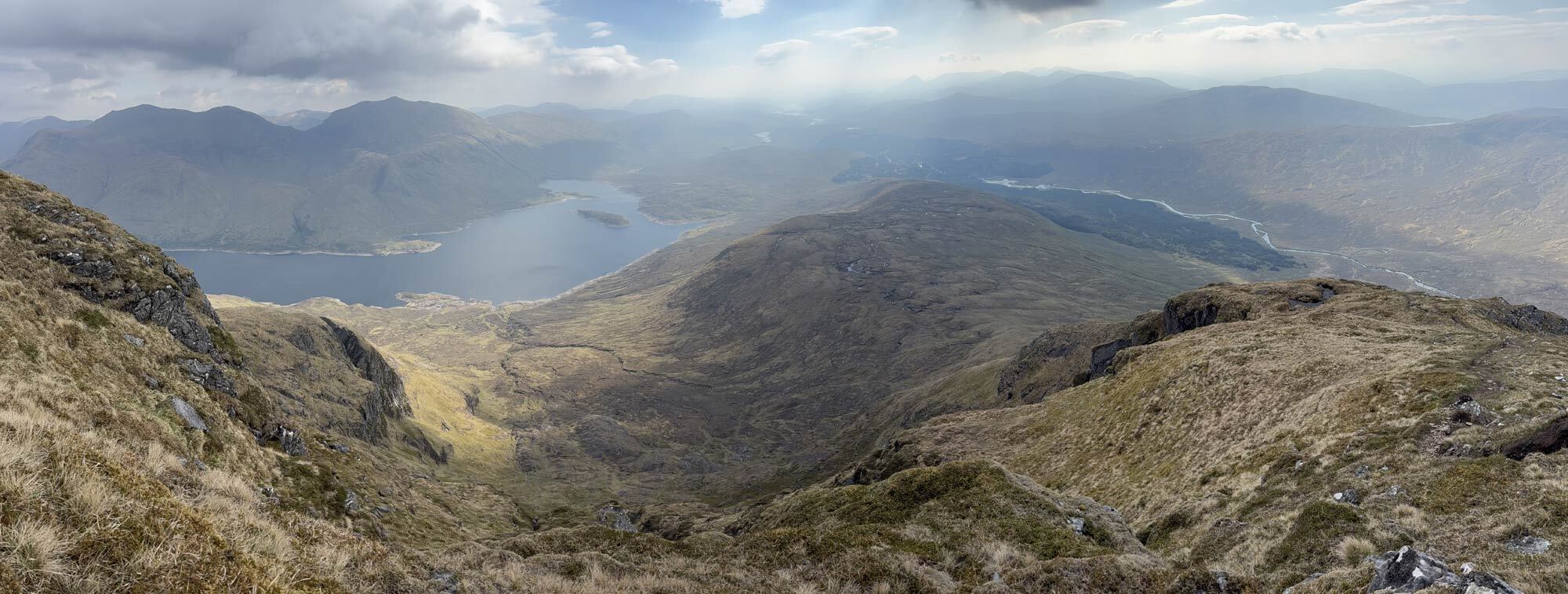
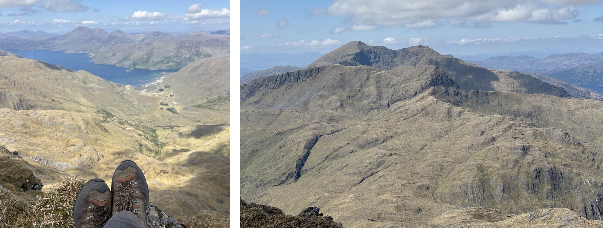
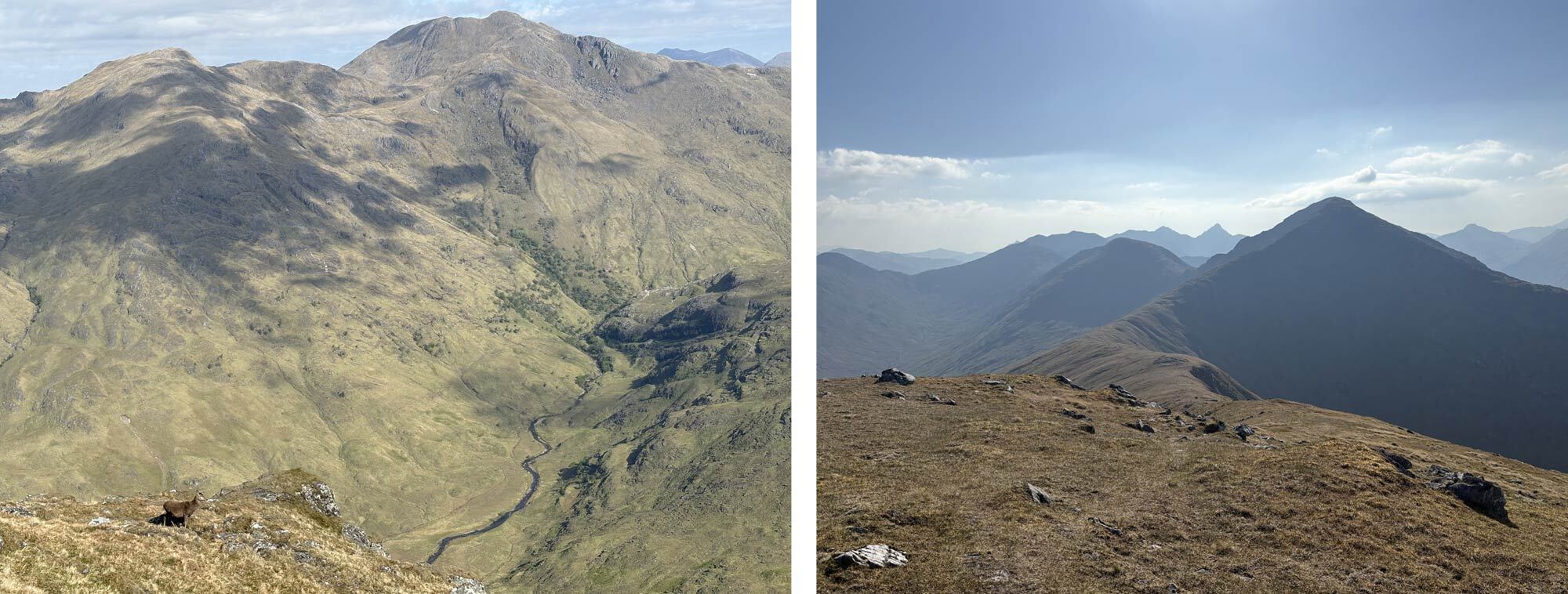
It was a sharp pull-up from the Glen floor, but it meant I quickly gained height, and the views began to open up. A broad grassy ridge would gradually become sharper with the summit up in the distance, a good path meant the going was straightforward and before long I found myself on the summit of Meall Dearg. The views were amazing looking out over the rugged Knoydart environment and the coastline below. The turquoise water looking almost tropical with only the chill in the wind reminding me I was still in Scotland. My original route plan for the day had me heading down and going to Sourlie’s Bothy for the night but with the weather being clear and stable I thought it would be rude not to go and bag the neighbouring Munro of Luinne Bheinn. It was still a couple of kilometres over a ridge line onto the second Munro so I knew it wouldn’t be a small extension to my route. I was also aware I only had a litre of water with me and even that was nearly gone, so I knew sourcing more water was key. With the consistent dry weather we had been experiencing, a lot of the small Burns (streams) higher on the hills were dry, so I resorted to finding a small lochan situated on the side of the hill beneath the second munro. I decided to filter and boil the water just to be safe as it wasn’t flowing at all. I used my Sawyer filter and a JetBoil, which can boil water in a matter of minutes, so I was soon able to get going again. I came across a surprising number of fellow Munro baggers which I didn’t expect in such a remote corner of Scotland. It was nice to stop for some pleasantries and my larger pack clearly sparked some questions about my trek and the route ahead. The summit of Luinne Bheinn was soon gained and the view over to the mighty Ladhar Bheinn (pronounced "Loe-er Vyn") with its multiple ridges and dramatic cliffs was stunning. It is the most remote of the Knoydart Munros and one I’ve still to do but will have to wait for another trip as it would have been an excursion very much in the wrong direction. I sat and had lunch on the summit. Lunches on a multiday trip can be quite basic, mine involved some peanut butter on oatcakes followed by some energy bars. Not exactly exciting stuff but much needed calories. I headed down the route I came up, back to the bealach beneath the summit ridge. As I was already off my original route plan a quick glance at the map suggested I could head almost directly east down some steep ground and drop nearly 700m in about 1km to the River Carnach.
Enjoying the view down to turquoise waters around Kinlochhorn and Looking over to Ladhar Bheinn from Luinne Bheinn.
It was hard going on pathless ground, but I picked my way down, zigzagging on the steeper ground until I passed through some woodland, carpeted with some lovely flowers. Once I got to the bottom of the Glen, I refilled my water supply from one of the streams and followed the river down to where it flows out into the sea at Loch Nevis. This is where Sourlies Bothy is situated. As I was heading down, I could see the next day’s first objective rising on the opposite side of the Glen, the Munro of Sgurr na Ciche. Now my original route was to stay at the bothy which was around 3.5km further down the Glen and then gain the ridge, which I was currently walking nearly opposite to, up onto Sgurr na Ciche however as I was walking right beneath the main summit and there seemed to be decent looking camp ground near the river I thought I could camp there and make steep ascent onto the Munro in the morning. This, I thought in my infinite wisdom, would save me walking the 3.5km down the valley only to walk back another 3.5km up the ridge the next day in effectively the same direction. What could possibly be wrong with that? So, I headed across the river, there was even a nice new bridge to cross, and headed to some sheep folds next to a small stream that was flowing down from the side of Sgurr na Ciche. What looked like nice campground from the other side of the Glen was quite rough ground with large grassy tufts that made pitching the tent a little awkward, but I managed to get it done. Having placed all my gear on the floor whilst pitching I soon came to realise the grass was teeming in Ticks. Just a hand on the ground would result in 5 or 6 of the little buggers crawling on looking for some soft skin to latch onto. Suddenly the extra 7km of walking and a bothy seemed a much better option! Nevertheless, I had pitched and decided to get myself zipped in behind the protective net of the tent. After brushing off numerous ticks from my trousers and getting some dinner sorted, I settled in for the night. I lay there watching as the unmistakable silhouettes of ticks could be seen crawling on the outside of my inner tent. Better out there than in here I thought!
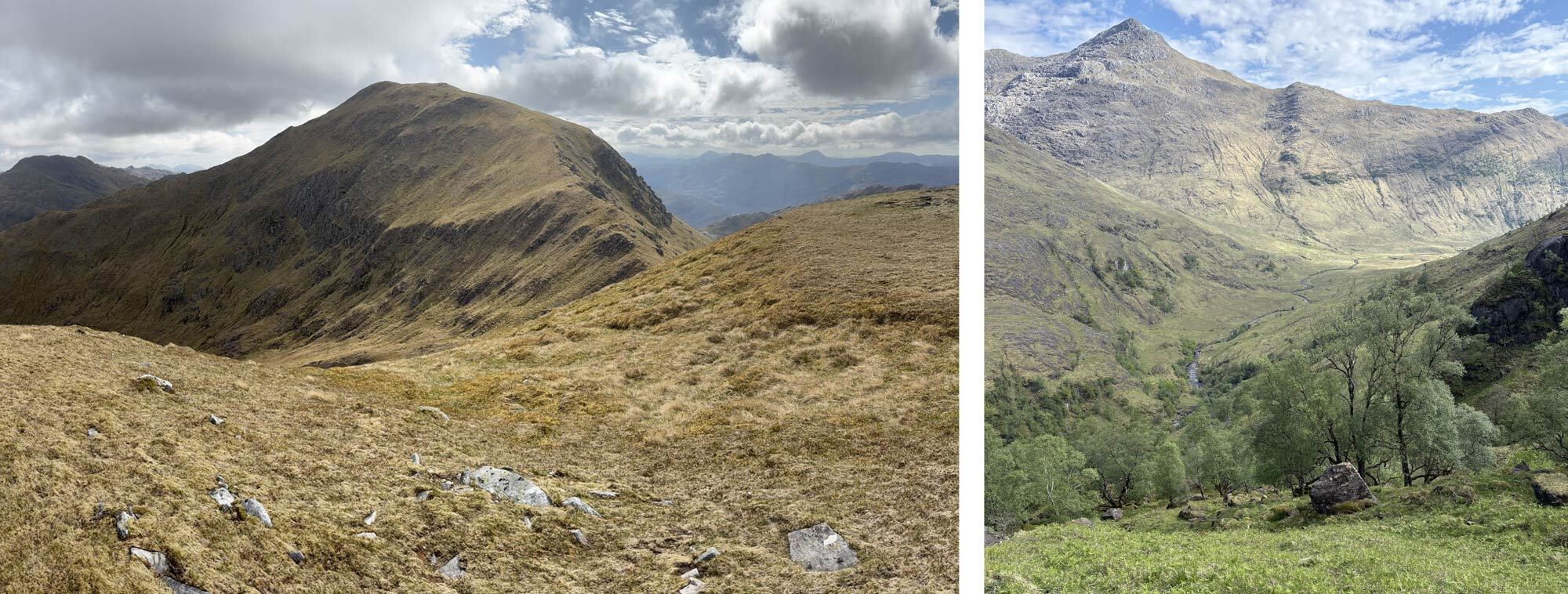
Approaching the summit of Meall Dearg and dropping into the Glen beneath Sgurr na Ciche.
Day 2 – 9th May
River Carnach to Bealach beneath Gairich
- Distance: 17.25km
- Altitude: 2131m
- Steps: 24,898
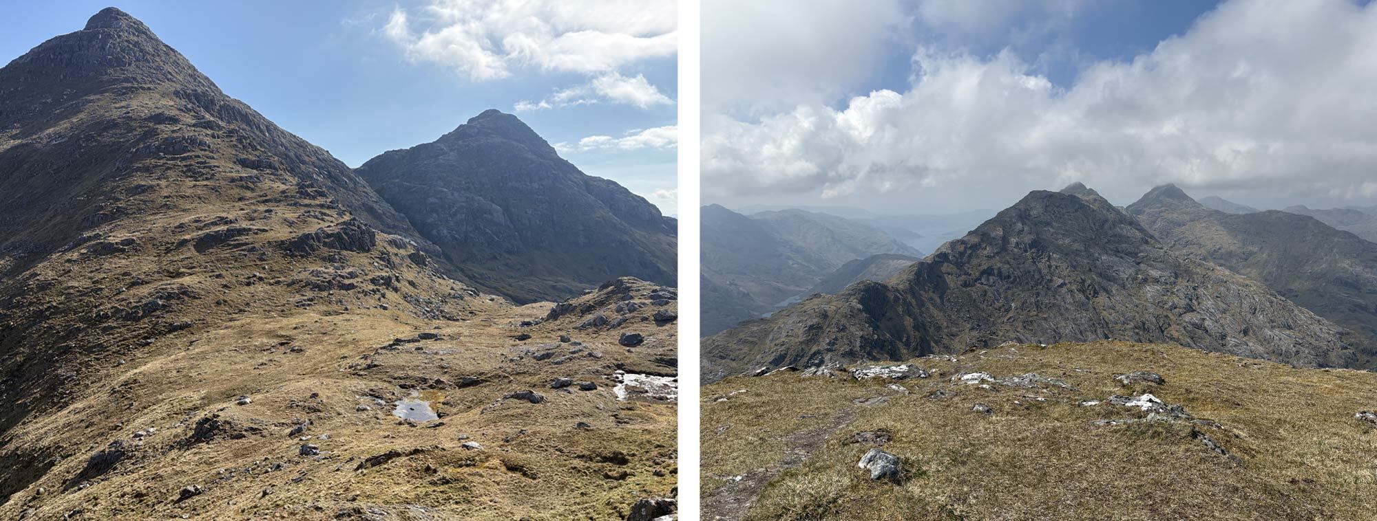
I managed to sleep until 6am despite the sun rising at around 4:30am in Scotland as this time of year. It was a still morning with clear skies so of course the midges were out. I managed some breakfast and packed up my gear without too much trouble and got moving as I didn’t want to be a sitting target. I knew today’s plan was probably my most ambitious of the whole trek. It was to try and bag the four Munros that extend east out from Knoydart, south of Loch Cuaich. This would involve staying high on the undulating ridge, so water was my biggest concern. Checking the map showed a steep ascent up Coire n Cuairtich following a waterfall, so this gave me ample opportunity to fill my water before making the ridge line. The going was hard though and unrelentingly steep. It was time to put a playlist on, get my head down, and gain some altitude. The first two songs were Heaven and Hell by Black Sabbath and Sometimes I feel Like Screaming by Deep Purple – this all felt very apt! The heaven of being in this beautiful environment but the hell of the steep climb sometimes just makes you want to scream. But to be honest the weather was gorgeous and the views were just getting better and better. I was having a great time. At the last chance I had, I filled all my water containers, about 3 litres, and pushed onto the ridge as I wouldn’t be dropping below 600m until I reached my camp spot. From there it was a further, steep pull up of about 300m on rocky and slightly scrambly ground to the impressive summit of Sgurr na Ciche. At 1040m this was the highest of the Knoydart Munros and the views were stunning. The cloud had come over at this point and although only just touching the summits it was nice to have some shade from the sun. I dropped down a steep path to the Bealach between Sgurr na Ciche and its neighbouring Munro of Garbh Chioch Mhor and followed a handy dry-stone wall that led almost directly to the second summit of the day. Before me I could see the rest of the ridge stretching over numerous summits towards my overnight spot. It seemed a long way to go but I was making good time already so decided to keep the momentum going.
Impressive views from the ascent of Sgurr na Ciche back down to the Glen and the impressive peaks of Knoydart.
After a couple of kilometres of undulated rocky ridge line, with some small scrambles here and there, the third Munro of the day was reached – Sgurr nan Coireachan. The view back at the impressively steep-looking twin peaks I had just come over was fantastic, but I knew it was another 4km over multiple lower summits before the last Munro – Sgurr Mor. Climbing a couple of hundred metres up just to drop down again can get quite demoralising especially with tired legs, but I felt I had completed the hardest parts now so I should just keep going and aim for my planned camp spot. With the weather being so good, I considered looking at a summit camp. With my quickly diminishing water supply I knew I needed to get down to where the streams were, hopefully, still flowing. A decent path on steep ground brought me to the summit of Sgurr Mor and my legs were feeling the fatigue of the long day, but I could see my target now. Just a long, gently undulating 3km ridge over a slightly lower summit then a steep drop to the Bealach beneath Gairich for another 1km. I eventually reached the Bealach at around 7pm having been on my feet now for 11 hours. After noticing a small stream that was still running, I quickly found the flattest area I could to get the tent up. In typical Scottish conditions the whole area I was on would having been very boggy and probably not the nicest place to camp, but with the prolonged dry weather, the ground was very dry and easy to set up on, even if it wasn’t that flat. Once the tent was up and the food was on, I collapsed onto my sleeping mat, very tired but satisfied my hardest and most mountainous day was over and I had achieved all the hills I’d aimed to do. I slept well that night.
Looking back to the impressive peaks of Knoydart and the rocky ridge leading from Sgurr na Ciche which is just in the cloud.
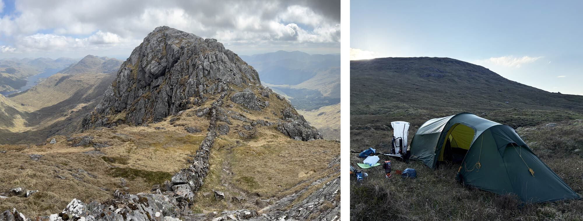
Following the dry stone wall up onto Garbh Chioch Mhor and setting sun behind my camp spot at the bealach beneath Gairich.
Day 3 – 10th May
Bealach beneath Gairich to Braigh Uaine
- Distance: 25.16km
- Altitude: 856m
- Steps: 25336
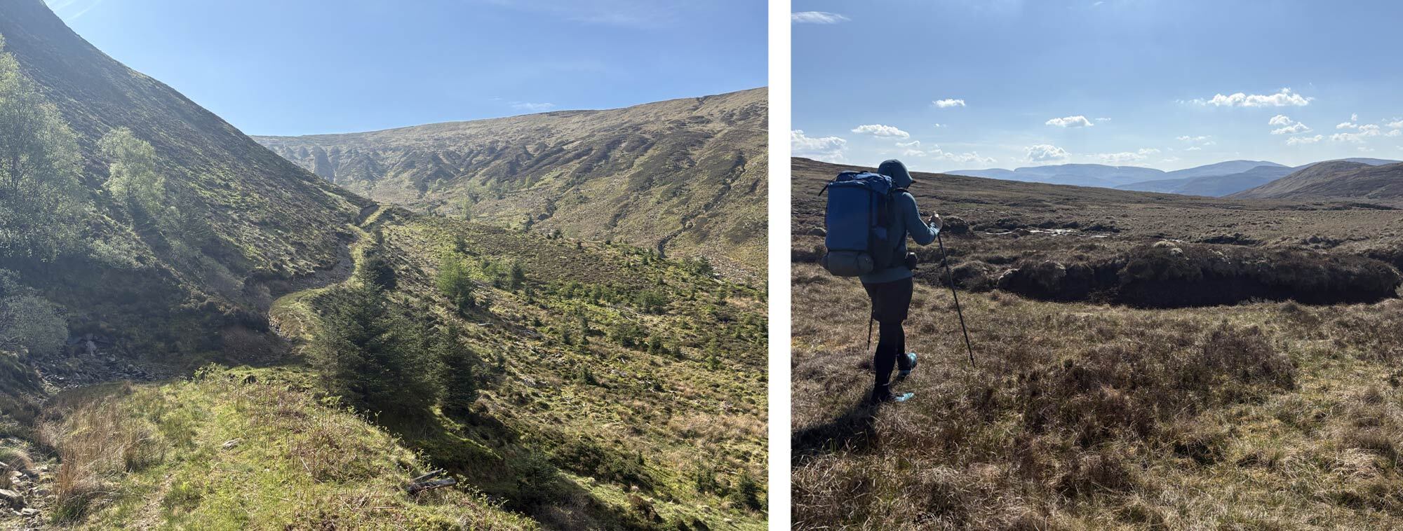
After a very good sleep, I woke with the sun again as it rose behind the peak of Gairich. This meant I would be in shade for the ascent up my last Munro of the trip. The path up Gairich was obvious as it zigzagged up the steep face. After about 400m of ascent, it levelled off, and I could see the main peak in the distance. As I crossed the gently rising ground, I spotted a figure a few hundred meters across from me on the decent. They had their phone up high, filming themselves and appeared to be talking to the camera. I wondered if they were commenting on being in such a secluded area at an early hour not realising, I was plodding past in the background of their shot! The ridge began to rise onto the summit plateau of Gairich. I sat for a while at the summit cairn. I had some food whilst admiring the view back into Knoydart and the route I had taken. The rest of my route, from now on, wouldn’t involve any Munro summits, but that didn’t mean it would be easy. I had a lot of miles to cover but first I needed to drop off the summit and get myself much lower. The descent from Gairich was steep but straightforward and soon levelled off across a peat-covered plateau. It then dropped down into Glen Kingie and into a much more forested world. I picked up a forestry track and knew it would lead me to my proposed camp spot, but I had about 15km to go, and it turns out they only grow one type of tree in Glen Kingie, and probably all of Scotland. It was certainly a different challenge walking on these forestry tracks with little views but occasionally I’d come to a clearing, and the views of the mountains or crystal-clear streams would give me something different to look at. Having a podcast in the ears also helped keep the mind occupied as the kilometres clocked up.
Approaching Gairich's summit with Loch Cuaich beyond, my last Munro of the Challenge.
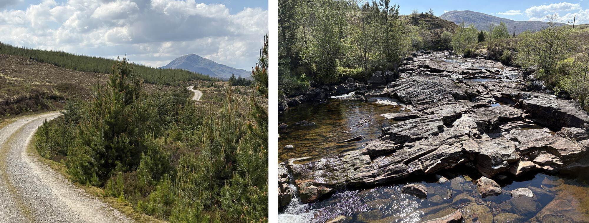
The forestry track and crystal-clear streams.
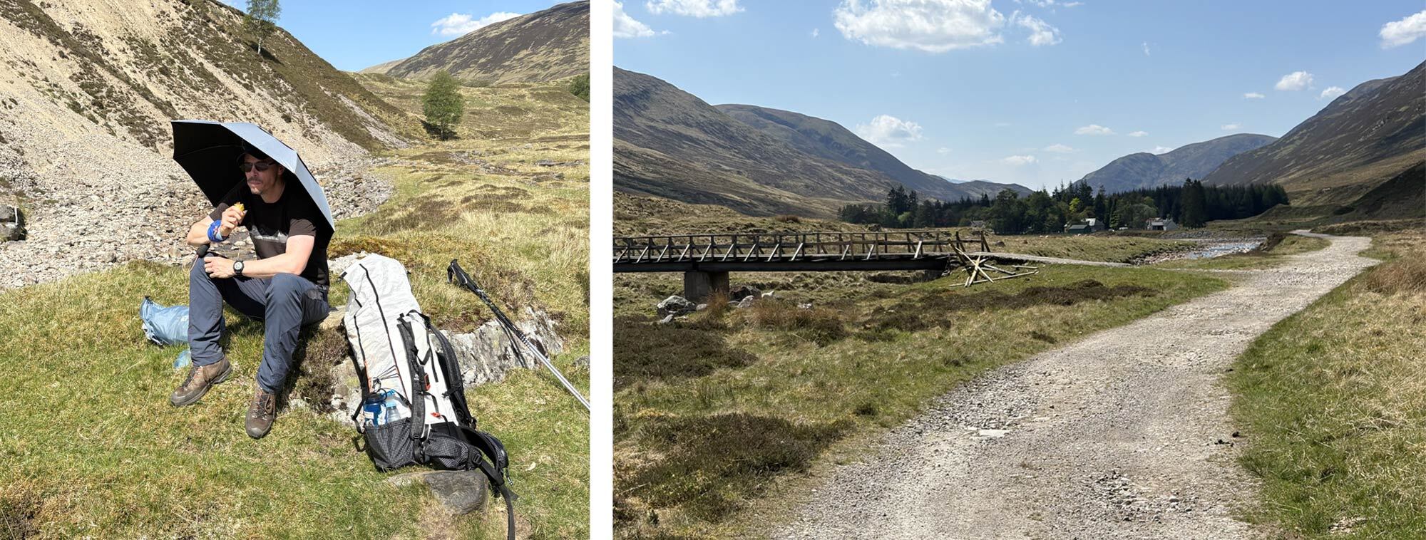
As the route eventually entered Glen Garry I came to a bridge and a couple of other challengers. These were the first I had met since leaving Inverie on day one. This was Paul and Charlies first time on the challenge, and it was nice to stop and have a chat. They had stopped for lunch and to refill some water so I thought it would be a good opportunity to do the same. The sun was now high in the sky and with barely a cloud the heat coming from the road was affecting my feet. I had chosen to use Scarpa boots rather than thinner walking shoes knowing I would prefer the thicker soles on the craggy peaks of Knoydart but now I was wishing for something lighter and more breathable on the feet. I also assumed it had to rain, or I would be crossing some proper Scottish bogs at some point however the current weather was making me feel a little over prepared. I also had a Hyperlite Umbrella strapped to my bag which was beginning to make sense as a parasol rather than to keep the rain off. Nether the less it was nice to sit and refill my water. Paul and Charlie carried on as they had to get to Invergarry which was a good 10km further on than my planned stop and I was enjoying taking some weight off my feet. After a short time, I packed up and carried on. It was just after 4pm when I got to the spot I had noted as a potential camp spot, just next to a river and away from the forestry track. The only problem with picking a camp spot from an OS map and Google Maps is it is very hard to determine what the ground it like. As it turned out the area I had picked was very overgrown and not suitable at all. So, I headed to the other side of the bridge and there seemed to be a decent bit of grass. To my surprise Paul and Charlie came up from the river having refilled and done some foot care. We had a chat again; mainly about how hot it had been and how sore the feet were. At this point I again noticed the small patch of grass I had dumped my gear on was crawling with ticks, so I headed a little further down the track and found a “layby” that was more dusty than grassy, something Ticks don’t like! I waved Paul and Charlie on and attempted to set my tent up. The ground was very hard for tent pegs but given the weather was so still and it was a sheltered spot I wasn’t too worried and didn’t bother with any guy lines. I was only bothered that the tent would stay up through the night. I settled down for a third night with a freeze-dried meal, and although they were getting a bit samey, I had saved the best for this night – Turmat’s Taco Bowl. I supplemented this with some Pepperami and used tortilla wraps to make a kind of burrito. Pretty damn good. The next night I would be at a hostel in the Great Glen so I could treat myself to a proper meal, but this wasn’t bad at all.
The long decent down into Glen Garry and the tiniest of Ticks, but there were a lot of them.
Day 4 – 11th May
Braigh Uaine to Great Glen Hostel, South Laggan
- Distance: 18.15km
- Altitude: 247m
- Steps: 19,727
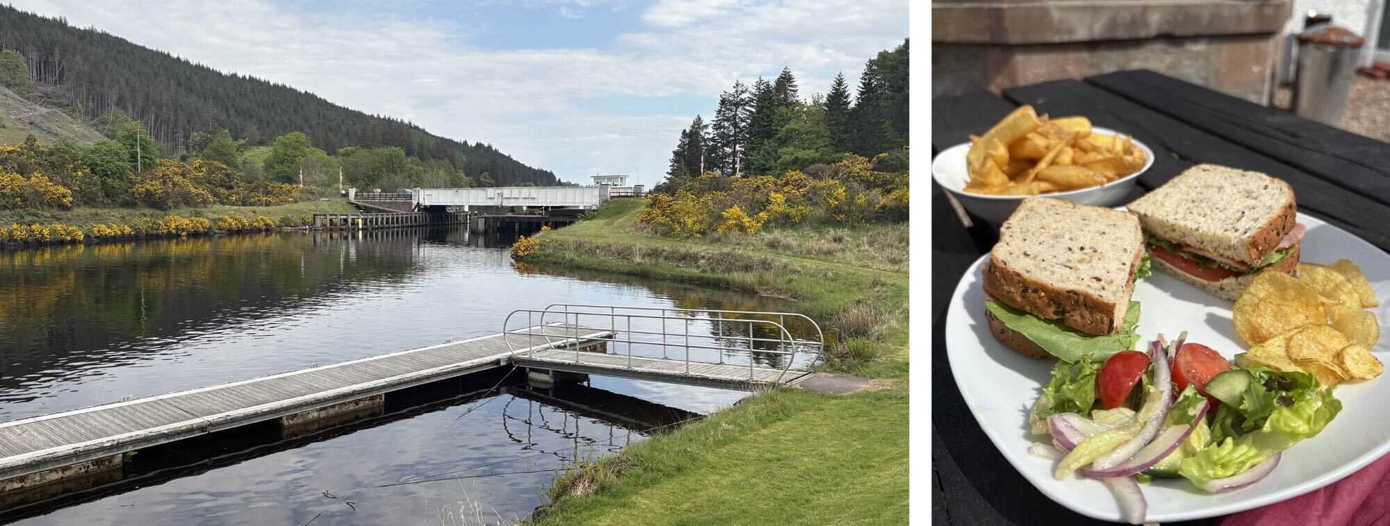
Apart from the very last day this would probably be the shortest day of the whole trip, just 18km with very little incline into the Great Glen. Despite this I still wanted to set off early. It was a lovely, still morning with blue skies above and no wind which did mean the midges were out. The head net was helpful whilst packing up to keep the worst of them at bay. It was much of the same in terms of the scenery. With long stretches of undulating tree lined forestry tracks occasionally broken by areas that had been cleared which allowed for some views. As I headed towards Invergarry the tracks finally came to an end and became a tarmac road with houses starting to appear for the first time since leaving Inverie on Day 1. I followed the road for a couple of kilometres then joined the Great Glen Way, helpfully sign posted with blue markers. This took me around the edge of a hillside until I was heading south above Loch Oich and the sound of the A82 became more noticeable. A large hydroelectric construction project was underway nearby, and the trail has, very obviously, been changed to accommodate large vehicles but this soon dropped to the A82, and I followed along the footpath until I reached the Laggan Swing Bridge which was in full operation. This goes over the connecting Caledonian canal that links Fort William to Inverness and follows the geological feature that is the Great Glen. Once the boats had past and I was able to cross over, it was a short walk beside the canal until I reached my hostel. I arrived just past midday so treated myself to a good BLT lunch with extra chips and sat outside. Just as I was tucking into my food Paul and Charlie arrived. They had had a bit of an epic walk the previous day and didn’t arrive to Invergarry until quite late. They were planning on getting to a bothy but decided to have lunch at the hostel first. We had the obligatory gear chat as we ate, and they headed off. Bumping into people you had previously said goodbye to, is a big part of the TGO as you inevitably cross paths on multiple occasions getting to the same locations. Having arrived good and early it gave me chance to have a well needed shower, clothes wash, and I could pitch my tent to dry it off from the condensation from the night before. I had also posted a food parcel to the hostel, so it was good to restock.
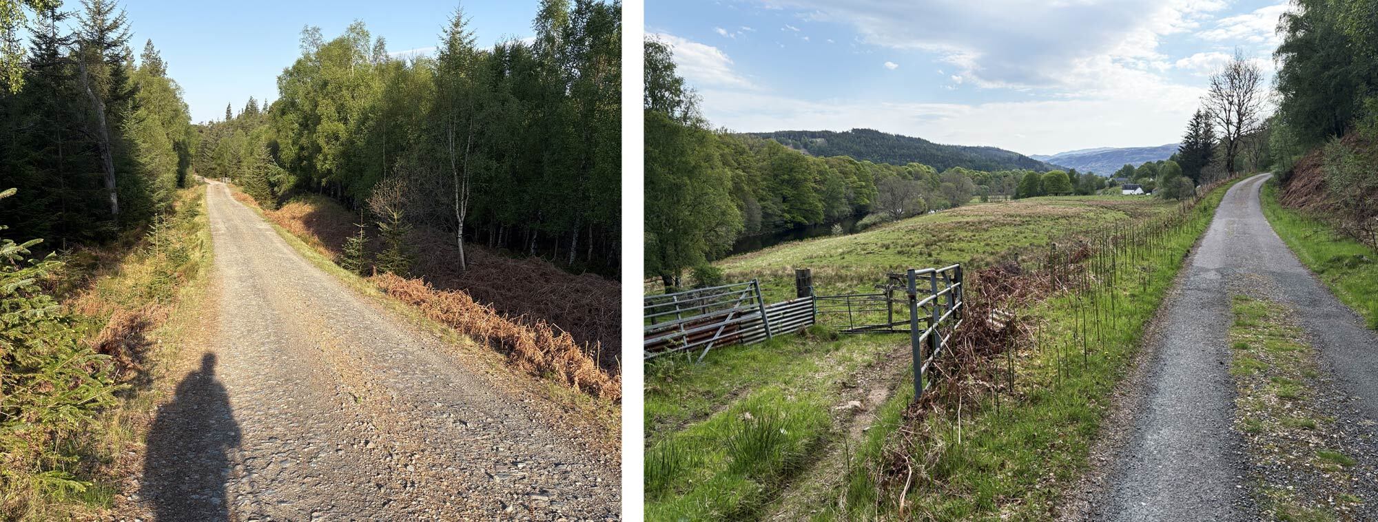
Forest tracks towards the Great Glen and back to civilisation.
Crossing the Great Glen at Laggan swing bridge and a very welcome lunch at the hostel.
I was staying in a shared dormitory and sure enough met a few other challengers all coming from different start points. I was also sharing with two very chatty Glaswegian guys who were heading into Knoydart to bag some of the Munros I’d just done. Both were on their final 20 or so Munros, and being a bagger myself, it was great to chat about Munro adventures. After a decent dinner of Venison Steak, it was off to bed knowing it was freeze dried meals from now until Braemar.
Day 5 – 12th May
South Laggan – Melgarve Bothy
- Distance: 27.71km
- Altitude: 887m
- Steps: 25,411
Having not slept particularly well, I must have gotten used to tent sleeping, I got up and packed my bag. It was now at maximum weight again having restocked my food supplies. After a delicious cooked-breakfast bap and a coffee it was time to set off. I had got chatting with a fellow challenger, also called Paul, who was from Cambridge. He was heading in the same direction to start. It was nice to have someone to walk and talk with. Paul was on his fifth TGO crossing so had plenty of stories and advice. We headed across the Great Glen and immediately joined some forestry tracks that would zig zag up the steep side of the glen into Coire an t-Sidhein. Once we had reached the top of the forestry tracks, we followed a faint path before taking the route of least resistance up the hillside until we hit a very substantial deer fence. There wasn’t any gate or opening but it was easy enough to climb over. It did feel a little like entering an animal enclosure though! We were at the high point of the day now. It was a steep descent into Glen Turret and we soon got down to the river. There we found some ruins of farm buildings in what would have been an idyllic location. Only the chimney stack was standing so some obligatory photos had to be taken of sitting in the fireplace. We then headed to Turret Bridge which was a meeting point of 3 rivers.
Following the rough track into Coire an t-Sidhein and Crossing the high moorland before dropping into Glen Turret.
Finally getting some use out of the Hyperlite Umbrella and Following the River Roy east.
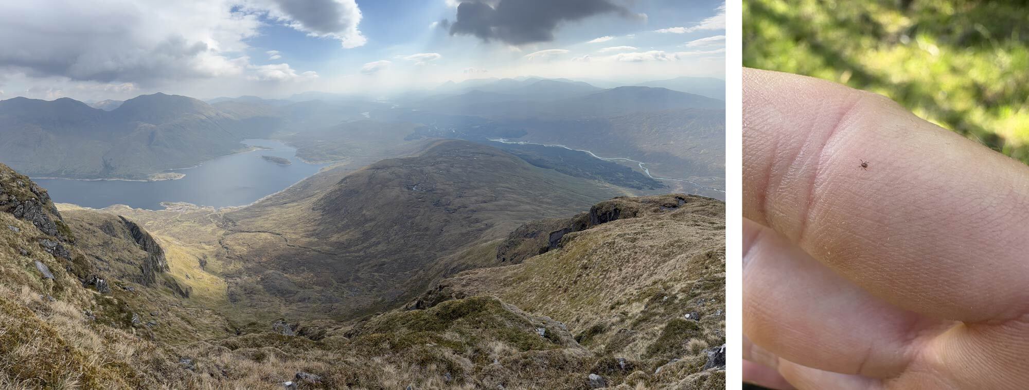
It was a glorious day of blue sky with just a few clouds and little wind so was great to sit and chill out with just the sound of the river flowing by (my umbrella became a very handy parasol). Paul’s plan was to head towards Creag Meagaidh and I was heading down Glen Roy so after taking a break and filling up some water we parted company. It was a straightforward walk on a decent path along the Glen, following the River Roy. At one point the river carved a gorge out of the Glen which resulted in the Falls of Roy, quite beautiful with a deep pool of crystal-clear water looking very inviting. I resisted the temptation to dip my feet and carried on eventually reaching Luib Chonnal Bothy. There was no-one there so took the chance to shelter from the unrelenting sun and eat some snacks. It would have made a nice overnight location however I had another 8km to get done. I had reached a small col which was the top of the River Roy and on the other side the start of the River Spey began at the small Loch Spey. The path again follows the Spey as it meanders through the Glen, it was easy going but with occasional pathless sections. The views were stunning with the norther slopes of Creag Meagaidh (pronounced Craig Meggy) rising on the opposite side of the Sprey with a couple of small snow patches hanging on despite the sun. The Bothy of Melgarve finally came into view. It is also situated at the southern end of the Corrieyairack Pass which is a popular route for Challengers coming from Glen Shiel as well Knoydart, so when I arrived there were several fellow TGO’ers already there. Some were just taking a break before heading on and some had set up camp. I found the small downstairs room free and set up my mat and sleeping bag. After getting some food ready and meeting some more challengers coming over the pass including Peter who I had met at the hostel in Mallaig I settled in for the night. A total of 4 of us made use of the Bothy and 3 camped outside, it was a pleasant evening, and I slept reasonably well.
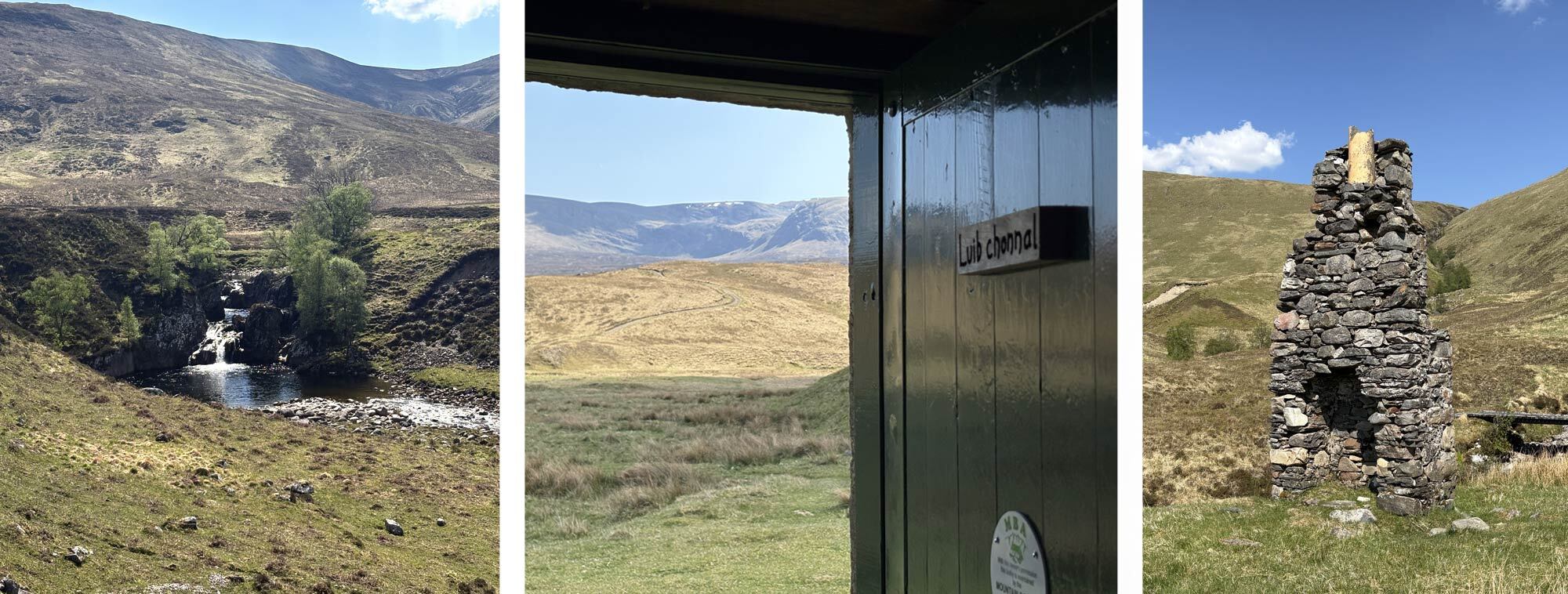
The Falls of Roy, Lunch stop and some shade at Luib Chonnal bothy and the last remenants of dwellings in Glen Turret.
The long and winding road through Glen Roy, brew with a view and Melgarve Bothy.
Day 6 – 13th May
Melgarve Bothy – Invernahavon Campsite
- Distance: 27.71km
- Altitude: 296m
- Steps: 35,792
Once again it was a lovely blue-sky morning, I packed my gear up and had some breakfast of cereal bars and an instant coffee. Not to sound too snobbish but I was missing decent coffee however after chatting with some of the other challengers I learnt there was a café called The Coffee Bothy in Laggan (not the same Laggan from a couple of days ago) so I checked my route and with a slight detour planned to pass through. I couldn’t miss the opportunity for coffee and cake!
The path from the bothy was a 4x4 track that was used by the house so was an easy walk with no navigation necessary. It was quite monotonous though. After 6km it crossed the Spey at Garva bridge and became a tarmac road. This sounds like it would be pleasant enough to walk on however with my stiff Gore-Tex boots and the warm weather it was becoming a bit of a sweatbox. Strangely walking on rough undulating terrain is far easier than hard unforgiving tarmac and the soles of my feet were getting quite sore. Despite this the scenery was stunning with the Glen opening to a wide flat strath (broad valley) known as Strathspey. The hills still rose up on either side and as I passed a large reservoir that the Sprey flowed in and out of I knew I was getting close to Laggan and the fabled Coffee Bothy. I had also been told that the locals in Laggan open the village hall up for TGO challengers to bed down in if they wanted to. This was a very tempting prospect as my planned camp spot was only a couple of kilometres outside the village. I’d mull it over with a coffee I thought.
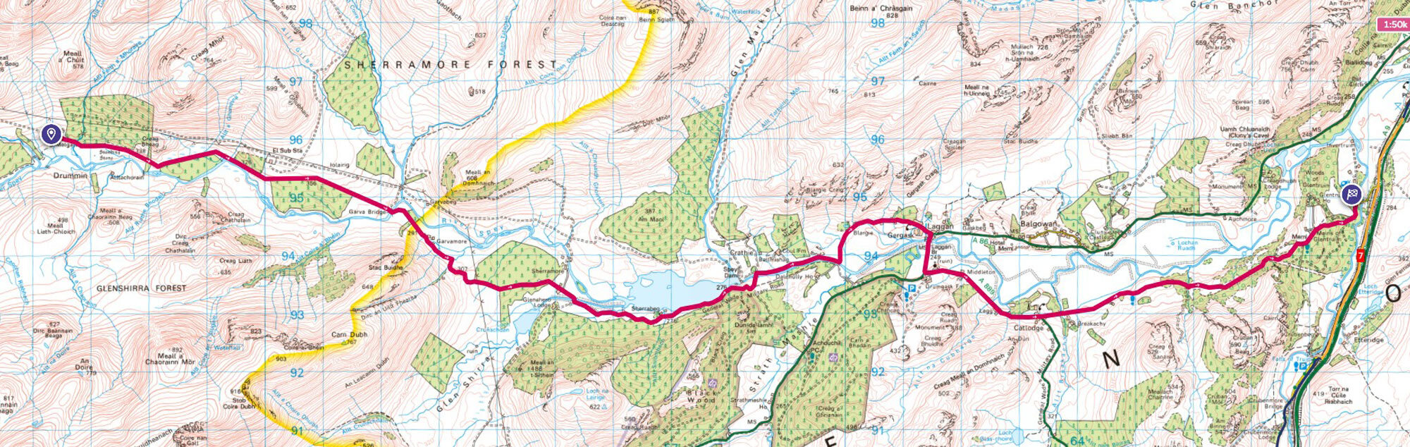
I had made very good time and arrived at Laggan at around 1pm. Just in time for Lunch. I located the Coffee Bothy and to my relief it was open and very welcoming. It was nice to sit out of the sun again whilst I devoured a Panini and coffee which tasted delicious. I took a look at my map whilst enjoying some cake and noticed there was a campsite about 10km out for Laggan right near the A9. I thought I might as well keep going and see if I can get to the campsite. At least that way I could eat into the next day’s distance, and if there was a hot shower at the end it would be a bonus. Unfortunately, it was mainly road walking which wasn’t much fun, but at least it was a quiet road. I went past a couple of interesting memorials; the first was a war memorial that looked out over the Sprey. It had strange description on the gate – “Touch not the cat but a glove”. I later looked it up and it was a warning from several Scottish Clans. Translated it means “Don’t touch the cat without a glove” and uses a Scottish Wild Cat as a metaphor. It basically means don’t mess with our Clan as we’re dangerous! The second memorial was a large stone with a plaque declaring this to be the Centre of Scotland. It is apparently the point furthest from the North Sea and the Atlantic Ocean. At the bottom there was a quote from the writer and broadcaster Cameron McNeish where he mentions that it is “Downhill to Montrose!”. He must have been on the TGO at some point!
I walked into the campsite, which thankfully had plenty of space, and set up my tent. I sorted some food and got myself settled in for the night.
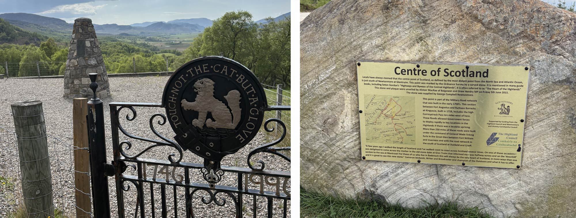
Memorial over looking the Strath Sprey and the Centre of Scotland.
Nick's TGO Challenge 2025 – Part 2
 |
||
| Nick Brown | ||
|
Nick has had a love of the outdoors, especially the mountains, for over 20 years. His passion has led him all around the world on many multi-day treks and mountain climbs in the greater ranges. As well as experiences in harsh environments such as the jungles of Asia and South and Central America and the vastness of the Trans-Siberian railway. A qualified Mountain Leader, he spends most of his time exploring the Scottish highlands and wild areas bagging Munros. On top of this, he enjoys trail running and rock climbing and strongly believes any outdoor experiences are good experiences - no matter what the weather, especially for mental well-being and happiness. |
||