Lois' TGO Challenge 2025 – Part 1
Posted by Lois Fife on Jul 31, 2025
9-22 May 2025
Portavadie to Arbroath
- Total distance 331km
- Elevation 6300m
- Precipitation 0%
- Midges >1%
- Ticks 3
The TGO Challenge is steeped in history. It started in 1980 when mountaineer Hamish Brown presented the idea of a coast-to-coast, self-guided challenge to Roger Smith, the then Editor at The Great Outdoors Magazine. Many challengers return year after year to join the pilgrimage from west to east and age and ailments don’t seem to deter their spirit of adventure. This year I joined the 292 challengers on my own journey.
Last year, I started the challenge, but foot issues that I couldn’t resolve by day 3 resulted in my untimely retirement. I was gutted, having felt I had prepared well, and the sense of unfinished business was immense! I learnt a lot during those first 3 days about walking my own walk, stopping when I need to stop, upsizing my boots beyond what I would normally use on a day hike and being a bit more selective with my kit. Thankfully I was given the opportunity to take a second bite of the cherry this year.
Planning for the event started in late autumn with many a dark winters night spent researching potential areas of exploration, plotting and replotting a route to make the distance, terrain and elevation suit the two-week window for the challenge. Early in my planning I came across the Cowal Way in Argyll and Bute which coincidentally started from the most southerly TGO start location at Portavadie Marina. The route offered a great variety of terrain, as it meandered its way to Loch Lomond, rich in wildlife and boasting stunning views of The Kyles of Bute, Lochs Ruel, Goil and Long. This became the launch pad for the rest of my route, as it linked seamlessly to the start of the Great Trossach Path on the eastern shore of Loch Lomond at Inversnaid. The Great Trossach Path intersects nicely with the Rob Roy Way on its way north from Glasgow to Pitlochry at Callander. Although initially adding a bit of mileage in a northerly direction, the route worked well for a refuelling spot in Strathayre before heading to Loch Tay. By leaving the Rob Roy Way at Aberfeldy I could head south-east to walk a southern section of the Cateran Trail in Perth and Kinross before hitting the inevitable tarmac home leg to the coast. A plan was hatched, a route plotted and submitted for vetting early in the new year. My Vetter had a few suggestions where local knowledge provided little nuggets of information that you can’t pick up from an OS map. A couple of path adjustments and a change of wildcamp spot to a recommended secluded lochside beach on Loch Katrine helped to dot the i’s and cross the t’s of my route.
Day 1 Portavadie to Glendarual
- Friday 9 May
- Distance 29.7km
- Elevation 417m
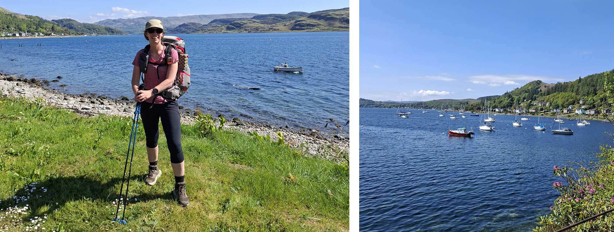
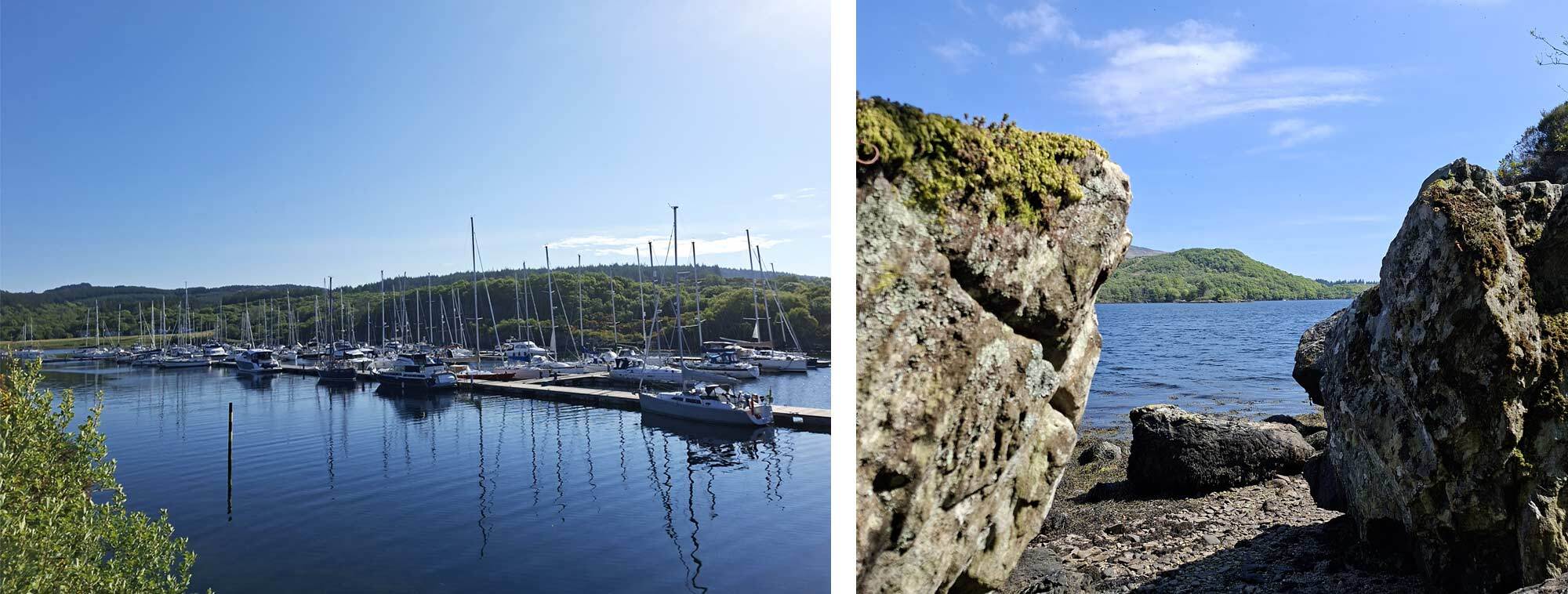
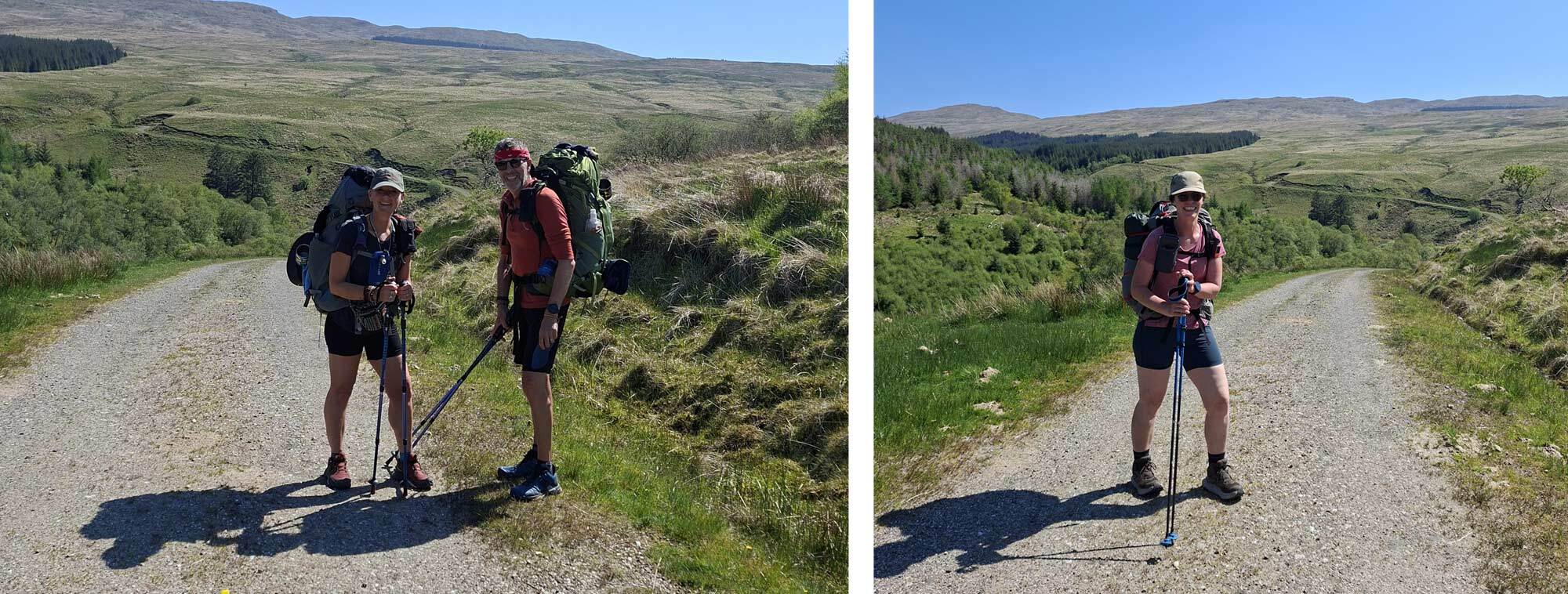
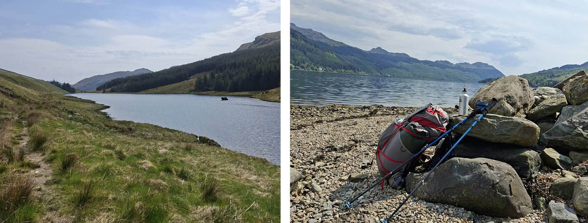
Arriving by bus at the glamorous Portavadie Marina, the first challenge was finding the reception where the TGO sign in book was located. On entering reception, I felt momentarily like I was in a strange version of ‘race across the world’ where you look to see who has beaten you to the sign-in book, and who you may see on your journey. As I’d left the hotel in Dunoon before breakfast service, and I had only eaten a danish and yoghurt in my room, I went in search of a nice big coffee to kick-start the trip at the Marina. Here I met another TGO challenger, Rolf who was fuelling before starting his journey too. Suitably caffeinated I set out along the boardwalk around the marina, past gleaming yachts and motorboats bobbing around in the morning sunlight, in search of a way to get down to the water’s edge to perform the TGO ritual of getting my feet wet and picking a suitable small stone to carry with me on my journey to the east coast. With rituals completed, I approached the start of the Cowal Way and found Rolf about to set off, along with a third Challenger, Colin, leaving from Portavadie that day too. It was nice to meet other challengers, as I did think that the less popular start of Portavadie may be a little isolated at times. Once under way, it was nice to get into a stride though I was mindful to adhere to my lessons learnt last year: not to get dragged along at a pace not natural to me.
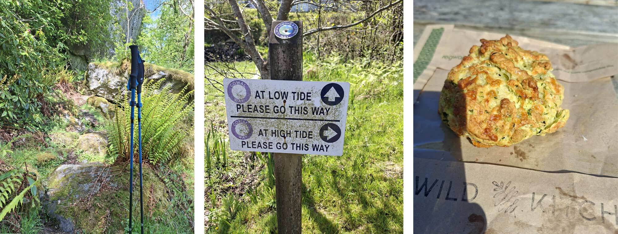
The route initially wove its way through mixed woodland and it soon became apparent that the signage was unreliable, with some signs missing, some blank where the sun had bleached direction pointers and some buried under the verdant foliage. We regrouped as a threesome after we had all taken wrong turns or missed discreet paths. I had to backtrack at one point as I’d missed a turn only to find Colin coming out of a different track after finding his own route. As we approached the village of Kames my mediocre breakfast seemed a distant memory and I was tempted by a rustic looking café, ‘Wild Kitchen’ serving home baked delicacies and a wild garlic cheese scone which was divine.
Along the road from Kames I caught up with a couple of back-packers who were not on the TGO but doing their own ‘Scottish Camino’ - a six-week tour linking some of the classic long distance walking paths in Scotland. Steve and Lesley were hiking the Cowal Way on the start of their journey and became great walking companions for the first four days of my trip.
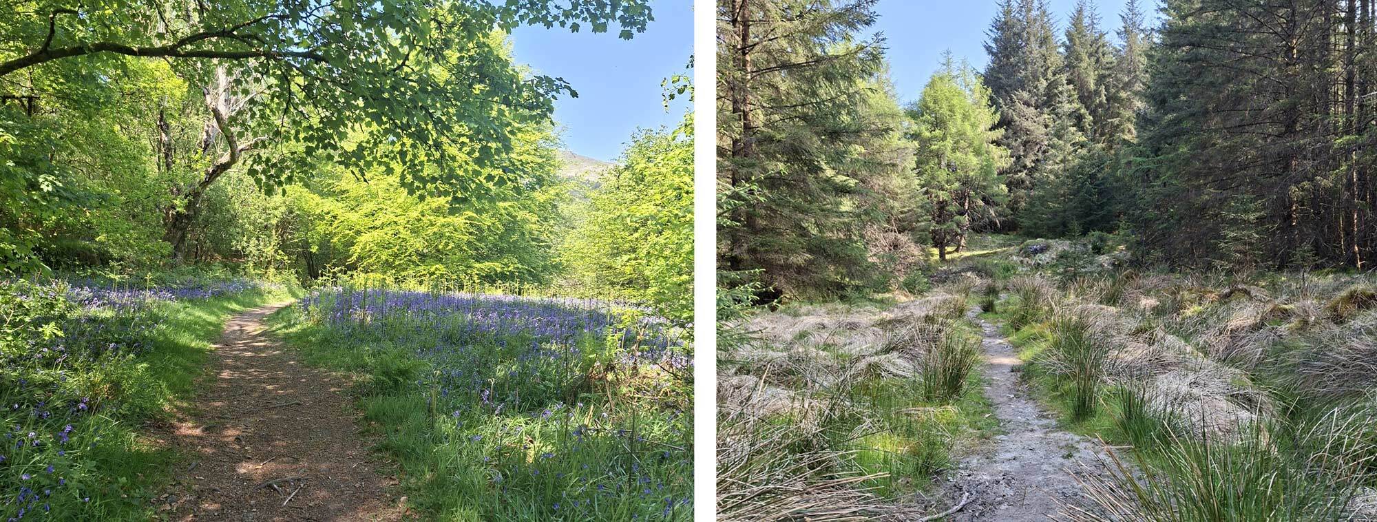
The route along the side of Loch Rule had some interesting and often challenging terrain. It meandered in between the rocks that plunged through the forestry into the water, creating isolated beaches and framing the loch and landscape beyond. Rickety handrails and steps helped with the tougher climbs as they ascended away from the water’s edge back into the foliage. This stretch of about 2km was very slow going but rewarding with its beauty. At low tide much of the coastal path is accessible and I was lucky with plenty of beach to pick a ‘smooth’ route through the stones and tidal debris. As the route approached the north end of Loch Rule, the path rolled through glades of bluebells that spread to the water’s edge and made a nice place to cool the feet and eat again before hitting the tarmac single-track road, that I’d taken in the opposite direction on the bus many hours earlier. Upon arriving at the Glendarual Campsite I was greeted by Annie, who was very helpful and so knowledgeable about the area. She was keen to share information about the damaged track on the approach to Glen Branter I’d be negotiating on day two. The flat grassy camp was shared with Rolf when he rolled in a little while later and other campers who shared my picnic table. I had lots of mixed nuts with me, these were bartered in exchange for red wine, and the banter was flowing.
Day 2 Glendarual to Glen Branter
- Saturday 10 May
- Distance 26.5km
- Elevation 533m
Day two’s route started on a narrow tarmac road, until it reached the A886 where a game of hopping on and off the verge when vehicles approached was adopted. I was walking with Lesley and Steve at this point and we were so engrossed in chats about books like the Salt Path, that we took our eye of the navigation and waltzed straight past the left turn and overshot it by about half a kilometre – that’s twice in 2 days – note to self – ‘keep your eye on your navigation!!!’
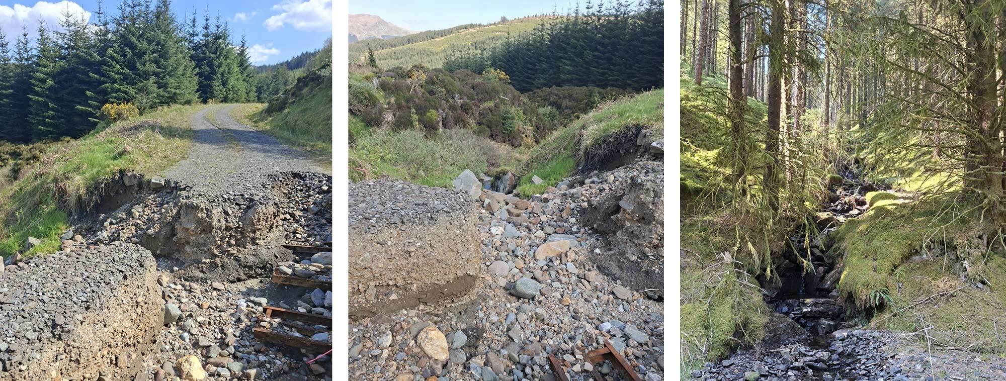
The day was certainly hotting up without a cloud in the sky and little shade as we climbed up a dusty dirt track up Strath Nan Lub. On reaching some shade from the forestry we took the opportunity to have a lunch stop and consider the options available to us for navigating the road that had been washed away by storms, and was most likely impassible. I had decided to take a left turn about 5km short of the affected route and head around the north side of the glen as opposed to the official detour that added 8km to the route to the south. My diversion still bore the scars of previous storms, with broken tracks and uprooted trees. The forestry was very dark and eerie with trees hanging onto their upright positions, rubbing limbs and squeaking with the smallest movement. The steep valley side appeared very unstable and with a lot of streams weaving a way through the trees, washing away the earth securing the roots, it felt as though the whole slope could give way at any time. The final approach to Glen Branter village was more like descending a riverbed, where water had destroyed the track and left huge boulders and deep channels in its wake.
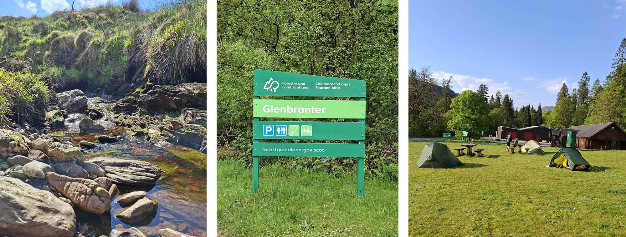
Glen Branter visitor centre, with toilets, a cold-water tap, lots of flat grass and a couple of picnic benches serviced our basic needs. Once fed, watered and about to get into the tent for the evening, who should come wandering into camp – Rolf. He had taken a look at the broken road and decided against it and then had to retrace his steps to take the 8km diversion.
Day 3 Glen Branter to Lochgoilhead
- Sunday 11 May
- Distance 16.9km
- Elevation 557m
In yoga practice, we set an intention, something to consider for the day. Today’s intention was ‘stay focussed and don’t go wrong’. Navigation was very easy today, though a stretch of a disused railway soon ran out and I had to fight my way through some briers to get back onto the A- road I was trying to avoid. It was only a short stretch until I turned off to ascend the edge of the forestry with Beinn Bheula on my right, a track recommended by my Vetter. At the T junction at the top, I rejoined the Cowal Way to Curra Lochain. I had originally planned to end day 2 about 5km short of Glen Branter and then wild camp at Curra Lochain to close day 3. However, as it was only just after lunchtime, and there was a lack of good camp spots, I decided to continue and stay ahead of schedule whilst remaining true to my plan not to overstretch my days and take care of my feet.
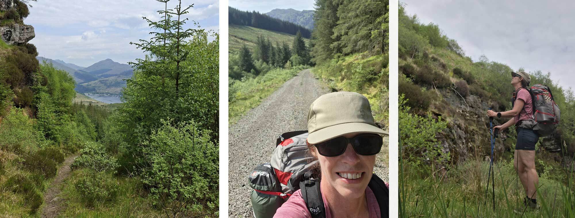
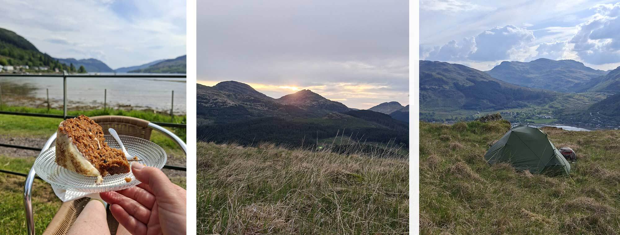
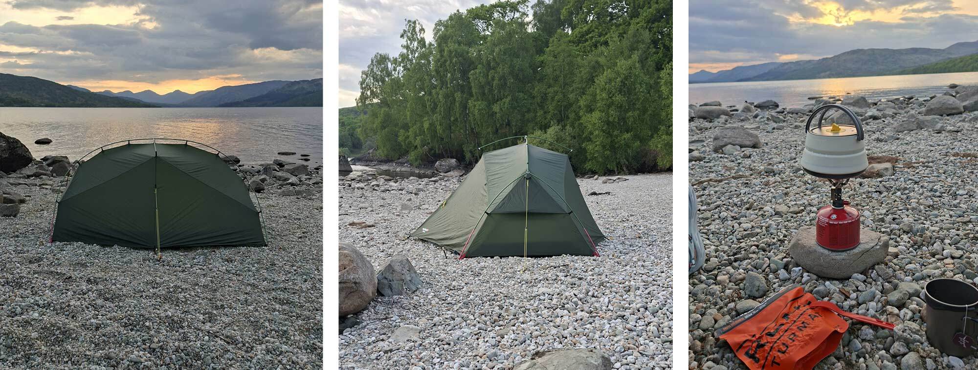
The Cowal Way after Curra Lochain is stunning as it descends with views of Sruth Ban Waterfall and first glimpses of Loch Goil. The western shore of Loch Goil was a welcome opportunity to cool the feet. This afternoon dip was becoming a daily ritual that was both good for the body and ‘sole’ – pardon the pun! The white, ‘Shore Guest House’ was a beacon upon the approach to Lochgoilhead and was a welcoming place to stop whilst considering where to pitch for the night. With the sun still warm and very little breeze, I ordered a pot of tea and a slice of cake and put my feet up in the sun and watched people passing by on the coastal path. After a little while the familiar tip tap of trekking poles could be heard as Lesley, Steve and Rolf came by. They were heading for the scout camp to see if they could pitch there, but I was hankering for a proper wild camp up higher with a view across the loch. A half pint of beer for the road later, I decided to continue along the Cowal Way and after about a kilometre I could see some large rocks on the open hillside to the right of the track, so I went exploring and found a lovely grassy spot with a gentle breeze. The view over the loch and the hills beyond was stunning and ever-changing as the sun went down.
Day 4 Lochgoilhead to Arrochar
- Monday 12 May
- Distance 15.8km
- Elevation 605m
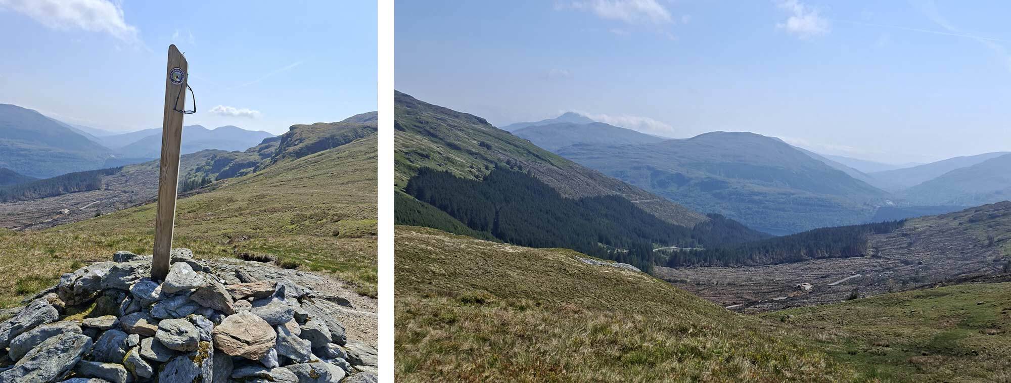
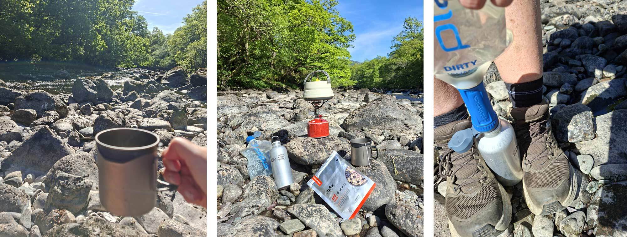
As Baz Luhrmann said ‘Wear Sunscreen’ – this was today’s message. The sun was hot from the get-go, and the 500m ascent to start the day certainly got the legs warmed up quickly. A nice flowing stream on the entrance to the forestry was a great place to filter some water as I had used all my resources overnight. Fallen trees across the track required some clambering over and limbo-ing under, both quite tricky manoeuvres with a backpack on. The track on the ground then disappeared as it dispersed across a vast grassy plane to a large cairn marking the crest, before the very long descent down Collessan Glen to Loch Long. Lots of clear felling is going on in this area with huge swathes of trees being harvested and stacked for transportation. The smell of fresh cut timber hung in the air in the heat of the day. Huge logging trucks were in action, and I was very mindful to get well off the track when I heard them thundering down the track behind me.
Once at shore level, the track meandered in and out of the trees as it rose and fell back to shore level again. There were many opportunities to stop and take to the water and I found a shaded beach to complete today’s dip before heading through Ardgarden forest and the final approach to Arrochar. When I planned my trip, had I known the weather would be so good, perfect for camping, I would have booked the campsite. However, I’d booked the Arrochar Hotel as a place to receive a food parcel, do some housekeeping and prepare for the next stage of my route as I would leave the Cowal Way here and head to Tarbet to cross Loch Lomond in the morning.
Upon arriving at the hotel, I was wearing my prescription sunglasses and as the reception area was quite dark, I put my glasses on my head and proceeded to check-in, partially sighted! I was handed my key and directed diagonally across the foyer and recall being told the room was on the ground floor. I glanced at the key fob and read the number as a 2. I saw it as a curly swan-neck shape with a line across the bottom. The first room I found was number 1 and next to it was number 2. I opened the door with the key (a yale type lock, not a fob or card) and thought, this is a nice room! I had a view of the loch too. I enjoyed a shower, did some laundry and spread out my kit and newly acquired box of food on one of the single beds. A little while later, I prepared to head out in search of some food and upon picking up my key, now wearing my glasses, I realised the number was actually a number nine, with a line underneath it to mark which way up the number was ie, it’s a 9 not a 6. I went and explained the mix-up to the receptionist and offered to move but pointed out that the key had opened and locked the door to room number 2. The receptionist took great pleasure in explaining that this was a far more expensive room than the room I’d booked and there was no way the key would work. I took her to the room to prove the lock situation, and she reluctantly said I could stay put!
I headed to the local bothy, with lovely views over the loch and met Lesley and Steve. We would be heading in different directions the following day. We had a great evening and wished each other well for our onward journeys.
Day 5 Arrochar to Loch Katrine
- Tuesday 13 May
- Distance 29.5km
- Elevation 622m
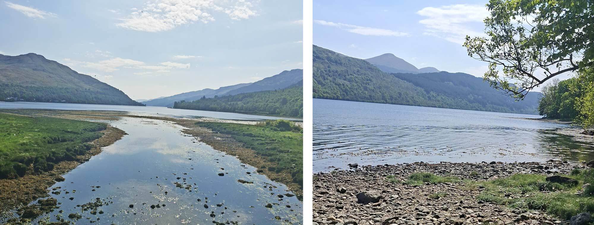
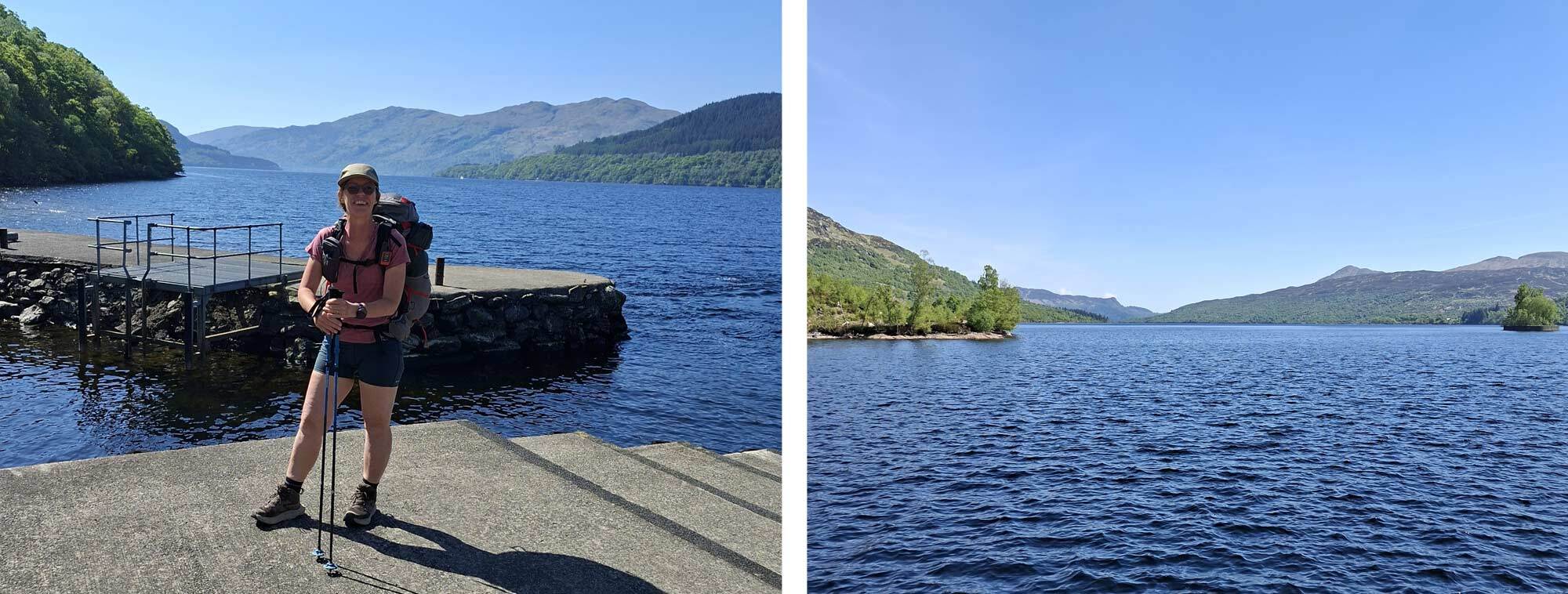
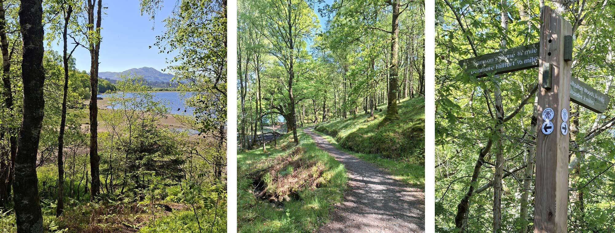
A chilled start to day 5 with a short walk to Tarbet in time for the 10.30am, 30-minute ferry across Loch Lomond to Inversnaid. Perfect conditions for a smooth crossing, with stunning views up and down the loch. The first sign from the jetty showed a north and south direction signpost for the West Highland Way and an eastbound sign for Callander and the Great Trossachs Path. I said goodbye to Rolf here as he was heading south on the WHW and I took to the Great Trossachs Path as it ascended steeply beside the Arklet Falls and through internationally important ancient woodland. Mostly traffic free, the first section of the Great Trossachs Path through Glen Arklet was on rolling dirt singletrack with views of Lock Arklet below. Glen Arklet has a rich history, including a battle in 709AD. It was here that Rob Roy MacGregor farmed for most of his life and probably where his rustled cattle ended up! This section of the trail follows the old military road dating back to 1700’s and shows advanced skills from the time with well-constructed culverts. Multiple cuckoos filled the air with their incessant calls and replies, and large birds of prey circled high above, the area has an RSPB centre and is certainly rich with wildlife. It was also here that I picked up my first unwelcome passenger – a tick!
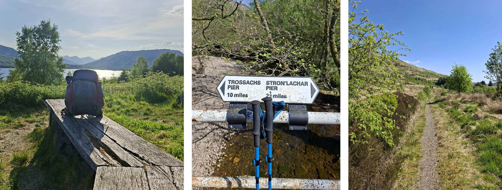
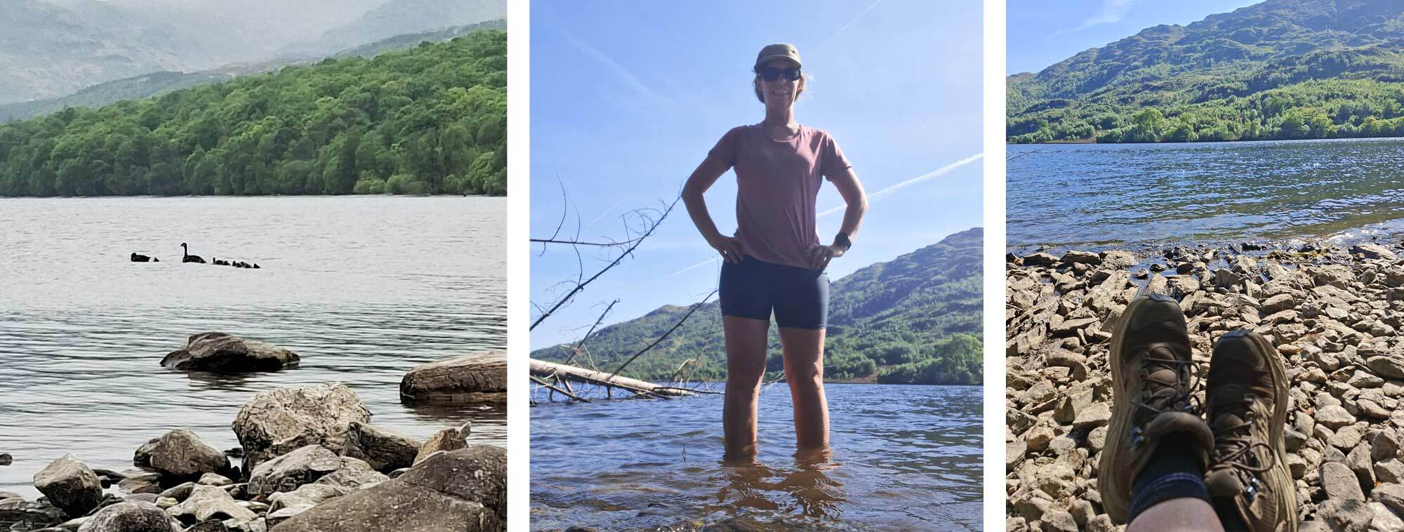
Shortly after leaving Glen Arklet, I arrived at Loch Katrine at Stonachlachar. From here I circumnavigated the loch in a clockwise direction. Initially in a counter-intuitive north-westerly direction. I feel that with the dry conditions and good visibility an anticlockwise direction would have been shorter and a potentially better option. However, I stuck with my plan and proceeded on the ‘cycle path’ around to the northern shore of the loch. The OS map had shown this as a track, but the reality was tarmac, mile after mile of tarmac and to add insult to injury, every time there was a bridge over a stream, there was a sign showing the distance to Great Trossachs Pier at the head of the loch. With the ferry crossing earlier this day, time was getting on as I was walking along the north shore, heading to the wild camp location suggested by my vetter. Eventually I exited the route onto a grassy peninsula at Ruinn Dubh Aird. Here I found the wonderful, secluded beach looking west up the loch as the sun was starting to set. Ducks and Canada geese swam by as I soaked my sore feet. Today had been a big day on tarmac and hopefully my feet would forgive me by the morning.
Day 6 Loch Katrine to Falls of Leny
- Wednesday 14 May
- Distance 23.8km
- Elevation 309m
The peaceful Canada geese from the night before made their presence known at first light. Their callings echoed in the atmospheric dawn mist. It lasted about an hour before they settled down and I settled in for my second sleep. It was just as well they became noisy again at a time I call the ‘school run’. At about 8.30 they walked their huge clutch of goslings to the water’s edge before taking them out for the first lesson of the day. I think I would have slept forever, had they not woken me from my slumber.
Back on the tarmac again I eventually arrived at the Pier and treated myself with a mid-morning reward of coffee and tea loaf. I think yesterday’s mileage had left me a bit calorie deficient.
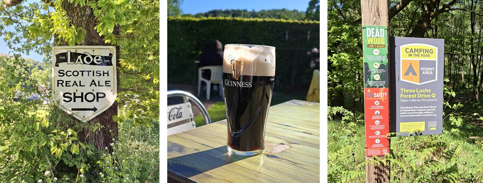
Relieved to say goodbye to the tarmac, the path then climbed through the Queen Elizabeth Forest Park. Passing Loch Achray on the forest drive the blue waters sparked through gaps in the trees. Flowing gravel cycle paths then continued to Loch Venachar and I made a note to return to this area on two wheels as it is very bike friendly, picturesque and has cycle paths spreading in all directions. Wild camping is allowed here with a permit and there were signs along the loch where firepits had been constructed. I contemplated stopping here, but as the fatigue had worn from my legs, the pack felt good and the afternoon was young, I decided to progress a little further, stopping at the furthest end of the loch to have my daily foot dip. As my schedule was now adrift, a bakery I had been recommended in Callander was not going to be open as I was arriving at teatime, so I decided not to go into the town, though a sign for a real ale pub serving good food was certainly a good substitute. The Laid Inn had just what I needed, a hearty fresh vegetable pasta dish on the specials board and I accompanied it with a green salad, washed down by a Guiness. As good as rehydrated meals are, my body was craving fresh vegetables. The guy on the next table in the beer garden asked if I was ready for that, as I squared up my knife and fork at the end of the meal. I guess I wolfed it down and it was probably not a pretty sight! I was just about to leave when Rolf appeared, having taken a totally different journey through the Trossachs.
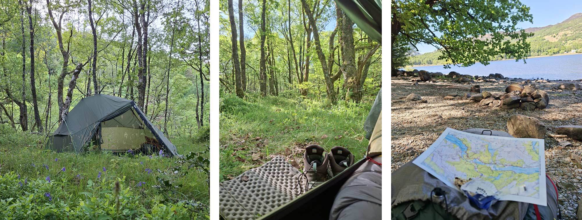
 Leaving the pub with fresh water on board, I soon found a nice wild camping spot in a peaceful woodland not far from the Falls of Leny in a permit zone.
Day 7 Falls of Leny to Balquhidder
- Thursday 15 May
- Distance 18.8km
- Elevation 291m
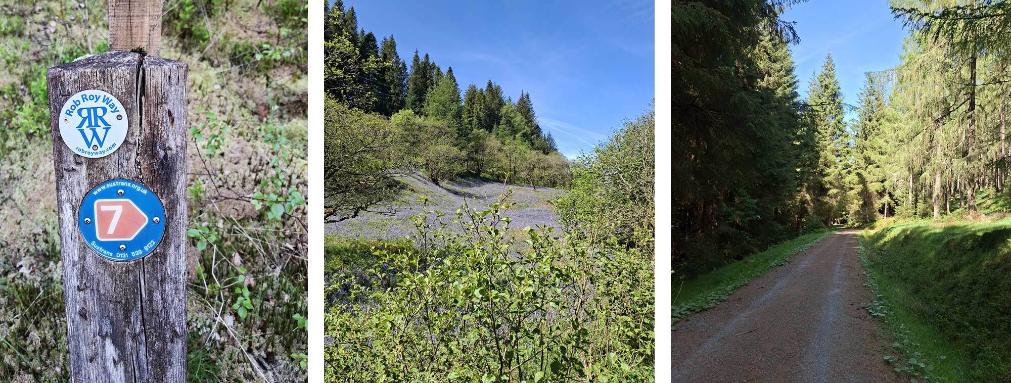
It is a joy to start the day with a light pack; I had used all but a trickle of water overnight and meal rations were depleted. Today there’ll be a food parcel with my name on it at Strathayre Post Office. I started the day with a muesli bar and as I was following the river ‘Garbh Uisge’ I waited for a nice riverside spot to stop for my porridge breakfast. It wasn’t far until the path descended revealing a perfect beach of flat riverbed stones, bathed in sunshine with lovely views of the river in both directions. Fast flowing and ideal for filtering water for coffee, breakfast and the morning ahead. The Rob Roy Way at this point followed the Sustrans Route 7 along an old railway line. It was very popular with cyclists of all ages and abilities, many slowing for a chat and asked where I was heading, I don’t think they expected my answer – ‘Arbroath!’ The cycleway was a mixture of surfaces, and my feet were feeling the effect from the last few days on hard surfaces, so at any opportunity I would step onto a grass verge or even a gritty gutter to lessen the impact.
On arrival at Strathayre, I headed into the tiny Post Office to retrieve my parcel, purchase an ice cream and some fresh fruit, along with some food for my accommodation in 2 days time as this was the last opportunity before arriving at Loch Tay. I found a nice spot on the grassy park next to the Post Office to open my box and assess the contents. The initial aroma of coffee was wonderful as I had enclosed a few fresh coffee bags for the second half of the trip. I recalculated how many snacks I would need as I found I was buying fresh baked goods at cafés, so I wasn’t using as many snacks as I originally thought, so I took the opportunity to send a parcel back home. I had also enclosed some fresh socks, so returned some laundry too. Looking at the long-range forecast, there was absolutely no sign of rain, so I made the conscious decision to send back my waterproof trousers and rain cover. I was joined on the grass by a couple of guys who were doing a very interesting hike, following the route inspired by Robert Louis Stevenson’s novel, Kidnapped, from the Isle of Mull to Edinburgh. They shared tales of how they had been escorted through a working quarry, having declined the offer of a lift to the exit, in favour of a vehicular escort for their own safety. Their next stop was Rob Roy’s grave. They were planning on writing a book about their route and were keen to discuss mine.
On leaving Strathayre fully loaded again with food for the next 3 days, I felt strong after the nice long rest and decided not to stop at the campsite. Instead, I crossed the busy A84 and ascended the steep wooded hillside of Strathayre Forest. Climbing was a nice relief for my feet as it took the pressure off my heels. The forest was very dark and dense with tightly packed trees; this kept the temperature down and the lack of sunlight created thick blankets of moss that covered the ground. A couple of vehicles were in the forest - University students doing field studies. They gave me great encouragement each time they passed me before stopping for me to overtake again on foot. On leaving the forest I headed towards a junction and spotted a parasol jutting out from a building on the corner. My mind raced, hoping it was a pub or hotel and not just a private dwelling, what joy when the Kinghouse Hotel became an oasis reality and not just a mirage. The heat of the day had left me parched and a refreshing pint of blackcurrant was just what I was craving, with a bag of crisps. I sat in the sun and rang my son. It was his birthday; he was working in Poland and had experienced snow and hail on his birthday for the first time. He could not believe the weather I was having in Scotland.
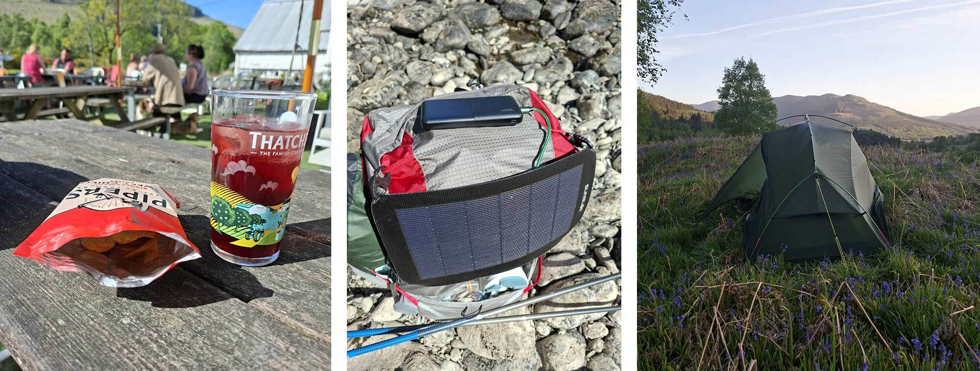
I found a quiet wild camp spot a couple of miles along the track in a nice field with grasses and bluebells and as it turned out, an abundant number of ticks. After pitching the tent, I was setting up my sleeping mat and the little blighters were crawling everywhere. They were on me, my kit, everywhere. I quickly boiled some water, made a cup of tea and rehydrated my food, then imprisoned in my tent, I set about removing them. Thankfully, my sleeping bag was still in its dry bag, so I could remove the ticks in the hope that my bed would be spared. I found two ticks attached to me by the morning, so I probably got off lightly.
Lois' TGO Challenge 2025 – Part 2
Lois' TGO Challenge 2025 Kit List
 |
||
|
|
||
| Lois Fife | ||
|
Lois is a keen cyclist and is always plotting a route… either for her next trip or looking for a different way to commute to work! She is regularly seen heading for the hills on a packed-up bike, be it for a quick overnight wild camp, or a longer multi-day adventure. She is currently plotting her route to walk the TGO across Scotland. She is a British Cycling level 2 leader and has been involved with MTB Guisborough encouraging the next generation of mountain bikers. Lois joined Ultralight Outdoor Gear in 2021 and is part of the Customer Service Team. She is always keen to get her hands on new kit to try in the field and share her findings on the website. |
||