Chamonix to Zermatt — 12thto 22nd July 2025
Posted by Mark Richardson on Sep 01, 2025
Day 1
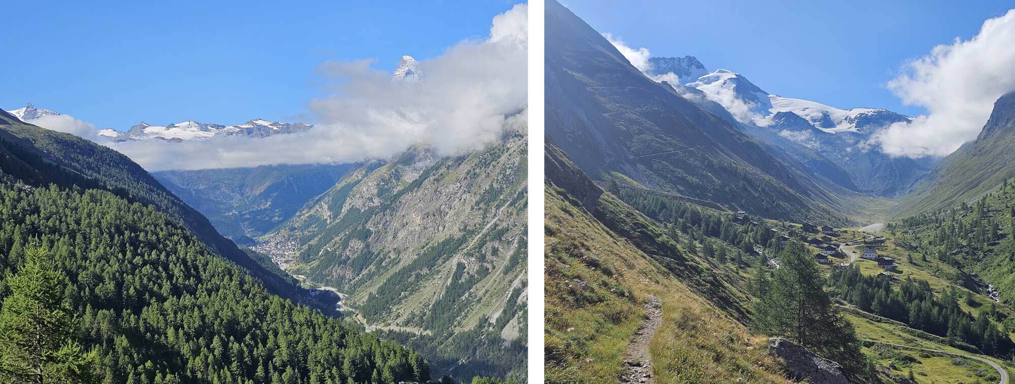
The official Day 1 route is a hike along the Chamonix valley to the end before climbing out (below a cable car) to the Col de Balme followed by a descent into Trient where there’s a place to camp.
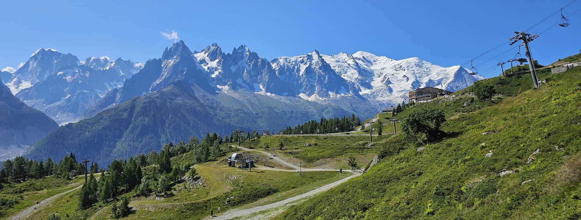
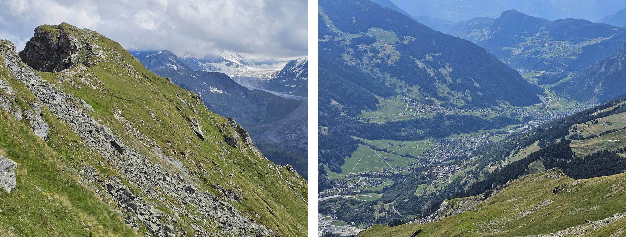
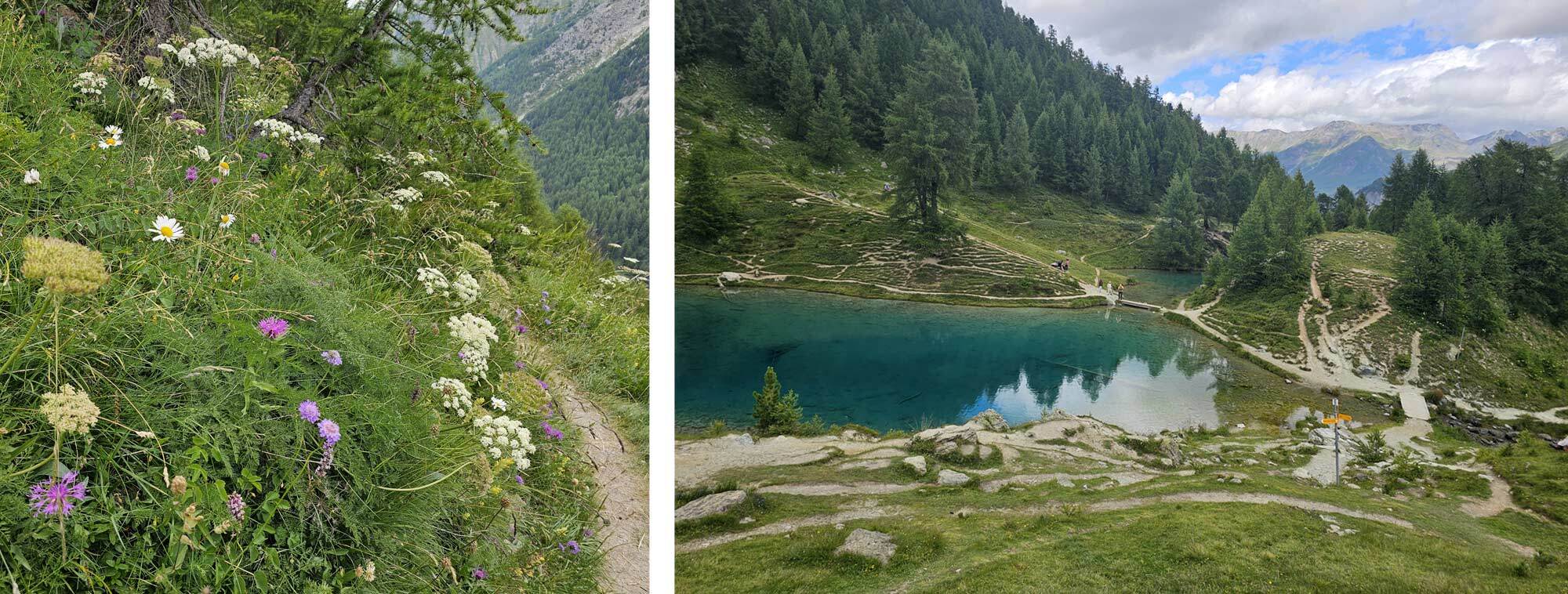
My idea was to use the Balcony du Sud path instead which contours along the Chamonix valley on the opposite side to Mont Blanc, about mid-way up the mountain side. It’s a superb path which gives extraordinary views across to the Mont Blanc massif. It’s actually part of the Tour du Mont Blanc route and infinitely better (in my opinion) than the suggested Day 1 route in my guidebook.
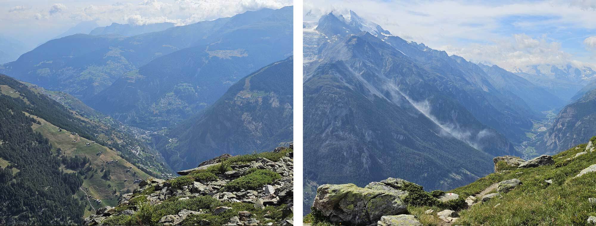
I caught the cable car up to Planpraz from the centre of Chamonix at 8.40am which gave me access to the Balcony du Sud which I followed North East for 5 hours until I reached Col de Montets at 13.30 and stopped for lunch. The weather was lovely and the path everything I remembered, it was a superb mornings walking.
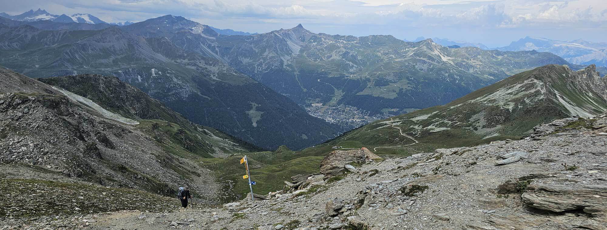
A fit walker could continue over the Aguille de Possettes to the Col de Balme but that was going to be too much for me and I picked up a path between Montets and Le Tour and arrived at 3pm.
I had hoped to hike up to the Col de Balme from here but realistically that wasn’t going to happen, the guidebook says 2 hours, plus I had another hour or so after the col which would add up to 9 hours walking for day 1. I paid for the cable car to take me almost to the Col de Balme and walked the rest of the way arriving at 3.30.
Mont Blanc Massive from the Balcony du Sud and Refuge & Col de Balme.
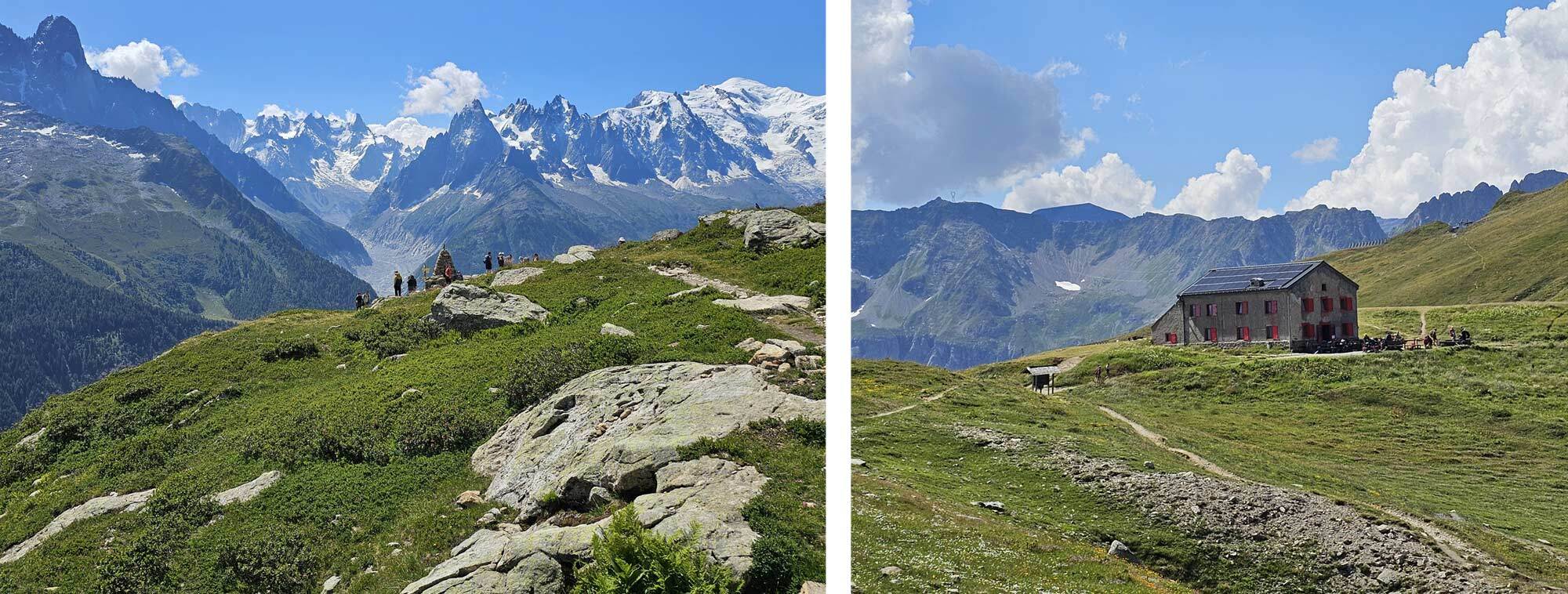
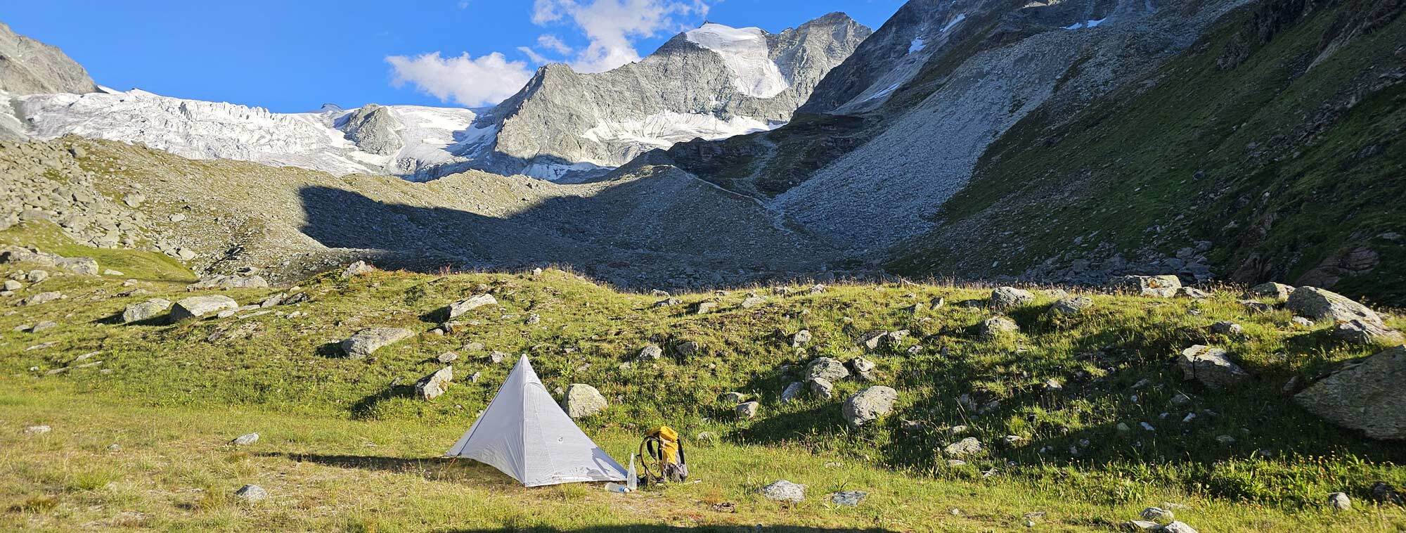
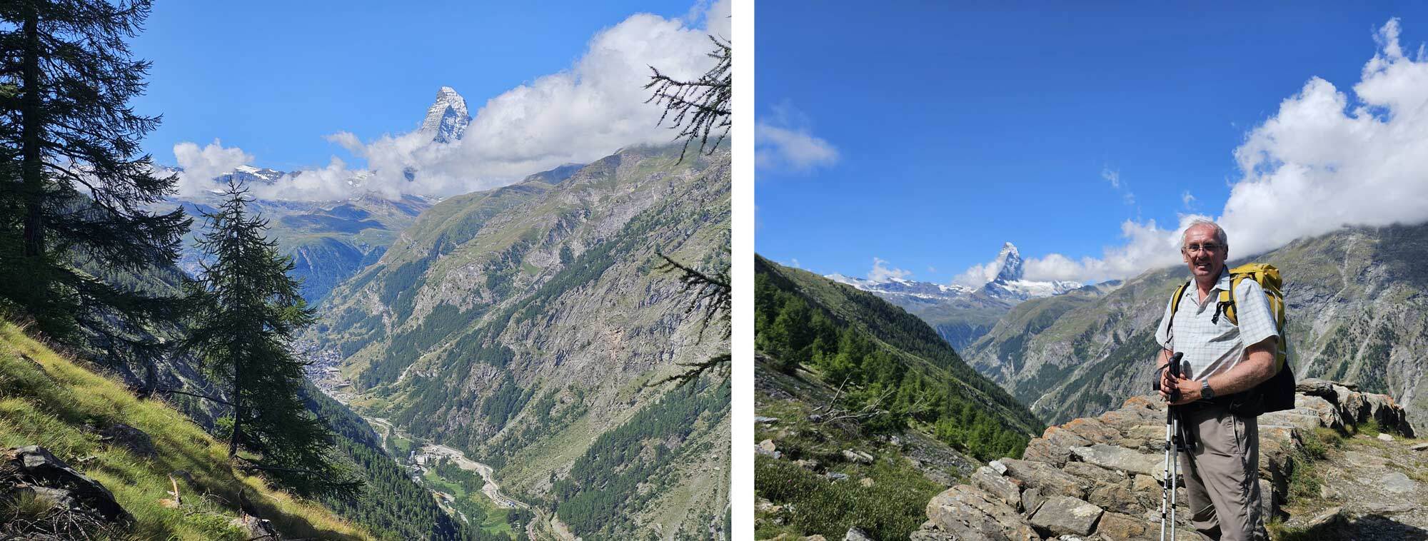
I had another variant for this last part – rather than descending into Trient I contoured to the Refuge Les Grands which also gives access to the Day 2 route. By camping at the refuge instead of Trient I wouldn’t save much time but would actually save quite a bit of ascent and descent.
I arrived at the refuge at 5pm, asked the guardian if it was possible to camp and she readily pointed out a good spot out of sight of the trails. She was very good, offering me hot water and use of the toilets etc.. Camping at the refuge is really restricted so it wouldn’t be possible for a large group to camp there – be warned, I suspect the guardian turns away many more than she allows to camp.
I was pretty satisfied, it had been a great days hiking, but it had been quite expensive too since I’d paid for two cable car lifts, and purists might not like that I took them rather than walking the complete route. My view is that I got the best out of Day 1, I’ve walked the paths I skipped in the past anyway, which is why I wanted to do something better.
Refuge Les Grands and Camping a short distance from Refuge Les Grands.
Day 2
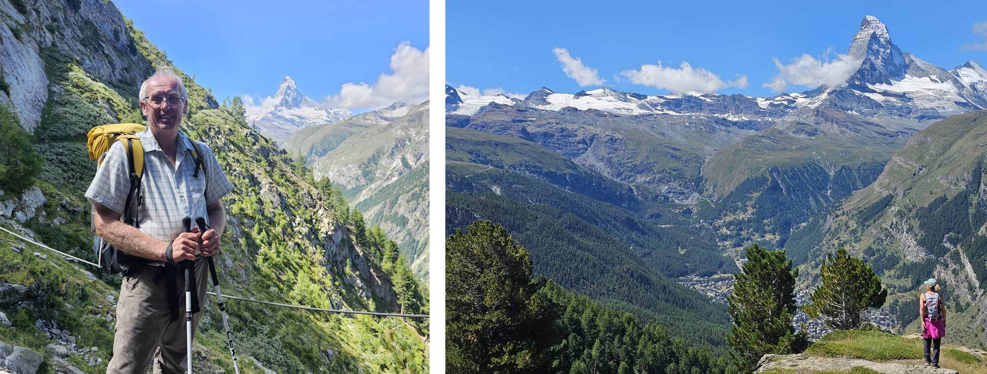
Up at 6.15 and away by 7.45 after a hearty breakfast. I takes just over an hour to descend to the Chalet du Glacier which is a small café on the path to the Fenetre d’Arpette (the highpoint of Day 2) and arriving there meant I was back on the official route.
There’s a lower level variant for Day 2 but I’ve never done it, the Fenetre d’Arpette is such a good place that anything else would be an anti-climax. It’s on both the Chamonix to Zermatt Haute route and the Tour of Mont Blanc so this was my fifth time going over it.
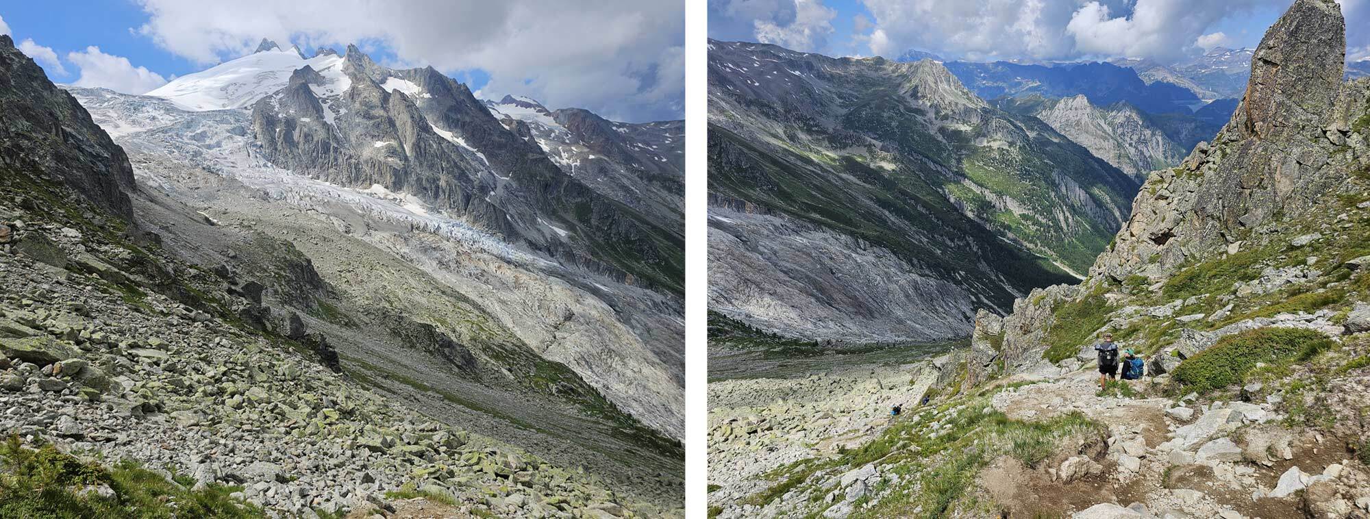
I arrived on the col three hours after scoffing coffee and blackberry pie at the café. The weather was broadly good but not clear blue skies, a bit cloudy and it did rain once or twice.
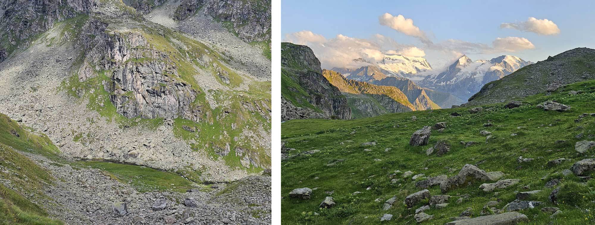
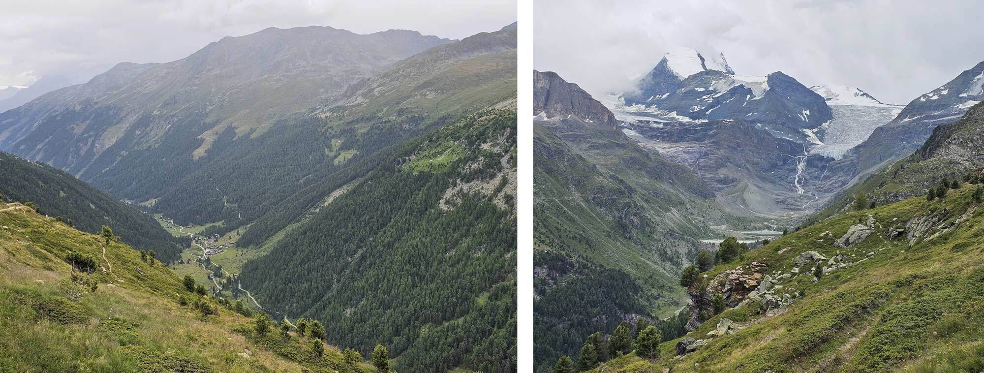
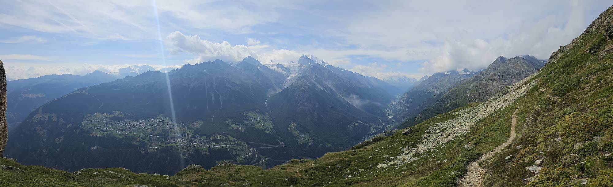
On the ascent you get a good view of the Trient Glacier which has retreated somewhat in the 19 years since the last time I made this trip, though it’s still impressive.
On the climb to Fenetre D'Arpette — you can see Refuge Les Grands across the valley.
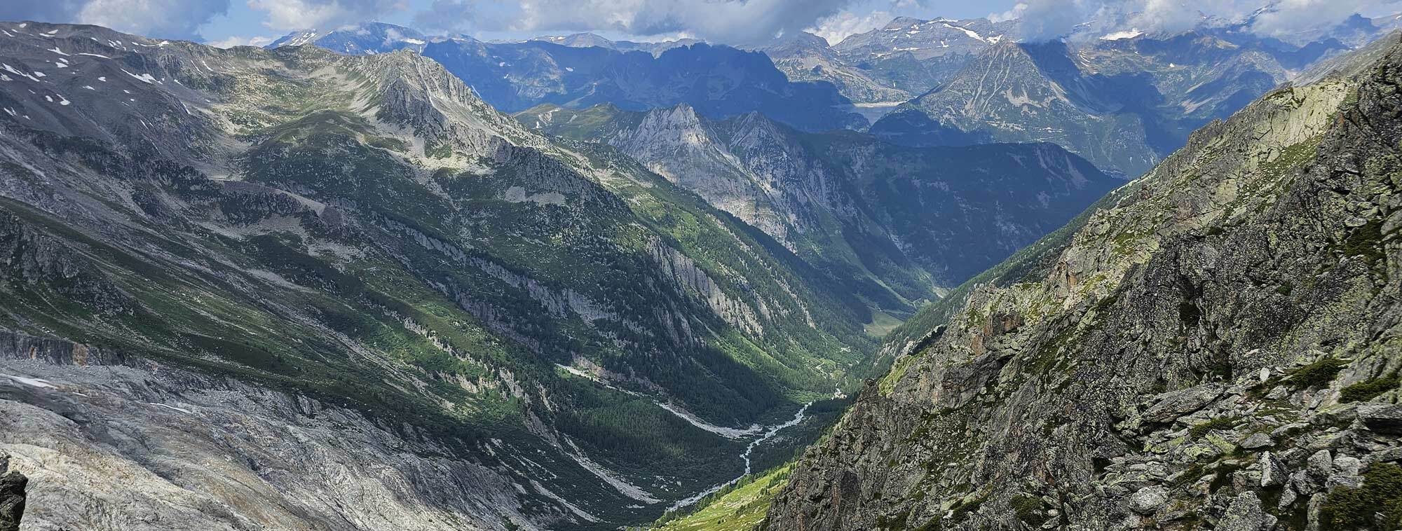
I left the Fenetre at 12.30 after a bite of lunch and a chat with some of the others on the col. It’s a good place for lunch. The initial descent is very steep and loose so care is needed, then there’s a long section of boulder field which can be slow going. Eventually the terrain levels off and a typical path emerges and heads off down the valley.
Climbing to Fenetre D'Arpette.
You first come to the Relais D’Arpette, which is a restaurant, bar and campsite, about 30-40 minutes before Champex. I was tempted to camp there but in the end didn’t want to add more time to tomorrows walking so headed off to Champex, the Champex campsite is nice but so crowded, probably didn’t help that it was Saturday, in the end I’d wished I’d camped at the Relais D’Arpette, you can learn from my mistakes.
It was about 4pm when I arrived at Champex, so plenty of time to wash my clothes, get washed myself and have a bit of relaxation. I also ate in town which was a bit of a treat.
The view from the Fenetre D'Arpette.
Day 3
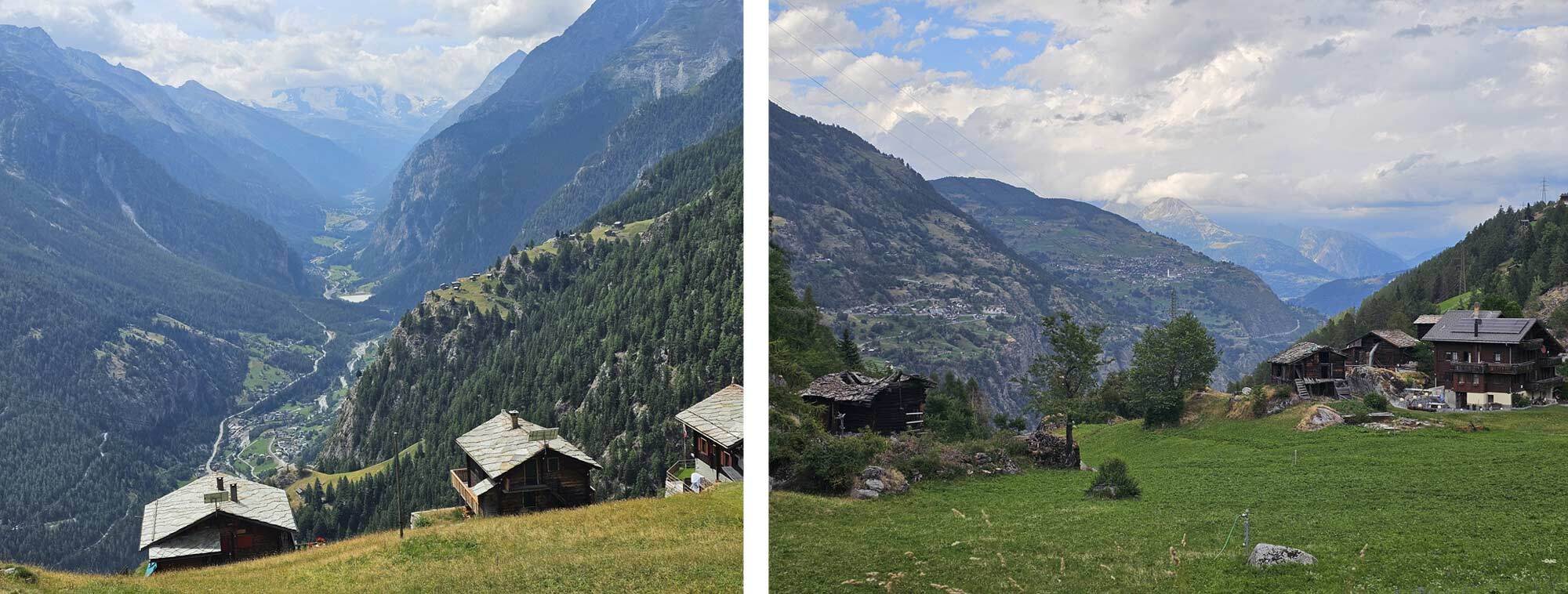
Pretty wet this morning but forecast was good after 11am, so headed off with full rain gear on. It was very misty but warm and the next section was across low level countryside through working farms and on to Le Chable. By the time I arrived at 11.30 the weather was brightening up, I had been walking for 4 hours so I looked for a bit of lunch which I found just outside the cable car station.
I took the Cable Car to Les Ruinettes, this saved me virtually a full days walking up through woods which, although the guidebook says it’s still interesting I think that maybe a bit rose tinted.
I made the same move last time I did the Haute Route and I think many other hikers do too, and for the record that was the last time I used help, the rest of the route I did with my own two feet.
Looking down on Verbier from the path to Cabane du Mont Fort.
OK, so Les Ruinettes gets you to within about an hour of Cabane du Mont Fort, which is the suggested accommodation if you’ve just slogged up through the forest. From here the next target is Col Termin, to get to this there is the choice of two magnificent balcony paths, one is designated Blue, which signifies mountain experience required and the other is the standard path. I chose the standard path due to my advanced years and dodgy balance, though speaking to a hiker I met at Col Termin, the Blue path is not difficult, just exposed.
Balcony path to Col Termin.
I reached Col Termin at 4pm, the path is magnificent with superb views up and down the valley and to the mountains on the other side. I was dismayed however to find signs at the col saying ‘no camping’. I had planned to camp somewhere between Col Termin and Col de Louvie but this was looking a bit difficult.
View from Col Termin.
About half way between the cols I decided to descend to the Cabane de Louvie and ask, if they wouldn’t let me camp near to the hut I’d stay the night. Had I decided this at the col there is a more direct path to the Cabane de Louvie that would have saved some time but hey ho, that’s life I guess.
It took at least an hour to get to the hut and I was told that camping was not possible, furthermore they were full this evening. She did stay that I could use some buildings at the end of the lake that I had passed to get to the hut. I did this; there’s a large table and benches outside which is ideal, what’s not ideal however are the buildings themselves.
En route to Col de Louvie and Descent to Cabane de Louvie.
Long stone built huts with no windows and only one of them had a raised platform to sleep on, and it was filthy. To make matters worse, I would be sharing with a young couple on a sleeping platform built for no more than 4.
That was an uncomfortable night, more so for them of course but I was so glad to get out of there the following morning. At least they had the decency to lay off what they normally did when sleeping together.
I’m counting that as a camping night. I think the restricted camping area is between Col Termin and Col de Louvie so the answer (if you have time) is to push on over the Col de Louvie, drop down and camp somewhere on the other side. Although there’s no obvious place, there are flat spots but no grass, not ideal but doable.
Cabane de Louvie.
Day 4
An early start today, my sleeping companions didn’t venture out as I made my breakfast, packed up and headed off at 6.30am. I shook off the unsatisfactory evening and regained the path between the cols, it was another superb day with enough cloud to keep the skies interesting and an amazing mountain scape looking South.
Climbing back to the trail and Crossing over Col de Louvie.
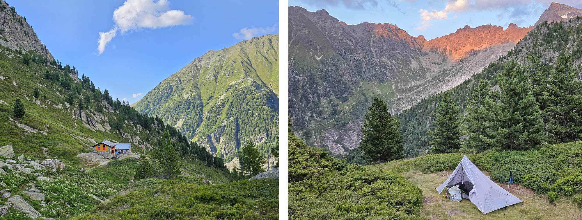
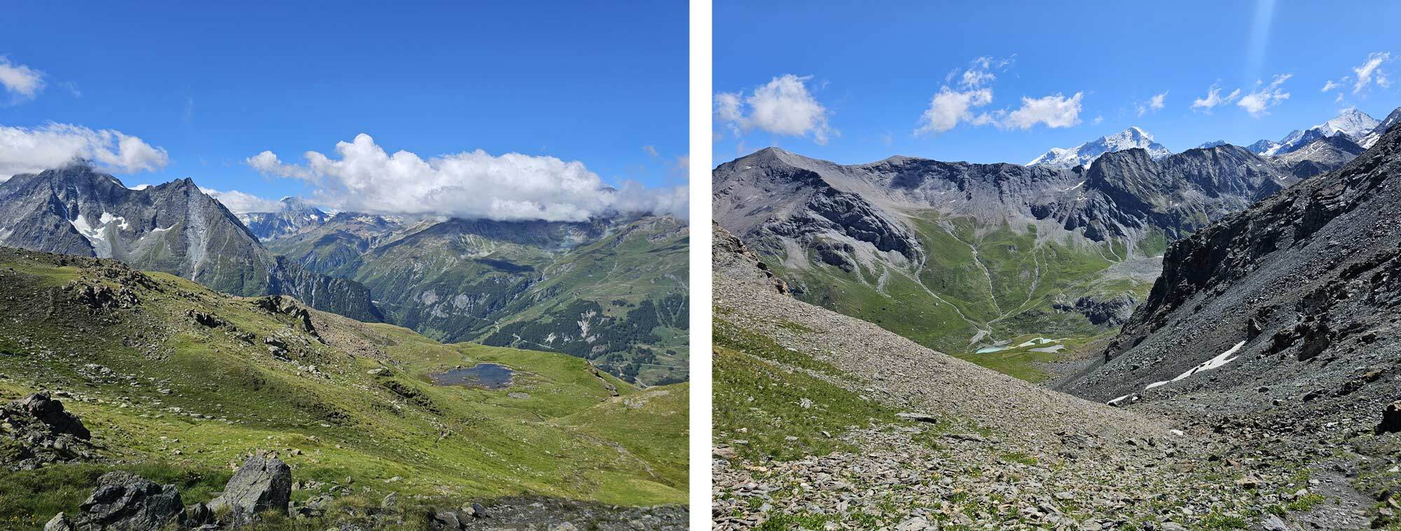
The path to the Col de Louvie was nice, not too strenuous and just what I needed. The next section is referred to as a desert because it’s pretty barren, but it’s definitely got a rugged beauty all of its own. The route crosses the desert by descending into a rocky bowl then climbing out to the Col de Prafleuri before the final descent to the Cabane de Prafleuri. There are places to camp in the environs of the hut but it’s still pretty austere, what’s more the next col is just half an hour away and over it the mountains are covered in grass again.
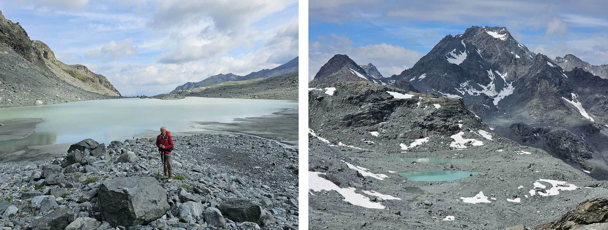
Across the upland 'desert' and en route to Col de Prafleuri.
I reached Cabane de Prafleuri at 2pm, I decided to relax and have a meal and drink. I spent about 45 minutes there before heading for the col.
Over the col there are two mountain huts within the first half hour of descent, I left the path just as I approached the first one and passed behind it onto a flatish area out of sight where I could pitch my tent. It was only about 4.30, so I had time to relax and take my time over dinner, I was well away from the path too.
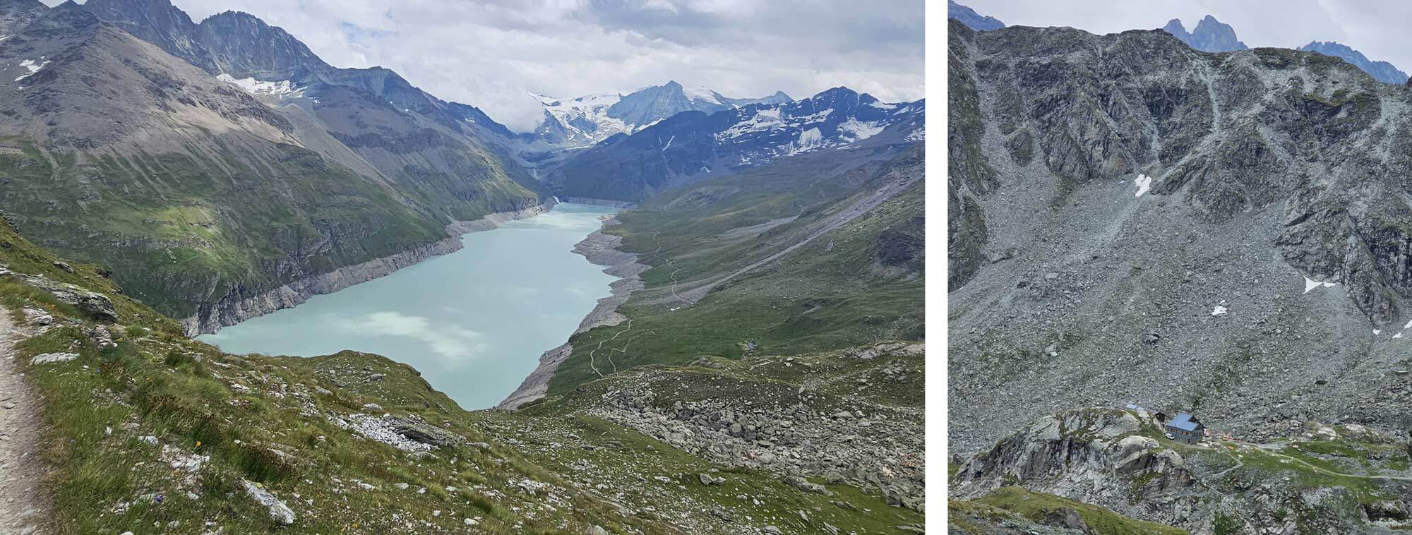
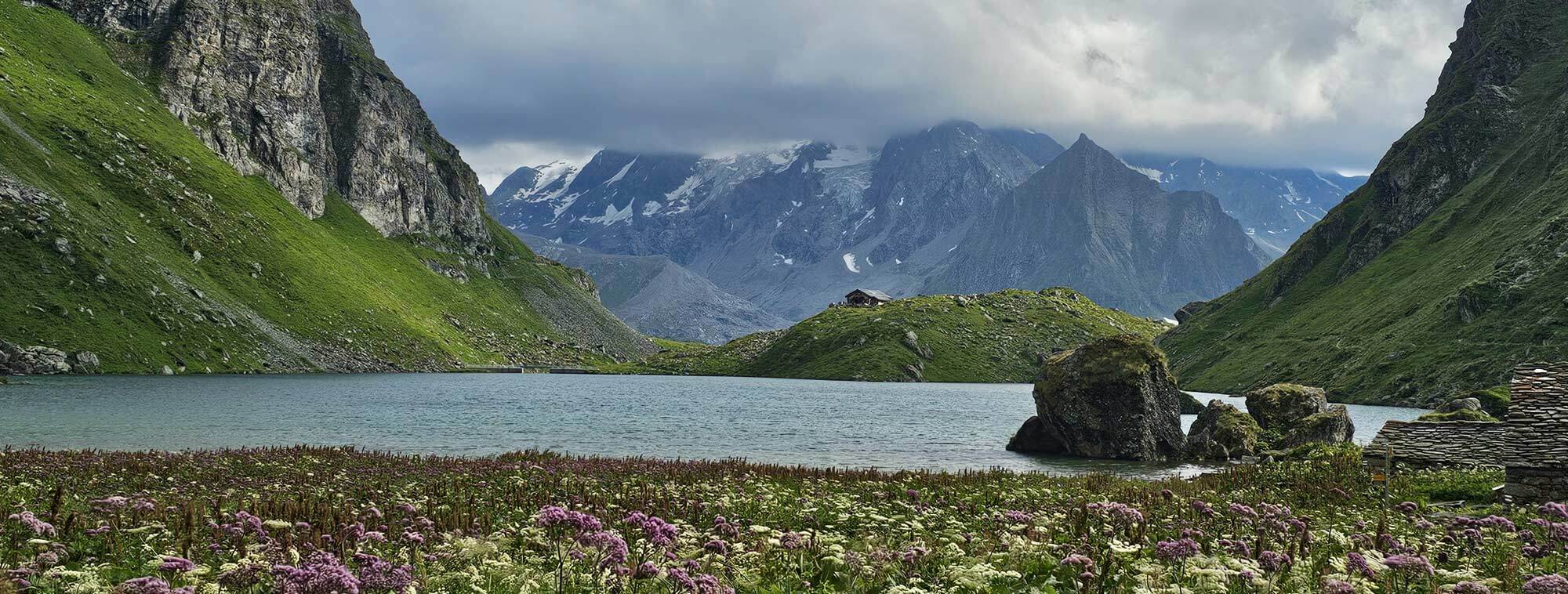
Lac des Dix from Col des Roux and Cabane de Prefleuri.
Day 5
Left camp at 7.15 and headed down to the path that skirts the edge of Lac des Dix, weather was cloudy but dry, I made good progress to the end of the lake and picked up a lofty exposed path which cut a corner off and joined the route to Col de Riedmatten. I shortly met Anton, a young Belgian man who was also doing the Haute Route though he had much more gear than I did.
Approach to Col de Riedmatten.
The route to Riedmatten is a great walk which I enjoyed very much, as you approach the final climb to the col I could see the Pas de Chevres, which is an alternative crossing, it looked serious with metal ladders, platforms and cages, I was tempted to give it a try but signage advised that it was closed. The final ascent to Riedmatten is steep and loose with chains in key places, I reached the top around 11.00am, I didn’t linger, preferring to descend the initial steep section before stopping for lunch by the trail.
According to the guidebook the descent to Arolla was about 2 hours but as I was going further I didn’t have to go all the way in, about 15 minutes out I stopped at a makeshift café bar and had a coffee. I asked the host which way he would go to Lac Bleu from here and he put me onto a short path that would get me on the right track.
Descent from Col de Riedmatten and Easier angled paths on descent to Arolla.
After Lac Bleu the route descends to La Gouille and follows a track down valley into Les Haudres. Despite his lack of English my café host managed to tell me that I could get a bus from Arolla to La Gouille and it would take 5 minutes! I said thanks but I was going to walk, and it took me 2 hours.
I eventually arrived in Les Haudres at 4.30pm and found the campsite, they said they were full but as I was on foot they found me a spot between some unoccupied cabins. Campsites saying they were full but finding a pitch for me became a theme of the trek from here on.
Wild flowers on the trek to Lac Bleu and Lac Bleu.
Day 6
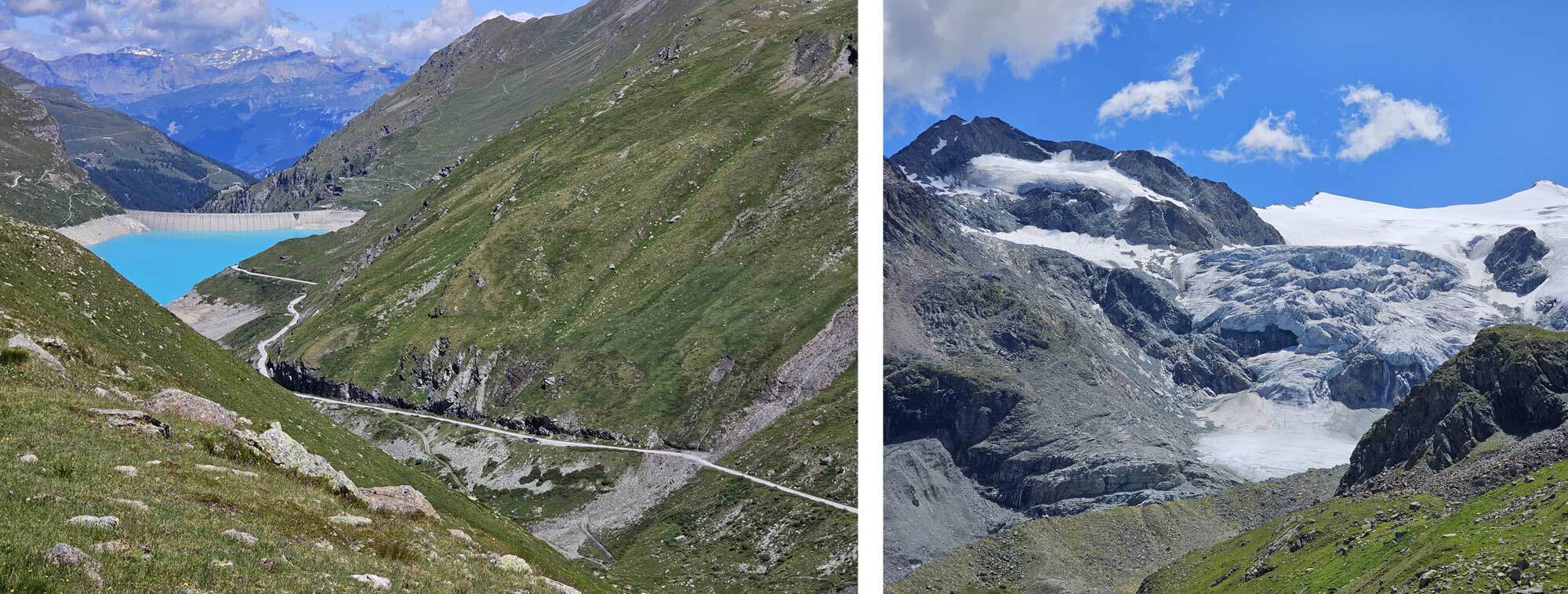
The guidebook suggests booking a place in the Cabane de Moiry for the next section, which is in an amazing location overlooking the Glacier de Moiry, unfortunately though I wanted to camp so I decided to take my chances at finding a good spot.
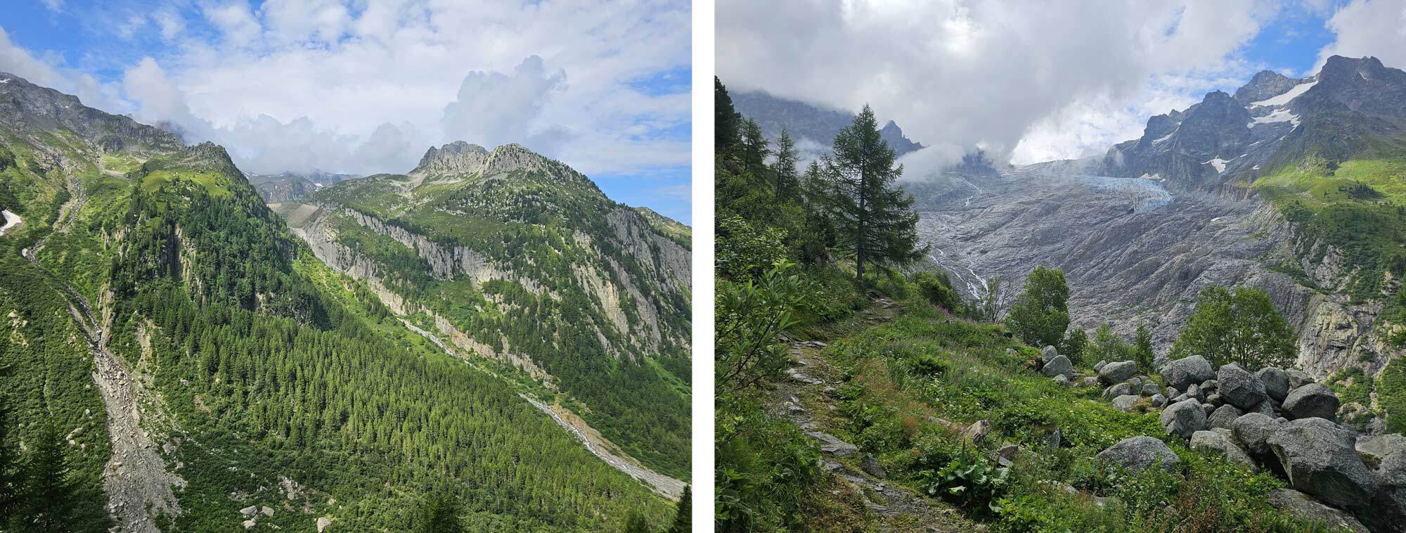
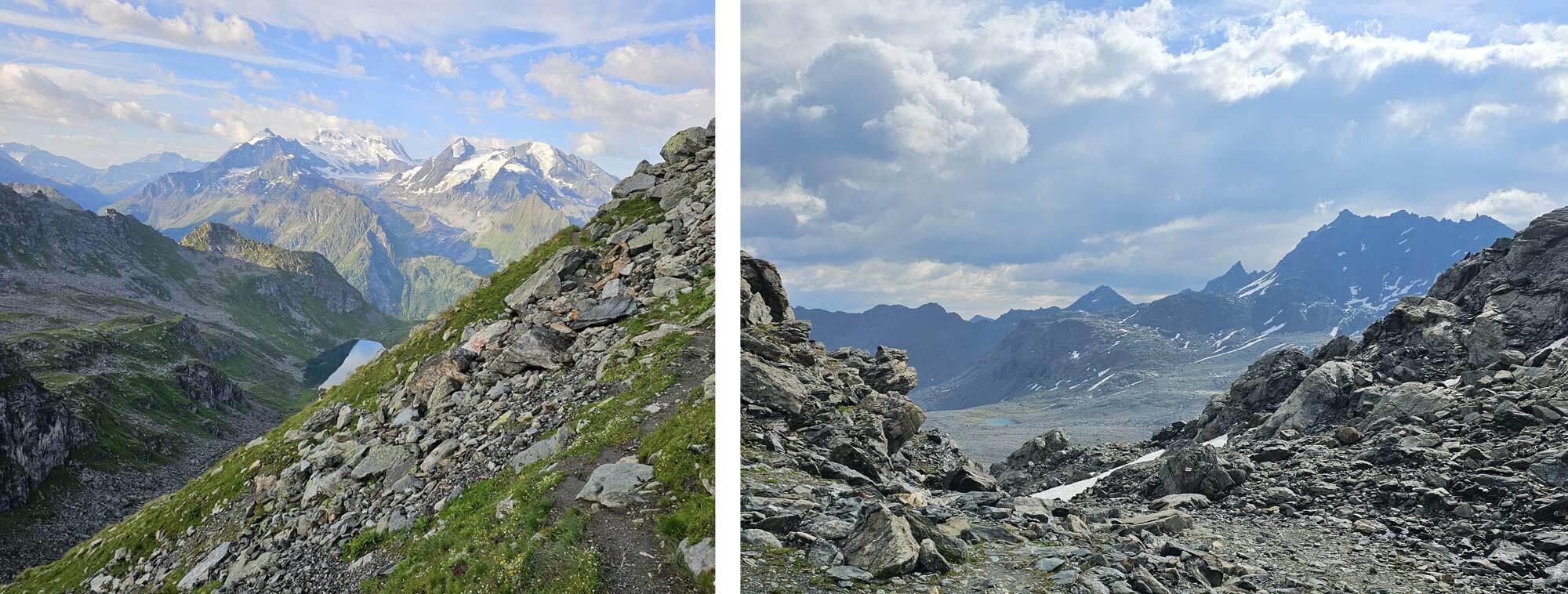
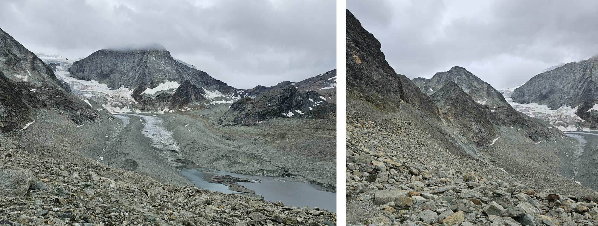
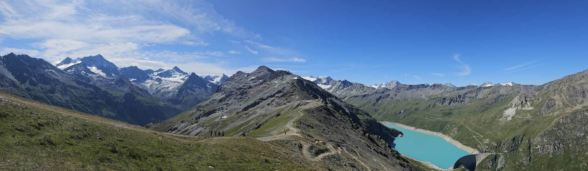
I left Les Haudres at about 8am and climbed to the Col du Tsate in four hours, the weather was full sun and clear skies. Over the col the Val de Moiry is laid out before you, it’s largely a man-made environment with a huge dam at one end, roads and a big carpark with toilets and a small café, so not so good. Look to the right however and you see the more inaccessible end of the valley with magnificent peaks surrounding the Glacier de Moiry, not as big as it used to be but impressive nonetheless.
Looking back on the climb to Col du Tsate.
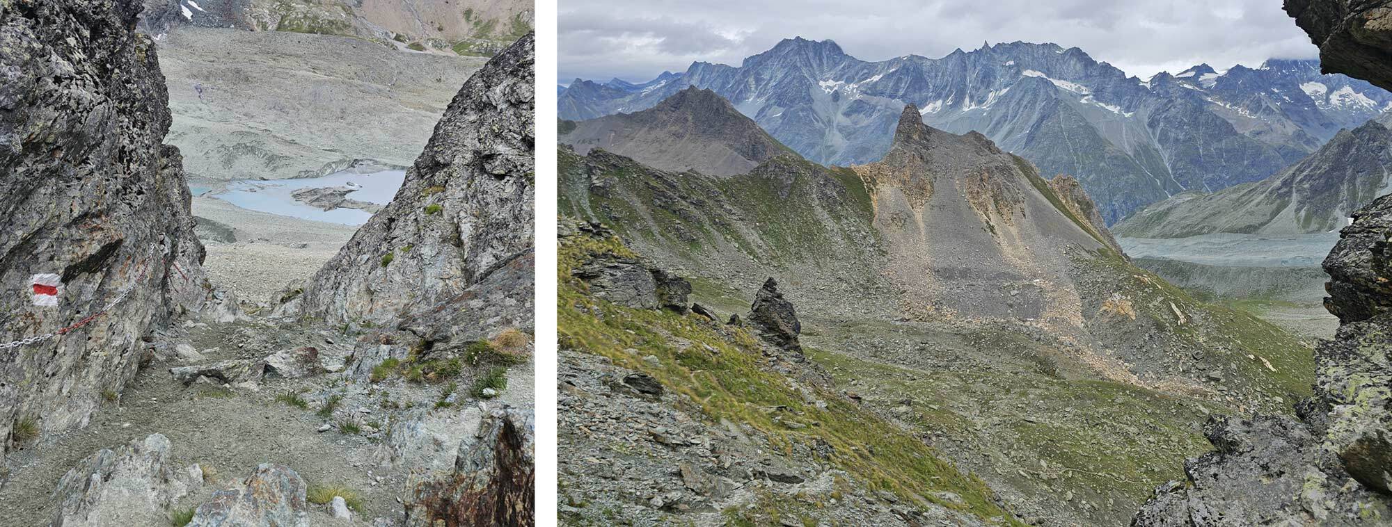
As you descend the Cabane de Moiry comes into view on the far side of the valley, staying on this side though, off to the right, there’s a footpath to a viewpoint that gets close to the glacier and overlooks it. I climbed to the viewpoint and spent about 45 minutes taking in the views. Tiny specks on the glacier turned out to be people who looked like they were practicing crevasse rescue while another group were walking over to access a path to the Cabane de Moiry.
Lac de Moiry and Glacier de Moiry.
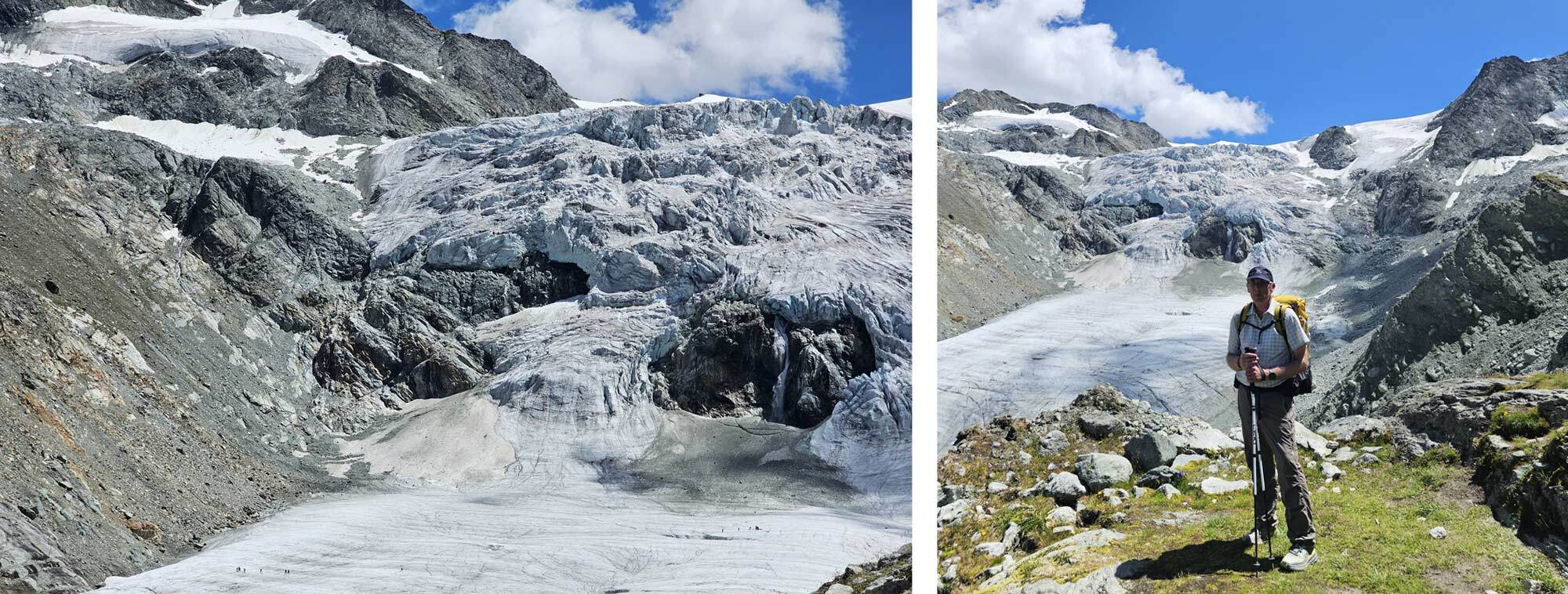
Glacier de Moiry viewpoint.
Eventually I descended slightly to an area suitable for setting up camp, there were a few old firepits around which I’m definitely not in favour of, but it did let me know that people had camped here before. It was still early, about 3.30pm so I had a leisurely afternoon in the sun cooking my meal and pitching the tent.
Camping below Glacier de Moiry.
Day 7
Another fine day dawned and I left the wildcamp just after 7am, it took only about an hour to hike down to the carpark then up to meet the path from cabane de Moiry – I was back on the route, which takes a fine balcony path along the length of the Val de Moiry as far as the barrage, then ascends via switchbacks to the Col de Sorebois which I reached at 10.30.
There’s a wooden bench off to the left, slightly uphill which I occupied to have something to eat, the views are amazing from this spot, you can take in both the Val de Moiry and the Val de Zinal, flanked on the left by the staggeringly beautiful Weisshorn. You definitely need a clear day for this section, to miss the views would be criminal.
I lingered quite a while and was joined by a fellow lightweight hiker and we chatted about the benefits of trekking in the mountains and the latest lightweight gear.
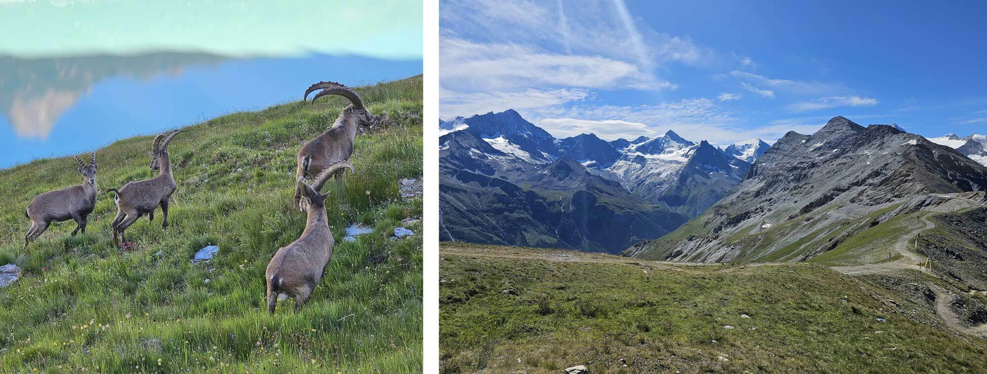
Early morning encounter with Ibex and Col de Sorebois.
View from Col de Sorebois.
Reluctantly I started the two and a half hour descent into Zinal, reluctant because it’s a major ski area and so for the hiker it’s not as pleasant as it could be. The campsite is at the southern end of the village, at reception they said they were fully booked but as I was on foot I should be able to find a spot in an area which was pointed out to me.
There’s a restaurant on site and I arrived quite early so after a shower and laundry I was able to relax in comfort.
Day 8
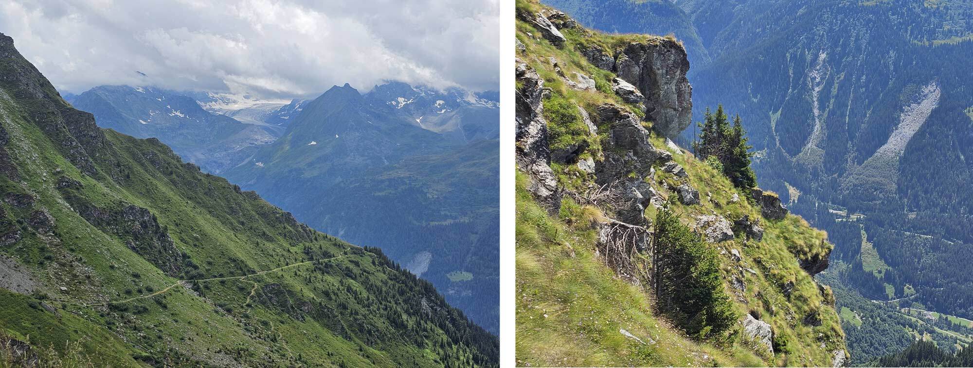
I left Zinal at 7am, the sky was a bit cloudy but the forecast predicted dry until about 3pm, I was hoping to reach Gruben before the rain appeared. The path to the Forcletta Pass affords good views of the Val de Zinal as it travels along the valley initially before turning to the East well above the tree line.
Barneuza Alp - above the Zinal Valley and Long distance views on the climb to Forcletta.
Approaching Forcletta pass.
I arrived at the pass just after 11am and could see it was raining on distant peaks to the West, and the clouds were coming this way.
I hurried over and began the descent, it rained a bit, on and off, but it wasn’t bad. The view up the Turtmantal valley was sublime.
Turtmanntal valley with Gruben.
As I approached Gruben it started to rain quite heavily, I picked up the pace and reached the Schwarzhorn Hotel just in time to avoid the downpour. It was chucking it down now but I was sitting on the covered veranda watching it. I ordered a meal and a drink and enjoyed the break.
By 4pm the rain was much lighter and the cloud was breaking up, I had been in the hotel for about ninety minutes so I decided to set off again, hoping that the worst of the rain was over. It was always my plan to go beyond Gruben as there was no camping there, the next section was the climb to the Augustbordpass and while it was a major climb I felt fully refreshed after my hotel stop.
The ascent to the pass is 3 hours and I covered the first hour and 45 before leaving the main path and setting up camp on a grassy outcrop among a large boulder field. I was visible from the path but well away from it, I didn’t expect to see anyone as it was already after 6.
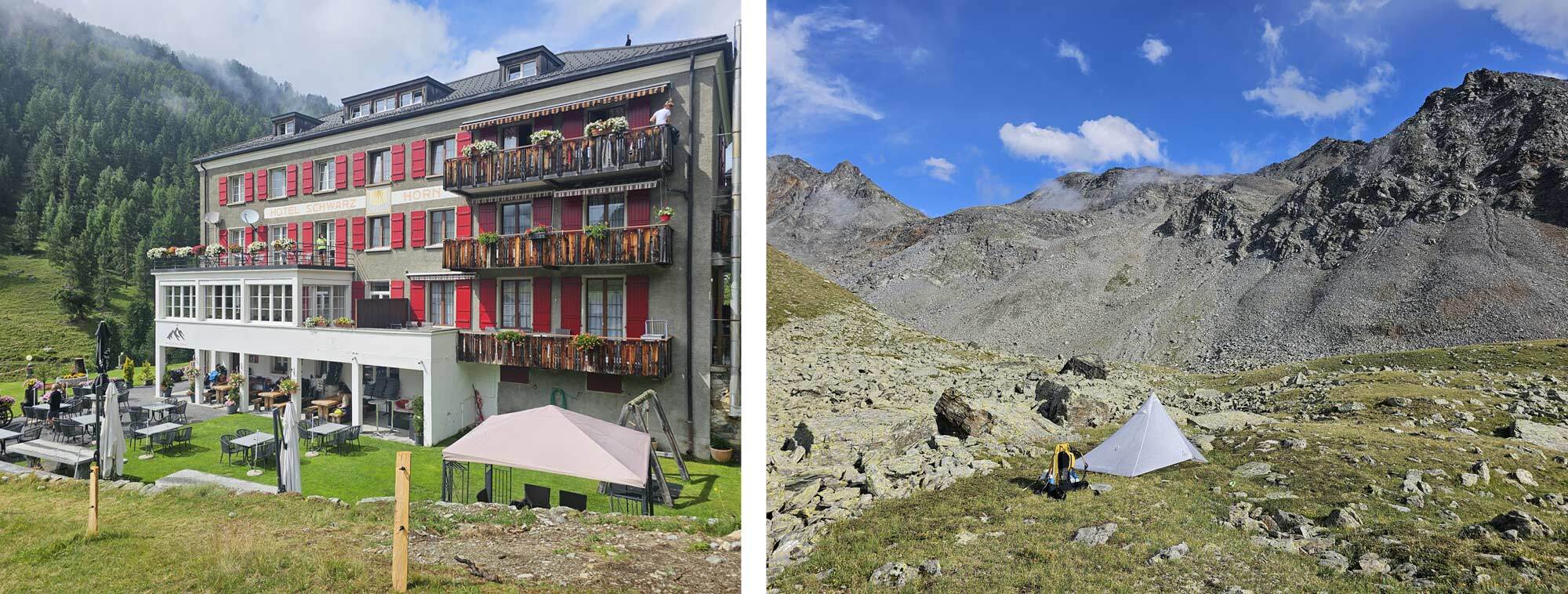
Hotel Schwarzhorn in Gruben and camping on the approach to Augstbordpass.
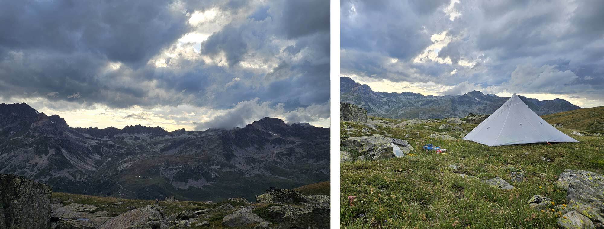
Foreboding skies seen from my tent and camping spot.
Day 9
It rained during the night again and it was very cold, by the morning it was dry but I shoved my hands into my gloves as I set off from my camping spot. I rejoined the path and made my way to the Augstbordpass.
Gaining the pass is just the first part though, beyond it a long boulder field crossing awaits, and I picked my way through it. I was feeling good, the weather was fine and it was hours before I saw another soul, eventually a few people passed me going the other way, towards Gruben.
By 9am I was emerging out of the upper reaches of the Augstbord and the Mattertal valley was coming into view. I have hiked this pass previously but had forgotten just how astonishing the views are, initially you see across the Mattertal but as the balcony pass rounds the corner you get a view along the full length almost as far as Zermatt.
On the amazing balcony path between Augstbordpass and Jungu.
I began to see more people on the narrow precipitous trail including one guy who was pushing a mountain bike up it, rather him than me but I did congratulate him on his guts and determination.
I took my time along this stretch, it was hot but also the views are not to be rushed. Eventually I stopped for some lunch about half an hour above Jungu, which is a key village on the route being the high station on the cable car from St Niklaus. If I hadn’t eaten my own food I’d have stopped at a restaurant in Jungu for certain, as it was I couldn’t justify it and headed through the village and down the path to St Niklaus.
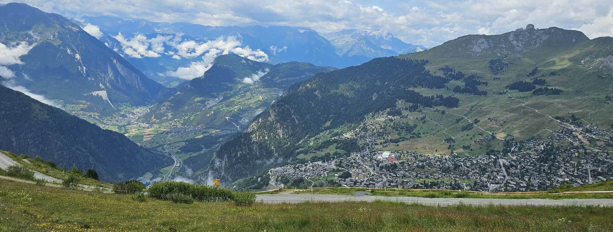
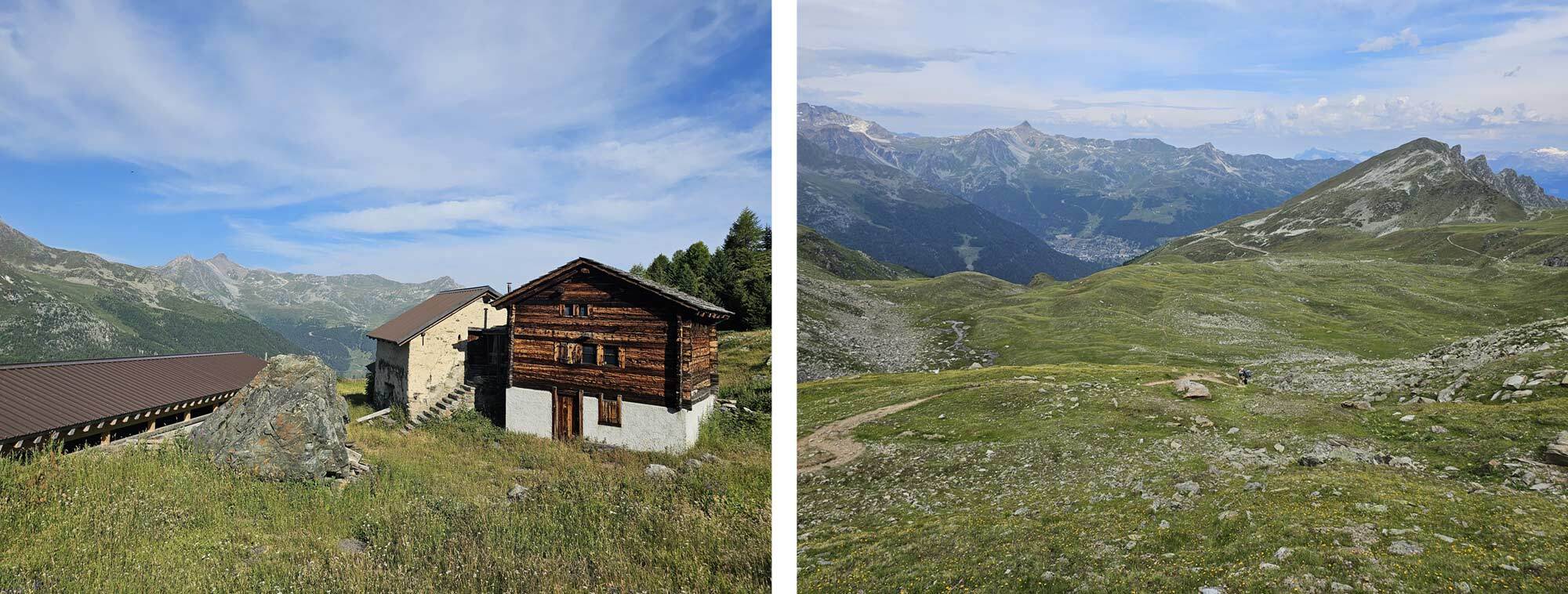
That was another two hours and I arrived at 2pm, I was suffering in the heat by this time and opted to sit outside a hotel with a beer and something to eat. Although there are no camping options in St Niklaus there is one in Grachen. If you are continuing on the Europaweg to Zermatt, Grachen is on the route, but it is another climb from St Niklaus.
I rang the campsite before tackling the climb, they said they were full but as I was on foot they would find space for me. It was another 90minutes before I reached them around 4.30. They don’t sell food at the campsite so after pitching my tent and getting cleaned up I got the bus into Grachen centre and walked back with provisions for that night and the next day. The campsite is excellent and it has great views down the Mattertal – happy days!
Approaching Jungu, looking down the Mattertal and view from the campsite in Grachen.
Day 10
Rain today, quite heavy first thing. I made my breakfast and ate it in the comfort of the tent. Forecast says it will brighten up from 11.00am and as I have a shortish day planned I can afford to hang around.
The big question is over the Europaweg, the high-ish level route between Grachen and Zermatt. It used to be a truly high level route but over the years it has been hard to maintain due to rockfalls and so the route has been modified somewhat and often has parts that are closed.
This year is no exception, the route was closed in one section beyond the Europa mountain hut. The recommended route is to leave Grachen and follow the route descending to the valley floor at Herbriggen, ascend to the Europa hut – continue on for a short section before descending once again to the valley floor near Tasch. Then climb back up to the route, joining it at TaschAlp.
My view was that if you are not staying the night at the Europa hut then what’s the point of ascending to it only to descend again shortly after. Therefore I decided to take the route to Herbriggen, follow the valley to Tasch, camp, then ascend to TaschAlp the following morning and complete the route from there into Zermatt.
On the Europaweg between Grachen and Herbriggen.
I have previously hiked the route from Zermatt past the Europa Hut (in the other direction) and down to Herbriggen, so I wasn’t missing anything I hadn’t done previously.
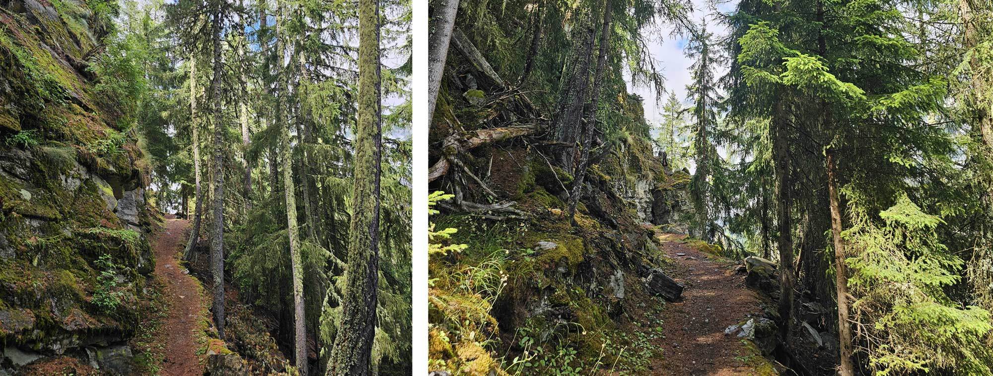
I left the campsite about 9.30am when the rain was fairly slight, stopped for an early coffee in Gasenreid because it had started raining again. Dodged this shower and continued on the route arriving in Herbriggen at 1.45. The route down is pleasant, a lot of forest walking but also some great views across the valley.

Herbriggen to Tasch is a straightforward walk along the valley floor. After eating my lunch I set off, by this time the rain was long gone and it was hot, the walk seemed to take forever but I eventually arrived at Tasch about 4.30. The campsite has a few small areas for tents, I asked in reception to camp but was told they were full but if I could find a space to put my tent then I could stay. This was the closest I came to not being allowed to stay in a campsite, I’m pretty sure I got the last space.
Day 11
The weather was good on the final day so I set off at a more usual 7.30am and climbed the route to Taschalp, I was back on the Europaweg by 9.15 and arrived at Taschalp a short time later.
Glimpses of the Matterhorn on the ascent to Taschalp and approaching Taschalp.
The final section of the Europaweg is an amazing path with spectacular views of the Matterhorn and Zermatt below, it’s essentially a balcony path and you don’t really descend until the very end. It’s also busier than the rest of the route because it’s a popular route for people based in Zermatt and my last day was no exception.
I made the most of it, I was reluctant for my trek to end but eventually I had to descend, there’s a choice of path, descend from Tufteren or continue on to Sunnegga and descend from there. I took the early descent because I’ve done the other route previously, however Sunnegga is the better option as the route from Tufteren is mostly through forest.
The campsite in Zermatt is well located near to the town centre however it has a decidedly urban feel to it so I was glad that I’d booked a hotel for my final night.
Europaweg final section to Zermatt.
 |
||
 |
||
| Mark Richardson |
||
|
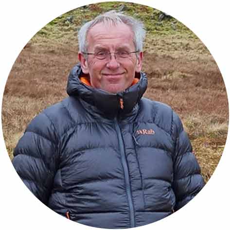
Mark was the founder of Ultralight Outdoor Gear back in 2006 and has completed long distance backpacking routes in some of the remotest parts of the world. His favourite hikes have been Torres del Paine (full circuit), the John Muir trail and the Markha Valley trail (Ladakh, India). Although semi-retired Mark has not lost any enthusiasm for minimalist backpacking and is tackling Scotland’s Munros choosing multi-day backpacking routes over the more usual guide book excursions. |
||