Jump to: Our Verdict / Features / Specifications
The UltraMap XT40 series are a super light, waterproof, pocket sized set of maps covering some of the most popular areas in the UK at 1:40,000. These are ideal for runners, fastpackers and hikers who want a map for simple navigation when covering longer distances.
Harvey Maps says
Covers a large area yet is handily compact. Pocket perfect!
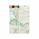
Detailed map for runners and walkers of the northern section of the Trossachs National Park at the magic scale of 1:40,000.
Includes Loch Lyon and Crianlarich. Includes the iconic Ben Lui and the Cononish Gold Mine.
All 7 Crianlarich Munros on one side of the sheet.
22 Munros, 14 Corbetts and 5 Grahams
Our Verdict
Harvey's UltraMap XT40 Maps are perfect for anyone wanting a practical and durable map to cover large areas without the need for 1:25,000 level detail. The Harvey Maps use light, waterproof paper so they are much easier to use and store than traditional paper or laminated maps. I moved over to Harvey Maps a few years ago and love using them for the weight, slim profile and waterproof nature as they are much more practical to use out on the hill. The UltraMap XT40 series is perfect for longer distances when fastpacking and running.
Due to the size of the map and the 1:40,000 scale I wouldn't take this to somewhere new where I would need to do a lot of navigation relying upon the map but for picking out general features or use as a quick reference this is hard to beat. If you haven't used Harvey Maps before they are different to OS maps but key features and symbols are easily understood and you soon get used to them.
- Reviewed by Ultralight Outdoor Gear
Features
- Fully detailed genuine HARVEY mapping
- Use without a map case: tough and 100% waterproof
- Opens directly to either side of the sheet
Specifications
- Weight: 22g
- Scale: 1:40,000
- Ratio: 2.5cm = 1km
- Flat size: 870 x 304mm (87.0 x 30.4cm)
- Folded size: 73 x 152mm (7.3 x 15.2cm)
- Area of mapping: 706sqkm
- Double sided: yes


