Jump to: Our Verdict / Features / Specifications
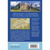
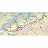
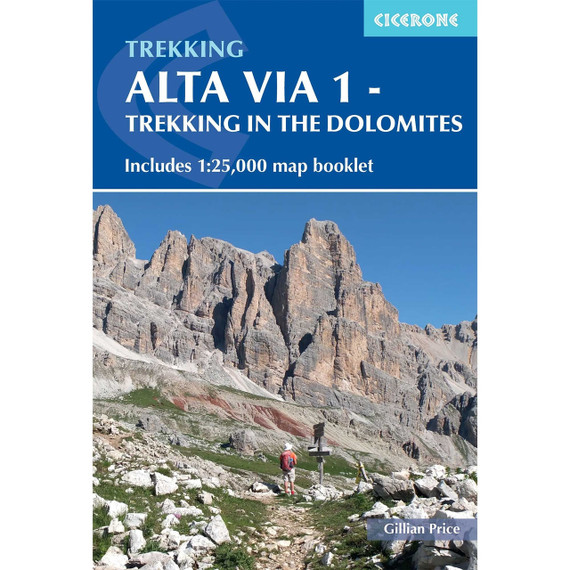
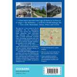
Guidebook to the Swiss Via Alpina, a 400km trek east-west across Switzerland, with options of detouring along the Alpine Pass Route. This demanding 3-week trek crosses 16 passes, including the 2778m Hohtürli, in a total of 19 stages from Sargans to Montreux, as well as a prologue stage from Liechtenstein. Requires good fitness and experience.
Cicerone says
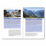
A guidebook to the Swiss Via Alpina, a 400km (250 mile) trek east-to-west across Switzerland, from Sargans to Montreux on Lac Léman (Lake Geneva). Previously the Alpine Pass Route, the Via Alpina (VA) is a fully waymarked Swiss national trail that involves nearly 23,000m of ascent and descent over roughly 3 weeks of trekking – a serious challenge suitable for experienced trekkers. The main route is described in 19 stages of 12-29km (8-18 miles), as well as a 27km (17 mile) prologue stage from Liechtenstein and detour stages via Lenk and Gsteig. Comprehensive route description is accompanied by 1:100,000 mapping, route profiles, facilities listings and advice on safety, transport, accommodation and language. Crossing 16 Alpine passes, the VA showcases some of the Switzerland’s most breathtaking mountain landscapes, from flower-strewn meadows to snow-capped peaks including the majestic Todi, Titlis, Wetterhorn, Eiger, Jungfrau and Wildstrubel. Accommodation options range from mountain huts to hotels and inns, with camping available at licensed sites along the route.
Our Verdict
For nearly 50 years Cicerone have been producing guidebooks on recognised treks, regions, areas and general tips for hikers.
We have used them countless times and they've always provided excellent insight and knowledge that you only get through experience, giving you the edge to make your trip a success and more enjoyable too.
If you're a gram counter you can easily remove sections of the book to take with you making your own ultra-lightweight guidebook with only the essential sections that you require.
- Reviewed by Ultralight Outdoor Gear
Features
- Seasons: From the start of July through to September. August can be wet, and an early season trek may find snow on the higher passes, so suitable additional equipment would be essential.
- Centres: Sargans, Elm, Linthal, Altdorf, Engelberg, Meiringen, Grindlewald, Lauterbrunnen, Kandersteg, Adelboden, Lenk, Gstaad, Rossiniere, Gsteig, Col des Mosses, Montreux
- Difficulty: It's pretty tough: the route amasses nearly 23,000m of ascent over 20 stages and nearly every day involves a pass crossing. Some higher passes and ridges present occasional exposure and technical difficulty.
- Must See: The Todi and Titlis; Eiger, Monch and Jungfrau near Grindlewald; valley-pass landscapes every day; the Lauterbrunnen valley; the Oeschinensee above Kandersteg; Blumlisalp and Les Diablerets.
Specifications
- Edition: Fourth
- Number of pages: 216
- Size: 17.2 x 11.6 x 1.3cm
- Weight: 253g
Contents
Mountain safety
Key to profiles
Map key
Route summary table
12 days on the trail – a two-week trek
Preface
Introduction
The Swiss Via Alpina
Suggested itineraries
Options for the last few stages
When to go
Getting there – and back again
Accommodation
Languages
Notes for walkers
Paths and waymarks
Recommended maps
Apps
Safety in the mountains
Using this guide
Information at a glance
The Swiss Via Alpina
The Liechtenstein start
Prologue Gaflei to Sargans
The main route
Stage 1 Sargans to Weisstannen
Stage 2 Weisstannen to Elm by the Foopass
Stage 3 Elm to Linthal by the Richetlipass
Stage 4 Linthal to Urnerboden by Braunwald
Stage 5 Urnerboden to Altdorf by the Klausenpass
Stage 6 Altdorf to Engelberg by the Surenenpass
Stage 7 Engelberg to Engstlenalp by the Jochpass
Stage 8 Engstlenalp to Meiringen by Planplatten
Stage 9 Meiringen to Grindelwald by Grosse Scheidegg
Stage 10 Grindelwald to Lauterbrunnen by Kleine Scheidegg
Stage 11 Lauterbrunnen to Griesalp by the Sefinafurgga
Stage 12 Griesalp to Kandersteg by the Hohtürli
Stage 13 Kandersteg to Adelboden by the Bunderchrinde
Stage 14 Adelboden to Lenk by the Hahnenmoospass
Stage 15 Lenk to Gstaad by the Trütlisbergpass
Stage 16 Gstaad to L’Etivaz by the Col de Jable
Stage 17 L’Etivaz to Rossinière
Stage 18 Rossinière to Rochers de Naye by the Col de Sonlomont
Stage 19 Rochers de Naye to Montreux
Alternative route after Lenk
Stage 15A Lenk to Gsteig by the Trütlisbergpass
Stage 16A Gsteig to Col des Mosses by the Col des Andérets
Appendix A Useful addresses
Appendix B Bibliography
Appendix C German–French–English glossary
Appendix D Stage facilities planner

