Jump to: Our Verdict / Features / Specifications
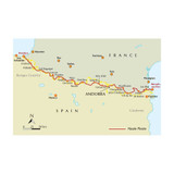
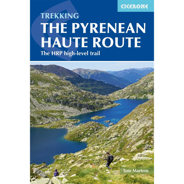
Guidebook to trekking the Pyrenean Haute Route, which zigzags across the Franco-Spanish border, staying close to the main ridge in the highest and most spectacular central Pyrenees. It covers 750km with over 40km of ascent, so is suitable for experienced mountain walkers only. The largely unwaymarked route is presented in 44 stages.
Cicerone says:
This guide presents the Pyrenean Haute Route in 44 day stages, which are divided between five sections: since each section starts and finishes at a location accessible by public transport, they can be walked individually if you don't have a spare month-and-a-half for a complete thru-hike. Although the route offers excellent opportunities for wild camping, each stage finishes at a mountain hut or village, meaning that you can sleep under a roof every night if you prefer. Clear route description is accompanied by 1:100,000 mapping. There are bad weather variants and alternatives to avoid the most technical sections, and the guide also includes optional ascents of 10 classic summits, including Vignemale, Pic du Taillon and the highest peak in the Pyrenees, Pico de Aneto. You'll also find helpful advice on travel to and from the route, equipment and safety.
There are three main trekking routes across the Pyrenees from coast to coast: of these, the Pyrenean Haute Route (or HRP for Haute Route Pyrénéenne) is the most challenging - and arguably, the most spectacular. Unlike the GR10 and GR11, it is not waymarked and borders on mountaineering at times, sticking as closely as possible to the main ridge. It stretches 750km from the Atlantic resort of Hendaye to Banyuls-sur-Mer on the Mediterranean, crossing the French-Spanish border many times on its traverse. The hike calls for experience, navigational competence and self-reliance, but offers rich rewards as you pass through some of the most stunning landscapes the region has to offer.
From the rolling green foothills of the Basque Country to High Pyrenean landscapes of aquamarine lakes nestled among 3000m peaks, the scenery is as varied as it is beautiful. Highlights include the karst terrain of Pic d'Anie, the Ossoue glacier, Lac de Mar in the picturesque Val d'Aran and the dramatic Cirque de Gavarnie with its towering cascade.
Our Verdict
For nearly 50 years Cicerone have been producing guidebooks on recognised treks, regions, areas and general tips for hikers.
We have used them countless times and they've always provided excellent insight and knowledge that you only get through experience, giving you the edge to make your trip a success and more enjoyable too.
If you're a gram counter you can easily remove sections of the book to take with you making your own ultra-lightweight guidebook with only the essential sections that you require.
- Reviewed by Ultralight Outdoor Gear
Features
- Seasons: The Pyrenean Haute Route is a summer route that is best hiked between late June and early October, when the days are long, the weather more settled and most of the snow has melted.
- Centres: Hendaye, Lescun, Gavarnie, Benasque, Vielha e Mijaran, Tavascan, l'Hospitalet-près-l'Andorre, Banyuls-sur-Mer
- Difficulty: Grades are used to give an indication of difficulty. Most of the 44 stages fall into Grade 2 (5-7 hour stages with a reasonable amount of ascent and descent) and should be within the capabilities of an experienced hiker. A small number are longer, more demanding routes (Grade 3) and a few are short, easy hikes (Grade 1). Three stages are graded E for 'exceptional': these routes contain steep and exposed sections requiring great care. Crampons and ice axe may be needed on some stages in early summer, but for each of these stages, an easier alternative is described.
- Must See: The karst landscapes surrounding Pic d'Anie, the Ossoue glacier on the famous Vignemale, the impressive Cirque de Gavarnie with one of Europe's highest waterfalls, the alpine landscapes in the Portillon region, Pico de Aneto (3404m - the highest peak in the Pyrenees), views of the Mediterranean from Pic du Canigou
Specifications
- Weight: 422g
- Edition: Third
- Number of pages: 344
- Size: 17.2 x 11.6 x 2.3cm
- Published: 11 April 2019
- Reprinted: 26 Jan 2022
- Author: Tom Martens
Contents
Introduction
The route
Geology
Plants and wildlife
Mountain weather
When to go
Getting there
Accommodation and services
Food, drink and fuel
What to take
Maps
Path conditions
Insurance, mountain safety and rescue
Using this guide
Section 1: Hendaye to Lescun
Day 1 Hendaye to Col de Lizuniaga
Day 2 Col de Lizuniaga to Arizkun
Day 3 Arizkun to Aldudes
Day 4 Aldudes to Roncesvalles
Day 5 Roncesvalles to Egurgui
Day 6 Egurgui to Col Bagargui
Day 7 Col Bagargui to Cabane d’Ardané
Day 8 Cabane d’Ardané to Source de Marmitou
Day 9 Source de Marmitou to Lescun
Variant 1 From Refugi de Belagua to Lescun via La Pierre Saint-Martin
Section 2: Lescun to Gavarnie
Day 10 Lescun to Refuge d’Arlet
Day 11 Refuge d’Arlet to Candanchu
Day 12 Candanchu to Refuge de Pombie
Day 13 Refuge de Pombie to Refuge de Larribet
Day 14 Refuge de Larribet to Refuge Wallon
Variant 2 Refuge d’Arrémoulit to Refuge Wallon
Summit 1 Grande Fache (3005m) from Refuge Wallon
Day 15 Refuge Wallon to Refuge de Bayssellance
Summit 2 Vignemale (3298m) from Refuge de Bayssellance
Day 16 Refuge de Bayssellance to Gavarnie
Summit 3 Le Taillon (3144m) from Gavarnie
Section 3: Gavarnie to Salardú
Day 17 Gavarnie to Héas
Summit 4 Piméné (2801m) from Refuge des Espuguettes
Day 18 Héas to Parzán
Variant 3 Parzán via the high route to Hourquette de Héas
Day 19 Parzán to Refugio de Viados
Day 20 Refugio de Viados to Refuge de la Soula
Day 21 Refuge de la Soula to Refuge du Portillon
Day 22 Refuge du Portillon to Refugio de la Renclusa
Summit 5 Pic Perdiguère (3222m) from Portal de Remune
Summit 6 Pico de Aneto (3404m) from Refugio de la Renclusa
Day 23 Refugio de la Renclusa to Hospital de Vielha
Day 24 Hospital de Vielha to Refugi de la Restanca
Day 25 Refugi de la Restanca to Salardú
Summit 7 Montardo d’Aran (2826m) from the Coll de Crestada
Variant 4 Three days on the GR11 from Refugio de Viados to Hospital de Vielha
Section 4: Salardú to l’Hospitalet-près-l’Andorre
Day 26 Salardú to Refugi Gràcia Airoto
Day 27 Refugi Gràcia Airoto to Alós d’Isil
Day 28 Alós d’Isil to Refugi Enric Pujol
Summit 8 Mont Roig (2868m) from Refugi Enric Pujol
Day 29 Refugi Enric Pujol to Refugi de Certascan
Variant 5 To Noarre via Tavascan
Summit 9 Pic de Certascan (2853m) from Coll de Certascan
Day 30 Refugi de Certascan to Refugi de Baborte/del Cinquantenari
Day 31 Refugi de Baborte/del Cinquantenari to Étang de la Soucarrane
Day 32 Étang de la Soucarrane to Refugi de Sorteny
Day 33 Refugi de Sorteny to Refugi de Cabana Sorda
Day 34 Refugi de Cabana Sorda to l’Hospitalet-près-l’Andorre
Section 5: L’Hospitalet-près-l’Andorre to Banyuls-sur-Mer
Day 35 L’Hospitalet-près-l’Andorre to Refuge des Bésines
Day 36 Refuge des Bésines to Refuge des Bouillouses
Variant 6 GR10 to Refuge des Bouillouses
Day 37 Refuge des Bouillouses to Eyne
Day 38 Eyne to Refugi d’Ull de Ter
Summit 10 Pic des Bastiments (2881m)
Day 39 Refugi d’Ull de Ter to Refuge de Mariailles
Day 40 Refuge de Mariailles to Refuge de Batère
Variant 7 GR10 to Refuge des Cortalets
Day 41 Refuge de Batère to Moulin de la Palette
Day 42 Moulin de la Palette to Las Illas
Day 43 Las Illas to Col de l’Ouillat
Day 44 Col de l’Ouillat to Banyuls-sur-Mer
Appendix A Useful contacts
Appendix B Glossary
Appendix C Facilities table


