Andy's 2024 TGO Challenge
Posted by Andy Neil on Jun 05, 2024
The Great Outdoors Challenge (TGO) is an esteemed annual long-distance walking event in the UK, which takes place every May. The event covers around 200 miles (320 kilometres) through the stunning Scottish Highlands, offering participants - known as 'Challengers' - a remarkable journey from the west coast to the east coast of Scotland. The TGO is not a race but an opportunity for outdoor enthusiasts to test their navigation, endurance, and self-sufficiency skills while enjoying the beautiful and remote landscapes. With 300-400 participants, the TGO encourages a sense of camaraderie and adventure, allowing Challengers to build friendships and share new experiences.
This year, the TGO challenge welcomed a vibrant mix of participants, with 40% embarking on this adventure for the first time. The fresh energy they brought and the seasoned veterans' wealth of knowledge created a unique blend that kept the challenge innovative yet rooted in its rich history. This dynamic mix ensured a genuinely enriching and memorable event for all.
2024 would mark my third attempt at the TGO, following my successful crossings in 2022 and 2023. As I penned last year, “There is a sense of anticipation that builds once you have completed your first TGO.” This anticipation only deepens with each subsequent crossing. I was eager to revisit some of my cherished spots in Scotland but equally excited to reunite with familiar faces I had met on my first two challenges. These fellow participants are now friends I get to see once a year. As I approach 40, I see these friends more often than some I have known for decades.
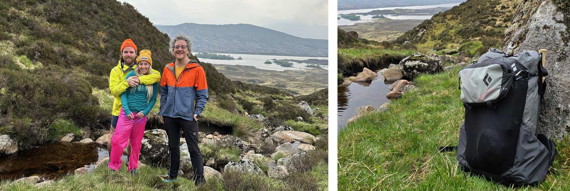
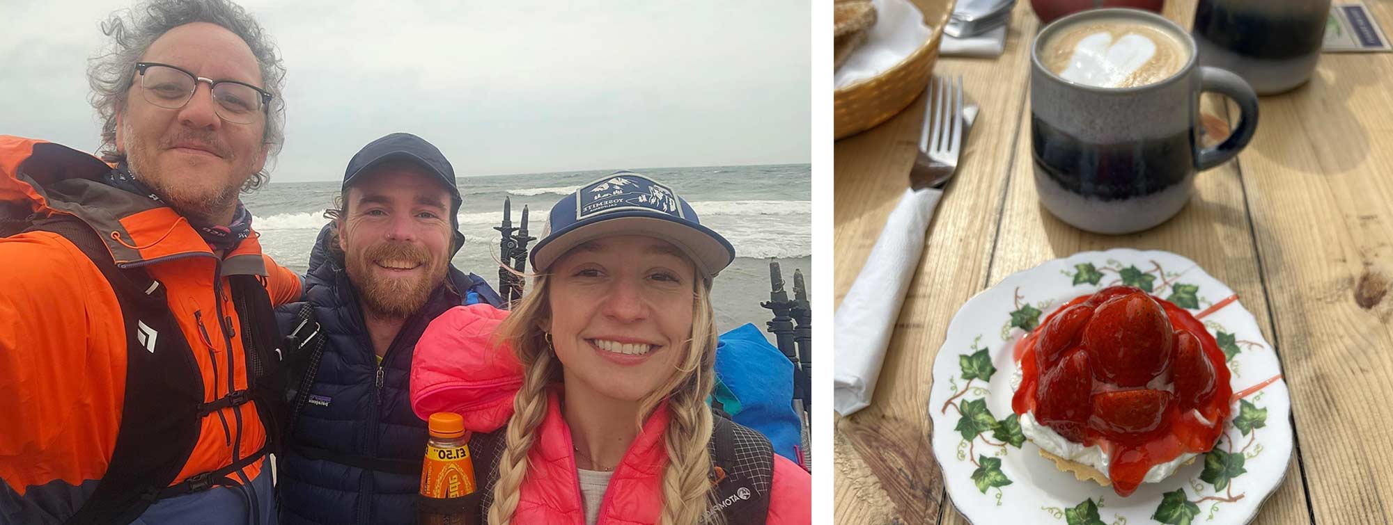
On my inaugural TGO challenge, I had the pleasure of meeting a group of Americans; we journeyed over 70 miles together, all the way to the North Sea. Since that unforgettable crossing, Brian and I have maintained a strong bond, and this year, we, along with his partner Jackie, decided to unite again and take on the TGO challenge.
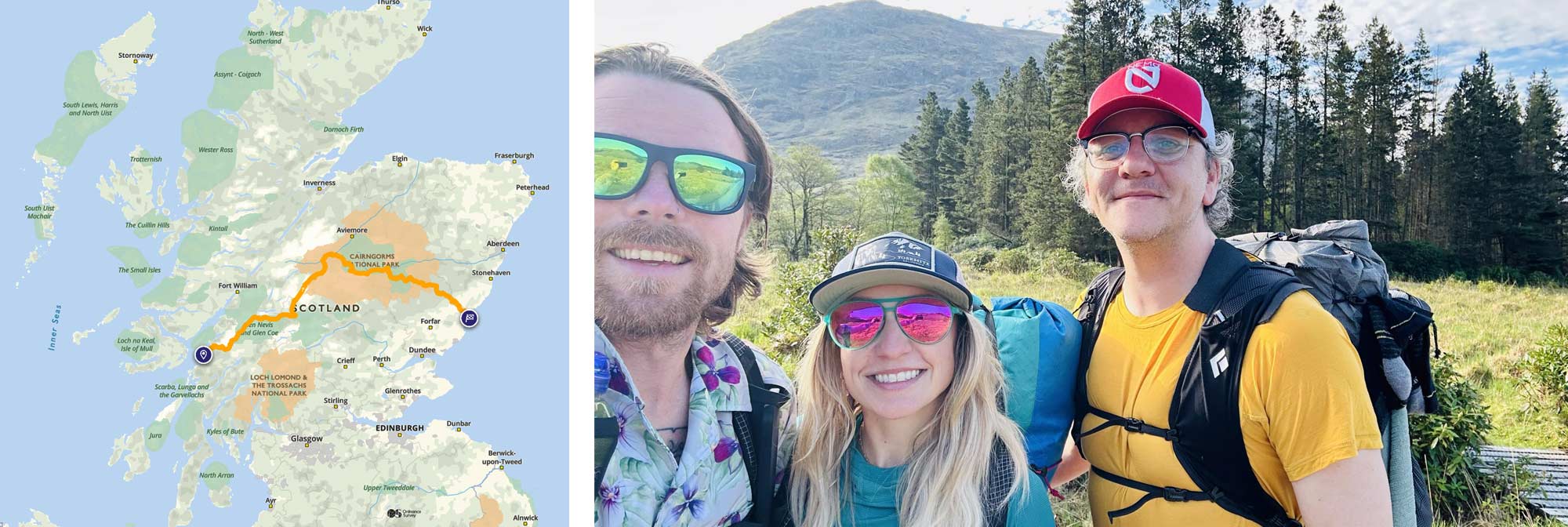
Choosing our starting point for this year's TGO challenge was a strategic decision. We opted for Oban, not only for its scenic beauty but also for its convenient accessibility from Glasgow. Months before securing plane tickets and finalising our travel arrangements, we had already decided that Oban would be our starting point.
The rest of our route blended new trails and a few areas I was eager to revisit from my previous attempts. As it was Jackie's first visit to Scotland, I was keen to showcase some of Scotland's more awe-inspiring landscapes, such as Glen Coe and Glen Feshie.
Day Zero, Middlesbrough to Oban
My journey north is often marred by train strikes, ferry cancellations, and buses that fail to show up, so I'm pleased to report that, for my own sake, I had no such luck, and my journey to Scotland passed without incident. The train ride from Glasgow to Oban was very scenic, passing along the shoreline of the picturesque Loch Lomond. The route was straightforward, yet the vistas were impressive, with towering mountains on both sides. I didn't set off from Darlington station until past lunchtime, so it wasn't till past 7 pm that I arrived in Oban.
Once a bustling harbour, Oban is now a picturesque village known as "the gateway to the Isles." Thanks to its stunning location, it is now a popular tourist destination. McCaig's Tower, an iconic colosseum-like structure, stands proudly overlooking the harbour, adding to the village's charm.
Brian and Jackie had already arrived and had booked into our hotel for the evening, so I went straight to meet them from the train. We caught up, had a few drinks, and chatted with fellow challengers before heading to the hotel. Here, we packed and repacked our bags to prepare for a relatively early start the next day.
Day One, Oban to Loch Etive, 16 Miles
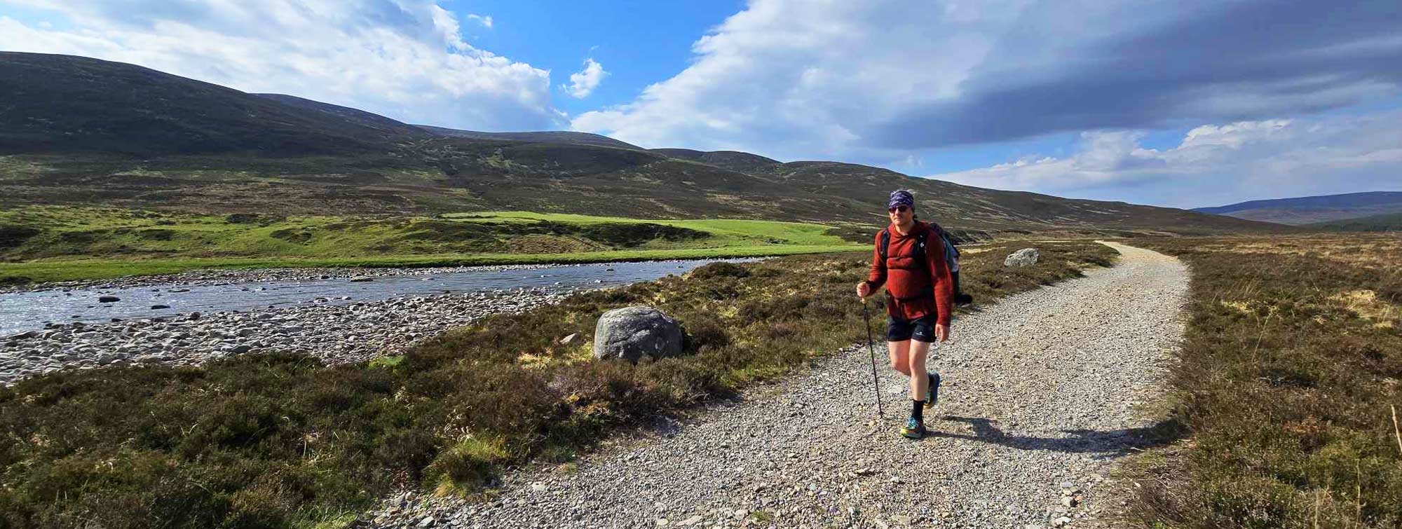
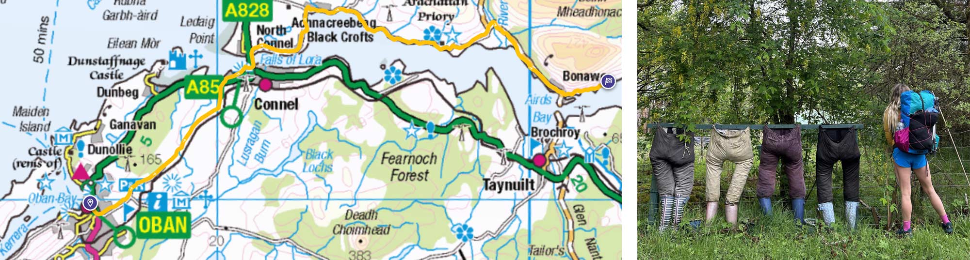
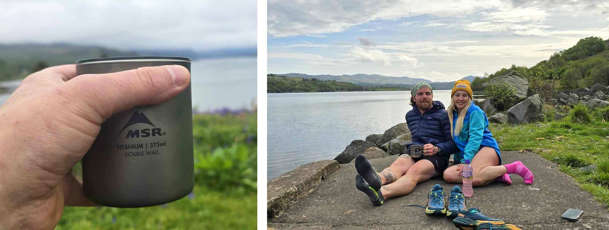
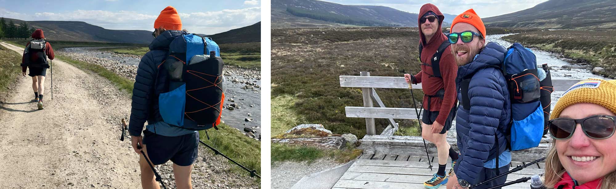
To officially start your TGO challenge, you must first “sign out” so the people at challenge control know who and how many have set off. We (eventually) found the Oban Hostel, our sign-out point; we dipped our feet in the sea and set off eastwards.
Our path led us away from the bustling streets of Oban, gradually transitioning from urban to rural. We followed the road, leaving the homes of Oban behind until it meandered into a pleasant country stroll.
It had been raining hard most of the morning. A fierce westerly wind had churned up the sea as we set off, bringing lashings of rain. We all set off in our full waterproof regalia, but by mid-morning, we were optimistic for a clear, even warm afternoon.
We passed through the town of Connel and over the bridge to North Connel; here, we stopped to watch surfers and kayakers battle the Falls of Lora, a naturally occurring tidal rapid.
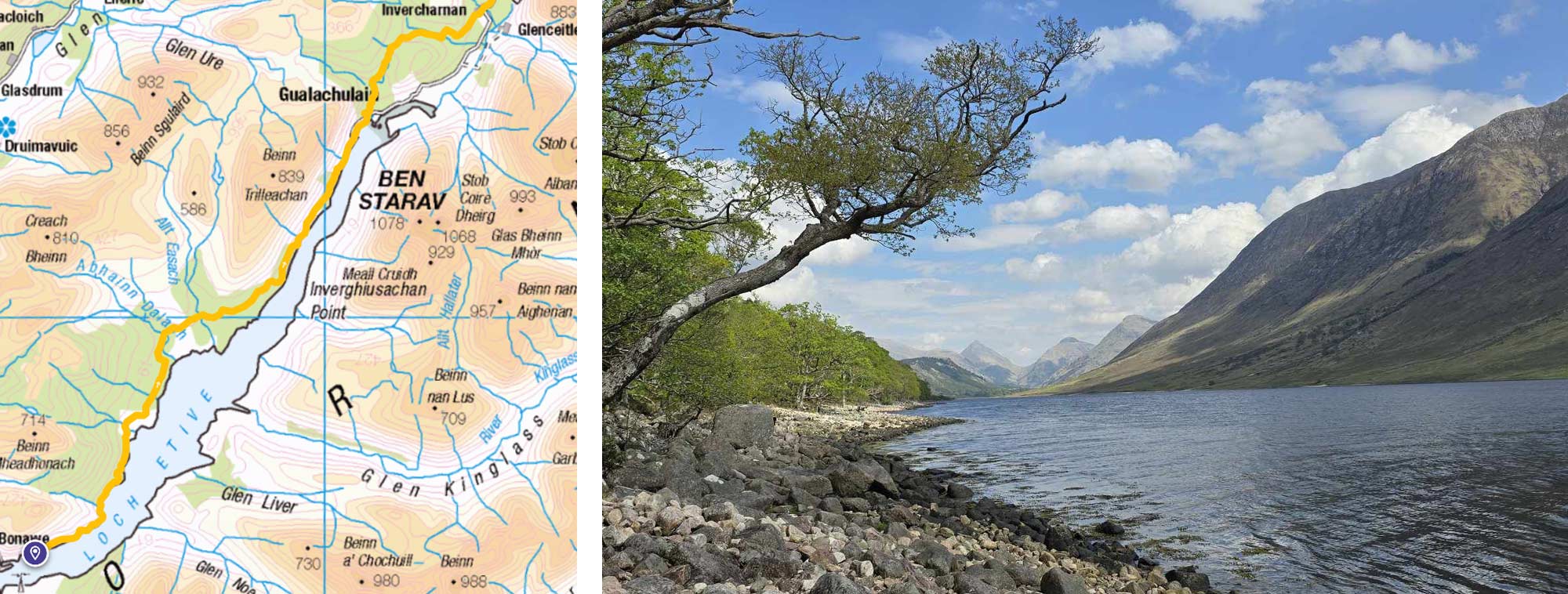
From here, we traced the northern shore of Loch Etive, a breathtaking sea loch that means 'little fierce one' and was recently showcased in the James Bond film Skyfall.
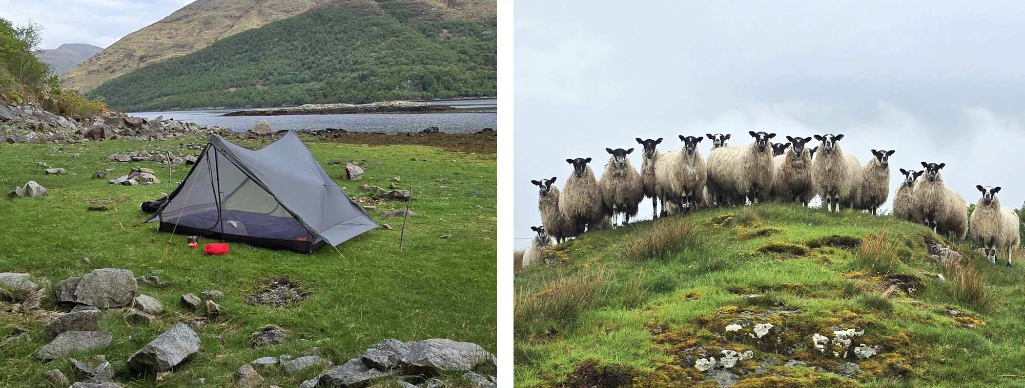
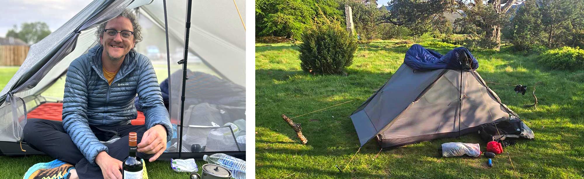
Despite spending most of the day on the road, the journey had been enjoyable. However, after covering 15 miles on day one, we were ready to find a spot to camp. Our search led us to a sheltered little bay, a perfect spot for our tents.
Remember how I said it was a sea loch? Once the water reached my furthest tent peg, I moved the tent slightly uphill.
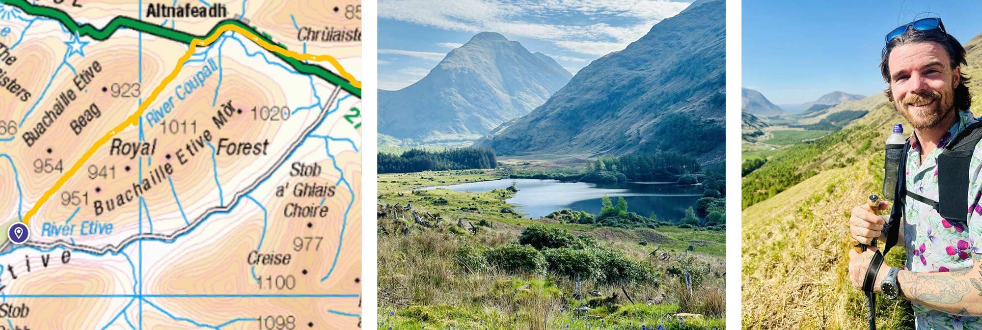
Day Two, Loch Etive to River Etive, 14 Miles
Yesterday, we had mainly been on roads or dirt tracks, but almost immediately today, we were on an actual trail, undulating footpaths and forestry roads, always a few meters from the loch shore. The weather was glorious, and we had to seek shade when we took breaks to get some relief.
The eastwards views from Loch Etive are some of the most stunning in Scotland. The vistas across the loch of Ben Trilleachn, Ben Starav and the Lairi Garthain (tomorrow's destination) dominated today's walking. This was a private view we had worked for.
After almost two full days of walking along its banks, we eventually reached the end of Loch Etive, entered the Etive Valley, and followed the Etive River.
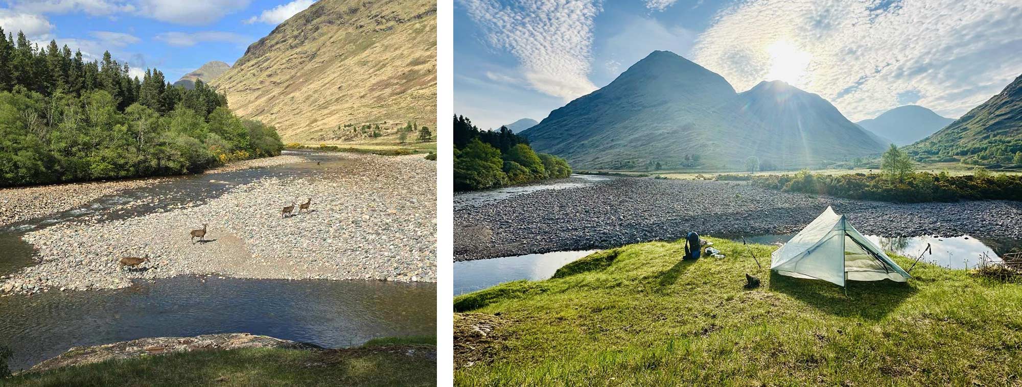
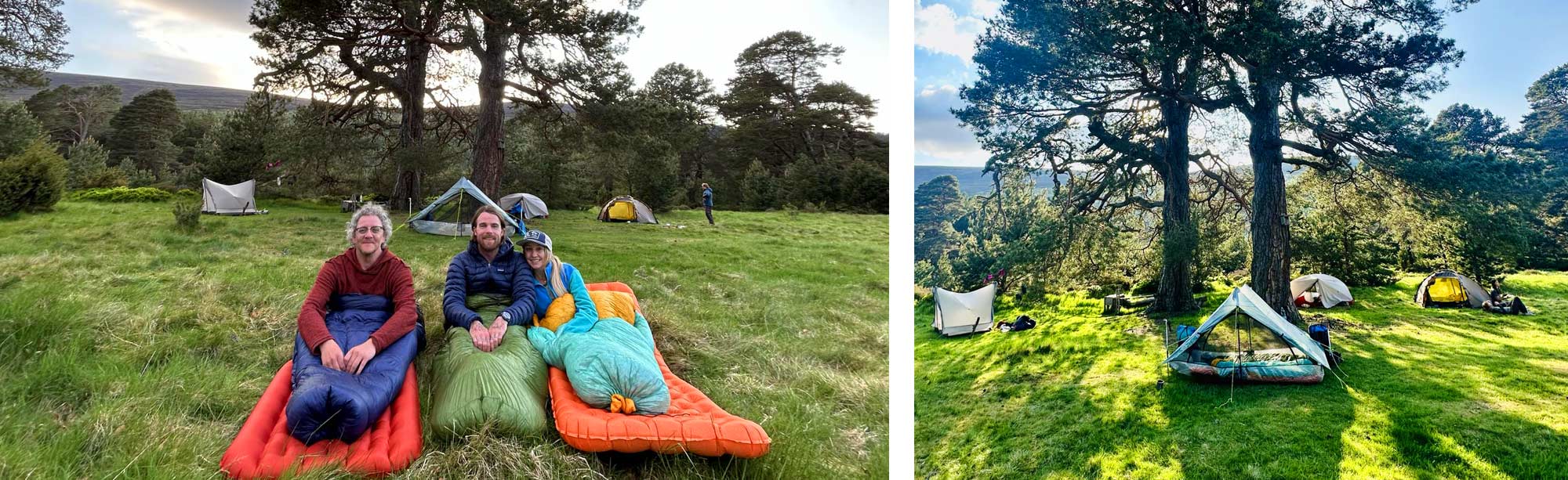
We started looking for a campsite, but our choices became increasingly limited the more farmland we encountered. Getting a little desperate, we followed a small track leading away from the main road into copse of trees. This unassuming path led us to a small viewpoint, looking down at the river below. The impressive mountain Stob Dubh loomed over us as a herd of deer splashed about in the water. “Yeah, that'll do.”
That night, the ethereal Northern lights, the Aurora Borealis, illuminated the Scottish skies and the entire UK's night sky. It was a once-in-a-generation phenomenon I have wanted to see my whole life.
I was asleep by nine and slept through the whole thing.
Day Three, River Etive to The Kings House Hotel, 11 Miles
We were up and off reasonably early, and as soon as the sun had crested the eastern hills, the weather was once again glorious!
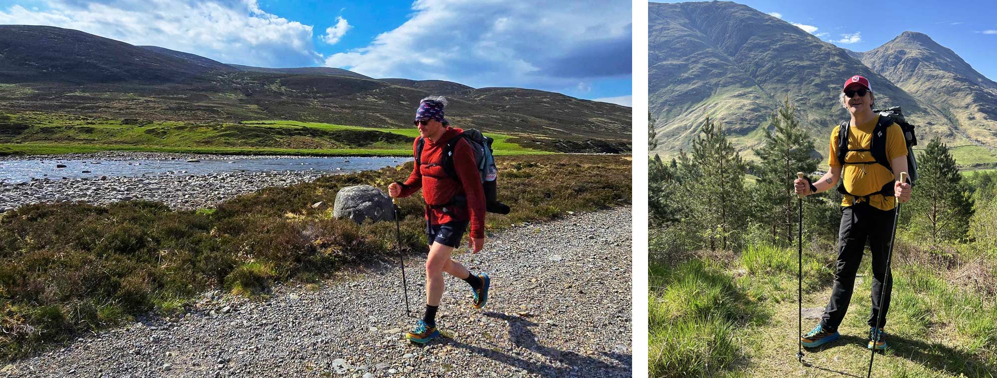
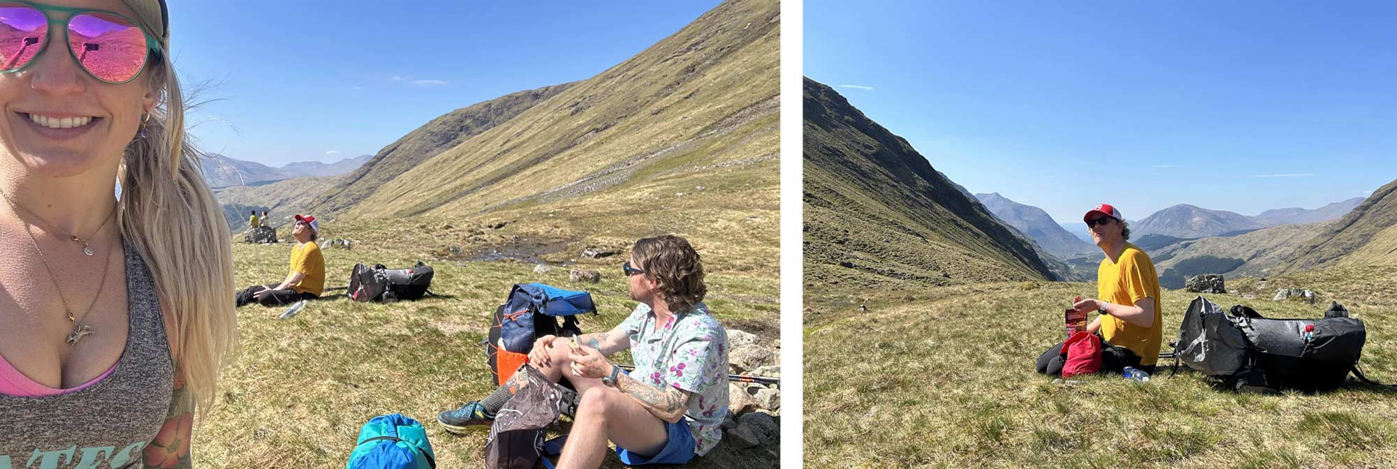
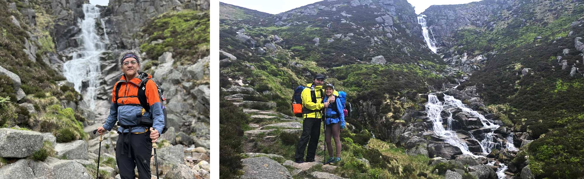
The morning hiking was primarily the walk up and along the Lairi Garthain. The Lairi Garthain is a stunning mountain pass between Glen Etive and the world-renowned Glen Coe. The iconic peaks of Stob Coire Altruim and Buachaille Etive Beag stand sentinel on either side of the dramatic pass.
In the heat, the climb was a real trudge. The Lairi Garthain, our first real climb of our TGO, was a mix of rocky paths and steep ascents. My trail legs had yet to set in, so my going was slow. The heat and the challenging terrain made it a tough climb, but the stunning views motivated us.
When I eventually reached the top, we stopped to rest, grab a snack and enjoy the magnificent view along the loch we had been walking alongside for two days. We were not the only ones appreciating this picturesque landscape. Walking up to this viewpoint from the car park in Glen Coe is relatively easy; it's only about two and a half miles to the top, and there is a little ascent, so this viewpoint is a very popular trail. We had only been on the TGO for two days, but seeing so many people was jarring and annoying as I needed a wee.
We set off down the valley, passing all the day walkers. I was in familiar territory once we had reached the car park and navigated the hectic road. We were at the bottom of the dramatically named “Devil's Staircase.” It's a name that has struck fear in the hearts of all West Highland Way walkers (it’s really not that bad).
I completed the West Highland Way (WHW), a 96-mile long-distance trail in Scotland, about ten years ago. To my recollection, the Kingshouse (not, at this point, our intended endpoint for the day) was just around the corner from the bottom of the Devil’s Staircase. “Not long till beer and venison burgers,” I proclaimed confidently. (FYI, it's over three miles and took us an hour)
When you are on the WHW and look back, you realise how magnificent Glen Coe is. Moving away from Buachaille Etive Mòr, one of Scotland's most iconic and photographed mountains, you can finally take in its majesty and dramatic pyramid shape that dominates the entrance to the glen.
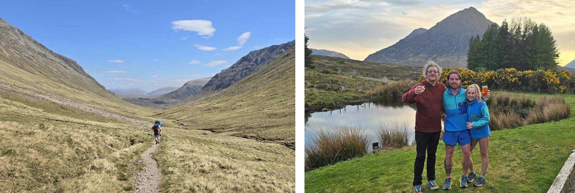
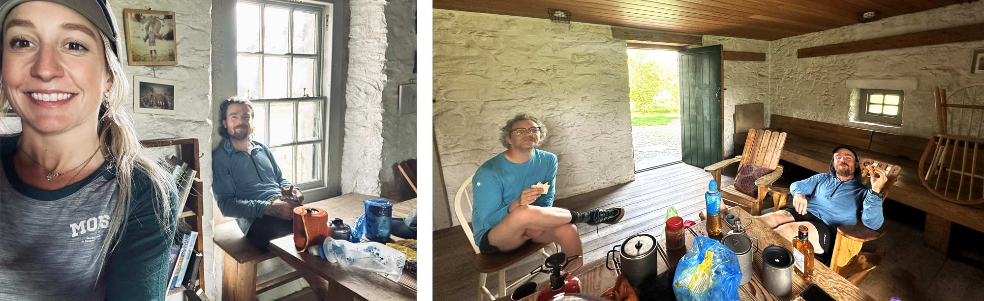
Finally, we arrived at the King House Hotel, a historic establishment dating back to the 18th century. It has undergone significant changes since my last visit; it's now more of a resort than a traditional pub. However, it still serves as a hub for hikers and other outdoor enthusiasts; you have to hike through the pub grounds on the WHW, making it a bustling spot. The outdoor seating area was strewn with backpacks and high-end bikes, and several tents were already popping up across the bridge.
We ordered food and some beers, and by our fourth pint, our plans to hike an additional ten miles had gone: we had a room at the hotel booked and a dinner reservation for the night.
We enjoyed our evening in the hotel. We ate well, drank well, and met some more TGO challengers. I had the curious task of explaining “what in the hell” the Eurovision Song Contest was to two Americans; the finals were on that night. Everything was going splendidly, and we were sure nothing untoward could go wrong. Incidentally, foreshadowing is a literary device in which a writer gives an advance hint of what will come later in the story…
Day Four, The Kings House Hotel to Bridge of Gaur, 18 miles
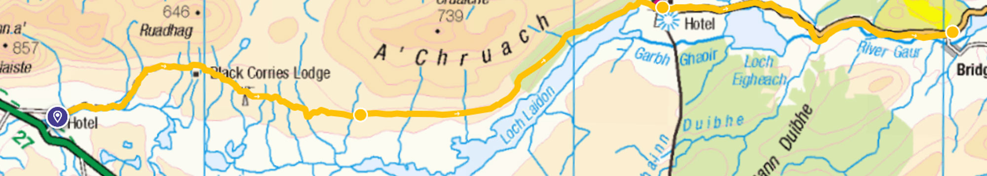
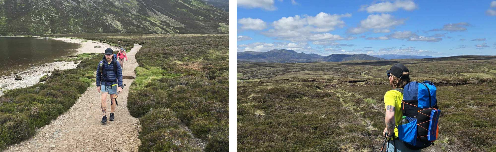
We were first in line for breakfast that morning and keen to get on the trail. We headed east towards the Black Corrie lodge. We were only a few miles into today's walking, and the scenery had dramatically changed. The further we walked, the smaller the mountain behind us became, now encompassing us on all sides; the vast openness of Rannoch Moor extended in every direction.
The day was warm but not as scorching as the previous ones, allowing us to make good progress. The well-maintained gravel path abruptly ended about 6 miles from the hotel. From there, we followed a line of pylons, our feet sinking into the rugged, boggy ground. Our pace slowed, but the path was part of the fun.
We were ready for a change after about three miles of navigating the bog. As we entered the welcoming embrace of the woods that lined the banks of Loch Laidon, the path widened, allowing us to walk three abreast, a refreshing change from the single-file trek through the bog.
After the openness of the moor, the wood enveloped us. Dappled sunlight streamed through the coniferous trees, illuminating swirling pollen. We emerged through the wood into beautiful sunlight, making our way to Rannock station and its tea rooms.
Rannoch Station is one of the UK's most remote and least-used stations. The station building is quaint and picturesque with a timeless charm that I'm sure the two Americans I was with fully appreciated.
Here, we ate and enjoyed tea (me) and coffee. We still needed to decide where we were going to stay that night. We were all perfectly happy to camp, but we had heard rumours of an imminent thunderstorm. A TGOer named Iain informed us that you “only need to be concerned about localised thunderstorms if they are local to you,” which did little to put our minds at ease.
Brian had been ringing around a few local B&Bs without luck; we followed our planned route towards the Bridge of Gaur, six miles away.
It was here Brian got very sick. Then I did, then Jackie did
I won't go into the grizzly detail, but luckily (lucky for us at least, not so much for the owners), a B&B did get back in touch. Mercifully, we got a bed for the night to shelter from the storm and, most importantly, a porcelain toilet.
None of us slept well that night, our last night as official TGO challengers.
Day Five, Newtonmore
Mercifully, whatever it was that I had contracted was ejected at some point during the night, and somehow, by morning, I managed some toast and tea and kept everything down; however, Brian and Jackie were suffering more serious ill effects than I was. We convened early that morning, our eyes heavy with sleep deprivation. We made the difficult call to Challenge Control, explaining our situation. It was a hard decision, but we knew we had to get to civilisation, a pharmacy and a bed.
I have to thank the Bridge of Gaur guest house for opening their door to us on a night that would have been incredibly uncomfortable in a tent, especially during a thunderstorm that indeed rolled in. So, thank you from all of us.
We contacted a Taxi who would leap-frog us to Newtonmore, officially ending our challenge. It was a hard decision, but it was the right one.
The driver shouldered our pack into the back of his taxi and, as he closed the door behind us, inquired, “None of you get car sick, do you?”
We arrived in Newtonmore, found beds and slept for the rest of the day.
Despite missing around 30 miles of our challenge and arriving in Newtonmore two days ahead of schedule, we never considered giving up. We were resolute in our decision to walk to the North Sea.
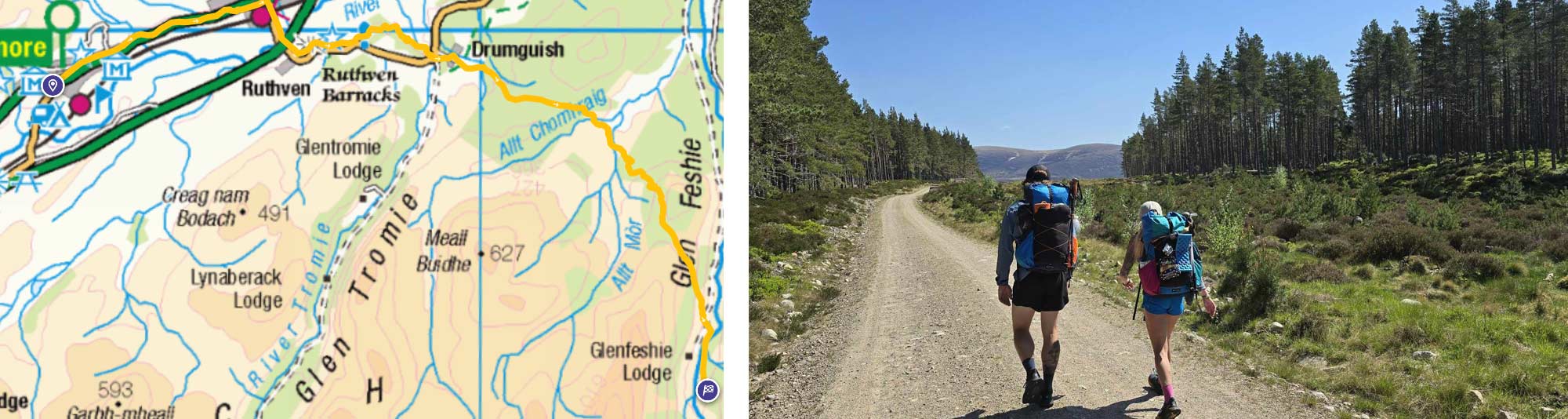
Day Six, Pharmacists, Aviemore & Wild Cats
Newtonmore is the epicentre of the TGO Challenge; the Youth hostel organisers Ali and Sue run becomes “mission control” for the event right up until the first eager challengers start homing in on the coast, and the whole operation up sticks and head to Montrose. So Newtonmore is an excellent place to spend to while away the day. The Hostel is humming with activity, vetters, volunteers, and organisers Ali, Sue and Mick, and countless challengers are all toing and froing, picking up parcels, answering challengers' phone calls and drinking vast quantities of tea.
After a full day in bed, we felt much more like ourselves, so we decided to catch the early morning train to Aviemore. Aviemore is a haven for outdoor enthusiasts, with a wide range of shops catering to hikers, climbers, and adventurers. Every hiker needs new gear, even when carrying a backpack full of it, so we were off to see what they had to offer. I was after some shorts after the spell of hot weather. We braved a veggie breakfast and coffee and wandered around the outdoor shops before we caught the bus back to Newtonmore, where we could pick up a prescription for anti-sickness medication and resupply our dwindling food bags. We also started collecting cats.
Dotted around Newtonmore are several large cat statues. The "Cat Cairns" of Newtonmore are a unique and whimsical feature of this Scottish village. These cat statues are scattered throughout Newtonmore, adding a touch of charm and character to the streets. Over the years, more cat statues were added to Newtonmore, each uniquely painted. Some are perched on walls or fences, while others can be found lounging in shop windows or hidden around corners, so we started collecting them like a game of Where's Wally (Waldo).
Day Seven, Newtonmore to Glen Feshie, 12 Miles
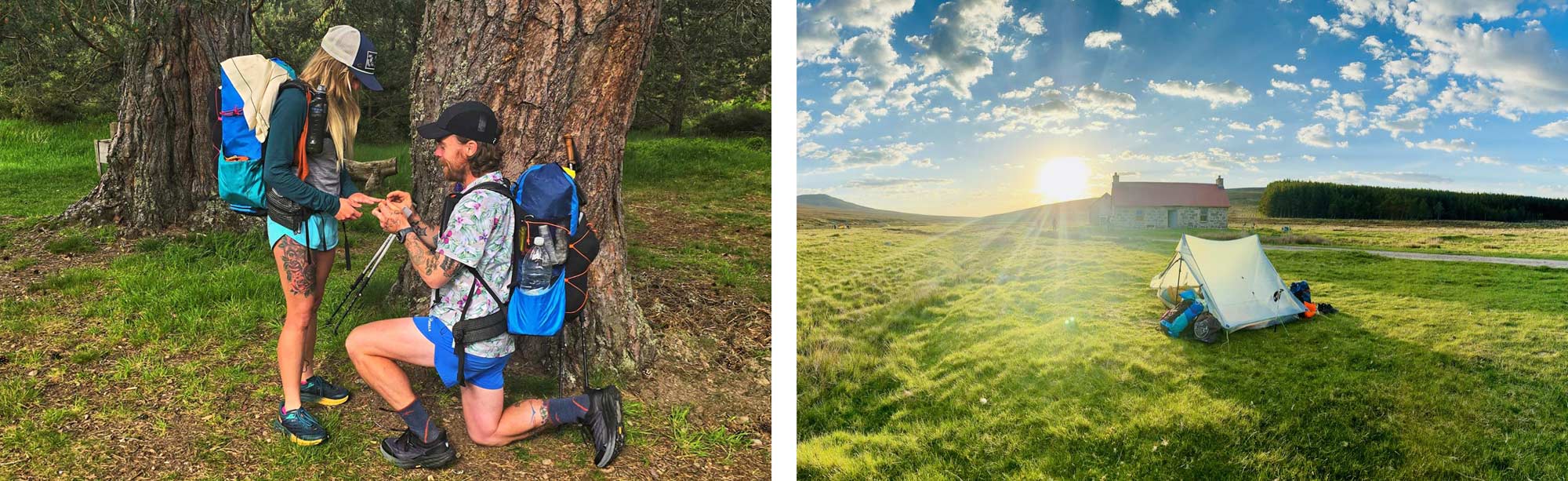
Both Brian and I were excited about today's walk. We had hiked this stretch together on our first TGO challenge, and it was one of the best days on the trail, so we were excited to revisit such a beautiful area. Brian was doubly excited; he planned to “pop the question” to Jackie the next day. We had briefly discussed this and devised a plan; he would nod at me, then propose whilst I took photos. Admittedly, it wasn't the most complicated plan.
Once again, the weather was stunning. We didn't have too far to hike but were still feeling tender, so our going was leisurely. We had 12 miles to do and all day to do it. The walk from Newtonmore to Kingussie follows the Speyside Way and passes by impressive walls of Gorse bushes. In Kingussie, we stopped and had a bite to eat. It had been a gruelling half-hour stroll, and we needed to replenish our depleting energy reserves with more cake. We then set off towards Glen Feshie.
Glen Feshie showcases the best of the highlands. Its unspoiled beauty and remote location boast dramatic landscapes marked by sweeping moorlands, towering Munros, and the meandering Feshie River. Under the care and guidance of Wildland Limited, Glen Feshie is undergoing a meticulous process of rewilding. This endeavour aims to restore the region's native habitats and species, preserving the inherent beauty and natural splendour of the Glen.
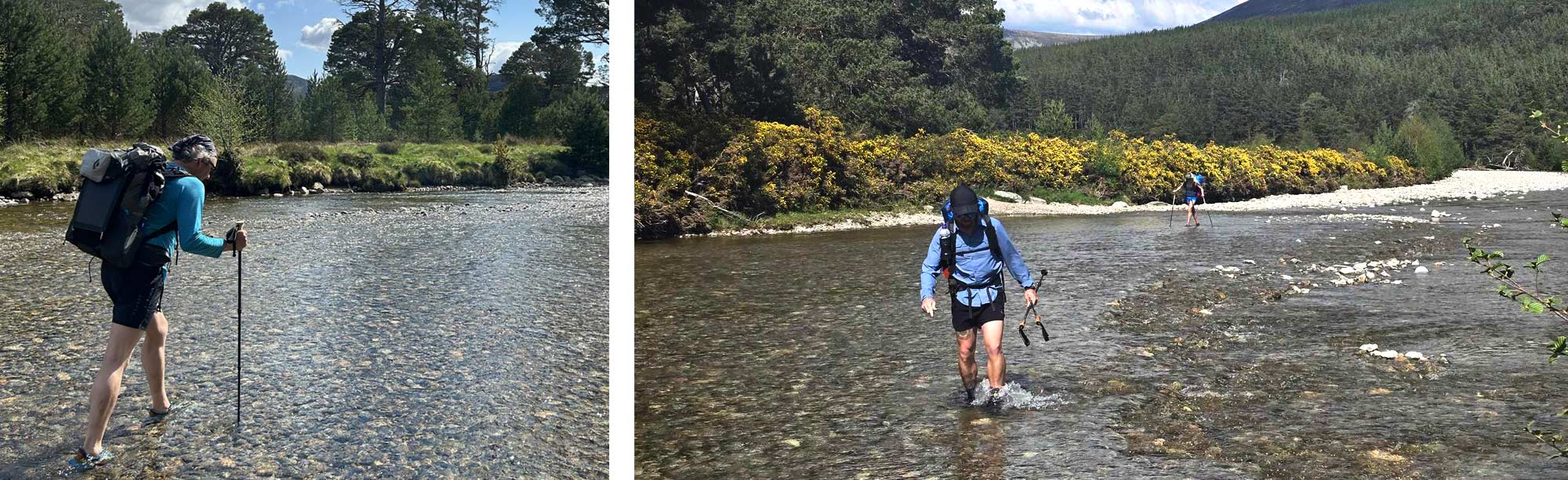
The walk to the glen was splendid. The weather only improved as the morning turned into afternoon, and we were eager for the shade of the ancient Caledonian pine forests we passed. Before too long, we were looking down over the glen. We took our time to bask in the sun as we descended before fording the wide Feshie River.
Our endpoint for the day (it was 2 o’clock) was the Ruigh Aiteachain bothy, a splendid homely bothy famously (infamously, depending on who you ask) manned by the custodian Lindsay Bryce. On our previous trip to Glen Feshie, Lindsay cooked us a full Chicken dinner and got us roaringly drunk. We were keen to see him again, but sadly, he did not make an appearance on this trip.
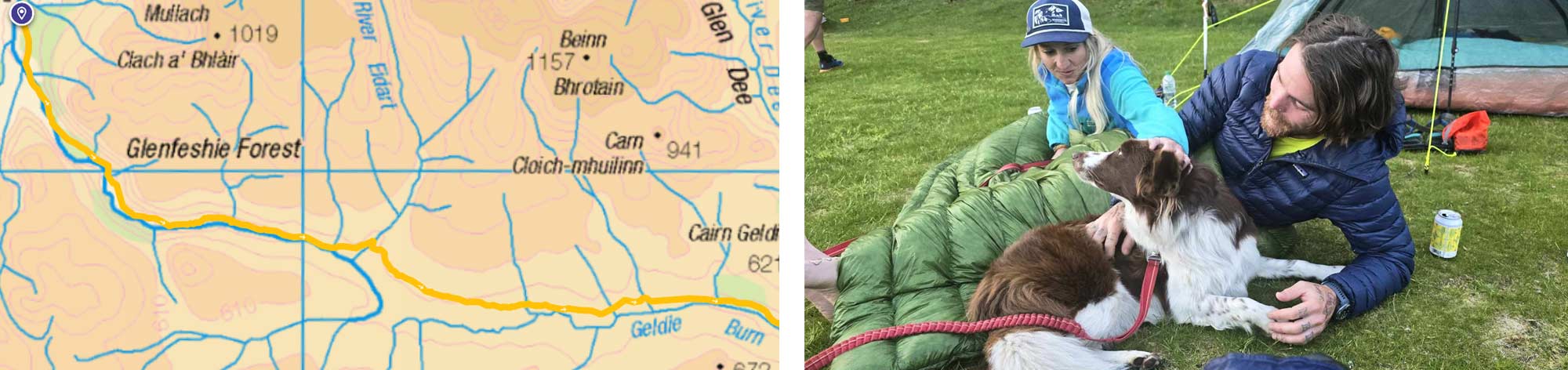
We explored the bothy, ate, and then pitched our tents. We met Paul Dudchenko, whom we had met on our first TGO, and we were happy to see him again on this trip. We swapped stories of our recent travels; he had just returned from a stint on the Pacific Crest Trail. We were also joined by our unofficial fourth team member, Ruby, the white and tan Border Collie who would intermittently hike with us the rest of the way.
Day Eight, Glen Feshie to the “Red House Bothy”, 13 Miles
She said yes! We packed our tents and ate a leisurely breakfast before Brian got down on one knee and proposed. We toasted with a celebratory tot of whisky and set off. The first half of the day, we walked up Glen Feshie, following the river almost to its source before crossing the drainage divide and following the Geldie burn, a tributary of the River Dee, in the opposite direction. As a bit of a geology nerd, I thought that following two rivers that go in opposite directions mere meters apart was pretty cool; no one else, of course, shared my enthusiasm.
The weather was once again glorious. It was bakingly hot, and we were all smothered in sun cream (recently purchased in Newtonmore); there was no relief from the sun that day. The valley was wide and open with little trees.
We made good progress, and soon, the “Red House Bothy” came into our view. Ruighe Ealasaid, or The Red House, is a newly renovated bothy with adjacent toilet facilities. We passed it on our previous crossing, but it wasn't completed. Massive thanks must be given to the volunteers, who were crucial in restoring and maintaining this bothy.
We put our tents up; the further into the cairngorms we hiked, the more people pitched up each night. We once again basked in the sunshine and enjoyed the impressive vistas.
Day Nine, The “Red Bothy” to Braemar, 11 Miles
Today, it was only a short but enjoyable hike into Breamar. We followed the river Dee through the impressive Linn of Dee woods and joined the road towards Mar Lodge, a grand Victorian hunting lodge. The Duke of Fife constructed this architectural gem in the mid-19th century. Although the Lodge only dates back to the Victorian era, the grounds have been used as a royal hunting estate as far back as the medieval period.
Managed by the National Trust for Scotland, Mar Lodge is friendly to TGO Challengers and offers tea, coffee, and biscuits. Many people send themselves parcels to collect here, but here's a pro tip: Send them to Breamar campsite; that way, you don't have to carry them the four miles to Breamar.
From my previous crossing, I remember that the road walk from Mar Lodge to Breamar seems like a real trudge. However, put it down to us being better rested, put it down to our trail legs finally kicking in or put it down to the thought of a beer to toast the engagement of two friends, but the next four miles flew by, and we were soon clinking cold pints in the hot sun outside of the Flying Stagg. Following its acquisition in 2018, the renowned Stagg has undergone a substantial renovation and is now owned by prominent art dealers. Its walls are adorned with an extensive collection of artworks featuring creations by esteemed artists like Pablo Picasso. It's a bit too posh and pricy for me, and that’s just for the pints. Have a look at how much a room costs!
We stayed at the Braemar campsite, just down the road, but around £800 a night cheaper than the Hotel. We had two nights booked on the campsite, as this is where we planned to have our rest day long before our unexpected layover in Newtonmore. We intended to stick to the plan and enjoy another day in Braemar.
Day Ten Braemar, A Rest Day in Braemar
Every year I've been on the TGO, I have had a rest day in Braemar. It's been a tradition for me to head to the pub, enjoy a few pints, and play some pool while my power bank recharges; however, this year, I was using a solar panel, which did a fantastic job of keeping my powerbank topped up. So, instead, I sought shelter in the pub from a sudden thunderstorm that rolled in.
During our rest day, we seized the opportunity to lighten our loads. We sent back some gear we no longer needed or hadn't been using, like my Merino wool thermals that I brought in case of cold weather. This practical decision allowed us to free up space in our packs. We also managed to grab some food and even did some washing, which dried quickly in the sun that inevitably followed the storm.
Day Eleven, Braemar to Loch Muick, 14 Miles
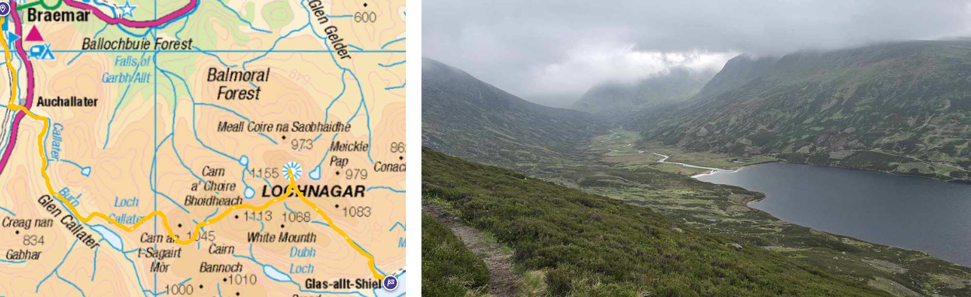
We started the day with a full Scottish breakfast and foolishly road-walked the two-and-a-half miles (there are much nicer ways to get to the trailhead; I just hadn't spotted them on the map then) to Auchallater. We then followed the Callater Burn up the glen. The weather was overcast and a “wee bit” chilly, which made a nice change.
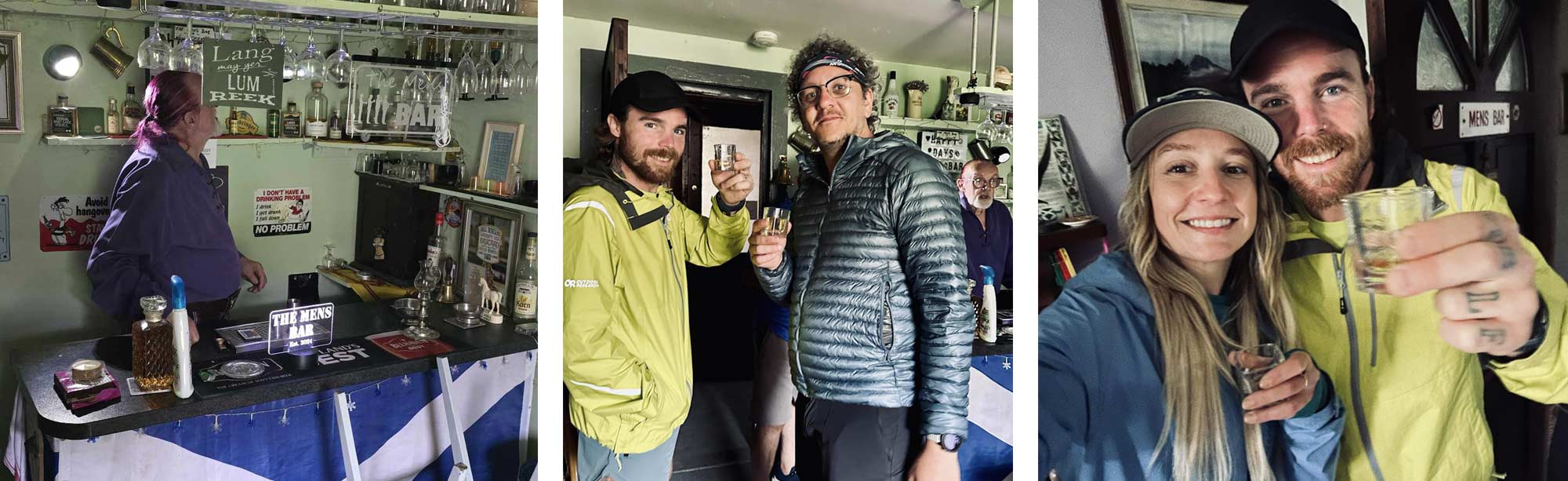
We followed the Burn up to Callater Lodge, a remote mountain bothy by the shores of Loch Callater. The Lodge is famous among TGOers as a good place for a booze-up. The bothy is “manned” during the event by Will Duncan, Michael Glass, George and Ian Miles, who turn the lodge into a cafe/pub/open mic night while the challenge is on. Many challengers opt for using one of the bothies' many beds, which seems a better place to sleep off the inevitable thick head the lodge is renowned for.
During our hike to the Lodge, we encountered a member of the TGO Old Guard, a veteran who, due to health reasons, could no longer participate in the challenge. Accompanied by his wife and daughter, they had trekked up to the lodge to share a few pints with his old comrades, a tradition he cherished. This poignant moment encapsulates the spirit of the TGO, a testament to its significance for those who have traversed its paths.
We were ushered inside, and I wasn't expecting the bothy's cosy, warm and welcoming buzz. The air was thick with the smell of fire, bacon sandwiches and the previous night's scrumpy. We grabbed a bun and a steaming hot mug of tea and were shown around the old shooting lodge. When we got to the “pub”, which included a bar, optics, and disco ball, we were offered a “wee dram” to send us on our way. It was 11 am, and we all accepted. There was a choice of five or six single malts.
“So, what's your whisky of choice? I’ll find you something that hits the spot.” Those familiar with Will's colourful language will understand the need for a slight edit. The man has a knack for colourful expressions.
“Oh, Laphroaig, or anything else that tastes a bit like TCP.”
He tapped his finger to his nose like a kindly old Granddad—imagine Gandalf but in a kilt—and pulled out an 18-year-old Laphroaig that must have cost the best part of £200 and poured us all a small glass.
“Slàinte Mhath!” he raised his glass, and we all echoed it back.
We hit the trail again. It was sad to leave such a wonderful place, but next year, I’ll skip my rest day in Breamar and head straight to Callater Lodge. From here on out, our way was uphill as we ascended Lochnagar.
Lochnagar stands at an impressive height of 1,155 meters (3,789 feet) and is renowned for its “rugged beauty, dramatic cliffs, and stunning corrie.” I quote that because I have no clue what Lochnagar looks like or how impressive its views are. As soon as we started climbing, we entered the cloud, and the thick mist fogged our vision. It was a good job we all had very bright colours on, as we could have easily lost each other.
The going was steep, and I'm sure it would have been a rewarding view, but with nothing to see, we just headed straight down the other side. The descent was one of those steep downhills that made your knees very grateful that you brought walking poles. I greatly respect anyone climbing up that way.
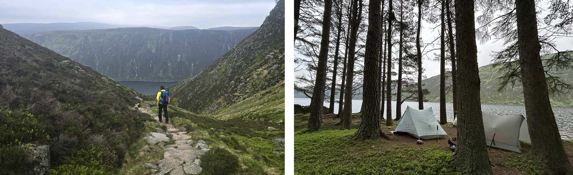
As we descended, we eventually broke through the cloud, and the views down and across Loch Muick opened up. The breathtaking waterfalls cascading alongside the path made hiking in the clouds worthwhile.
We reached the shores of Loch Muick and Glas Allt Shiel, a former royal residence initially built for Queen Victoria and Prince Albert. Glas Allt Shiel served as a secluded retreat where the royal couple could escape the pressures of court life and enjoy the rugged beauty of the Highlands. Here is where we made camp. If it's good enough for V&A, it's good enough for us.
Day Twelve, Loch Muick to Tarfside, 17 Miles
We set off early, as we had some good miles to cover. We walked along the banks of the loch, aiming for the small visitors’ centre near the end of the loch. We passed a herd of deer and stopped and chatted to fellow TGOers before ascending the glen, aiming for the Shielin of Mark Bothy. Looking back, we were treated to views of Lochnagar, the mountain on which we spent the best part of yesterday.
You will only know the Shielin of Mark bothy exists if someone literally points it out on a map. Even when you know it is there—hell, even if you have been there as I have—it's still hard to find. You only spot the bothy once you are almost on top of it. We brewed some coffee and chatted with the other challengers who arrived.
Next, we tackled Muckel Cairn, the last real climb of our trip. It's a straightforward climb, but navigation can be a little tricky as there is no path. We made our way up without incident and immediately found the path to descend. Our route then followed the contours of Glen Lee and, eventually, Loch Lee. Large Red flags informed us we were on the cusps of a live firing range; long-range snipers, some up to a mile away, were culling the deer that roam this area.
On our way past Monument Hill, just before we reached our destination of Tarfside, we saw the most astonishing site I have ever witnessed in all my years of hiking in Scotland: not one but two Golden Eagles locked in combat above our heads.
Tarfside is incredibly friendly to TGOers. They open their town playing field to camp on, but more importantly, the Free Masons of the town open their lodge to us all, serve beer, and even put on a BBQ. Make sure you bring cash if you are ever following in my footsteps, or you will be sorely disappointed. We all had a couple of burgers and beers, then headed to our tents, keen for a good night's rest for the penultimate day of the TGO.
Day Thirteen, Tarfside to North Water Bridge, 16.5 Miles
We set off-road, walking out of Tarfside, heading for the Folk Museum, just outside town. The museum graciously opened early and served the most amazing traditional breakfasts with loose-leaf tea out of a bone china pot, which was splendid.
The walking was easy; following the river North Esk, the path gradually meandered downhill through farmlands till we reached the Rocks of Solitude. We had planned to nip into Edzell, a town about two miles away and get some supplies. However, a downed bridge meant that we would have to backtrack another two miles if we wanted to make this journey (lots of other TGOers just forded the river, an option we would have probably taken if we had known about it), so we ordered a taxi, she picked us up and dropped us back off at the exactly same place, our rucksacks clinking as we walked the last four miles to our campsite.
We stayed at the North Water Bridge campsite last year. Sadly, severe storms flooded the site last year and washed away many caravans. Thankfully, it is again open, and they kindly offered their space to the TGOers this year.
Everyone was keen to lighten their packs for the last day, so we feasted that night on wine, cheese, olives, dehydrated salmon and broccoli pasta; it was a very civilised affair. It was here that I was lucky enough to meet Jean. I will do the gentlemanly thing and not reveal a woman's age, but she was the oldest woman crossing this year. Her age, however, is just a number. Her accomplishments in life, her spirit of adventure, and her determination are far more impressive than being the oldest woman on the TGO. If she ever writes it, I will be first in the queue for her book.
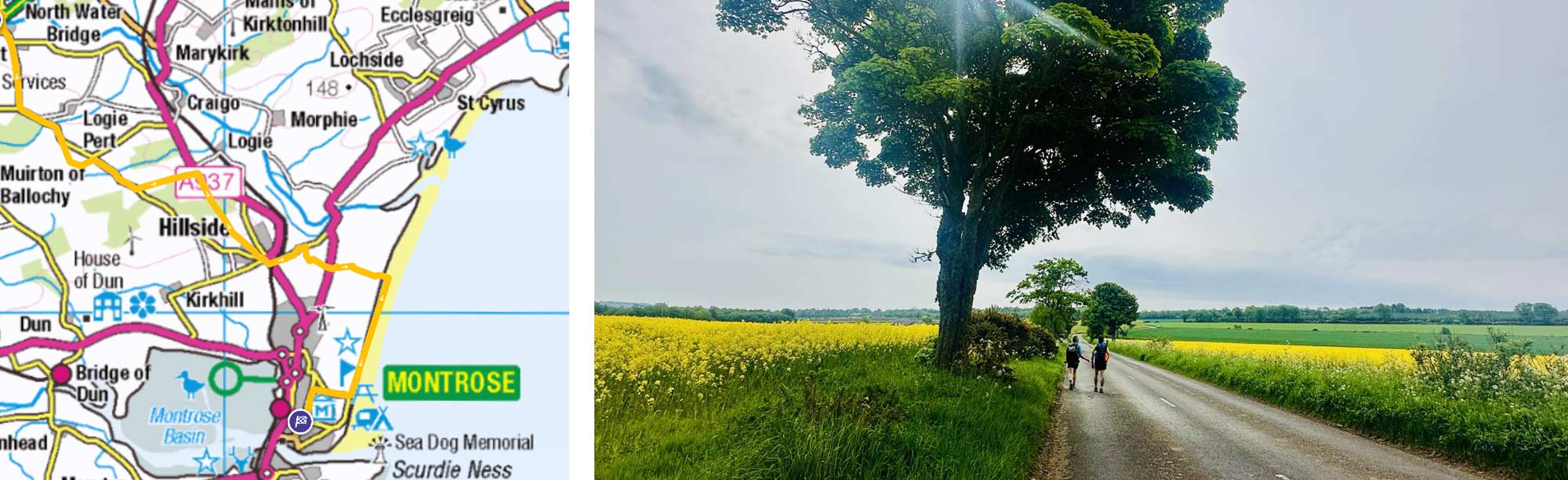
Day Fourteen, North Water Bridge to Montrose, 10 Miles
Everyone at the campsites was up on our last day, notably early. There was a weather warning of thunder and heavy rain for most of the East Coast, which we were now tantalisingly close to. The weather front was due to hit around midday, so everyone was keen to get to the sea and walk the mile to Montrose before the weather hit.
Our journey led us through flat farmland, gradually transitioning into the woods that infringe on the town of Hillside. We were so close to Montrose that we decided to make a detour to a strawberry farm I visited last year, known for its delectable strawberry tarts. After this delightful diversion, we set off east for the final leg of our journey.
The weather was turning as we walked through a mass of gorse bushes and onto the dunes. The tide was in, so we didn't have far to walk, which was just as well, as we were exposed on the beach. The wind was fierce and bitterly cold, so we made our celebrations short.
We opted to walk back inland rather than along the beach. We made it straight for the park hotel, challenge control, and the end of our TGO challenge.
This year's attempt will go down as a “partial crossing,” although I did not complete the challenge this year, I did get to walk (most of the way) across Scotland with my mates, which I think is just as good.
The TGO challenge is not just a long-distance hike; it's a transformative journey that allows you to disconnect from the stresses of everyday life and reconnect with nature and oneself. The physical and mental challenges, the sense of freedom, and the opportunity for self-discovery create an unparalleled experience.
The true spirit of the TGO challenge lies in the people you meet and the bonds you forge on the trail. Whether it’s the seasoned challenger reuniting with old comrades, the vibrant atmosphere at Callater Lodge, or the warm hospitality in Tarfside, the spirit of community and mutual love for the outdoors is what sets the TGO apart.

|
||
 |
||
|
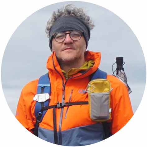
Andy Neil |
||
|
Andy has been a keen long-distance hiker and wild camping enthusiast since he completed the Cleveland Way in 2015. Since then, he has walked thousands of trail miles all over the UK and is an active member of the Wild Camping UK community, being an admin of the largest wild camping community on Facebook. He strongly advocates for responsible wild camping and believes it is important to leave no trace when camping in the wilderness. He joined the UOG team in 2021 and works as a website developer and content creator. |
||