Andy's 2023 TGO Challenge
Posted by Andy Neil on Jul 27, 2023
Intro
The Great Outdoor Challenge (TGO challenge) is an annual communal coast-to-coast crossing of Scotland; each year, 400 “challengers” set off from one of 14 different start points located on the west coast of Scotland, aiming for the east coast. Some will head to the hills and attempt to bag as many Munros as possible, shunning small towns and villages and choosing to stay in the wilds. Others, in contrast, will opt for well-trodden, lowland paths that snake through Glens and along river banks, aiming for B&Bs and bunk houses; however, most will opt for a little of both.
I completed my first crossing last year. It was a fantastic experience, and I was keen to get a second TGO under my belt. There is a sense of familiarity once you have completed your first TGO. Once alien-sounding place names are now cornerstones of your route. Whether you passed through them on your last crossing or fellow challenges inform you of them, these places become intimate to you. “Braemar is a good place for a rest day”, or “If you’re lucky, Tarfside will have a barbeque on”. Last year I set off on this trip solo; this year, Chris (another team member here at UOG) and I would be joining forces. Chris also completed his first crossing last year, so together, we devised a route that would take us to some places we were keen to revisit, but mainly it would be untrodden (by us, at least) ground.
Travelling up
Our chosen starting location this year was Plockton, an idyllic fishing port in a well-sheltered bay famed for its palm trees. The small town nestles on Lock Carron just north of the Skye Road Bridge and is accessible by train. The train journey north to Plockton is surprisingly simple from here in the northeast of England. It’s still quite a way to travel, so we opted to split our journey over two days.
I got on the early morning train towards Newcastle, where I would meet Chris at the station. We only had a short wait before our train departed for Edinburgh. We had an hour and a half wait before our next train, so we took the opportunity to stretch our legs and get some food; the sun was blisteringly hot (for Edinburgh in May), a taste of things to come. We bought some Indian street food and enjoyed our lunch in Saint Andrews Square, appreciating the sun, before heading back to the train station to board our train to Inverness. The scenic train journey heads north, then skirts the Cairngorm National Park through Dalwhinnie, Newtonmore and Kingussie, these place names signified that we were now in TGO country.
We arrived in Inverness, dropped off our bags at BazPackers, our home for the evening, and went off in search of food. We found a place called MacGregors, a traditional music bar, where we were treated to some accordion music and our first taste of haggis this trip, a Chicken burger topped with a haggis onion bhaji, fusion food at its finest.
The next morning, we returned to the train station for our 10.30 am train to Plockton. The journey from the East Coast to the West was beautiful, through the highlands, past Lochs and herds of deer. Eventually, the train made its way to the shores of Loch Carron. We were then treated to our first glimpse of Plockton, a row of stark white cottages that hug the sea lochs’ shores, tall palm trees stand in contrast to the snow-capped mountains away to the north. Plockton is a special place.
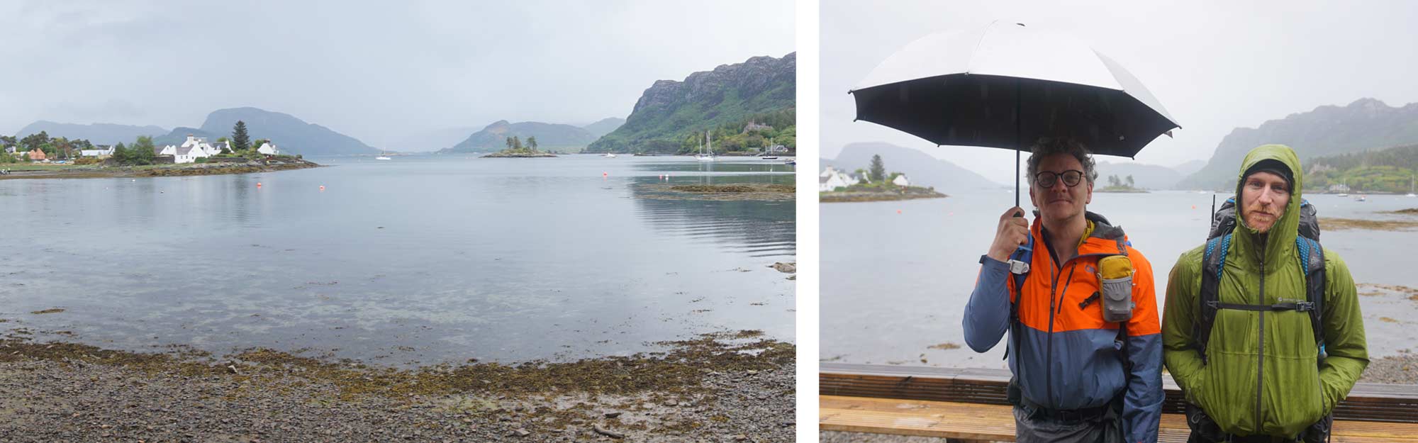
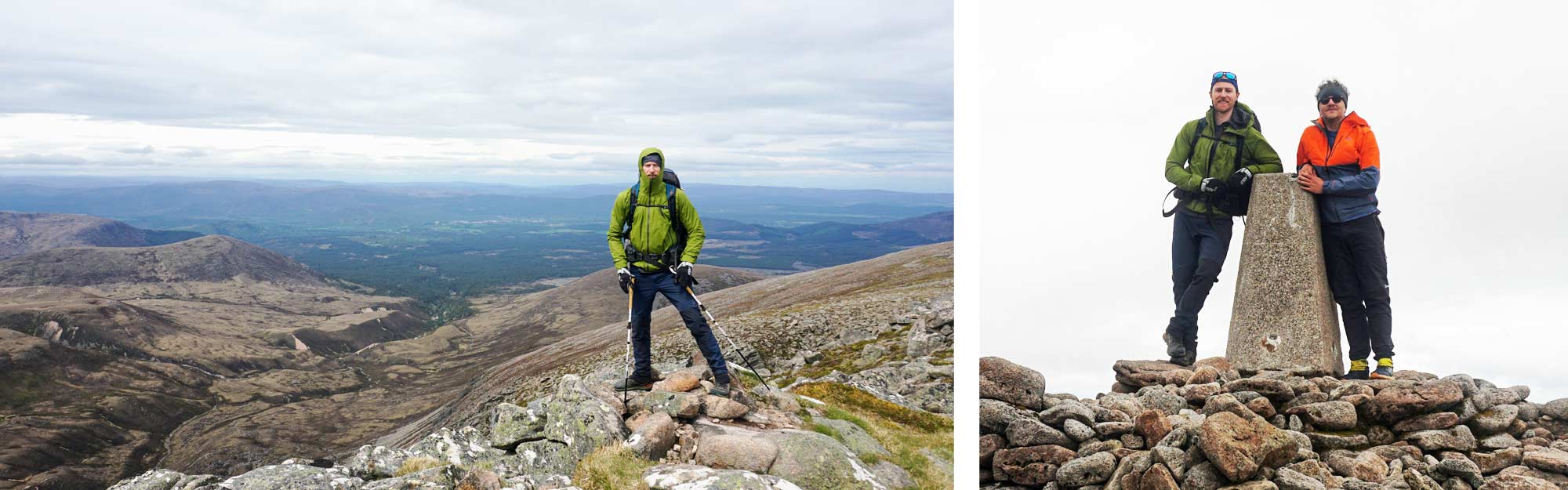
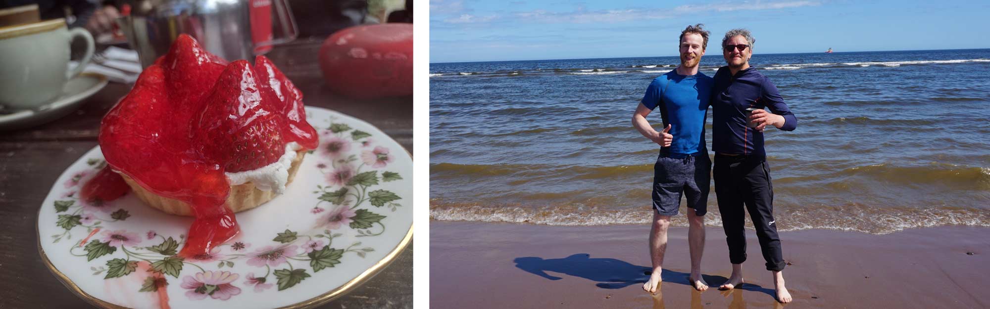
Andy (Left), Chris (Right)
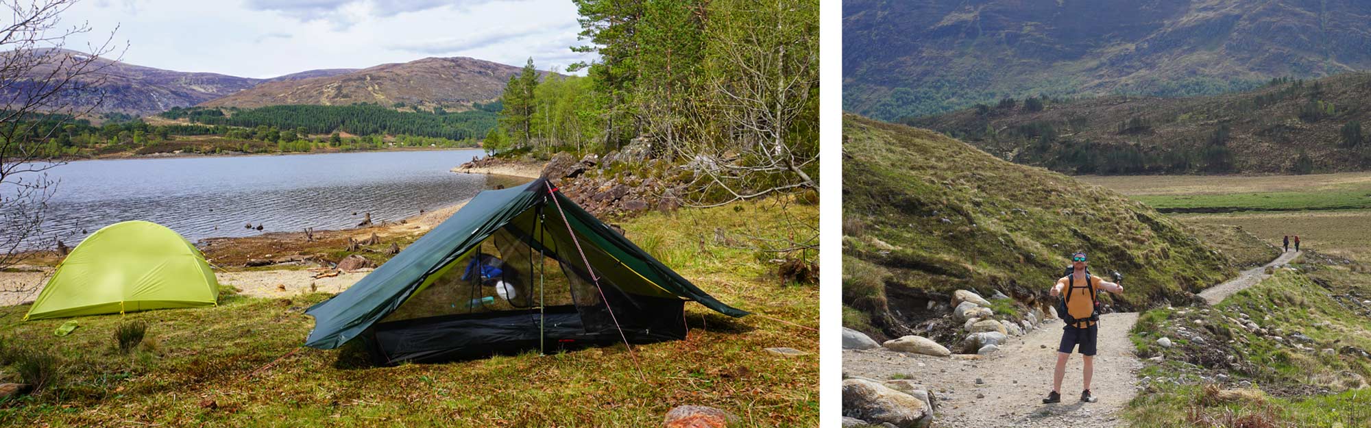
The train dropped us off at 3 o’clock. It was raining when we arrived. We grabbed some lunch and found some shelter whilst we waited for the pub to open. Unfortunately, we had nothing much to do in Plockton other than kill time. We couldn’t officially start our TGO challenge till we had “signed out” of the Plockton Hotel the next day. We headed out of town, found a secluded spot to camp, and bedded down.
Day One; Plockton, to the River Glennan, 14 miles
We were up early and made our way to the Plockton hotel to start our TGO challenge. After some confusion about who we were and what we were doing, we were off on our long journey eastwards.
The day started hot and proceeded to get hotter. We rounded the bay of Plockton and headed south through Strathellen Woods, past two small lochs.
It felt great to finally be on the trail. Months of planning and poring over maps, writing gear lists, and two days of travel fogged my mind; I almost forgot why I was here.
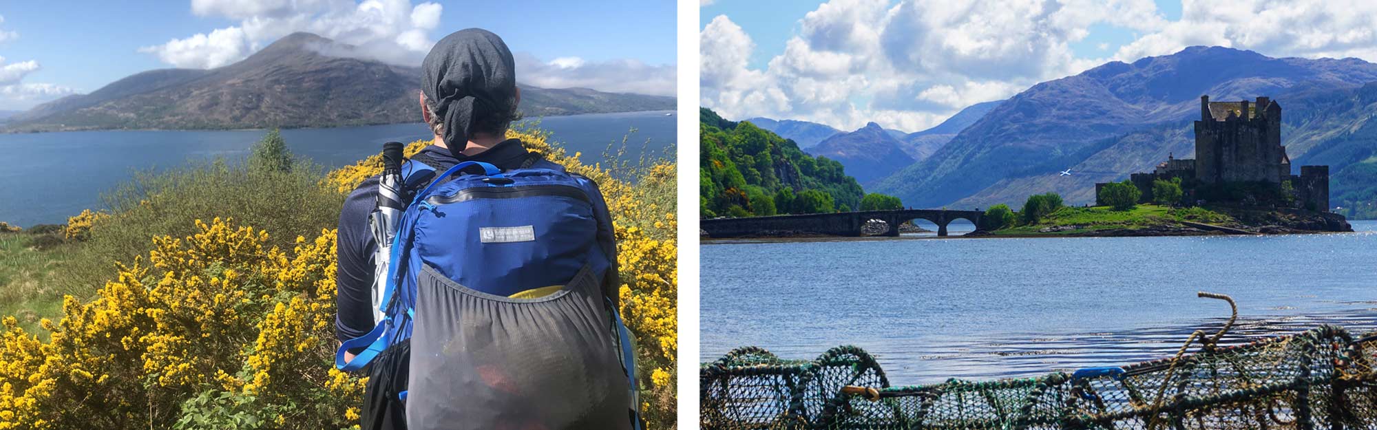
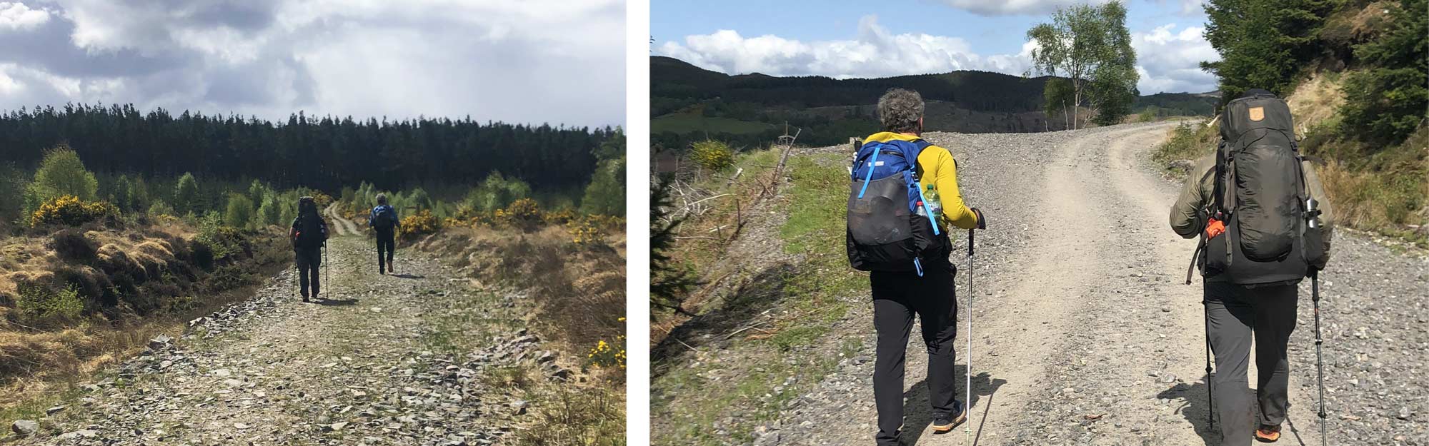
We had a stretch of road walking to do, not every hiker’s dream, but it wasn’t so bad on the first day. The sun beat down on us, and our progress was good. The monotony of the road was soon behind us. We turned off the busy A87 and went through the town of Ardelve, a small town just over the bay from the famous castle.
Eilean Donan Castle is a stunning 13th-century castle situated on a tiny island at the junction of three sea lochs. The island is accessible by a dramatic-looking bridge that only adds to the castle’s majesty. We stopped here for a while before heading along Loch Long and through the town of Dornie. We headed eastward, following the river Glennan, where we stopped to make camp for the night. The valley we slept in faced almost due west, so we were treated to views of the sun setting over the isle of Skye; a brilliant first day on the trail.
Day Two; River Glennan, to Glen Affric Youth Hostel, 17 miles
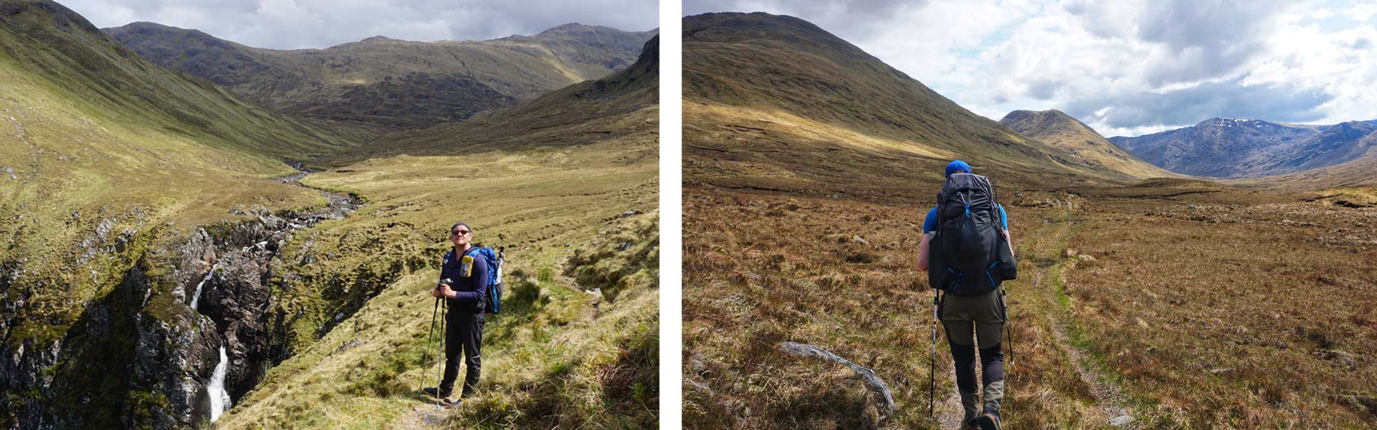
We packed up the tents and continued along the river Glennan through the valley. We were slowly picking our way along a supposed path, we soon found ourselves cresting a hill overlooking a small cluster of houses. It was still early, but the sun was hot overhead, we stopped in the shade of a tree to cool off. Our first big climb of the trip was looming over us. The Falls of Glomach (1093 ft) has an infamous reputation. It’s an incredibly steep climb with some sheer drops. It’s one of Britain’s highest and most remote waterfalls.
Once at the top, we again found ourselves in a valley surrounded by snow-peaked mountains. Although the scenery was stunning, we found ourselves pathless. Our going was slow, but we had high hopes a path wasn’t too far away to our east. Unfortunately, the path was little more than a quad bike track. More specifically a quad bike track for people who like going uphill and through bogs repeatedly. We abandoned the “path”, deciding it would be better to tackle the flat boggy ground, as opposed to the uphill boggy ground. Our going was very slow, but eventually, we made our way south onto something that almost resembled a path. This whole section was a real trudge. I found this section to be the most miserable time of this year’s TGO.
Our path led us onto the Affric Kintail Way, a fully signposted, two-person wide track that stretches for 44 miles from Morvich on the west coast to Drumnadrochit on the banks of Loch Ness. This would be our trail for the next three days.
Almost as soon as we joined the Affric Kintail way, we stopped for the evening. We had made it to Allbeith and the Glen Affric Youth Hostel. Apparently, this is the most remote hostel in Scotland. We pitched up behind the hostel and slept.
Day Three; Glen Affric Youth Hostel, to Loch Beinn a'Mheadhain, 11 Miles
Due to us having accommodation booked in Drumnadrochit and wanting to avoid turning up a day early, we had two relatively easy days ahead of us. About 23 miles on flat, easy-going, well-trodden paths.
For the first half of the day, we would follow the River Affric through the Glen Affric valley, a high and wide glen with steep-sided mountains and the occasional tributary of the river Affric on either side of us.
The Glen Affric way is very popular with TGOers and, as we had lots of time, we slowed our pace to chat with as many of them as possible. We asked “The three questions”; “where did you start?”, “Where are you finishing?” and “How many challengers have you completed.” You will ask, and be asked, these three questions by every fellow TGOer and they can lead to lifelong friendships.
We stopped and ate some food at a viewpoint where Loch Affric meets Loch Beinn a'Mheadhain and once we had eaten, we were on the lookout for a decent camp spot. After lunch, the forest became denser. To our left, the plantation sloped downhill to the loch below and to our right, the pine and birch trees ascended steeply uphill over the boggy ground. It took us over a mile to find a spot we thought was both acceptable and accessible.
The tents went up and we settled in for an early night.
Day Four; Loch Beinn a'Mheadhain, to Cannich,12.5 miles
We were awake, packed-up and on the trail early the next day. The thought of a proper town (by ‘proper town’ I mean it has a pub) inspired us to get moving. The long stretch through this woodland was becoming tedious. Our pace was good, but the heat and uninspiring views stifled the woods. We pressed on and by 11 am we had made our way to Dog Falls (a series of beautiful waterfalls) where we stopped for a bite and took out our map.
The Glen Affric Way at Dog Falls crosses over a road and continues uphill through more plantations before descending into Cannich. Chris pointed out "If we cut off this stretch here and continue along the road, we will save about one and a half kilometres of walking”. At the same time, I was commenting, “If we stick to the road, we won’t have to go uphill and it’s about a mile quicker.” The fact that Chris and I were using utterly different units of measurement hadn’t come up until this point. We continued to use different distance measurements the whole trip, Chris in Kilometres, myself in miles. It added to the adventure, neither of us knew precisely how far anything was.
Either way, we decided to take the road and I'm glad we did. We now had unrestricted views down to the river. We soon found ourselves in flat, pleasant farmland and not long after that we were in Cannich itself. Almost the first building we came to was the pub. It was only 12.30 pm and the sign on the door read “closed” for about half a second before it was miraculously turned around, the door was flung open, and we were welcomed inside. The landlord informed us he opened early during the TGO and was waiting for the first arrivals to show up before he opened. Three cocker spaniels excitedly jumped around us, vying for attention and strokes, as we ordered beer and food.
Last year both Chris and I hiked solo, Chris started in Torridon and I started in Mallaig. After my first day, I didn’t see another person for three days. It wasn’t until I got to Fort Augustus that I started meeting fellow TGOers. We had already seen more people and TGOers this year and here in Cannich there was a festival-like atmosphere.
After lunch, we checked it at the Cannich Woodland Camping and Caravan Park (worth staying at if you are ever in the area). We pitched our tents and went for a mid-afternoon doze. We were surrounded by ultra-light tents when we awoke. It was a good job we had already eaten as the pub was now packed and you needed to have a reservation to avoid going hungry. We bumped into people we had met the year before, as well as lots of new faces. It was here we met up with Steve, Chris’s friend from back home, who would intermittently walk with us most of the way to the east coast. Eventually, everyone made it back to the campsite and bed.
Day Five; Cannich, to Drumnadrochit, 14(ish) miles
We woke up surprisingly early. The Cannich campsite has an onsite café that opens at 6.30am and not long after opening, we were in getting breakfast. (NOTE to anyone ordering a “full English” in Scotland, don’t, unless you wish to be met with hostility from the otherwise friendly staff).
Today was longer than expected. The Affric Kintail Way’s official route, which we were still on, has recently been changed. Not even a mile into today’s walking, we were already completely off our plotted GPS course. We stuck to the new route layout; confident it would eventually get us to the banks of Loch Ness.
The path led us further off our original course, we decided to opt for a stretch of road walking along the banks of Loch Meiklie before descending into Deishangie woods where The Affric Kintail way rejoined its original route. It was a relief to get out of the baking sun and into the sheltered woodland. Giant pine trees lined the forest path, wide enough for us to walk three abreast. The path slowly climbed for the next few miles, the forest below eventually falling away, revealing views down to the valley below.
Loch Ness, conspicuous by its absence, finally appeared when we rounded the last corner of the Affric Kintail Way. The plantation melted away to be replaced by a much older and more diverse woodland. The Pine trees were now replaced by Oak, Beech and Birch, all of which were dwarfed by a most impressive sight, a Giant Redwood tree standing as a sentinel at the edge of the woods.
We had reached Drumnadrochit, found the local supermarket, resupplied our dwindling supplies, and then headed to a greasy takeaway to stuff our faces. Chris and I had a hotel booked that night, Steve was staying in the youth hostel. The next day we would all be walking together again so, we made plans to regroup in the morning and went our separate ways.
This was our first night in a bed since BazPackers, back in Inverness. I was even more overjoyed to find the hotel had a bath, in which I promptly cooked myself. Then I washed my stinky socks in the sink and padded away to the bar for a few well-earned pints. We chatted with some fellow TGOers, including my vetter Graham. We were in bed early that night with an early start and a long day ahead.
Day Six; Drumnadrochit, to Coignafeuinternich Ruins, 23 miles
Though this is a walking trip across Scotland, some exceptions are made regarding public transport. You are permitted to get a ferry across Loch Ness. When we submitted our route months ago, we always intended to get the ferry across, Chris had crossed Loch Ness last year and I was keen to do the same this year. However, the morning we intended to cross, Gordon, the ferryman was otherwise engaged. TGO mission control presented us with two options, wait for the afternoon ferry at 1.30 pm, which could very well be full, meaning we would have to get an even later ferry. Or option two, we would have to get the 8.30 am bus to Inverness, then get a second bus to Inverfarigaig. As we had a 22-mile day ahead of us and a schedule to keep too, we had to opt for the bus, and, in the end, I'm glad we did.
So, at 8.30 am the next day, Chris, Steve, and I were outside waiting for our bus to Inverness. We hopped on the bus, expecting to meet some fellow challengers who had opted for the early bus ride around the loch. The only other TGOer, was Dennis, the self-proclaimed “slowest walker on the TGO” who we had met once or twice along our route. He was in his 70s (still is, for that matter), ex- army and usually sat by the side of the road sunning himself as we passed him. He smiled cheerily at us as we went and joined him.
We made our way to Inverness without any incident, then our connecting bus decided to leave from a completely different stand to the one advertised, somewhat scuppering our plans. Dennis however, was having none of this and sent Steve off searching for a taxi. Forty pounds lighter, but still on time, we arrived in Inverfarigaig. We had crossed the grate glen fault. Now we had to cross the Monadhliath Mountains.
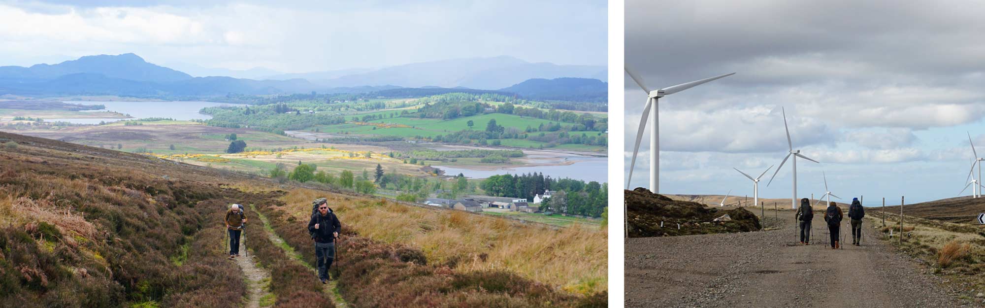
Dennis had now officially joined the party and took up his old job title of company officer. We set off, heading steeply uphill along a narrow road. We met some other challengers who had made the ferry crossing the night before. We made our way through a farmstead near Loch Mhor and the going started getting rougher. Though there was supposed to be a path, it was lost long ago to the bracken, heather and bog. Thankfully, the weather had been good or the going could have been treacherous. Slowly, we picked our way down to Drumaglass Lodge and here, by a stream, we stopped for lunch.
We then turned our attention to the wind farm high above us. At this point, we realised Dennis’s map was so out of date (11 years, to be exact) the wind farm we needed to cross wasn’t even on it. Dennis had been saying all day that he would walk with us as long as he could keep up. Admittedly, we had slowed our pace so he could keep, but he was such good company we honestly didn’t mind. When it became apparent, he wasn’t entirely sure where he was going, we decided it was best to all stick together. It was past lunchtime, and we still had 15 miles to go.
The going was slow. Eventually, we made it up to the first wind turbine. I had never been this close to one, the sheer size and noise when you get up close to one is quite daunting. Chris had been over this section last year and informed us about a bothy that we would pass. Dennis had decided he would stay at that bothy in the hopes that that evening he would meet some fellow TGOers to while away the night with. Chris dived into his pack and pulled out our up-to-date paper map, which we gave to Dennis so he could at least tell he was in a wind farm.
We all had concerns about leaving Dennis up on top of this mountain. Still, he was pretty insistent we carried on, so, with a heavy heart we set off once again (Spoilers: Dennis was fine. Sadly, he didn’t complete his challenge, but he made it to Aviemore. We rang and texted him whilst on the challenge). It was past six now. We still had 8 miles to go and we resolved that we would be walking late into the night and set off down the mountain.
Leaving the wind farm behind us, the going was once again slow, but eventually, we found the footpath we were looking for and descended into the valley of the Findhorn River. The valley here is wide and flat. We disrupted a herd of deer, at least 40 strong, who warily watched us till we were safely round the corner. It was almost 10 pm when we got to our chosen campsite near the Coignafeuinternich Ruins. It had been our most challenging day on the route so far. We quickly pitched our tents, grabbed some food and slept.
Day Seven; Coignafeuinternich Ruins, To Aviemore, 15.5 miles
We were all up and off surprisingly early. Steve would be walking with us for a few miles today, then heading off to do his own route, but we would meet again in Aviemore that evening.
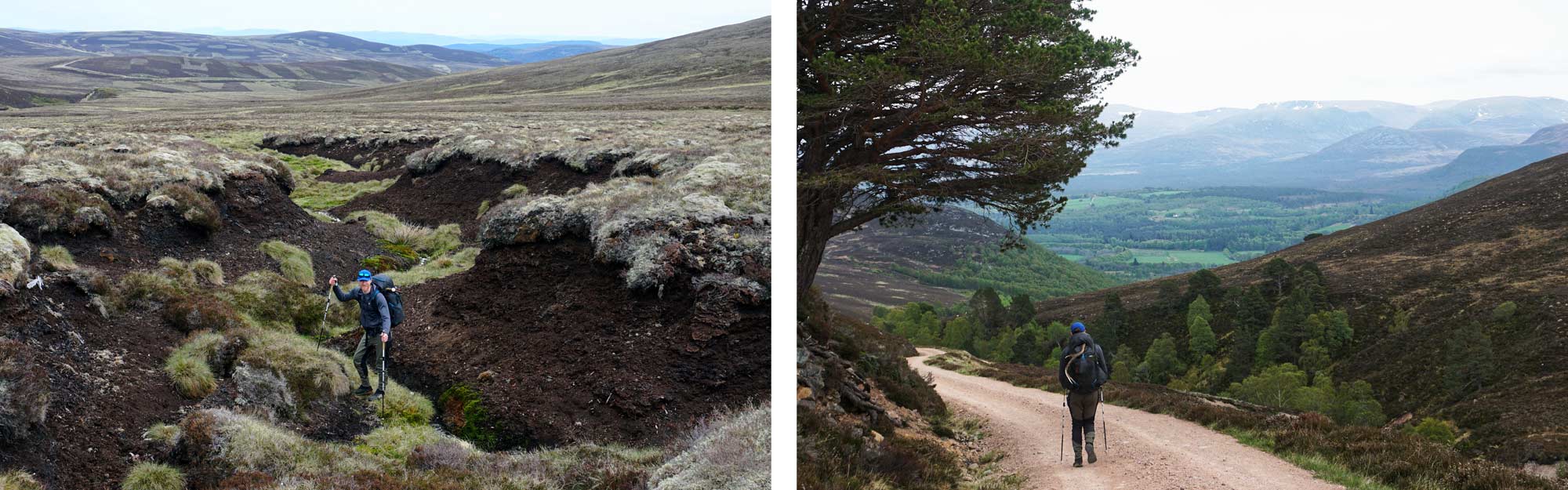
The morning’s walk was spectacular. We followed a tributary of the Findhorn up to the source as it meanders into the mountains. We knew the next part of the trail would be tough going. We had to get over the mountains but there was no direct path, so we knew we were about to do a bit of ‘off-roading’. We had a two-and-a-half mile stretch we needed to cross and then we would pick up a well-trodden path. I don’t think we were prepared for how difficult this next stretch would be.
We scrambled up and onto the high moorland. It looked as though some huge beast had been clawing and rutting all over the top of the hills. Deep peat scars gouged the landscape, some at least 12 feet deep, and, we needed to cross them. It took us almost three hours to climb, scramble, crawl, and slide across the two-and-a-half mile stretch of the moor. Though the going was slow, it was good fun.
Eventually, we reached a solid, wide path not too far from a bothy where we stopped and had lunch. We followed the path down to the river Dulnain and to “The Red Bothy” where many people seemed to be stopping for the night. It was only early afternoon so we carried on, besides, we had accommodation in Aviemore, so there was no question of stopping. We rounded the corner and joined the Burma Road.
The Burma Road (or at least the bit we were on) is a rare thing in Scotland, a straight path that steadily ascends gently for almost four miles. It never drops you back down, only to force you to climb again. It doesn’t twist and turn, adding extra miles. It's almost a straight shot, and we made good time climbing the path.
The views from the top of the Burma Road (an impressive altitude of 2219 feet) are staggering. Away to the south the snowcapped Cairngorm Mountain range filled the horizon. We would be heading straight for them tomorrow, but first, we had to get to Aviemore, 3 miles away and about 1500 feet below us.
We followed the Burma Road down briefly, joining the Speyside Way. We eventually reached our evening accommodation on the outskirts of Aviemore. We dumped our bags, showered, and went off in search of food, beer, and Steve.
Day Eight; Aviemore, To Loch Etchan, 15.5 miles
We wanted to get an early start today, it was going to be tough, we wanted as much time as we needed on the trail. We walked through the Rothiemurchus Forest in the early morning sunlight, our path slowly ascending.
Eventually, we walked out of the forest and into the Lairig Ghru, the famed mountain pass. The Lairig Ghru is a valley that acts as the gateway into the Cairngorm plateau, it’s surrounded by 5 of the highest peaks in the UK (only Ben Nevis stands above these mammoth mountains). The places you can explore from here are almost limitless. It’s a wild, exposed valley that can act like a wind tunnel even on a fine day.
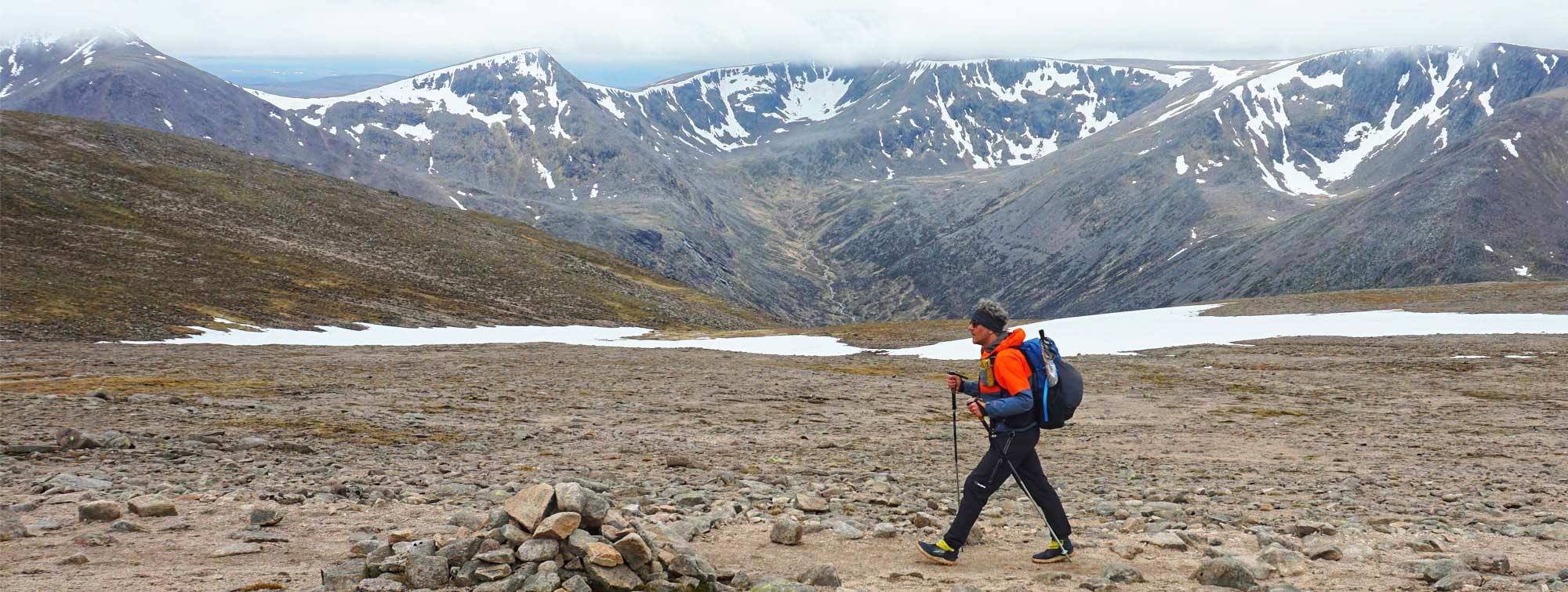
We stopped by the stream that cut through the valley and prepared ourselves a hot lunch, it was around 11 am. Our path climbed up, out of the Mountain valley, and onto the shoulders of Castle Hill, our goal: Ben Macdui - the second-highest peak in the UK. Four months ago, in a warm office planning our route, this seemed like a fantastic idea, but now I wasn’t so sure.
The path climbed steeply for about a mile, ascending 1200 feet rapidly. The heather-lined, mossy path was replaced by boulder fields. Up and up, we climb, till eventually, panting and exhausted (well, I was, Chris is much fitter than I am), we made our way up and onto Lurcher’s Crag. The view from up here is spectacular. To our east, Cairn Gorm, the mountain that gives the park its name. To our west, the Braeriach and the Cairn Toul ridge, still covered in snow. To the south and far below us, the Lairig Ghru rolled on. To our north, the Burma Road snaked off over the hills we had previously walked.
When you are this high up, this knackered, and every direction yields a view this stunning, you suddenly have limitless energy and come over all giddy. We still had three miles to go until we reached the summit of Ben Macdui, but it could have been 20 and I would have happily skipped along. It was nothing short of spectacular.
Now we were up high, the going was easy. Steadily, we climbed until we reached the trig point and summited Ben Macdui.
We then headed towards our camp spot for the evening, loch Etchan. The way down was still covered in snow, we embraced this, sliding our way down a few hundred meters in minutes. The wind whipping across the Loch was cold and much stronger than expected. I had to reinforce my tent with rocks at the guy outpoints, but I slept soundly despite the wind.
It had been a long day, gruelling in some places, but overall, it was one of the finest days of hiking I have ever had. A day I will never forget.
Day Nine; Loch Etchan to Braemar, 15.5 miles
Today was downhill and then relatively flat walking through some of the most stunning landscapes in the UK. Loch Etchan is over 3000 feet in altitude, so we had a way to go to drop down. We descended past the Hutchison Memorial bothie and entered the incredibly scenic Glen Derry Valley. We followed the Derry Burn River as it descended through the valley to meet the Lui Water at Derry Lodge, a disused 18th-century shooting lodge.
We continued to follow the Lui Water River till we reached Mar Lodge, a vast country estate managed by the National Trust of Scotland. Mar Lodge is friendly to TGOers. They allow you to send resupply parcels here and they provide tea, coffee and biscuits. Chris and I had food parcels waiting here and we took advantage of the complimentary tea and coffee.
For the first time on this challenge, I was on familiar ground. I had walked through Mar Lodge last year, heading towards Braemar. This was another classic case of “It doesn’t look that far on the map”. I'm sure that since last year, they had moved Braemar a few miles further to the east. After about an hour, we eventually made it to Braemar and to The Flying Stag, the bar in The Fife Arms hotel.
The Fife Arms Hotel is a spectacular place, far too posh for the likes of me. It’s a combination of hotel and art gallery and serves a very good, albeit expensive, pint of beer.
We were booked into the campsite that night, so we pitched our tents. We then went and had a mooch around Braemar. We were supposed to meet up with Steve here, but he had been waylaid. It didn’t matter as we decided tomorrow, we would take a rest day. After a bit of toing and froing, we spoke to the campsite manager and booked ourselves on the campsite for an additional night.
Day 10
The next day we figuratively and literally charged our batteries, ate plenty of junk food, did some washing and found Steve.
We still had a way to go, but once in Braemar you feel that you are almost there. The end is in sight. You have made it to, and over, the Cairngorms and the east coast is now only 50 or so miles away.
Day 11; Bramar to Spittal of Glenmuick, 14 miles
We started today with a full (not English) breakfast. We were feeling fresh after a day of sitting around not doing very much and we were raring to go. We set off through the forest that encroaches on Braemar. There are many red squirrels in this woodland and I didn’t ever get sick of spotting them. The woodland here soon turns into the Balmoral Forest, it had rained the day before and for the first time in over a week, we were watching where we were putting our feet.
We climbed up and out of the regal woods onto open moorland. The mist had rolled in, shrouding the hills above us in mystery. We were aiming for Gelder Shiel bothie, one of the ‘royal’ bothies built for Queen Victoria, often visited by the Monarch and John Brown, later a frequent haunt of the late Queen Mother, who apparently used to invite hikers in for Champagne and sandwiches. Charles evidently wasn’t in the area, or if he was, he wasn’t feeling too social, so we had to make do with a dehydrated meal.
A word of warning for hikers who have visited Gelder Shiel and are heading east, a small path on the OS map appears to be a shortcut. This is a lie; retrace your steps, and loop back around. I make these mistakes to advise you better. The going was uphill, boggy and soaking wet. Eventually, we returned to the path a “wee bit miffed.”
Once back on the path, the going was easy. We saw the Cairngorms Mountain rescue team doing some training, as we rounded a hill, the path quickly descended into a wide valley. We found a nice spot in a beautiful woodland and pitched our tents. We met fellow TGOers Gavin from Scotland and a couple from Israel.
Day 12; Spittal of Glenmuick to Tarfside, 15 miles
That morning, an early morning mist had settled in the beautiful and peaceful valley of Spittal of Glenmuick. We passed a sleepy herd of red deer as we made our way to the visitor centre where several early morning TGOers had gathered around the public loos. We picked our way up a small valley onto uneven boggy moorland. We were aiming for the Shielin of Mark bothie, where we planned to have coffee and food.
We arrived to be met by even more TGOers, most of whom had stayed in the bothie that night. The Shielin of Mark Bothie is remote and hard to find, even if you know it's there. It wasn't until we were almost on top that we saw the bothie nestled in a small gorge below us. We again met up with Steve, who was walking with another chap named Chris. We had met Chris in Braemar, we would now, the four of us, walk together for the remainder of our crossing.
From the bothie, we could see Muckle Cairn (2387 ft) looming over us. This was "The last hill". It would all be downhill from here. The ascent had no path, it was a short but brutal climb.
The sun was shining on us as we descended into Glen Lee, before long, we were walking along the banks of Loch Lee, heading towards the small settlement at Kirkton. We were now walking in procession, some 15-20 TGOers strong. Everyone had one thing on their minds, beer and BBQ.
Tarfside is a famous name in the TGO lexicon. Every year, the Free Masons of this little village open their lodge to the passing rabble and serve them beer and barbeque at a very reasonable price. As we passed the Hill of Rowan with its high monument, we saw the little town of Tarfside come into view.
It is not just the Freemasons that open their arms to all these dirty hikers. The village hall opens for bacon sandwiches, cakes, tea, and coffee, and the village green is even open for us all to camp on. For three days a year, Tarfside is transformed into Ultralight Glastonbury.
We all descended on the green and pitched out tents. We waited patiently, eagerly watching the Masonic lodge door, which opened promptly at 6.
Burgers were had and we went back for seconds. Beers were had and we went back for sixths.
Day 13; Tarfside to North Water Bridge, 16 miles
It was a slow start for most this morning. It was a reasonably long but relatively easy day ahead. We set off road walking on the north side of the River North Esk, a river we would follow most of the day. We crossed an enormous bridge onto a footpath a few miles into today's walk. The scenery had changed now. We had left the high moors and hills behind us and were now in more managed farmland. Lapwings and Curlews flew overhead as we passed the Rocks of solitude towards Edzell.
Only a few places were open in Edzell, but we found an excellent deli to stop in and grab some food. We got some evening provisions at the local post office/hardware shop/off-licence/garden centre and set off towards our campsite.
There was a long, arduous stretch of road walking on a fairly busy road, but eventually, the campsite came into view. To call it a campsite is a stretch. It's a static caravan park that allows TGOers to stay while the event is on. Sensibly, most of the caravan users were giving the place a wide birth that week. Everyone at the Tarfside BBQ was already here, or not too far behind us, so the party started again.
This was the last night; tomorrow, we would all be in Montrose.
Day 14; North Water Bridge to Montrose,11 miles
Today was a short day, so the four of us, Chris, Ste, Chris and I, were the last to leave the site. The walking was present enough, flat, but mainly along roads through some small towns and derelict farms. We made our way to Hillside, a town of some size, practically a city compared to the villages we had been walking through and got our first glimpse of the sea.
We had been told about a "fantastic strawberry farm", which didn't appeal to me, but I was happy to go along with the consensus and was glad I did. The sunlit courtyard had streams of bunting hanging everywhere, packed with TGOers and disconcerted locals, and I'm pleased to say that the strawberry tart was possibly the best thing I have ever eaten. The beach was less than one mile from here, so we finished our cakes, downed our tea, and picked up our bags for the final stretch.
In glorious sunshine, we powered through the last mile, up and over the sand dunes and down to the North Sea. We dipped our feet (Chris and Steve both swam) in the sea; we had made it, coast to coast. We met some of the friends we had made along the way, Germans, a Pole, a French chap and a fellow Brit, and together, we all sat on the beach and had a celebratory drink before walking along the beach towards Montrose to officially end this year's Great Outdoor Challenge.
Oban next year anyone?

|
||
 |
||
|
Andy Neil |
||
|
Andy has been a keen long-distance hiker and wild camping enthusiast since he completed the Cleveland Way in 2015. Since then, he has walked thousands of trail miles all over the UK and is an active member of the Wild Camping UK community, being an admin of the largest wild camping community on Facebook. He strongly advocates for responsible wild camping and believes it is important to leave no trace when camping in the wilderness. He joined the UOG team in 2021 and works as a website developer and content creator. |
||