Alpamayo Circuit - Peru 2014 - Trip report
Posted by Mark Richardson on Aug 04, 2014
The trip to Peru to do the Alpamayo Circuit was my most ambitious yet and with acclimatisation days I spent almost as many days off the trail as on it, so those down days are just as much part of the trip as the trek itself - my Trip Report covers these days as well.
Huaraz - Pre Trek
I arrived at Huaraz airport mid morning and got a ride to the hotel I'd booked about a week earlier, today was Wednesday. If you look at Google Street view of Huaraz you might get a shock its still being built, the Hotel San Sebastian however is an oasis among the grime and noise of the busy streets.
Huaraz is at 3050m above sea level so some acclimatisation is required - I dumped my gear on arrival and because I'd slept on the plane I wandered into town discovering the street markets and supermarkets. You can buy anything on the streets of Huaraz, from phone chargers to guinea pigs and everything in between. The few main streets are very noisy and the honking of car horns never stops.
I couldn't find corned beef on the shelves of the supermarkets which was a bit alarming, partly because this was the basis of my menu planning - and partly because that's weird - no corned beef - wow!
I snoozed from 3pm till 5, showered, went for a meal, back at 8.30 pm - went o bed. Terrible night, thick head, vomiting feeling weak. The affects of altitude kicking in, couldn't drink, didn't feel like eating. Slept a lot but woke at Midnight - (6am at home), fitfull night sleep - forced myself to get up around 8am for breakfast. Took two paracetamol. By the time I started eating I was feeling much better - the worst was over.
Spent the day getting food and fuel. Bought Peruvian Meths at a hardware store. Ideally I wanted to spend a few days here, perhaps do an acclimatisation hike but the weather forecast forced my hand, the next few days were clear and sunny but later in the week cloud and rain was coming - with no prospect of clear weather for some time. I decided I would tackle the main trek tomorrow - this would give me the best weather window.
To support this decision I enquired about a taxi ride to Hualcayan which was arranged for 8.30am the following morning.
Alpamayo Circuit Day 1
You could skip my report of Day 1 if you wish - its a bit embarassing. I left the hotel at 8.30am but didn't get dropped off till 10.45am after haggling with the driver who wanted more cash than we had agreed. I hadn't reckoned with the poor quality of the road once off the main drag, the taxi driver did a great job in a vehicle not designed for it so I paid him more than we'd settled on.
I knew how early it got dark and I now realised that I'd struggle to make my first campsite, keen to get some distance though I spent some time figuring out where the track was then set off uphill. Unfamiliar with what to expect I spent the afternoon struggling to make progress, the track I was following came and went and I negotiated some pretty rough ground on my way to nowhere. After far too long I realised that whatever I was on it couldn't be the path and I retraced my steps to Hualcayan pretty dispirited. I set up camp just outside the village and felt better after a meal, at 6.30 it was dark - later that night I got an amazing view of the Milky Way.
Day 2
The next morning I was determined to find the correct path and packed up early, the sun was hot and as I stepped off the field onto the village track I met Jan Haenraets, he looked shocked to see another hiker in this place at this time of day. Jan was doing the first few days of the trek and had spent the night in some of the village farm buildings - although a Belgian, living in Vancouver, he was working and traveling for a number of months in Peru. He could speak Spanish, which sadly I could not, and very good English. He'd asked in the village where the path was and gestured to it - I had been convinced that the path was the wrong one for a number of reasons based on my map - but I was happy to admit that I was wrong.
Actually I had taken the Austrian Alpine Club 1:100000 map which is actually quite good given the restrictive scale - I have no excuse.
Thanks to Jan's intervention I was on my way. The path was good, wide enough for donkeys, unlike the path I'd been trying to follow the day before. The weather had the promised sparkle and as we gained height you could see the shelf that was home to Hualcayan spread out below. Across the wide valley was the Cordillera Negra range. Day one ascent was to be 1800m and the guidebook estimated 5-6 hours. The initial stretches were fine and I trekked for 2-3 hours keeping pace with Jan. Initially it looked like we were making good time but but then I slowed - that was the altitude kicking in, and although I didn't feel ill I could only go quite slowly if I was to avoid getting out of breath. Jan ploughed on ahead benefiting from weeks at altitude.
At about 4000m we were assaulted by large Black flies, they looked like over sized blue bottles but they also bit into your skin. My hands were vulnerable because I was using trekking poles and I found myself using up a lot of energy just swatting them away. Eventually I donned thick gloves and my headnet which meant I could operate without interference - but it was a bit hot.
I stopped and managed lunch at around 11.00am but didn't linger because of the flies. The trail eventually hits rock as you climb up and along the right hand side of a valley and it swings round to the right then left as you reach the head. There's an amazing man-made watercourse - a mini canal - that carries water from the lake above all the way down the valley, presumably to Hualcayan then further down to villages at a lower altitude.
Eventually I reached the lake at around 14.15pm - it had taken me 7 hours. The lake is a massive water project and there are a few building including one that identifies itself as a campsite office - but all were locked up and deserted. The ground at the 'campsite' was rock and the area not that pleasant so I walked on hoping to find somewhere better. After about 15minutes I came to a great site but no water. I decided to camp and I trekked back to the lake and gathered 4Litres of water for the night ahead. At around 4.50pm the flies disappeared, granting me a blissful 90 minutes to enjoy the campsite - I was at 4600m.
Day 3
I set out after a breakfast of muesli and a cup of coffee at 7.00am. It generally takes an hour to an hour and a half from waking to taking my first step, today it had been just less than 60 minutes. I had had a good nights sleep and was ready to go. There were two passes to cross today followed by a long walk up the Alpamayo Valley - and I would be rewarded by my first view of the mountain that give this trek its name. The weather was great, clear, sunny and warm. Between the days passes I met a photographer who was walking the circuit in the opposite direction to me - he was young and looked well loaded up, he was bemoaning the clear blue skies - he needed clouds for drama in his photographs. He was taking 14 days and had started with a 46kg load - I could hardly believe it - a fair proportion of the weight was camera equipment and he carried one of the biggest rucksacks I'd ever seen - and a further kitbag across his shoulders. He thought he'd probably brought too much - really.
The path was good and easy to follow, the views from the passes were fantastic, I exchanged gestures with a local who had hiked up with his parents and a donkey. Over the second pass I met a french couple who asked me if I 'was the Englishman' - I was astonished until they explained that Jan had mentioned me! They were taking 10 days over the trek and were nearly finished. I trekked into the valley, the path reaches the bottom then skirts the right hand side of the river.
I met my first donkey team coming the other way - I should explain - the most common method of doing the Alpamayo Circuit is to hire a guide and donkeys to carry your gear. This is not too surprising because carrying ten days food with backpacking gear is quite a big ask - I was doing it because I'm an ultralight fanatic and love solo backpacking - but I know that's not for everyone. The alternative though seems to go to the other extreme. In a few days time I talked it over with an English couple who were walking with a German hiker -there were three of them - they'd hired a guide, a cook and a donkey driver along with six donkeys. There's a multiplier at work here, once you hire donkeys to carry your stuff - you also have to carry the donkey's stuff (food etc), so you need more donkeys. There's the driver's stuff as well (tent, sleeping bag, food etc..) and if you have a guide there's their stuff as well. There are now five of you, and if you don't want to provide meals for your staff yourself you'll need a cook, and cooks come with a lot of stuff - which need more donkeys, who have their own stuff to bring!
Still - you have little to do then but walk, and its good for the local economy.
I hadn't seen Jan since lunchtime the previous day, however as I reached the end of the valley and turned to face Alpamayo itself I saw Jan hiking towards me. He'd reached the valley the previous day and had walked the length of it as I had, then he went on an excursion into the surrounding mountains, he was making his way back to the valley floor to camp. I on the other hand still had to visit the lake at the foot of Alpamayo - I was feeling fit for most of the day but was now starting to flag a bit. The guidebook promised a good campsite by the lake and I struggled up the moraine dam to look down upon it. The whole range at this point is beautiful, and I was seeing it in perfect weather - I sat for a while an contemplated life, the universe and everything.
I couldn't see the attraction of camping by the lake - rocky and uneven ground - so I headed back to the valley floor - not quite to where I knew Jan was camping as I'd spotted a shorter route to the next part of the trek. I pitched my tent on the flat valley bottom between two tributaries, it was a comfortable pitch, the cows agreed but were a bit put-out that I was there. Thankfully there had been no Black Flies today - and in fact I had no further problems. Finished walking at 4.30pm, campsite 4264m.
Day 4
The next day was beautiful again - though I expected that this would be my last for a while. The views today are among the best of the whole circuit, and again I was seeing them in perfect weather. From the valley floor the route climbs up to CaraCara pass at 4830m. On the way up I could see Jan's tent on the other side of the valley, it seemed an age before he was packed up but then not very long at all before he'd caught me up! We took mutual photos of each other. I also met two English women with their guide, who explained the meaning of the name of the Pass - named CaraCara after the large bird of prey that hovers on the winds - he explained that if we didn't get across the pass by midday we'd struggle because the winds are so strong. Further up we passed their 6 donkeys and two drivers.
The pass was indeed windy - I reached it at 10.30. The colours of the rocks are amazing, and the vista on the other side was impressive, looking back at Alpamayo though, was the best view of the trek. Jan and I dropped into the valley on the sweeping trail and had lunch together as soon as the trail levelled out. After food and chat we set out - Jan forging ahead, that would be the last I'd see of him as he was peeling off the route to get back to Huaraz.
Hiking to the Mesapata pass at 4460m was reminiscent of the Scottish Highlands though the folding of the rocks in the Andes is extreme and beautiful. There's not much height loss and gain to reach the pass but it takes a few hours, on the other side the trek descends to Quebrada Tayapampa and you follow a track out to the few buildings called Huilca. The valley bottoms are wide and flat, with mountains rising steeply at the edges, at Huilca I came across a camp of an English couple and a German hiker with their entourage as described previously. I was taken aback again when they came over and asked me if I was 'the Englishman'! You go all that way and you don't expect to be referred to specifically by people you meet.
The sun dipped behind the mountains around 5pm and it got quite cold - I was glad of my down jacket, my gear choice had been spot on. Cup-a-soup, Beef Goulash, Coffee and Cake...
Day 5
Headed off early, 6.30am, wandered up the valley passing a farm, a collection of small buildings with animal pens all around, as I passed a young woman cam bounding out the house re-arranging goats as she went - she gave me a big smile and shouted 'Ola Gringo!' - its funny what sticks in your memory! Weather today was cloudy - the sky was grey and bland and I couldn't see the peaks. The Yanacon Pass at 4610m was reached but it could have been anywhere, over the other side the trail descends initially steeply to a high and wide valley floor then levels out for a while - the trail largely disappears on the plain but its essential to be in the right place to pick up the path for the next section of descent - it took a while to figure out the correct way, after following one false trail I found the correct one.
The last section of descent was through woods and I popped out suddenly into the wide Jancapampa valley. The guidebook mentioned a path but the way wasn't obvious, I knew I had to cross the valley and head down it before picking up the next turning at a place called Pishgopampa, the obvious thing to do was cross the valley floor to the track I could see on the other side, but there was a river to negotiate and the ground was extremely boggy in places.
I got help from a shepherdess with route finding and could see a group of locals training horses, a woman approached me with a young boy and asked for sweets, which I gave her - caramellos. I started to struggle to avoid the boggy areas until I was waved the correct way by a man in the distance standing on his porch. I finally hit the track which has a few houses along it. At one a man was making kites for a group of children, without language I exchanged toothache treatment from my first aid kit for directions to Pishgopampa.
The weather had improved slightly during the day and I put some distance between me and the village before setting up camp at a river confluence which was almost dry.
Day 6
Weather this day was worse than yesterday, quite a bit of rain around and the peaks were shrouded in mist, I hiked up to the TupaTupa pass and arrived at 9.30am and descended to a small lake, there's a path junction marked on the map but it wasn't clear on the ground. I could see a path that looked correct but there was no path to join it - after some deliberation I decided to follow it as it was the only path going in the right direction.
The descent to the next valley floor was tricky and I needed a path - but the one I was following petered out after 45minutes. I scouted around but could find no continuation of the path, the terrain was quite steep rock and spiny vegetation broken by deep clefts - so it wasn't a question of simply making my way down. I checked my position with GPS and I was spot on where I should be. I carefully picked my way down the mountainside feeling lucky that I'd found a viable route off.
I hiked up the Tuctubamba valley looking for a footbridge over the river, I couldn't find one despite having a good view of the area - I made a strenuous crossing at a narrow point and managed to keep my feet dry. As I got towards the end of the valley the rain got heavy and I waked the rest of the day in full waterproofs. I passed Lake Huecrucocha trying to get as far as I could up the valley towards the next pass. I reached a river crossing which looked like it was used as a campground - it was comparatively late so I decided to camp, although I wasn't entirely happy - this was a poor site - animal faeces everywhere and bits of litter lying around, then the midges moved in - I quickly cobbled together a meal and retired indoors at 5.30 to read. Another heavy shower started about an hour later. Campsite at 4205m.
Day 7
The day started badly as it was still raining though not heavy, I shook the tent to remove some of the water and stuffed it in the big pocket on the outside of the pack - and set off to make the steep climb to Alto de Pucaraju. Low cloud robbed me of the views and the altitude made it hard work. I reached the pass at 9.00am and within a few minutes was joined by a group of hikers doing a day route to the Santa Cruz Valley.
The route down to the valley was steep but straightforward and I crossed the valley floor to finally join the 'Santa Cruz' trek. The circuit I completed is not well traveled - most visitors to the area do the Santa Cruz trek, a 3-4 day trek up the Santa Cruz valley, over the Punta Union pass and along the Huaripampa valley. I was joining it near its end and hiking down the valley rather than up it - but I still had to get to the Punta Union pass.
The weather was improving as I hiked up to the pass so I got tantalising glimpses of the snowy peaks at the head of the valley. I found it hard going - but this was the last climb of the walk. I stopped for lunch and drank plenty then plodded on, reaching Punta Union at 1.15pm. Suddenly there were lots of people around, the group I'd met at Alto de Pucaraju turned up and celebrated with me in a bizarre moment of photograph taking and quite a few groups were milling around at the pass taking in the amazing sight down the valley and around the small lake. I stayed here quite a while, dried my tent off, and there were plenty of people to talk to after 7 days of relative quiet.
After a good rest I wandered down to the campground which was a few hours from the pass. Feeling great again, the campsite here was one of the best, very flat area with great views of the surrounding mountains. I had an excellent meal.
Day 8
As usual I started at 7.00am, there was no movement on the campsite, I was clearly the first up and off. It's clear why the Santa Cruz trek is the one everyone does the scenery is stunning, the weather was quite good although there were still ominous clouds at the head of the valley - looking down the valley though, the skies were clear. As I hiked I realised that the weather was moving down the valley as I was but I was managing to stay ahead of it. Anyone leaving much later than I did would be continually in poor weather, whereas I was continually in good weather!
There are long sections of what seems to be dried up lake beds, the ground is sandy, just like a beach and it looks out of place in the mountain environment. The trekking was really pleasant and as I approached the latter stretches of the valley the good weather stabilised and I enjoyed the sunshine. I eventually walked out of the narrow confines of the Sana Cruz valley reaching Cashapampa at 13.45pm.
Cashapampa to Huaraz - Post Trek
There's a small garden shed that's been turned into a bar as you enter Cashapampa, which is the recognised place to visit at the end of your trek - whether it was the full Circuit or the Santa Cruz valley trek. Its a good place to relax. There was a local guy there who spoke English so we exchanged the time of day, though he was obviously here to arrange taxis - which he duly did. I was alone, so the price was steep, but my view is to support the local economy, I hadn't hired a guide or donkeys so I was happy to contribute in this way. As an interesting observation though - I paid 150 soles to get me along the few miles of dirt road to the main metalled road to link up with the Collectivo buses which run up and down the valley between Caraz and Huaraz. My taxi ride took about half an hour. I got a Collectivo into Huaraz which took 90 minutes and cost me just 6 soles.
I arrived back at the hotel in Huaraz at 4.45pm, 8 days after leaving.

|
||
 |
||
|
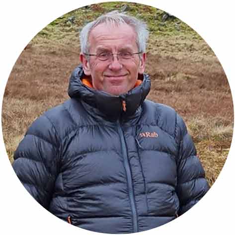
Mark Richardson |
||
|
Mark was the founder of Ultralight Outdoor Gear back in 2006 and has completed long distance backpacking routes in some of the remotest parts of the world. His favourite hikes have been Torres del Paine (full circuit), the John Muir trail and the Markha Valley trail (Ladakh, India). Although semi-retired Mark has not lost any enthusiasm for minimalist backpacking and is tackling Scotland’s Munros choosing multi-day backpacking routes over the more usual guide book excursions. |
||