Jump to: Our Verdict / Features / Specifications
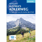
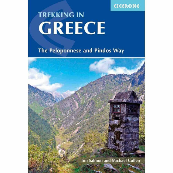
Guidebook to trekking the Adlerweg, a multi-stage walk through the Austrian Tyrol. The 324km route is broken down into 24 stages with easier alternatives provided for the most challenging stages. This east-to-west trek visits the historic town of Innsbruck and the mountain sub-ranges of Wilderkaiser, Rofangebirge and Lechtaler Alpen.
Cicerone says:
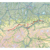
A guidebook to Austria's Adlerweg (the Eagle's way) a long-distance trail from St Johann in Tirol in the east, passing through the historic town of Innsbruck at its mid-point before continuing to St Anton am Arlberg in the west. This waymarked 324km trek is presented in 24 stages ranging between 7 and 32km in length, with easier alternate routes provided for the most difficult stages. This guide features 1:50,000 mapping, accommodation details for the start and end points of each stage, which serve hearty meals and refreshments, and details on local transport, planning and local history. Traversing the North Kakalpen Alps the route passes through the Wilderkaiser, Bradenberger Alpen, Rofangebirge, Karwendelgebirge, Wettersteinebirge and the Lechtaler Alpen ranges, enjoying views as far as Munich and the Swiss Alps. It is the perfect adventure for those looking for an alpine challenge.
Our Verdict
For nearly 50 years Cicerone have been producing guidebooks on recognised treks, regions, areas and general tips for hikers.
We have used them countless times and they've always provided excellent insight and knowledge that you only get through experience, giving you the edge to make your trip a success and more enjoyable too.
If you're a gram counter you can easily remove sections of the book to take with you making your own ultra-lightweight guidebook with only the essential sections that you require.
- Reviewed by Ultralight Outdoor Gear
Features
- Seasons: This is a summer walk, with a season from late-June to mid-September. On the highest parts snow can fall at any time of year, though this is unusual in July and August. The best time is August, though popular mountain refuges can be busy then.
- Centres:The path mostly keeps to the mountains and avoids population centres. Apart from the start and finish points (St Johann and St Anton), the only towns/villages passed through are Kufstein, Maurach/Pertisau (Achensee), Innsbruck, Leutasch and Ehrwald.
- Difficulty: To walk all the stages is a challenging undertaking that requires a good level of fitness, surefootedness and experience of mountain walking. Some of the stages have fixed walking aids in the form of chains, pegs, handholds or ladders, though neither climbing experience nor special equipment are needed to complete the walk. All stages are graded, either white (easy), red (medium) or black (challenging). For all the black stages, alternative less challenging routes are described.
- Must See: ‘Must sees’ are the various high mountains encountered en-route; the Wilderkaiser, Brandenberg Alpen, Rofangebirge, Karwendelgebirge, Wettersteingebirge (Zugspitze) and the Lechtaler Alpen plus Innsbruck, the historical capital of Tyrol.
Specifications
- Edition: Second
- Number of pages: 232
- Size: 17.2 x 11.6 x 1.4cm
- Weight: 270g
Contents
Overview map
Map key
Introduction
Background
The Adlerweg
The natural environment
Preparation
Getting there
Navigation
Accommodation
Food and drink
Amenities and services
What to take
Safety and security
About this guide
The Route
Section 1 Kaisergebirge
Stage 1 St Johann in Tirol to Gaudeamushütte
Stage 2 Gaudeamushütte to Schiesti (Hintersteinersee)
Stage 3 Schiesti (Hintersteinersee) to Kufstein
Section 2 Brandenberger Alpen and Rofangebirge
Stage 4 Langkampfen to Buchackeralm
Stage 5 Buchackeralm to Pinegg
Stage 6 Pinegg to Steinberg am Rofan (Unterberg)
Stage 7 Steinberg am Rofan (Unterberg) to Mauritzalm
Section 3 Karwendelgebirge
Stage 8 Maurach to Lamsenjochhütte
Stage 9 Lamsenjochhütte to Falkenhütte
Stage 10 Falkenhütte to Karwendelhaus
Stage 11 Karwendelhaus to Hallerangeralm (via Birkkarspitze)
Stage 11A Karwendelhaus to Hallerangeralm (via Karwendeltal)
Stage 12 Hallerangeralm to Hafelekarhaus
Section 4 Innsbruck and Patscherkofel
Stage 12A Innsbruck city tour
Stage 13 Patscherkofel to Tulfeinalm
Section 5 Wettersteingebirge and Mieminger Gebirge
Stage 14 Hochzirl to Solsteinhaus
Stage 15 Solsteinhaus to Leutasch (Weidach)
Stage 16 Leutasch (Weidach) to Ehrwald
Stage 17 Ehrwald to Loreahütte
Section 6 Lechtaler Alpen
Stage 18 Loreahütte to Anhalter Hütte
Stage 19 Anhalter Hütte to Hanauer Hütte
Stage 20 Hanauer Hütte to Württemberger Haus
Stage 21 Württemberger Haus to Memminger Hütte
Stage 22 Memminger Hütte to Ansbacher Hütte
Stage 23 Ansbacher Hütte to Leutkircher Hütte
Stage 24 Leutkircher Hütte to Arlbergpass
Section 6A Lechtal valley
Stage 19A Boden to Häselgehr
Stage 20A Häselgehr to Steeg
Stage 21A Steeg to St Anton am Arlberg
Appendix A Distances, timings and facilities
Appendix B Tourist offices
Appendix C Useful contacts
Appendix D Glossary of German geographic terms


