Jump to: Our Verdict / Features / Specifications
Explore the diverse landscapes of the North York Moors and Yorkshire Wolds with this essential guide to three classic trails. From dramatic coastal cliffs to rolling countryside, this book provides detailed route descriptions, practical advice, and an OS map booklet to help you navigate over 250 miles of stunning scenery.
Cicerone says:
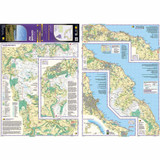
A walking guidebook to the Cleveland Way and Yorkshire Wolds Way National Trails, plus the Tabular Hills Walk. Crossing the North York Moors National Park, coastal scenery and quiet countryside, the three routes can be joined to create an easy circular route of over 250 miles (400km). Includes an OS 1:25K map booklet of the Cleveland Way.
Seasons - All year round, though winter can be bleak and wet on the moors.
Centres - Scarborough, Whitby, Filey, Helmsley, Osmotherley
Difficulty - Suitable for all: the trails are divided into sections ranging from 2-12 miles. There are some isolated stretches.
Must See - Yorkshire's Heritage Coast; Ryedale Folk Museum; Rievaulx Abbey; Whitby; historic villages; moorland scenery
Our Verdict
For nearly 50 years Cicerone have been producing guidebooks on recognised treks, regions, areas and general tips for hikers.
We have used them countless times and they've always provided excellent insight and knowledge that you only get through experience, giving you the edge to make your trip a success and more enjoyable too.
If you're a gram counter you can easily remove sections of the book to take with you making your own ultra-lightweight guidebook with only the essential sections that you require.
- Reviewed by Ultralight Outdoor Gear
Features
- Also contains route descriptions of the Yorkshire Wolds Way (130km, 80 miles) and the Tabular Hills Walk (80km, 50 miles)
- Contains step-by-step description of the route alongside 1:50,000 OS maps
- Includes a separate map booklet containing OS 1:25,000 mapping and route line for the Cleveland Way
- The book features a trek planner that highlights information about accommodation, facilities and public transport along the route
- GPX files available to download
Specifications
- Weight: 303g
- Edition: Third
- Number of pages: 200
- Size: 17.20 x 11.60 x 1.15cm
Contents
- CONTENTS
- Map key
- Overview map
- Cleveland Way trek planner
- Route summary table
- Introduction
- Planning your trip
- Daily schedule
- When to walk
- Getting to Yorkshire
- Getting around Yorkshire
- Accommodation
- Tourist information centres
- Food and drink
- Money
- Planning day by day
- Using this guide
- Maps of the routes
- Waymarking
- Rescue services
- Trail officer
- All about Yorkshire
- Brief history
- Wolds, moors and coast
- The Yorkshire Wolds Way National Trail
- Stage 1 Hessle to South Cave
- Stage 2 South Cave to Goodmanham or Market Weighton
- Stage 3 Goodmanham or Market Weighton to Millington
- Stage 4 Millington to Thixendale
- Stage 5 Thixendale to Sherburn
- Stage 6 Sherburn to Filey
- Stage 7 Filey to Scalby Mills (via the Cleveland Way)
- The Tabular Hills Walk
- Stage 1 Scalby Mills to Levisham
- Stage 2 Levisham to Hutton-le-Hole
- Stage 3 Hutton-le-Hole to Helmsley
- The Cleveland Way National Trail
- Stage 1 Helmsley to Sutton Bank
- Stage 2 Sutton Bank to Osmotherley
- Stage 3 Osmotherley to Clay Bank
- Stage 4 Clay Bank to Kildale
- Stage 5 Kildale to Saltburn-by-the-Sea
- Stage 6 Saltburn-by-the-Sea to Sandsend
- Stage 7 Sandsend to Robin Hood’s Bay
- Stage 8 Robin Hood’s Bay to Scarborough
- Stage 9 Scarborough to Filey
- Appendix A Useful contacts


