Jump to: Our Verdict / Features / Specifications
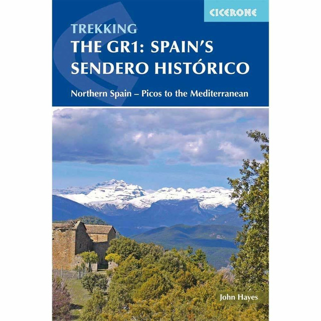
Guidebook to the 1250km of Spain's Sendero Historico (GR1), traversing northern Spain from Puerto de Tarna in the province of Leon in the west to the Mediterranean near L'Escala in Catalonia, through fascinating, varied landscapes and the foothills of the Pyrenees. Described in 53 stages, about 25km each in length, with detailed mapping.
Cicerone says:
This guidebook is for trekkers aiming to tackle all or part of the GR1 or Sendero Historico – 1250km of waymarked route across northern Spain through the Pyrenean foothills from Puerto to Tarna at the western end to near L’Escala on the Mediterranean coast. Broken into 7 sections and 53 stages, the walking goes through remote landscapes, but accommodation is accessible at the end of every day, and the terrain is not difficult. All sections are suitable for novice and experienced walkers alike.
Providing all the information trekkers will need, the guide starts with a useful introduction combining practical information about planning your own itinerary, when to go, what to take and the accommodation, cuisine and terrain to expect along the way with general information about the varied geology and fascinating history of the provinces you will be walking through. Step-by-step route description is accompanied by custom-drawn, contoured mapping, vibrant photography and stage and section summary information to help you plan, as well as detailed information about the accommodation options available at the end of each day’s walking. Also included is information about how to get to Puerto de Tarna from the northern coast of Spain, if you want to make the GR1 into a true coast-to-coast.
Walking through rural Spain is a unique experience and the GR1 meanders through some of the best scenery northern Spain has to offer. At the same time, the route visits many medieval churches and castles from the time of the Christian kingdoms, the reconquest, the crusades and Spanish Unification as well as key locations in the development of modern Spain. What’s more you’ll have long views of the changing landscapes all the way, as the mountains of Spain, unlike the rest of Europe, are not cloaked in pine forests.
Our Verdict
For nearly 50 years Cicerone have been producing guidebooks on recognised treks, regions, areas and general tips for hikers.
We have used them countless times and they've always provided excellent insight and knowledge that you only get through experience, giving you the edge to make your trip a success and more enjoyable too.
If you're a gram counter you can easily remove sections of the book to take with you making your own ultra-lightweight guidebook with only the essential sections that you require.
- Reviewed by Ultralight Outdoor Gear
Features
- Seasons: Potentially accessible throughout the year but best experienced from April to early June and in September and October
- Centres: Reinosa, Vitoria, Olite, Murillo de Gállego, Graus and Gironella
- Difficulty: Quiet and often remote providing a wide range of walking experiences none of which requires technical expertise; accommodation can usually be found on the route and at the end of a 7 to 8-hour walking day
- Must See: Combines visits to many of the most important sites in the country's historical development with some its best scenery
Specifications
- Edition: First
- Number of pages: 304
- Size: 17.2 x 11.6 x 1.7cm
- Weighs 340g
Contents
Introduction
Topography of the route
Climate and vegetation
Agriculture and wildlife
History
What the trails are like
Staying in Spain
Eating in Spain
When to go
Breaking the GR1 into chunks
Planning your walk
What to take
Finding your way
Using this guide
1 Puerto de Tarna to Reinosa
Stage 1 Puerto de Tarna to Salamon
Stage 2 Salamon to Prioro
Stage 3 Prioro to Camporredondo de Alba
Stage 4 Camporredondo de Alba to Cervera de Pisuerga
Stage 5 Cervera de Pisuerga to Brañosera
Stage 6 Brañosera to Reinosa
2 Corconte to Berantevilla
Stage 1 Corconte to Pedrosa de Valdeporres
Stage 2 Pedrosa de Valdeporres to Salazar
Stage 3 Salazar to Paresotas
Stage 4 Paresotas to Bóveda
Stage 5 Bóveda to Espejo
Stage 6 Espejo to Fontecha
Stage 7 Fontecha to Berantevilla
3 Berantevilla to Olite
Stage 1 Berantevilla to Peñacerrada
Stage 2 Peñacerrada to Bernedo
Stage 3 Bernedo to Santa Cruz de Campezo
Stage 4 Santa Cruz de Campezo to Los Arcos
Stage 5 Los Arcos to Larraga
Stage 6 Larrage to Olite
4 Olite to Murillo de Gállego
Stage 1 Olite to Ujué
Stage 2 Ujué to Sos del Rey Católico
Stage 3 Sos del Rey Católico to Petilla de Aragón
Stage 4 Petilla de Aragón to Biel
Stage 5 Biel to Murillo de Gállego
5 Murillo de Gállego to Graus
Stage 1 Murillo de Gállego to Loarre
Stage 2 Loarre to Bolea
Stage 3 Bolea to Arguis
Stage 4 Arguis to Nocito
Stage 5 Nocito to Paúles de Sarsa
Stage 6 Paúles de Sarsa to Ligüerre de Cinca
Stage 7 Ligüerre de Cinca to Tierrantona
Stage 8 Tierrantona to Salinas de Trillo
Stage 9 Salinas de Trillo to Graus
6 Graus to Gironella
Stage 1 Graus to Lascuarre
Stage 2 Lascuarre to Puente de Montañana
Stage 3 Puente de Montañana to Àger
Stage 4 Àger to Hostal Roig
Stage 5 Hostal Roig to Messanés
Stage 6 Massanés to Oliana
Stage 7 Oliana to Cambrils
Stage 8 Cambrils to Sant Llorenç de Morunys
Stage 9 Sant Llorenç de Morunys to Sant Lleïr de la Vall d’Ora
Stage 10 Sant Lleïr de la Vall d’Ora to L’Espunyola
Stage 11 L’Espunyola to Gironella
7 From Gironella to the coast
Stage 1 Gironella to Lluçà
Stage 2 Lluçà to Alpens
Stage 3 Alpens to Ripoll
Stage 4 Ripoll to Sant Pau de Segúries
Stage 5 Sant Pau de Segúries to Oix
Stage 6 Oix to Besalú
Stage 7 Besalú to Banyoles
Stage 8 Banyoles to Orriols
Stage 9 Orriols to Sant Martí d’Empúries
Appendix A Route summary tables
Appendix B A Spanish coast-to-coast
Appendix C Useful contacts


