Jump to: Our Verdict / Features / Specifications
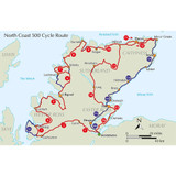
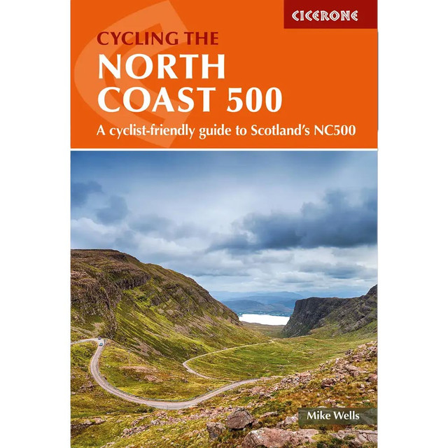
Guidebook to cycling the 528 mile NC500 circular cycle route around northern Scotland, starting and finishing in Inverness. Although the scenery is wild, the going is almost entirely on asphalt roads, many of which are quiet with little traffic and can comfortably be cycled within a fortnight.
Cicerone says
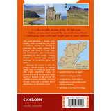
A guidebook to the 850km (528 mile) NC500 cycle route around northern Scotland. This circular tour starting and finishing in Inverness and passing through Wester Ross, Sutherland, Caithness, Easter Ross and the Black Isle is suitable for all types of bikes, and cyclists with a good level of fitness. The NC500 can be cycled in 2 weeks.
- Presented in 16 stages between 24 and 89km (15-55 miles)
- Alternate routes are given to avoid the steep ascent of Bealach na Bà or the undulating Assynt peninsula
- The busy A9 east coast road is avoided, but is described as an alternative route
- Route passes Ullapool, Thurso and Tain
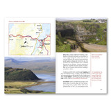
- 1:150,000 mapping and profiles are included for each route
- GPX files available to download
- Detailed information on accommodation, refreshments and facilities along the route
Our Verdict
For nearly 50 years Cicerone have been producing guidebooks on recognised treks, regions, areas and general tips for hikers.
We have used them countless times and they've always provided excellent insight and knowledge that you only get through experience, giving you the edge to make your trip a success and more enjoyable too.
If you're a gram counter you can easily remove sections of the book to take with you making your own ultra-lightweight guidebook with only the essential sections that you require.
- Reviewed by Ultralight Outdoor Gear
Features
- Seasons: Best cycled between May and September.
- Centres: A circular ride starting and ending in the highland capital Inverness. Small towns are passed at Ullapool, Thurso and Tain.
- Difficulty: A challenging cycle route due to frequent undulations, with ascent totalling nearly 8000m. Climbs vary from steady climbs over low mountain passes to short steep hills. The road surface is asphalt throughout, presenting no problem. Suitable for all types of bike with a wide range of gears and appropriate tyres. Lights and high-vis jackets essential due to the possibility of misty conditions on narrow roads.
- Must See: The beautiful and varied landscapes of the far north of Scotland. Major mountains are passed at Torridon, An Teallach and in Assynt. The route reaches both Durness and John o' Groats, near to the northwestern and northeastern extremities of Scotland.
Specifications
- Weight: 220g
- Published: 29 Jan 2024
- Edition: Second
- Number of pages: 200
- Size: 17.2 x 11.6 x 1.25cm
Table of Contents
CONTENTS
Map key
Overview map
Route summary
Introduction
Background
The route
Natural environment
Preparation
Getting there and back
Navigation and information
Accommodation
Food and drink
Amenities and services
What to take
Safety and emergencies
About this guide
The route
Stage 1 Inverness to Garve
Stage 2 Garve to Lochcarron
Stage 3 Lochcarron to Shieldaig (direct route)
Stage 3A Lochcarron to Shieldaig (via Applecross)
Stage 4 Shieldaig to Gairloch
Stage 5 Gairloch to Ullapool
Stage 6 Ullapool to Lochinver
Stage 7 Lochinver to Kylesku
Stage 8 Kylesku to Durness
Stage 9 Durness to Tongue
Stage 10 Tongue to Melvich
Stage 11 Melvich to John o’ Groats (coastal route)
Stage 12 John o’ Groats to Melvich (inland route)
Stage 13 Melvich to Altnaharra
Stage 14 Altnaharra to Tain
Stage 12A John o’ Groats to Lybster
Stage 13A Lybster to Brora
Stage 14A Brora to Tain
Stage 15 Tain to Nigg (for Cromarty ferry)
Stage 16 Cromarty to Inverness
Stage 15A Tain to Dingwall
Stage 16A Dingwall to Inverness
Appendix A Facilities summary
Appendix B Tourist information
Appendix C Hostels and bunkhouses
Appendix D Campsites
Appendix E Cycle shops and cycle hire
Appendix F Munros near route (mountains over 914m)
Appendix G Distilleries en route
Appendix H Useful contacts

