Pyrenean High Route - Section 5 2017 - Trip Report Day 6-10
Posted by Mark Richardson on Aug 01, 2017
Day 6 – Refuge Mariella to Gite d’etape de Batere
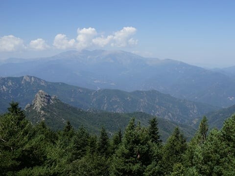
Left camp at 7.30 and began the climb up to Canigou, the second key peak on the route. Initially the route is a steady climb but shortly before the summit there’s a steep rocky section which develops into a scramble, Grade 1 in my estimation. It’s straightforward and really enjoyable and culminates in the summit giving some excellent views of the surrounding mountains and countryside.
Like Pic Carlit the opposite side is the tourist trail and so the summit is always busy, today the weather was hot so it was no exception, after about 15 minutes I headed down the steep path towards Refuge des Cortalets, it’s quite well eroded in places making progress quite tricky.
I arrived at Cortalets at noon but they didn’t start serving lunches till 12.30, this was disappointing as the smells from the kitchen were very enticing. Cortalets has a service road and so is a popular refuge for walking or just a nice lunch, the cafe was quite busy, I ordered a soft drink and ate the lunch I’d brought. At 12.30 I was ready to set off again, it was very hot by this time and the next section was the worst part of the day – a 4km walk down a dirt road, it took me an hour.
Once off the road however the path becomes quite spectacular, it traces the head of a steep sided valley and is a joy to walk, although the heat was still causing me problems. The head of the valley is dissected by a couple of streams and I found the Frenchman from last night’s campsite sitting beside a deep pool, he was nursing a foot injury, there was no one else around so I stripped off and plunged into the water – it was freezing, in a good way!
The route then climbs out of the valley and contours round a mountainside (part of the Canigou massif), there are a few places you can stop if you wish, the first is a basic refuge and the second is an unmanned building with a reliable water source, a picnic table and good views. This marks the start of a climb to the next col which threads through trees before breaking out into the open at the highest point.
I met an English couple here, they were intending to stop at the abandoned building that marked the start of the climb to the col, which would mark the end of the descent for them. An hour further on I arrived at the Gite d’etape de Batere, part of a group of rundown buildings, one of which was a ruined hotel. The location is uninspiring, but the bar and the Gite are okay, there’s a field some yards away for camping but there are no facilities to speak of, I used the Gite’s toilets but I think this may be frowned upon.
There were quite a few campers, which apparently was very unusual, I got chatting to a young French couple who spoke good English, we had a laugh over coffee.

Approaching Canigou

Canigou Summit

Descent from Canigou

Balcon de Canigou
Day 7 - Gite d’etape de Batere to Amelie les Bains
My old guidebook differs from the most recent addition which bypasses Amelie les Bains in favour of Arles sur Tech further up the valley, as I hadn’t realised this I followed the old route as far as Amelie intending to walk on at least another few hours. The weather was very hot again, I found out when I got home that the area I was walking in was experiencing a heat wave – even in a normal year it’s hot, but this year it was significantly hotter than normal.
The trek from Batere to Amelie is fairly mundane, mainly on dirt tracks, in the hot sun it became a bit of a slog. To make matters worse you can see Amelie long before you reach it, it looks close but the terrain means it’s still a few hours away.
I eventually arrived at 1pm hot and weary, I had a meal in a pavement restaurant and considered my next move. The temperature was so high that I decided to stay in a hotel and use the time to recuperate, the next section was a steep climb which would pass easier after a good night’s sleep. I was also looking worse for wear and a bath wouldn’t go amiss.
I walked to the hotel watching local people swimming in the river, as I entered I saw the French group I had been walking with a few days before checking in just in front of me, we said hi. My night at the hotel was great – I asked for a room with a bath and ate in the restaurant that evening, I got the most out of the break.

Rolling countryside to Amelie les Bains

Amelie les Bains

Day 8 - Amelie les Bains to Las Illas
The trail climbs long and hard through forest and it took me 5 hours to reach the next ridge at Roc de France, the heat was affecting my progress again, even with tree cover the trail was hot and dusty and water was an issue. A very rough path traces the top of the ridge for a short time before the route leaves it and reaches the Col de Puits, this is a meeting point of four paths not far from the Refuge des Salines.
The signposting is not great at the col and after a false start I found my way to the Refuge, it’s a great building currently being restored, there is a restaurant but it smells damp and needs a bit of work yet. I had a salad and a soft drink before walking down to the ‘spring’ to get water.
The rest of this section is on tracks through forest then breaking out into open ground, the route goes into Spain then crosses back into France before descending to the small hamlet of Las Illes. As you enter the village there’s a restaurant but walk further in and you come to a communal camp ground, its small, by some cross roads but there are toilets and an open air shower, all of which are provided free of charge.
I re-acquainted myself with the French group who were also camping there.

Roc de Frausa

View from Roc de Frausa

Day 9 - Las Illas to the Tagnarede watersource
Getting out of Las Illas the following morning lost me about an hour, the village is quite extensive with varied tarmacked roads joining the large houses, the route is supposed to follow the GR10 so I expected to see white and red flashes marking the way – they were nowhere to be seen.
The low scale of the map was limiting and I used a compass to determine the way, the lack of markings had me stumped though and it caused me to try several routes before I met the French group who were using a handheld GPS, they confirmed the route – which was the one I was following but I lacked the confidence to be sure.
An explanation presented itself after a while, when we reached Super Las Illas, a village above Las Illas, at this point the route turned into a dirt road and headed beyond a group of signs baring entry, after much deliberation we decided to ignore the signs and press on – we also started seeing ‘blacked out’ GR10 signs indicating a re-route had been decided at some stage – since neither of us had access to what the new route could be we carried on, eventually meeting another route from the left – clearly the diversion.
The weather continued to be hot and still, today’s walking was not taxing but the heat took its toll. I parted company with the French group preferring to go a bit faster on the level tracks eventually coming to the Col du Perthus, which is a traffic choked village that’s not worth stopping at, there’s a water point in the centre, down the main street, the route passes on to the end and turns right at a road junction.
The next 5km is on this road before mercifully there’s a section of path through a forest – it’s indistinct in parts and I had to concentrate on the paint markings to ensure I was going in the right direction – I took a few wrong turns before exiting the trees by a track, below a hillock with a church on its top. I was relieved to leave the path as I could imagine getting hopelessly lost quite easily.
Past the church and on to a junction, the Refuge on the Col de d’Ouillat is signposted as 1hr and 15minutes, but its virtually all up hill, mainly on open ground the sun once again becomes a significant factor affecting progress, by the time I reach the Refuge I am struggling. I have a drink and notice that the French group have just arrived and the old French couple have been here a while.
The group are staying put but the French couple are going on another couple of hours, in the guidebook a water source is mentioned after two hours and, refreshed after my drink and a few nibbles I decide to head for it.
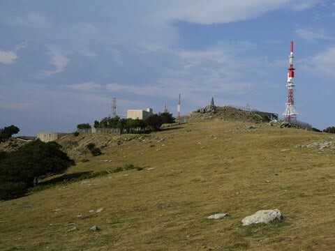
The route is straightforward and a breeze picks up as I approach Pic Nuelos with its tall communications mast, below the summit there’s a sign saying Banyuls sur Mer is only 7.5 hours away. The Pic is a high point and the path then drops steeply eventually coming to the water source after 90minutes from Col de d’Ouillat.

Pic Nuelos

Pic Nuelos

Taguarede
Day 10 - Tagnarede water source to Banyuls sur Mer
I woke to a heavy storm this morning, thunder and lightning, wind and heavy rain battered the tent so I decided to sleep in. After about thirty minutes or so there was a lull in the storm so I had breakfast and packed up as fast as I could, I got away dry and followed the ridge path that traces the border with Spain.
The storm had not gone away though, it reappeared and brought thick mist that severely reduced visibility, I had to rely on compass work to ensure I made the right choices as the path was indistinct in many places.
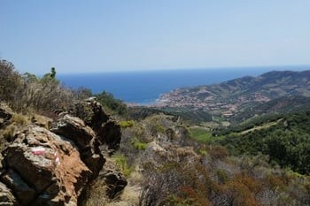
After a few hours the weather started to brighten again and I could see the sea in the distance – the mountainous terrain continues virtually all the way to Banyuls and it was with some excitement that I reached Pic Sailfort, the last major obstacle to the end of the route.
By now it was hot again and the skies were quite clear, the descent from Pic Sailfort is quite steep and difficult in places but eventually you reach Col des Gascons from which you get a clear view of the town and the route down to it. The path cuts off a few switchbacks in the road before reaching a further col above some vineyards, avoiding the road there’s a path that is well signposted and threads through the rows of vines till you reach the outskirts of the town.
I headed straight for the sea of course and stood on the beach at 2.45pm, I had completed the Haute Route de Pyrenees, walked from the Atlantic to the Mediterranean, albeit with a couple of breaks.

Following the ridge

Pic des Pradets

Descent from Pic Sailfort

Banyuls sur Mer

|
||
 |
||
|
Mark Richardson |
||
|
Mark was the founder of Ultralight Outdoor Gear back in 2006 and has completed long distance backpacking routes in some of the remotest parts of the world. His favourite hikes have been Torres del Paine (full circuit), the John Muir trail and the Markha Valley trail (Ladakh, India). Although semi-retired Mark has not lost any enthusiasm for minimalist backpacking and is tackling Scotland’s Munros choosing multi-day backpacking routes over the more usual guide book excursions. |
||
