Bikepacking to the Four Corners of the North York Moors National Park
Posted by Lois Fife on Oct 13, 2023
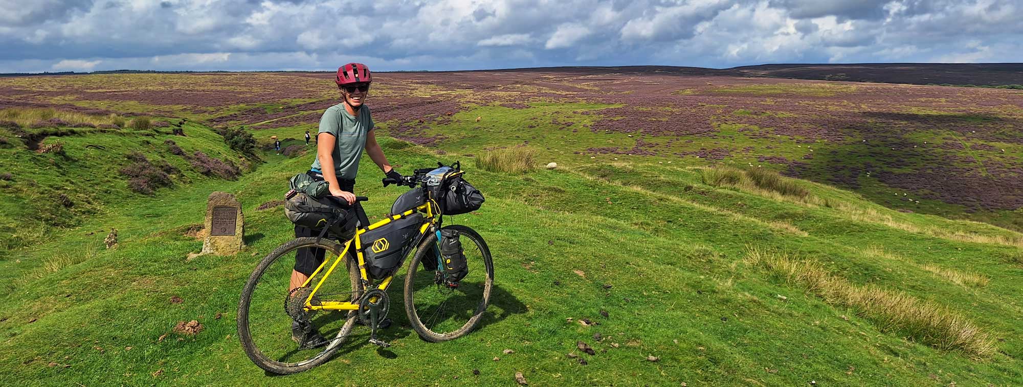
Bikepacking to the Four Corners of the North York Moors National Park with Apidura’s Expedition Range.
Sometimes you get an idea that’s like an annoying itch that won’t go away until you give it a good old scratch.
I am blessed to be living about 100m outside of the boundary of the North York Moors National Park. It’s very presence, beauty and characteristics are a huge part of my life in particular the enjoyment and benefits of having vast outdoor space on my doorstep that I have access on foot or by bike. I have been ‘itching’ to ride to the 4 corners, or compass points, of the National Park for a while, and when a window of opportunity came up, starting on the August Bank Holiday weekend there was no better time, with the heather on the Moors at it glorious best to start scratching the itch!
The
Route
Starting from my hometown of Guisborough, a market town on the northern edge of
the National Park my 245km route kept within the National Park boundary
throughout, ridden in an anticlockwise direction, thus avoiding honeypot
tourist areas on the Bank Holiday Monday. Staying within the National Park
boundary throughout, called for some challenging route planning decisions,
where cutting outside of the boundary would have been simpler and shorter. The
route visits the most westerly, southerly, easterly and finally northerly
points, in that order, or as near as possible by bike. Another ‘self-made’ rule, as if the ride
wasn’t challenging enough, was to visit the highest and lowest elevations in
the National Park. The latter, I chose sea level, although Boulby Potash Mine
that extends 1400m below sea level is within the National Park, it is not
accessible by bike without pulling strings.
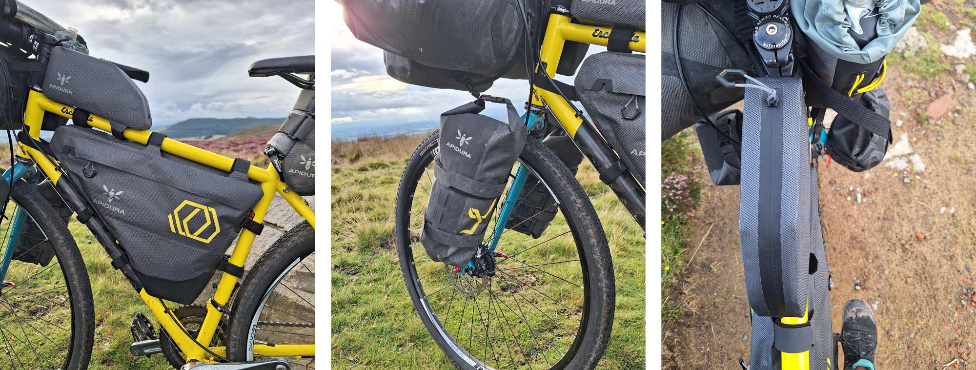
Bikepacking Bags
and Contents
Apidura Expedition Range - these are not only highly durable and waterproof,
but also very light weight:
- Saddle Pack 14 Litre - Quilt, Liner, Pillow, Clothing
- Handlebar Pack 9 Litre - Tent, Sleeping Mat, Sit Mat, Down Jacket (In a Drybag)
- Full frame pack 6 Litre - (5 sizes available and we can order the size specific for your bike if we don’t have them in stock. I used the 6 litre as it was the best size for my small bike frame) - Water bladder, bike pump, inner tubes and tools, first aid kit, toiletries etc in the main pocket. Bike lock, wallet & phone in the small pocket.
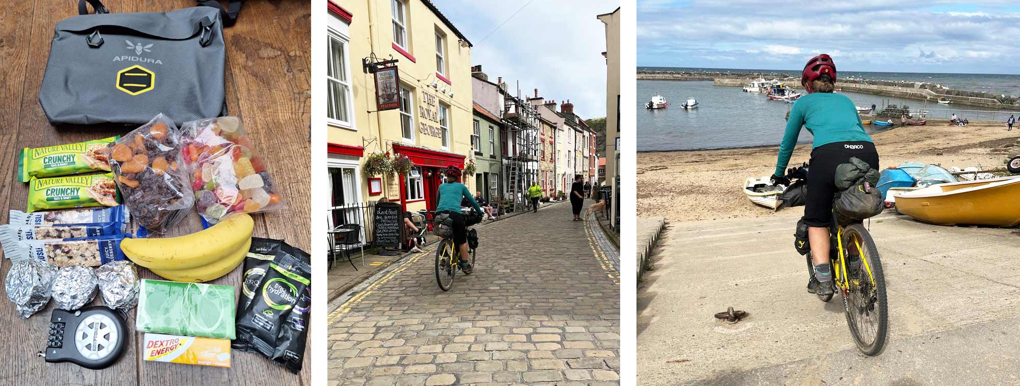
- Expedition Fork Packs 2 x 3 Litre - Stove, Gas, Cook Pot, Cup, Bowl and Spork. Food (Main Meal and Breakfast)
- Accessory Pocket 4.5 Litre - Snacks, sweets and the odd pork pie. Great for easy access.
- Toptube pack 1 Litre - Electricals, Chargers, Head Torch.
- Food Pouch 1.2 Litre Plus - Drink Bottle, Hydration Powder Sachets in the External Mesh Pocket.
Shelter & Sleep System
- Tent Wechsel Bella 1.5P - 3 Season Tent, pitches quickly inner and outer together. Roomy 1.5 person. 1.3kg. Not bikepacking specific, but works well with my wide swept back bars.
- Thermarest NeoAir Uberlite Regular Sleeping Mat - R Rating 2.3 very light at 264g
- Thermarest Corus 20 Down Quilt - 772g (Regular)
- Rab Silk Liner - 110g
- Nemo Fillo Elite Pillow - 82g
- Thermarest Z Seat - My 54g luxury item for sitting in or outside of the tent, kneeling in the tent whilst sorting bed area etc also great for moving dry kit to the bike for repacking.
Other Accessories
- Soto Stove & MSR piezo ignition
- Titanium 750ml pan with lid
- 450ml Titanium cup
- Titanium spork & plastic spoon
- Expedition foods 3 breakfasts and 2 evening meals
- Torq hydration sachets
- Tool kit & spare inner tubes
- First Aid kit
- Clothing & waterproofs
The Journey
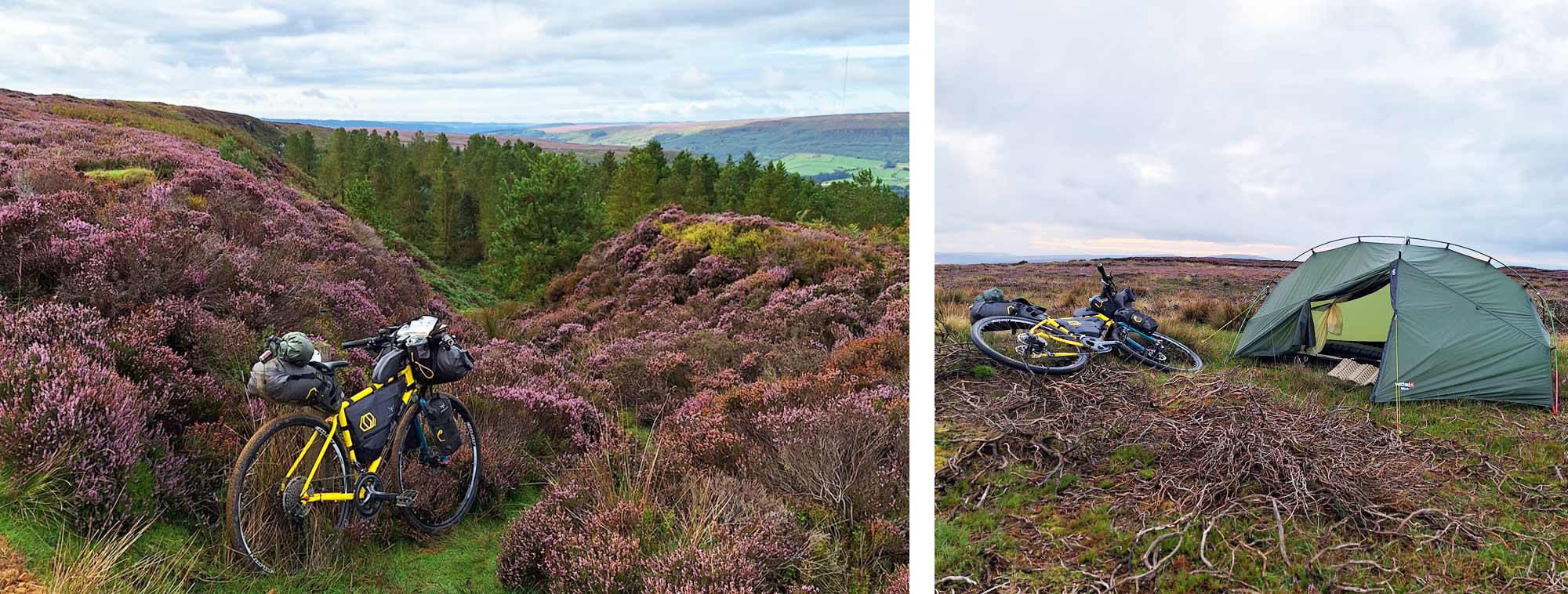
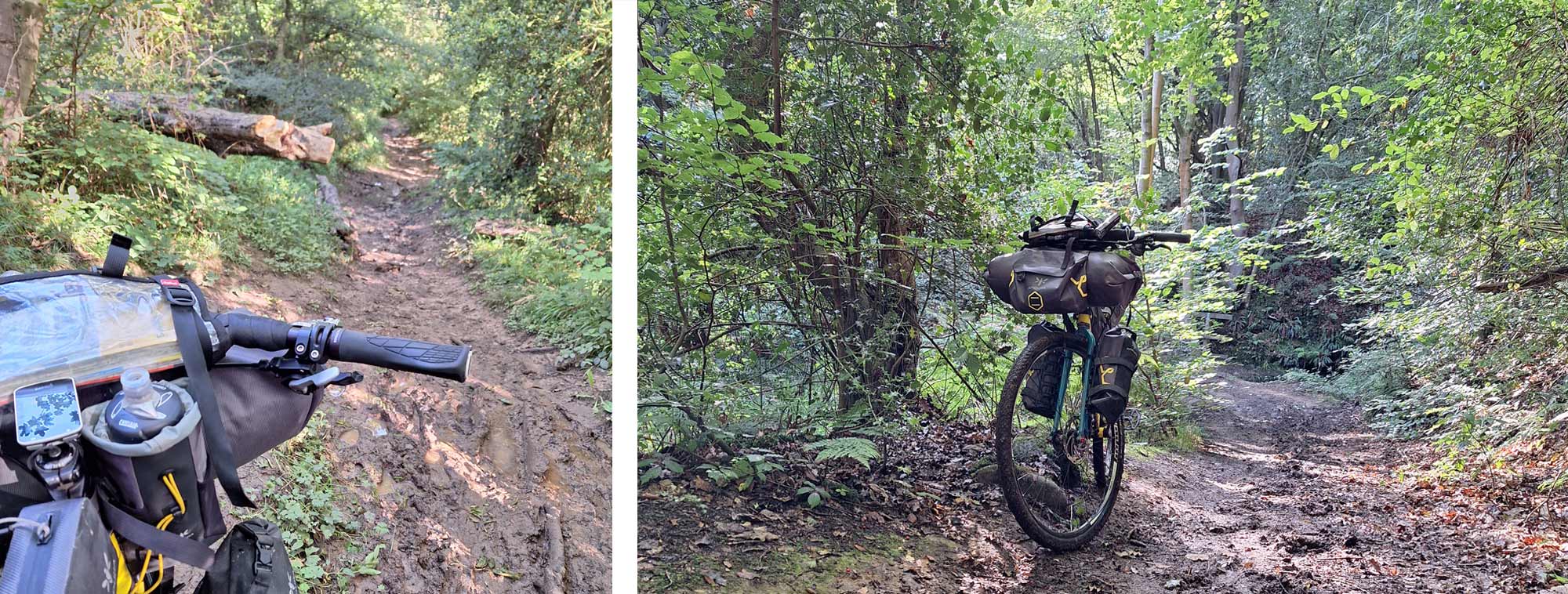
With my Cotic Escapade, steel, fully rigid gravel bike already packed and ready for me to finish work as part of the Customer Service team here at Ultralight Outdoor Gear. I quickly crammed a pre-ride bowl of pasta and was rolling by 5.30pm to do the first 30km of the route. This took me onto the Moors via an all too familiar warm-up climb out of Guisborough and along Percy Rigg, a rough track that was perfect to test the packing set up. As packs and contents settled, a few straps needed tightening and my tools needed adjusting to take out an annoying rattle and having started in the rain, my waterproof jacket was soon shed and attached to top of the rear pack under the elastic loops, in a dry bag for easy access as the sky certainly looked like it still had contents to share. With warmed-up legs and a securely packed bike I headed up Park Nab out of Kildale, a long steady tarmac climb that turns into rough track all the way to Bloworth Crossing, a pivotal junction on the former railway. Being a well-used route by laden walkers on the Cleveland Way it was nice to share the start of my journey with those looking fatigued at the end of day 3 or 4 of theirs. The clouds cleared and the lowering sun picked up the contrasting colours of the heather and lichen-covered stone walls as I climbed to the highest point of the Moors: Botton Head a trig point on Round Hill, Urra Moor and the end of the first day.
Day 2 always had the potential to be a lengthy day in order to get to my preferred overnight spot. The day started well, rising to a beautiful rainbow to the south over Bilsdale, leaving clear skies above and calm weather in its wake, perfect for riding. The descent into Bilsdale is always ‘interesting’ as it is more suitable for a mountain bike than a packed-up gravel bike. Recent rain and morning dew made the steep track very slippery and my fast-rolling tyres offered little gip. Late summer foliage hung onto moisture like a sponge and provided a refreshing morning shower that I hadn’t ordered. I was glad I chose to wear my Inov8 G400 Goretex boots over my usual flat cycling shoes as this helped keep my feet dry if nothing else.
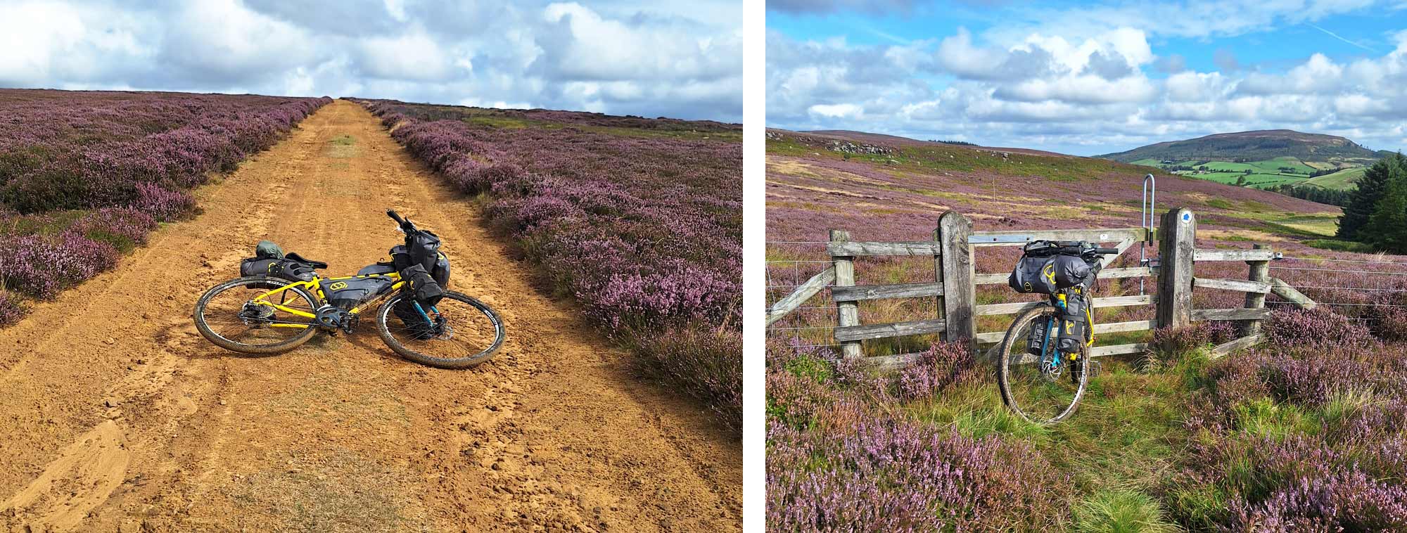
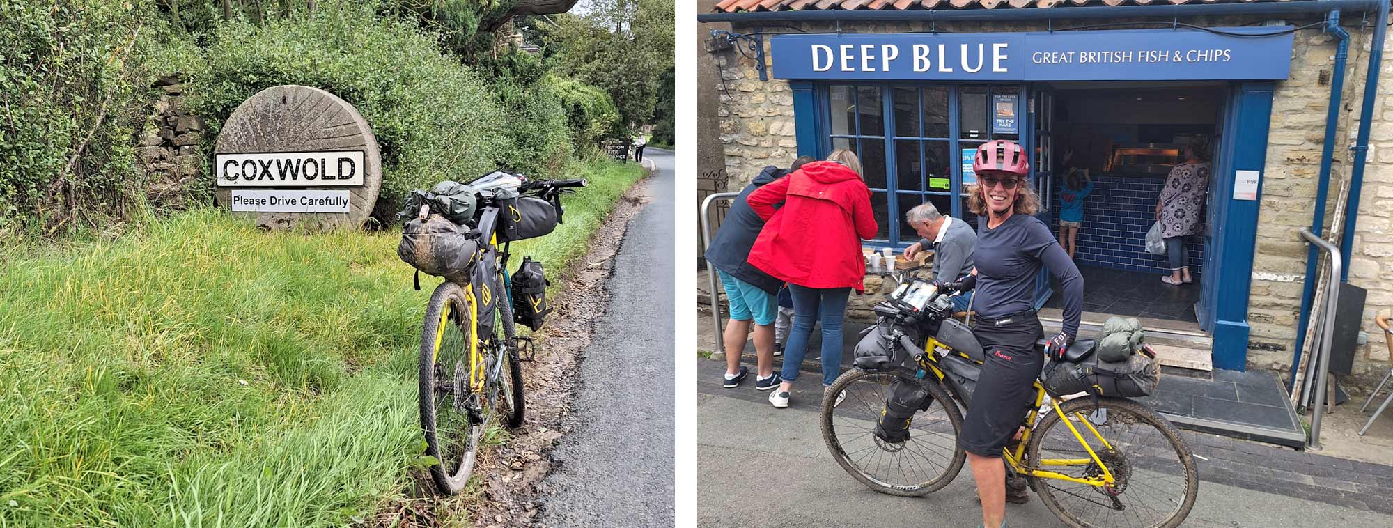
Once in Bilsdale, the climb out of the west side up Raisdale Mill onto Barkers Ridge is steep, even on an unpacked bike in dry conditions this is only partially rideable, but I was prepared for a hefty push onto the ridge. I treat myself at the top to a celebratory pork pie as I stopped to admire the view, with the realisation that although I had only done 10km in an hour and a half, I was about to reap the rewards for my efforts. Brushing past the Bilsdale transmitter, that can be seen from miles around, the jeep track down to Snilesworth is, in my opinion, one of the best gravel tracks on the Moors. The favourable big-ring gradient allows the bike to get up to speed and stay there with little leg effort, mirroring the effortless soaring of the Red Kites that circle above. The yellow sandy track winds its way mile after mile through vast purple heather towards Black Hambleton hill in the distance. Joining tarmac again, I continued west, passing the turn off for Black Hambleton, towards Osmotherley and then Thimbleby - the most westerly point of the route.
The boundary of the National Park at the westerly point is where the road on the south side of Thimbleby joins the noisy A19 dual carriageway. I marked this point from a suitable distance and took a U-turn to stay within the boundary and the peace and quiet of the National Park and pickup my traverse south to Kepwick. This tranquillity was soon interrupted as I passed the Thimbleby Shooting Club as clays were regularly being shot from the skies and gunshot echoes down the valley. Having bypassed the pervious climb up Black Hambleton, I still needed to do the ascent, so took the steep tarmac climb from Kepwick onto the historic Drove Road. Formerly a route used by Scots, driving cattle and goods on their way to York and beyond, today it is mainly used by local farmers and landowners, hikers and bikers all still calling at the 16 th century High Paradise Farm for refreshment, a must if you are passing through.
Rolling again, I proceeded south, past Sutton Bank and the glider station where Red Kites gave way to gliders and sweeping singletrack turned into tarmac on the approach to the pretty village of Coxwold, the most southerly point of the route. A sharp right turn at the bottom of the village took me past the pub (so tempted, but resisted!!!) and in a north easterly direction around the ruins of Byland Abbey and onto Wass and my third and final big climb of the day, a steep and prolonged incline on tiring legs, this became a steady push, but a constant supply of brambles took the edge of the pain. After the climb it was a fairly swift route to Helmsley and as tea-time approached the call for Fish and Chips become irresistible! I parked up at the cross in the market square along with about 50 motor bikers all sharing the enjoyment of 2-wheelled travel, though some of us I feel had earned our food more than others! Fed and watered, I headed north deep into Bransdale for my second night by a quiet stretch of river.
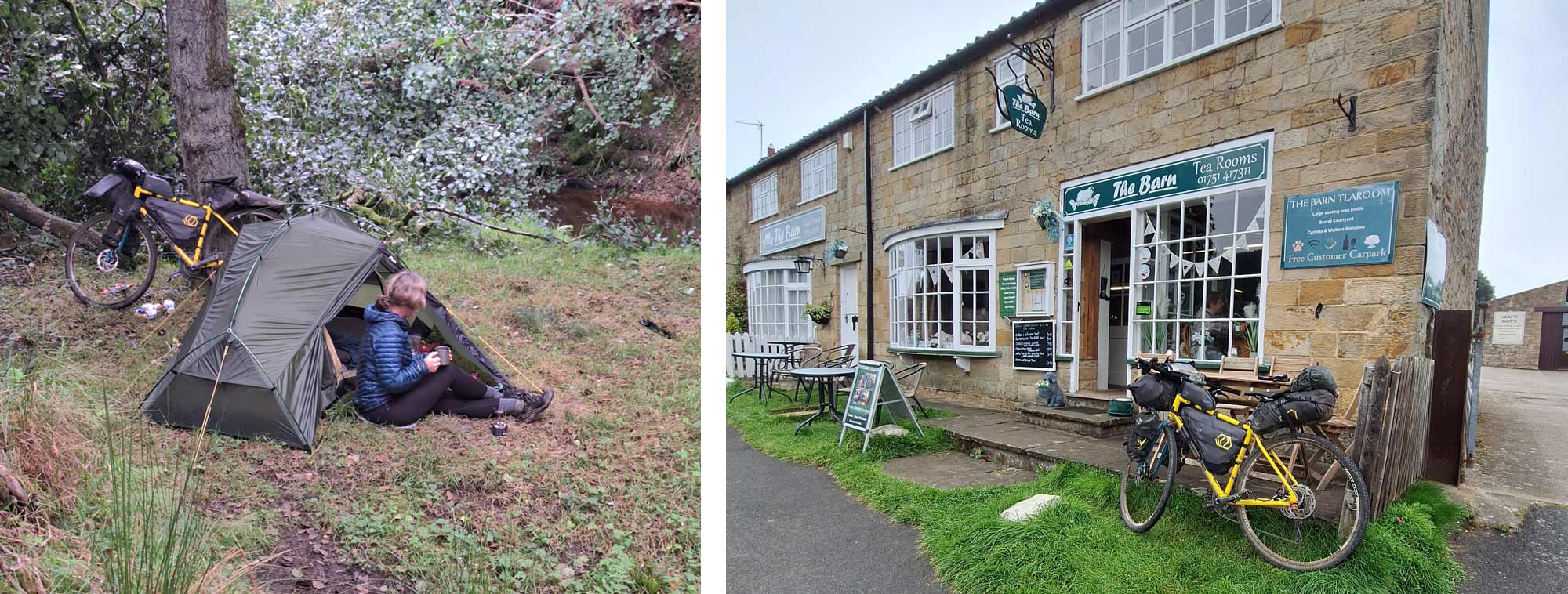
The third day started with the realisation that I had accidentally pressed the record button on my Garmin when I plugged it into the power bank to charge, so not only did it record me not moving for 12 hours, it also drained vital power from my reserves. I was using my Garmin for navigation and my phone as a navigation backup for OS Maps and Google maps, emergencies and Strava, so the necessity to repower the power bank became a priority, although I did have paper maps with me if I couldn’t get sorted. Thankfully Hutton-le-Hole was on my route that morning so, thank you to Caroline at The Barn cafe for the warmest welcome, great coffee, a fantastic second breakfast and 6000amp/h of power!
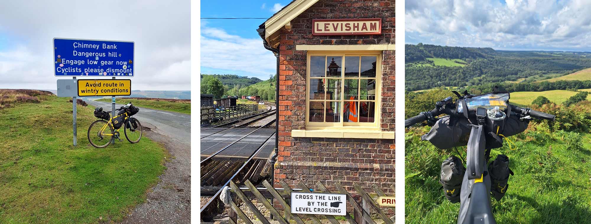
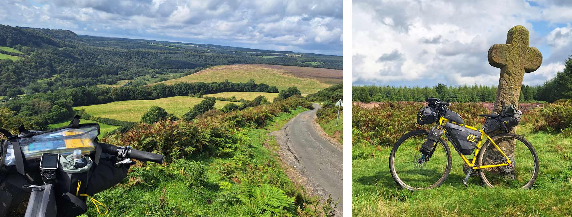
The route for the rest of the day was generally in an easterly direction, rising up and over the finger shaped hills and into the valleys of the southern fringe of the National Park. A descent down the infamous Chimney Bank into Rosedale Abbey was a blast, and ‘yes’, I did ignore the ‘cyclists dismount’ sign at the top. Fast rolling forest tracks through Cropton Forest were effortless and guided me towards the North Yorkshire Moors Railway and across the tracks at Levisham Station. The climb out of the valley is steep to start with then opens out onto grassy moorland where the highland cattle roam free. They are extremely beautiful and docile and don’t really care where they stand, you just have to weave around them. There is a lovely pub in the village of Levisham at the top of the hill and I was looking forward to having a cold refreshment there, but it was closed and the beer garden was full of walkers eating their own picnics! Pressing on to the Hole of Horecum, locally known as the ‘Giant’s Handprint’ as it looks as though it has been scooped out of the ground by a Giant. At this time of year, it is covered in purple heather and the views are stunning in all direction. After crossing the main road at Saltergate and descending to Lilla Cross in a beautiful grassy glade on the edge of the forest, I decided to take the single track on the edge of the moor rather than the forest track along the edge of the wood as from past experience, I know it has a beautiful piece of single track that heads towards, then around the boundary of Fylingdales Early Warning Station where you certainly get the sense that you are being watched! A recent downpour left the peaty surface slick and puddly in equal measures and certainly brought my fast progress to a halt.
Once back in the forest the speeds increased again and the broad fire roads through Wykeham Forest were amazing on a weighted bike that tracks as though it was on rails. A sharp left turn at the end of the forest road was probably my sliding doors moment of the route which I took to keep me further inside the boundary of the National Park and traffic-fee rather than choosing tarmac along its southerly edge. The track down through woodland to Harwood Dale was good to start, then petered out to a grassy singletrack with ever increasing foliage. This then opened out into a wide expanse of tree-felled scrub with no obvious route through. Relying purely on the Garmin to keep me heading in the right direction, I had to carry, drag, man-handle the bike over the scrub towards a wood that was guarded by head-high bracken that was thriving in its newly found sunlight. It took ages to find the exit and left me crawling with bugs and scratched to high heaven and not very happy! To make matters worse, where the exit track met the road, I was greeted by an 8’ metal fence with a small round kissing gate at the side which proved problematic. It was like a scene from ‘We’re going on Bear Hunt’. I tried to go over it (way too high), I tried to go under it (just not enough room), eventually I managed to shoehorn the bike through the kissing gate after removing the fork packs and twizzling the bike on its back wheel at the same time trying not to scratch the frame on the centre post. Steam was definitely coming out of my ears and I had a severe case of the mumbles by the time I got through….! From there, the route to the coast and my easterly marker was a mixture of bridleways and backroads, though tarmac was favoured as my energy levels dipped and water was running low.
My final approach to Cloughton was via a stretch of the ‘Cinder Track’ a lengthy disused railway line running up the coast. Access onto the railway was via a rickety stile, which again proved awkward as I lifted the bike and deposited it in a heap on the other side whilst precariously perched astride the stile. Certainly, the less glamourous side of bikepacking! Once on the railway it was a short distance to the end of the road above Cloughton Wyke which is a popular spot for van-lifers enjoying the evening sun and wonderful views out to sea. Here, I too admired the view and ticked off the easterly point of my route before taking a quick about-turn and back onto the Cinder Track, in a northerly direction this time. With just a dribble of water left in my bottle I was on the lookout for any refill opportunity. This oasis came as I rounded the clifftop at Ravenscar and the RNLI lifeboat station was open and the crew were on stand-by, enjoying a cuppa in the sun…. I anchored up and they were more than happy to come to my rescue! With hydration back under control, my mind turned to food and shelter for the evening and I opted for a grassy pitch close to Robin Hoods Bay and a tasty rehydrated curry with stunning views, wandering deer and the Blue Moon making its appearance as night fell. Body and mind blissfully restored and ready for kip.
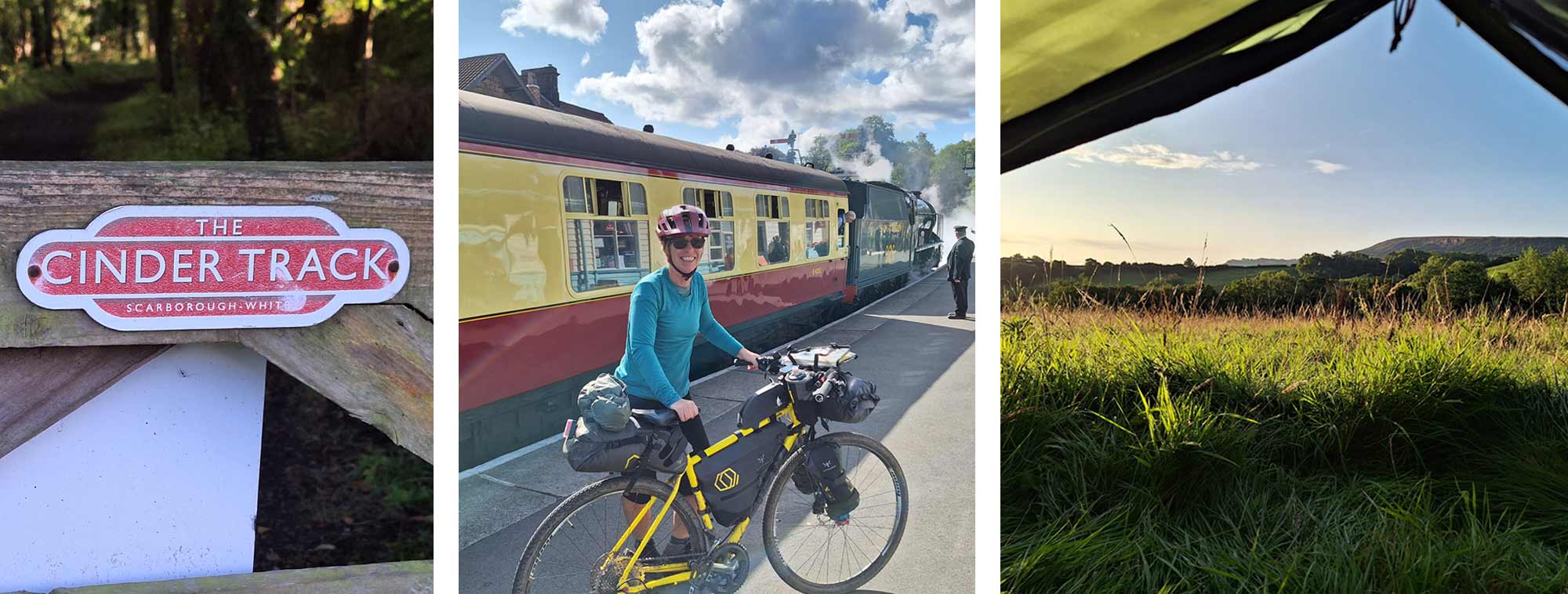
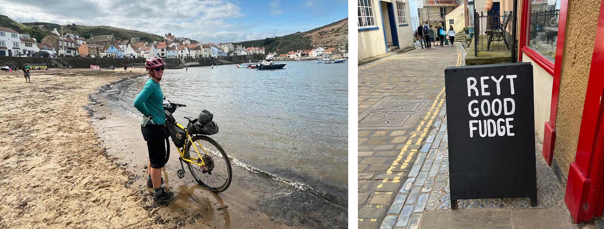
Day four could have been a swift trip through centre of Whitby on the Cinder Track, but as the town and its neighbour Sleights are not in the National Park, I had to come off the railway at Stainsacre and head inland to Grosmont. Again, traffic free options were taken where possible and the ever-familiar muddy tracks made for slow progress in places. A peaceful refreshment stop at Grosmont Station Cafe was interrupted by the majestic steam trains with their whistles and a reminder of a bygone era. The final stretch of the route then headed in a northerly direction and although it didn’t look far on the map, the tight contours told a different story. From Grosmont it was initially a short flat ride on a gravel track following the River Esk to Egton Bridge before café legs kicked in as the gradient kicked up to Egton. With the North Sea in my sights, I crossed the busy A171 Moor Road getting ever-closer to my destination. The climb through to East Barmby would be my final test and as I topped out, I finished my last handful of Midget Gems, sat on the stone sign on the entrance to the hamlet and looked back across the vast landscape I had just explored. Not dwelling on the tricky terrain, tough climbs, overgrown tracks, technical mishaps or grumpy walkers who have not heard the ping of my bell! But, with a satisfaction and marvel of the beautiful big picture. A final fling of the leg over the saddle, the pedals turned with surprising ease as muscles kept doing what they had done for days. A final stretch of gravel from Kettleness round the cliff top of Runswick Bay provided amazing views up the coast and a few miles of tarmac would lead me through Hinderwell and drop me into Staithes where a wetting of the tyres in the sea marked the lowest elevation of the route. A hop across the estuary via the foot bridge to Cowbar, was where I marked the most northerly point of the route and end of my journey. 245km of stunning scenery, 4779m ascent, 60% offroad / 40% quiet country roads. Zero mechanicals and a celebratory bag of ‘reyt good fudge’ as a reward! Thank you to Apidura for providing some of the kit for this trip and it performed amazingly well throughout.

|
||
 |
||
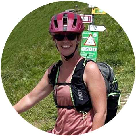
| Lois Fife |
||
|
Lois is a keen cyclist and is always plotting a route… either for her next trip or looking for a different way to commute to work! She is regularly seen heading for the hills on a packed-up bike, be it for a quick overnight wild camp, or a longer multi-day adventure. She is currently plotting her route to walk the TGO across Scotland. She is a British Cycling level 2 leader and has been involved with MTB Guisborough encouraging the next generation of mountain bikers. Lois joined Ultralight Outdoor Gear in 2021 and is part of the Customer Service Team. She is always keen to get her hands on new kit to try in the field and share her findings on the website. |
||