Jump to: Our Verdict / Features / Specifications
The British Mountain Map series are a lightweight, waterproof, durable set of maps covering some of the most popular and challenging areas in the UK at 1:40,000. These are ideal for climbers, hill walkers and mountaineers who want a detailed map of technical terrain suited to accurate navigation where it's needed most.
Harvey Maps says
"This is a fabulous map for a fabulous area; for the first time it shows crags, bouldering areas and clear details in what could seem a maze of rock and water. It must surely set the standard for all future maps." John Mackenzie, the Earl of Cromartie.
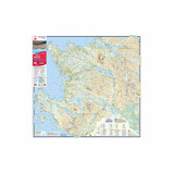
Detailed map for hillwalkers and climbers of the spectacular peaks of Assynt at 1:40,000 scale.
Includes Quinag, Suilven, Stac Pollaidh, Cul Mor and Ben More Assynt.
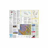
Enlargements at 1:15,000 scale of Stac Pollaidh, Suilven and Quinag on the reverse.
Climbing crags are highlighted and a climbing route on Stac Pollaidh is included.
The map area includes 2 Munros, 9 Corbetts and 6 Grahams.
Our Verdict
Harvey's British Mountain Maps are perfect for anyone wanting a practical and durable map to cover large areas of some of the most demanding ground in the UK. The Harvey Maps use light, waterproof paper so they are much easier to use and store than traditional paper or laminated maps. I moved over to Harvey Maps a few years ago and love using them for the weight, slim profile and waterproof nature as they are much more practical to use out on the hill. The British Mountain Map series are ideal for climbers, hill walkers and mountaineers who want a detailed map of technical terrain showing more features for safe, accurate navigation.
The range of information on the other side of the map is fantastic. From detailed diagrams of crags for climbers, geological mapping and history provided by the British Geological Survey through to tips and advice on staying safe in the mountains and basic navigation techniques and more. I prefer the Harvey Maps to OS Maps now as I prefer the layout and level of detail on more technical terrain even on the 1:40,000.
- Reviewed by Ultralight Outdoor Gear
Features
- Tough, light, durable and 100% waterproof
- Genuine original HARVEY mapping
- Tried and tested by the British Mountaineering Council
Specifications
- Weight: 82g
- Scale: 1:40,000
- Ratio: 2.5cm = 1km
- Flat size: 992 x 940mm (99.2 x 94cm)
- Folded size: 124 x 235mm (12.4 x 23.5cm)
- Area of mapping: 1228sqkm
- Double sided: yes


